All the way south (Dagui & Snow City Gannan Sichuan Northern Cycling Notes)
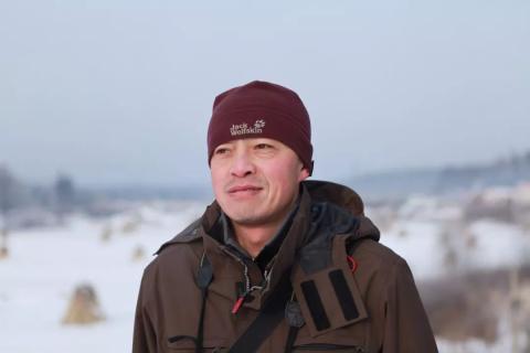
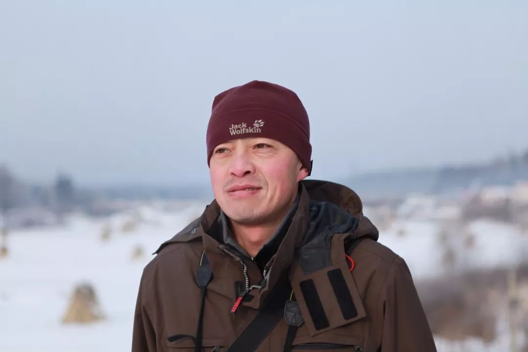
Author: Big Ghost. A traveling friend with a sense of humor, an honest, honest and polite person who is afraid of causing trouble to others; we sneaked around corners together and carried big bags together. We actually didn’t play together a few times, but we left a good impression. Kind-hearted, with the feeling of asking for more than you can lose face.D1DepartureThe centenarian rides Gannan and Sichuan north starting from Lanzhou today. No problem, my good friend Sui Zi's combined age is exactly 100. It's a pity that Peng Fei didn't come, or 150.Continuing the fine tradition of serious night flight delays, I arrived at the hotel at 3:30 in the morning. Hotels near Lanzhou Airport had free pick-up and drop-off services. At six o'clock, both brothers woke up. Centenarians usually don't stay in bed very much and start walking. Lanzhou Airport is seamlessly connected to the high-speed rail station. You can get off the plane and go directly to the high-speed rail station. You can reach Lanzhou Station in one hour, about 70 kilometers away, with an average of one trip per hour, which is very convenient. China Railway Express picked up the car, packed it, and set off. Today’s destination is Linxia. I met Shajia Beef Noodles for breakfast. It was really delicious, but the key was the toppings.We really hit the road around 9 o’clock. The road out of the city was dirty and I couldn't get a good impression of this city. The most indispensable thing in the Yellow River Basin is loess, and the dust is very heavy, so the sprinklers came out and the dust was eliminated. However, we were riding in the yellow mud soup all the way and could not ride fast. The road slowly goes up for nearly 20 kilometers and merges into the G309 at Houjiayu Village. The roads are mostly gravel and very narrow, disgraceful as a national highway, but there are very few cars. When starting to climb, the slope is relatively large, and the smallest crankset is often used. 36 kilometers to Qidaoliang Pass. Finally, after 51 kilometers downhill, we arrived at Zhongpu Town, Lintao County for lunch. It was already past two o'clock in the afternoon.After dinner, we continue to descend slowly, 64 kilometers to Zheqiao Town, where the Tao River flows. I was almost exhausted, and the next 30 kilometers of gentle riding was very tiring. Sui Zi was basically fine, thanks to his insistence on running. The landscape is still tall mounds, with no scenery to speak of. There are mosques in many villages and towns along the way, but the roofs are basically Chinese-style hill tops, which is a bit of a combination of China and Iran.After 93 kilometers, we finally reached the Suonan Tunnel. After passing the tunnel, we reached Dongxiang County. From there, we went downhill, down the flat road until we reached Linxia City, where the Daxia River passed through the city. I felt like it was a warm, humid, beautiful, clean, and lovely city.When we arrived at the hotel at nearly 8 o'clock, we went to the nearby Ersha Shoushao recommended by the front desk of the hotel. It should be good, but we were disappointed.Cooperation City tomorrow. D2Linxia-Cooperation 103 kilometers 8:40-17:00This trip is from Lanzhou to Chengdu, a total of more than 1,500 kilometers, and is expected to be ridden for 16 days, passing through Linxia, Hehe, Luqu, Maqu, Jiuzhi, Banma, Luhuo, Daofu, Bamei, Danba and Siguniang Mountain .Yesterday was the first day from Lanzhou to Linxia. The journey was boring but intense, so you might consider skipping it and starting from Linxia. Today, both the scenery and the feeling are beginning to get better, but not too intense. In comparison, yesterday's trip would be nothing if evaluated in professional terms.The Xuehe Manbo Hotel we stayed at was NT$135. The room was okay and it even included breakfast. But the quality was predictable. But for a casual person, I don’t care at all. I just want to eat more and avoid having a bowl of ramen in the morning until noon like yesterday. Hypoglycemia due to hunger.The antique houses in Bafang Shisan Lane are nearby, so I went there to have a look. It is very large and I just wanted to cycle around there. The mosque is very beautiful.Depart at 8:40. The 20-kilometer long non-motorized road along the river is flat and open, with lush street trees along the way. The weather is cloudy, cool and comfortable. Linxia is a Hui Autonomous County. In appearance, Hui men all wear white hats and beards, and women wear headscarves. Most of them are white, black or red, and they speak Hui dialect.The flat road is very pleasant, but the end point is nearly a thousand meters higher than here, and the difficult climb is inevitable. After 30 kilometers, we enter the mountains. Come on, brother, let’s start working. It's an ups and downs road at the beginning, then it's still an ups and downs road, and then it's still a slope? It became clear after a few tunnels appeared, because it didn't have to climb.The highway is always there, but there are not many cars. But on the same route, the National Highway 568 we took was full of traffic, especially large cars.After passing Tumen Pass for 34 kilometers, the scenery began to change. The mountains were tall, there were many rivers, and highland barley fields began to appear. It gradually felt like a Tibetan area. The houses in the villages along the road have also changed accordingly, and they seem to be a perfect combination of Han, Hui and Tibetan styles. I saw many Tibetans passing Linka on the grass beside the road, where relatives and friends gathered for a picnic.13:30, 69 kilometers to Wanggeer Village for lunch. There are restaurants in the village, but there are no restaurants in Xioxiang or Madang Township. There are restaurants in Kagaman Township behind.It felt like ups and downs, but in fact it was slowly rising, but the feeling was not obvious. Later, I saw that the elevation curve recorded by Sui Zi was still all the way up.At 90 kilometers, what is supposed to come will come. The 7-kilometer climb begins. Although it is not long, it is also extremely difficult for the final stage of Qiannu. After passing the pass, we went downhill into Hehe City, the capital of Gannan Tibetan Autonomous Prefecture. The Hehe Temple, a Tibetan Buddhist temple, is large in scale and exquisite in architecture.Arrive at Yongde Hotel at 17:00, no breakfast at 142, and the room is good. We went to the Sichuan restaurant across the street for dinner. We couldn’t eat at the halal restaurant because drinking was not allowed.Luqu County tomorrow.D3Hehe City (2800 meters)-Luqu County (3500 meters) 82 kilometers 9:30-16:00The journey today was short and we set off at 9:30. I bought some cakes and water and planned to find a beautiful piece of grass on the way to cook some soup and eat the cakes for lunch.According to international practice, the slope is right out of the gate, and it is 15 kilometers long, but the slope in the front section is gentle. I have enough energy in the morning and don't feel much. The pass is at an altitude of 3,200 meters. After taking a short rest, we started a 10-kilometer long descent, which was exciting. True alpine meadows begin to appear, carpets of velvety green dotted with wildflowers. There are many prairie dogs, with fat hips and thick waists, and a sense of joy in their appearance.Maybe it was because the weather was gloomy and there was no sunshine, but the scenery was actually quite average. Don’t expect too much from Gannan’s scenery. It's good to escape the heat in summer. The temperature in Hehe City today is 9-22 degrees. It's very cold in the morning and evening. The hottest temperature during the day is only over 20 degrees. This is basically the case throughout the summer.There are a lot of vehicles on this road today, almost constantly, probably most of them are tourists. We met more people riding bikes today, and they were all going in the opposite direction to us.41 kilometers to Amuquhu Town, there are many small restaurants serving tourists. After discussing it, the two brothers were too lazy to do it themselves since they had the conditions. Besides, there were raindrops in the sky from time to time, so they planned to have a picnic on the grass like the Tibetans did when they visited Linka. The plan fell through.It is an international practice to set off after dinner. The slope is gentle but 18 kilometers long. We finally arrived at the pass at three o'clock in the afternoon, and the welfare came. We went downhill gently for 23 kilometers, all the way to Luqu County, a very clean and beautiful small county.We booked the Luqu Hotel for 202 without breakfast. There was a smell in the room when we entered it. It was better to change the room. The hotel was too old, but I was considering changing to another hotel and it was too troublesome to go to the parking lot to pick up the car and pack it, so I had to make do with it!We went out to eat at 7pm. It was still bright and the sun was glaring, 16 degrees.D4 Luqu County (3200 meters)-Maqu County (3500 meters) 98 kilometers 8:00-17:10When we set off at eight in the morning, the temperature was only a little over ten degrees, and a layer of mist floated in the sky and hung on the mountainside, making the small town even more beautiful. It is still international practice to go out on a slope, which is 20 kilometers long, but the slope is not large.Maybe the hinterland of Gannan grassland is south of Luqu. Today's scenery has changed my view of yesterday. Of course, the sun is very sunny today, so the colors are rich and gorgeous, and there are beautiful scenery everywhere you look. The blue sky and white clouds, the lush green alpine meadows, and herds of cattle and sheep dotted the landscape are enough to satisfy your eyes.Arrive at the pass at around ten o'clock, at an altitude of 3,500, and go downhill for 26 kilometers to Gaxiu Village, where you can eat. Then continue on slowly for 36 kilometers to reach Jila, which is the right intersection to Maqu County and the starting point of Provincial Highway 204. After turning onto this road, the traffic flow became less and it was as if the world suddenly became clearer. It turned out that there were so many clear and sweet birdsong in my ears, which had been covered up by the noise of cars before. There were too many vehicles on the 213 National Highway going to Langmusi, almost one after another.At 45 kilometers, Sui Zi found a five-star camp in front, with a small river flowing meanderingly, and an endless stretch of grassland that was flat and clean. In this perfect camp, we used our own set of pots and gas tanks to boil water and make soup, plus the purchased Shaobing and pickled mustard are the solution for lunch. Today’s itinerary still requires you to bring your own food on the road, because the only place where you can eat is Gaxiu Village, but it was too early, only after ten o’clock.Then slowly climb up to the 61-kilometer Zhongke Tunnel, which is 2.3 kilometers long. The scenery along Provincial Highway 203 in the afternoon was more beautiful than in the morning, but no matter how beautiful it was, I was tired. This is an excellent summer pasture. There are many Tibetans grazing here along the way. According to the guide, there will be many herdsmen’s mastiff dogs chasing and biting cyclists along the way. We have prepared dog sticks for a long time, but in fact everyone Too lazy to talk to us.After passing the tunnel is the Zhongke Yellow River First Bend Observation Deck, where you can overlook the Yellow River in the distance. The terrain suddenly transforms into an open, flat wetland plain with spectacular scenery.We drove down the road for 98 kilometers and arrived at Maqu County at five o'clock. Maqu means the Yellow River in Tibetan, and the other places it passes through each have their own characteristics. Linxia is known as the Mecca of the East, Hehe is called Lingcheng in ancient times, and Luqu is the hometown of Guozhuang.Booked the Phuntsogang Hotel for 183 without breakfast. It has the best conditions so far. The weather is cool, with a maximum of 18 degrees.Tomorrow we will go to Jiuzhi County, Qinghai Province.D5Maqu County (3500 meters)-Jiuzhi County (3600 meters) 107 kilometers 7:50-16:30A relatively casual and eye-catching day.Today I don’t follow the usual rules. There is no slope when I go out, because this is a flat Yellow River wetland. I cross the Yellow River when I leave the city. The water is open and gray in color. It is not like the unforgettable earthy yellow seen in the Central Plains. , the strange thing is that the water flows to the west.After 12 kilometers of flat road, it starts to go uphill for 3 kilometers, and then the road is undulating.29 kilometers, starting with a steep uphill climb of 6 kilometers, reaching the pass at about 10 o'clock, with an altitude of 3800. Then we slowly descended to Awancang Town, which is also an endless wetland plain. That is, we rode over the mountains from the Yellow River Wetland to Awancang Wetland.11:30, 53 kilometers, lunch here, only simple fast food, such as various noodles, not even rice.A few kilometers ahead is the magnificent Nyingma Monastery.After passing through this wide river valley, we met the Yellow River again at the end of the wetland. We went up the river and entered the mountains. We soon left the Yellow River and followed the undulating road along its tributaries until we reached Jiuzhi County.The road conditions were very good in the morning and there was very little traffic. In the afternoon the road became rough with mud, sand and gravel, and there were more vehicles. The scenery was the same as yesterday, beautiful views of alpine meadows.I met several cyclists in the past two days. Today, a van from Sichuan B took pictures to refuel us and gave us two bottles of water. I was very touched.107 kilometers, we arrived in Jiuzhi County at 4:30. Where did we book the hotel? After searching the entire building, there was no one, but the door was open. What's going on? I temporarily found another hotel nearby, Jiuyue Business Hotel, 169 no breakfast, the owner is a beautiful Muslim woman.The temperature here is 5-19 degrees.D6 Jiuzhi County (3600 meters) - Baiyu Township (3800 meters) 123 kilometers 7:30-19:30 There are not many guides on this section of the road. I only knew that I needed to climb a few passes. I didn’t expect that there would be five in the end. , of course the climb at each pass is not high, but it is still a very intense day that tests your climbing ability while continuing to provide a visual feast. It is also an international practice to go uphill right out of the gate, but it starts slowly. After 18 kilometers, you reach the first pass of Sangchi Mountain Pass at 4054 meters. You can overlook the Rigancuo Jiao Peak and Nian Baoyu, which are the most typical peak features formed by glaciers. , gray-black, sharp and towering, like a sharp point piercing the sky. Today’s route is to circle around Nian Baoyu Ze for more than half a circle. After going downhill for 5 kilometers, we immediately continued to climb. After 32 kilometers, we reached the second pass of 4207 meters of rocky stone pass. There are no towns on the way today, so for lunch we can only buy instant noodles at a small shop run by herdsmen on the roadside. The two of us once again found a place on the riverbank to cook soup, the steamed buns we bought in Jiuji in the morning, and the leftover lamb chops from last night. Seeing a big yellow dog coming from the herdsmen's tent area in the distance, the two brothers were so full of love that they gave it half of their food rations. Start climbing to the third pass at 47 kilometers, which is only 3 kilometers away, that is, to the third red soil pass of 4037 meters. Going down to the bottom of the slope, 50 kilometers away is the Nianbao Yuze Scenic Area, which has long been closed. As a result, too many businesses in Jiuzhi County that rely on tourism for a living have closed down. Start climbing to the fourth pass, 55 kilometers to the Zala Mountain Pass, 4239 meters. After 7 kilometers of downhill, there is a long undulating road. I thought that was it, but at 86 kilometers, I started to climb again. It was already five o'clock in the evening, I was exhausted and exhausted. The sky is raining lightly and there are ice particles, and the moon reflected in the two springs should be a perfect match. At 18:30, 93 kilometers finally reached the Longge Mountain Pass, 4398 meters. Fortunately, it went downhill gently all the way, and we easily arrived at Baiyu Township at 19:30. I thought this was a very remote small town, but it was unexpectedly lively. I also found a hotel that looked quite high-end, priced at 288 with breakfast. Go to Banma County tomorrow.D7Baiyu Township (3800 meters)-Banma County (3800 meters) 9:30-12:3053 kilometersYesterday was very intense, and it was very rare to climb five passes of more than 4,000 meters in one day. Of course, the climbing distance at each pass is not long, ranging from 3-9 kilometers each. It is recommended that you set off early and try to get to Baiyu Township, otherwise you won’t be able to stay on the way. Unless you don’t mind staying in herdsmen’s tents, there may be some that are open to the public.From Jiuzhi County to Banma County, it is a half circle around the Nianbao Yuze National Geopark. I have never seen a real snow mountain so far. Maybe I can only see the first snow mountain - Yala Snow Mountain after passing Daofu.My companion is extremely physically strong and it was his first time riding on a plateau without any difficulty. He is known as Snow City in the outdoor circles. It’s not a chain. He is now busy participating in various marathons and triathlons.Baiyu Township seems to have developed around Datang Temple. There is a rare and huge pagoda here, which is magnificent and shocking! Maybe it's relatively close to Seda. There are obviously more temples and monks in these two days.The two brothers' idea is that as long as the conditions are available, they should try to live in a larger county where the food and accommodation conditions will be better. Today we only reached Banma County, which is 53 kilometers away, because there is no county seat further ahead, and Seda County is too far away, nearly 200 kilometers away. I decided to take it easy today and take a half-day rest to save my energy for arriving at Seda County, which is 135 kilometers away tomorrow.We set off at 9:30 and went down the river valley along the Maqu River. There was no climbing over the mountains, it was all ups and downs. There are few vehicles and the road conditions are good. Under the blue sky and white clouds, in the quiet valley, the riding experience is wonderful. Although the scenery was much inferior to the previous two days.Arrive at Banma County easily at 12:30 and stay at Gangjian Hotel, 196 including breakfast, very good and suitable for afternoon rest.D8Banma County (3800 meters)-Jiuzhi County (3900 meters) 7:00-19:45143 kilometersIt was so comfortable to rest for half a day yesterday. It was the first time that the two brothers had dinner before 6pm, and they could go to the Red Army Park for a stroll after dinner. Then we have to work today. Because we don’t want to live in the towns with poor conditions on the way, we have to rush to Seda County, which is 140 kilometers away. I only knew that I had to cross two passes, but I didn’t expect that these two passes would be turned over. All day long.Set off at 7 o'clock, climb slowly and uphill, climbing 33 kilometers, and reach the pass of Depei Mountain at 11 o'clock, 4448 meters. The road condition is very poor, full of cracks and gravel, the uphill resistance is great, and the downhill cannot be driven quickly, so we can only go downhill slowly at an average speed of 12, and the bottom of the slope is slightly better. After 59 kilometers, we arrived at Zhiqin Township. We took a wrong turn here and took a detour of 6 kilometers. Before entering the township, we turned left and crossed the bridge in the direction of Seda. I saw trees for the first time in several days, and they were large, tall and handsome fir trees. With the embellishment of the forest, the mountain scenery was richer. It feels very much like Linzhi, and the color of the river is blue-green like the Niyang River.Continue to slow down and reach Nianlong Township for 82 kilometers. There is a country hotel here, which looks okay from the outside. There was accommodation in Zhiqin Township before, but the conditions were very poor. There are very few Han people operating shops in these two townships. There is a checkpoint in Nianlong Township, just swipe your ID card. For lunch, the tomato and egg noodles made by the Tibetan elder sister are delicious, but many people may not be able to eat them if they see me.The road conditions finally improved when we left the country, but we started climbing again. It was very hot and it was the afternoon when we were physically exhausted, so the climb was extremely difficult. I met my first cyclist friend on this trip, and also encountered a group of Tibetans playing bazi (different names for Linka). A group of children and a young monk came to the road from the river beach below and insisted on inviting us. That’s what the adults below mean. But we didn’t have enough time today, so we had no choice but to politely decline. We could see the disappointment on the child’s face, and finally we took a group photo and sent him a WeChat message to leave.The Z-shaped winding mountain sections in the final stage of the climb looked shocking. It was not easy for Sui Zi to encounter such a brutal climb on the plateau for the first time, but his final performance was perfect. At 18:30, after 108 kilometers, we finally reached the Dele Pass, 4517 meters. Then came the joy of climbing, and in just over an hour we traveled more than 30 kilometers to Seda County.Red Coral Hotel, 133 no breakfast, nice room.Onda Town tomorrow.D9Seda County (3900 meters)-Luhuo County (3100 meters) 8:45-18:50143 kilometersThe original plan was to ride an easy 82 kilometers to Onda Town today, but after researching in the morning, I found that this section of the road is very easy, and it will be very early to arrive at Onda. It is better to work harder and work harder to reach the next big county town, Luhuo.Set off at 8:45, it went downhill slowly and very quickly. 20 kilometers to Luoruo Town is where Larung Gar is located. It is now officially closed, but you can climb the mountain without going through the main entrance. There are still many tourists here.I met a large group of Tibetans taking outdoor photos. The Kham Tibetan costumes were very beautiful! It is 37 kilometers to Huoxi Township and 67 kilometers to Xuri Township. There are accommodations in both townships.At one o'clock in the afternoon, we easily arrived at Onda Town after 81 kilometers. There are many accommodations here but not as prosperous as imagined. After dinner, we left the city and started climbing. The slope was steep and the temperature was high. It was very difficult to ride, but the road conditions were very good.At 16:40, after 97 kilometers, we finally reached the entrance of Laozheshan Tunnel. It is 4.4 kilometers long, has good lighting, few vehicles, and is a five-star tunnel.Then all the way downhill to Luhuo County. The road was closed during road construction and dozens of cars were blocked. At this time, the advantages of bicycles were immediately obvious. It was like entering a deserted land and directly crossing the long traffic flow, and then enjoying dozens of kilometers of riding without car interference.Arrive in Luhuo County at 18:50. Casa Grand Hotel, 197 including breakfast.Arrive at Bamei Town tomorrow.D10Luhuo County (3100 meters)-Bamei Town (3600 meters) 7:45-19:00 149 kilometersJust like yesterday, I overturned the original plan. I originally went to Daofu County easily today and rested for half a day. After two consecutive days of high-intensity riding, my body was very exhausted. But the two brothers always like to cause trouble, so before going to bed they decided to increase the amount and rode across Daofu to Bamei Town, turning two days into one day.The suite at the Casa Grand Hotel that I booked yesterday was very large but very hot. This may be due to the low altitude here. It was the first time I felt the heat of summer.Luhuo, Seda before it, and Daofu behind it are all very clean and tidy counties, and they all belong to Sichuan. It can be seen from the clothes of the locals that they are richer and more fashionable than those counties in southern Qinghai and Gansu.Depart at 7:40 and go down the Xianshui River. The bright yellow rapeseed fields on the roadside set off the beautiful Tibetan-style houses. These are the famous Daofu houses.The route from Luhuo to Chengdu is an important route into Tibet, so there are many vehicles and the road is narrow. If two large cars meet, there will be no room for us, so we must ride extremely cautiously.The descent speed was very fast, and we reached Daofu County at 11:20 after 69 kilometers. In order to save time, we simply had a bowl of noodles. The noodles made by Sister Qionglai were delicious.After dinner, we left the city and started climbing. The slope became increasingly steep. It rained twice in succession as we approached the top of the slope. I had to put on and take off my raincoat. It was very troublesome, but it had to be done. If I didn't wear it, my clothes would get soaked. There is a hidden danger of hypothermia in high altitude areas. If the rain stops, it will be extremely hot again.It is another long slope, 36 kilometers, and the final climbing section shows various weird Z shapes. At 17:00, 105 kilometers reached the summit of Songlinkou, from Daofu with an altitude of 2,900 meters to here at an altitude of 4,000 meters.Along the way, I met many cyclists who went to Tibet and set off on the road for their dreams. I wish them all the best!After that, of course, we went all the way down and passed the Longdeng Grassland, which was indifferent to us. We were really tired and we didn’t bother to take pictures for the past two days. Suddenly I saw a corner of the Yala Snow Mountain. It was not beautiful because it was too far away, but it was also the first time I saw the snow mountain in this trip.At 19:00, we arrived at Bamei Town after 149 kilometers. Another high-intensity day was successfully completed. Just tighten it first and then loosen it. Since then, the intensity has decreased and the altitude has also dropped significantly.Lanxin Hotel, 174, no breakfast, average, not recommended.Danba County tomorrow.D11Bamei Town (3600 meters)-Danba County (1800 meters) 8:20-14: 40 86 kilometersIt was finally time to take a break. I was very tired from three consecutive days of high-intensity cycling. I had to write travel notes in a hurry at night, which was basically done in a hurry. I had no time to record the stories during the trip.I remember the day when Bai Yu arrived in Seda, a Tibetan elder brother with clothes as dark as his face said hello in front of the herdsmen's tent on the roadside. Where are you going? Answer Seda. He shook his head, unable to reach the ground. I ignored it and continued riding. My elder brother suddenly shouted behind me: Come on, believe in yourself!Our trip was bitter first and then sweet. Once the bitterness is over, we can enjoy it slowly and relaxedly. The last four days of the journey were relatively easy, such as today.Today there are only more than 80 kilometers, climbing out of the city, 17 kilometers to the top - Nadaliangzi, 4000 meters above sea level. There are large alpine meadows here, and many tourists are playing here. Some curious people gathered around us to ask questions, and some used cars as props to take photos.Next is a super steep descent, 6 kilometers to the entrance of Yala Snow Mountain. Unfortunately, the top of the snow mountain is shrouded in clouds and mist, and the peak is the most beautiful part of the snow mountain.The next ride was wonderful, with the deep valleys and dense forests, the clear streams rushing down, the fresh air like a forest bar, and the melodious chirping of birds, making this canyon ride extremely enjoyable. Of course, there is also the factor of going downhill all the way. Today I met many cyclists who were riding to Lhasa and had a difficult climb. They would not have a wonderful experience.13:30, 67 kilometers to Donggu Township for lunch. I have always felt the coolness of the plateau, but today I suddenly felt extremely hot. From the 4,000-meter pass plummeting in the morning to 1,800 meters in the afternoon, the temperature must have increased significantly. So I feel even more sorry for those cyclists who get burned while climbing.The road condition is not very good. There are many roads damaged by water. Most of the roadbed has been hollowed out by the water flow, leaving only half of the road surface. This may be related to the previous heavy rain.At 14:30, we arrived in Danba County after 86 kilometers. We had been here with my family ten years ago.Hyde Hotel, 150 including breakfast.Siguniangshan Town tomorrow.D12Danba County (1800 meters)-Siguniangshan Town (3200 meters) 8:00-18:00 113 kilometersI also had to keep track of my running accounts, because I arrived late and didn’t have much time, so I had to turn in my tasks quickly.I had a short break yesterday afternoon. It was very comfortable and I could watch the Olympic Games leisurely. The hotel conditions are acceptable. The roar of the Dajin River running through the city made it impossible to sleep even if I stayed on the fifth floor and opened the window.Although we did not climb mountains today, we had to climb nearly 1,400 meters from Danba, which is 1,800 meters above sea level, to Siguniang Mountain Town, which is 3,200 meters above sea level. The morning's slow climb was barely noticeable, upstream along the Kogan River with a slight incline. The weather was cloudy, and the air in the valley was moist and fresh. The cool feeling made it very comfortable to ride. It was not as cold as the morning rides on the plateau a few days ago.At 12 o'clock, we easily arrived at Xiaojin County after 55 kilometers for lunch. Last year, there was a flood, and many road sections and houses were washed away. To this day, you can still see collapsed houses and 5 kilometers of bad roads. Motor vehicles are also prohibited from passing through. That is, motor vehicles are not allowed to pass from Danba to Xiaojin. It is expected to be opened to traffic within this year. At this time, the advantage of the bicycle was shown again, and it was easy to pass through the roadblock made of big rocks. A friend on a motorcycle who was blocked outside was envious because he could not pass like a motor vehicle. Except for this section of bad road, the whole road is in very good condition. It is a new road. The old road that I walked with my family ten years ago has long been abandoned. Xiaojin County has also built a new ring road around the city, eliminating the need to squeeze into the narrow lanes in the city.After leaving Xiaojin, the slope gradually increases and it is no longer so easy. 15:20 Dawei, my father took a photo at the Red Army Reunion Monument ten years ago. I also took a photo in the same position as my father.As the slope increases and there is a headwind, the difficulty increases. Especially the last ten kilometers, the gradient increased sharply, and it actually took nearly two hours. Siguniangshan Town (formerly known as Rilong) has changed a lot. Except for the location of the main entrance of Shuangqiaogou, I can't recognize anything else because they are all newly built, such as hotels, restaurants, scenic service places, etc. It used to be more prosperous and beautiful, with more tourists.At 18:00, we arrived at Siguniangshan Town after 113 kilometers. The hotel we booked is at the mouth of Changpinggou, Holy Land Image Hotel, 200 including breakfast.Show tomorrow.D13Siguniangshan Town (3200 meters)-Yingxiu Town (900 meters) 8:40-15:30121 kilometersThere is a bit of superstition about car punctures. It seems that just mentioning it will definitely cause a puncture, so I have never dared to talk about it, and it has not happened yet. But the day before yesterday, Peng Fei suddenly said that he couldn't stop it, so when Sui Zi went out this morning, he found that the front wheel was flat! But now I can change the tire in ten minutes and set off at 8:40.There is a slope right out the door, and the slope is very steep. Raindrops were falling in the sky, dense forests were everywhere, the air was moist and sweet, there were few cars in the morning, and the only sounds that could be heard were the chirping of birds and the sound of water. Even though it was climbing a hill, I still felt the beauty of riding. After a while, we arrived at the observation deck, where we could have seen Mount Siguniang in the distance, but on a cloudy day we had to imagine. What you need to climb is Balang Mountain. The pass is more than 4,300 meters above sea level, and the tunnel entrance is more than 3,800 meters above sea level.After 14 kilometers to reach the tunnel entrance, the two stubborn old men wanted to do something else. They climbed to the pass without going through the tunnel. From there, you can see the beautiful scenery of snow-capped mountains emerging from the sea of clouds. But after asking the self-drivers who came down from the pass, they said that there was heavy fog at the pass. Missing, so give up. The tunnel is 7954 meters long and it actually took me 20 minutes to ride out. The lighting inside is very good and there are not many vehicles.The fog was even thicker on the other side of the tunnel, and visibility was extremely low, about twenty meters. Going downhill is a bonus, but at this time, even wearing a raincoat and rain trousers, it is very cold, and my fingers are numb from the cold. It is better to put on a fleece jacket. It is the dog days!Going down the mountain is a very dangerous Z-shaped route, because the mountains here are extremely steep and there are many points where the roadbed collapses. The lower you go, the cloud layer breaks through, the view becomes clearer, and the temperature rises. Going down to the bottom of the slope is Dengsheng Village, and it begins to slowly descend along a clear river. The scenery is extremely beautiful, with handsome peaks and shrouded clouds and mist, just like a fairyland. This place is called Dengshenggou.After several sections of water damage and road repairs, it was very muddy because of the rain, so there were mud spots all over our clothes and car.At 13:30, we arrived at Wolong Town for lunch after 78 kilometers. The town is very small.The temperature gets higher as we go down, and the rain stops. There are many inns and farmhouses on the roadside, indicating that this route is rich in tourism resources. The stretch from Xiaojin County to Yingxiu Town is now named China Panda Avenue.There were many tunnels we passed through today, and they were long. Fortunately, they were all downhill. When we rushed down quickly, we saw many cyclists struggling to climb up. The air in the tunnel was poor, and the road was narrow and dangerous. It was five kilometers long. It may take nearly an hour to climb through the tunnel. I really admire them!At 15:30, we arrived at Yingxiu Town after 121 kilometers. It took less than five hours to descend from more than 3,800 meters at the entrance of the Balang Mountain Tunnel to more than 800 meters here. It can be regarded as a three-thousand-meter drop.Yingxiu New Town is very beautiful. There are many small inns for tourism. When I found a Meijie Hotel, the Minjiang River flows right in front of the door. The eldest sister is a local and keeps the room clean. She has a washing machine and can wash the car outside. I had thought of rushing directly to Dujiangyan before, so I thought it was a wise decision.Chengdu tomorrow.D14Yingxiu Town-Chengdu City 7:30-12:50 95 kilometersThis ride was the only one where I didn’t get a puncture. The previous 318, Grand Canal Qiandao Lake, Hulunbuir, Changbai Mountain, Sino-Russian border Dongning, Fuyuan, etc. were all without exception.Peng Fei was very concerned about whether we were being chased by dogs. There were indeed many examples in the guide of being chased and bitten by herdsmen’s Tibetan mastiffs. A riding friend I met also said that we were chased twice. We were prepared early and put some roots in the car. I beat the dog with a stick, but the dogs I encountered were either on chains, or they didn't raise their eyes and were too lazy to pay attention to us. Anyway, they were not chased.My good friend Yu Zi moved to Chengdu this year. I made an appointment with him for a drink half a month ago. After riding 1,500 kilometers, I finally made it to the restaurant tonight as promised.Departing at 7:30 in the morning, the ups and downs slowed down. The road was narrow and there were many large trucks. There was almost constant traffic. The ecstasy of loud horns made me crazy and the riding experience was not very comfortable. It wasn't until we passed Dujiangyan City and left the mountainous area that we found flat and open roads with dedicated bicycle lanes. The weather was extremely hot, and it was quite cool when riding. I was sweating profusely as soon as I stopped. Many cyclists are riding in Tibet, climbing uphill hard under the scorching sun, cheer them on!At 12:50, we arrived at Chengdu Railway Station after 95 kilometers, and checked in the bicycle smoothly, at a cost of more than 140 yuan per bicycle. This method is the simplest. There is no need to unpack the car, just hand it over to Chengdu Railway Station and pick it up at Dalian Railway Station in a few days.The 14 days of riding was successfully completed. The overall scenery index was average. The only two snow-capped mountains were not visible due to weather conditions, but the intensity was not low, especially since we compressed the time into two days.I never wore a mask or checked the itinerary code during this trip. Everywhere I went and the locals seemed to think that the new coronavirus was very far away, but today it seemed that I was back to the familiar world again, especially since there were confirmed cases in Chengdu .The painful and happy short ride of the centenarian is over, but the careful life journey is far from over. Aren’t we always on the road?Thank you friends and family for your attention!The author of this article’s previous cycling travel notes can be found in the following postsDaiogawakura Cycling Notes