
Why do so many people want to drive on the Sichuan-Tibet Line? Because on the most American road, G318, there is a fascinating scenery along the way. However, it takes a long time to drive to Tibet by car. If your vacation is limited, it will be unforgettable to only take a part of the journey in western Sichuan.
The great beauty of Sichuan lies in western Sichuan. There are many attractions to visit in western Sichuan, which are roughly divided into large loop routes and small loop routes. The large and small loops in western Sichuan are basically concentrated along the Garze Tibetan Autonomous Prefecture and the Aba Tibetan and Qiang Autonomous Prefecture. The main arrangements for regular attractions are as follows:
West Sichuan Small Ring Route: Chengdu - Siguniang Mountain Scenic Area - Danba Jiaju Tibetan Village - Bamei - Tagong Grassland - Xindu Bridge - Red Stone Beach - Hailuogou - Chengdu (7 days)
Western Sichuan Ring Road: Chengdu, Li County, Bipenggou Scenic Area, Seda, Wuming Buddhist College, Garze County, Xinlong County, Litang County, Daocheng, Aden, Xinduqiao, Kangding, and Chengdu (10 days)
The picture below shows the locations of various places in western Sichuan:
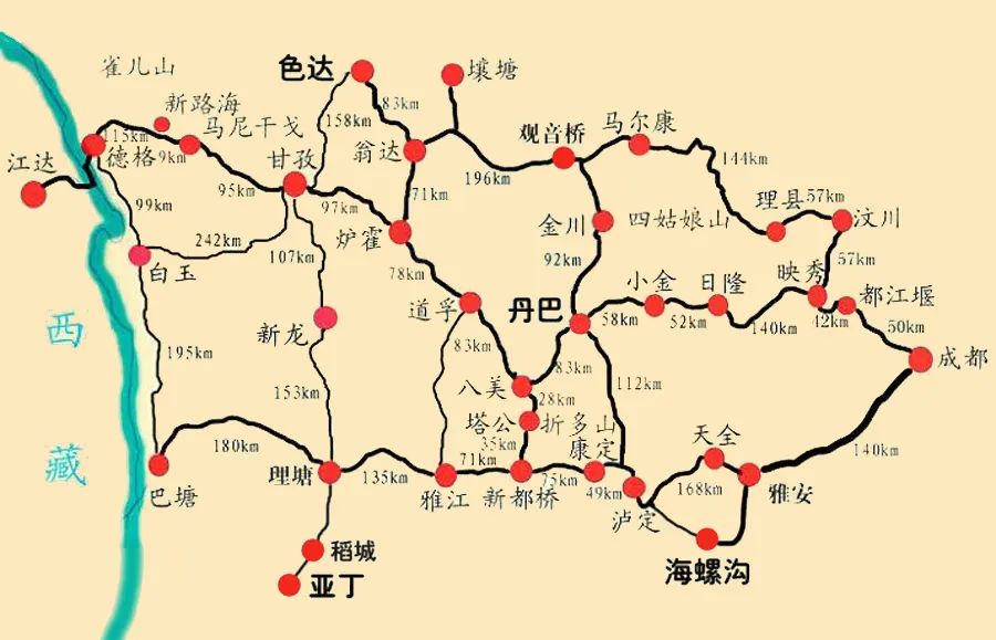
Along the ring road, there are many little-known niche attractions, such as: Lenggacuo, Wu Xuhai, Yaqing Temple, Yuzixi, Danling Mosca, Dawa Genzha, Cuoka Lake, Cuopu Ditch, etc., the tourism resources around Chengdu are so rich.
This summer vacation, due to limited time, I decided to drive to Daocheng Aden in western Sichuan. It is known as "the last pure land on the aqua blue planet" and "the last Shangri-La". It has an altitude of more than 4,000. This time I finally made up my mind to go.
The advantage of self-driving is that you can change your plans at any time.
Summer is the rainy season in mountainous areas. If it rains, many scenery cannot be seen. Therefore, during the trip, we kept paying attention to the weather conditions. When we were approaching Daocheng Yading, the weather forecast was always moderate rain, and because we had just finished traveling in Cuo In Pugou, my body had some altitude sickness, but in Aden, the altitude is 4200-4700m, and I have to climb mountains, which will definitely be too much for my body.
After reading the guide from netizens, I put Cuopugou and Aden in the same echelon. Its scenery is similar to Aden and can be compared with Aden. Coupled with the sudden outbreak of epidemics across the country during our trip, we decided to abandon Aden, shorten our trip, and go home early.
Although it is a bit regretful, I also reaped the beautiful scenery along the way, and this trip was considered a worthwhile trip.
Itinerary introduction
D1(2021.7.24) Wuhan-Ankang
D2(2021.7.25) Ankang-Chengdu
D3(2021.7.26) Chengdu-Luding Bridge-Kangding-Yala Pass-Xindu Bridge-Yajiang
D4(2021.7.27) Yajiang-Eighteen Bends of Tianlu-Litang-Maoya Prairie-Haizishan Sisters Sea-Batang
D5(2021.7.28) Batang-Cuopugou-Xinlong County
D6(2021.7.29) Xinlong County-Coka Lake-Yajiang River
D7(2021.7.30) Yajiang-Tagong Grassland-Moshi Park-Damba
D8(2021.7.31) Danba-Leshan
D9(2021.8.1) Leshan-Dazhou
D10(2020.8.2) Dazhou-Shiyan
See Chengdu again
Chengdu is the starting point for traveling in western Sichuan. There are so many tourist attractions radiating around Chengdu to the west and north, which makes me very envious of Chengdu people. They can reach the foot of the snow-capped mountains in more than 2 hours with just one step of the accelerator. And when we drive from Wuhan to Chengdu, it takes 2 days one way.
On the first day, we departed from Wuhan at 7 a.m. and arrived in Ankang at 5 p.m.
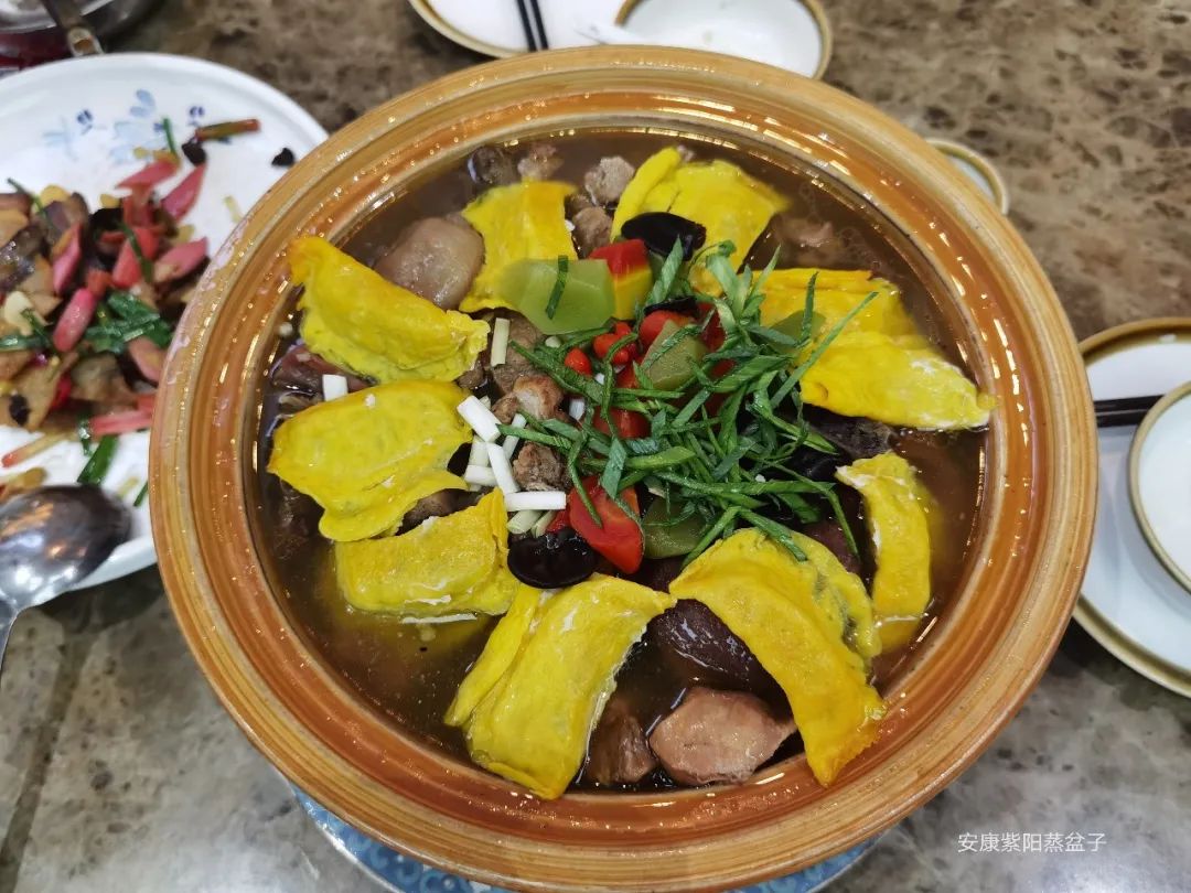
Ankang's specialty dish - steamed pot, which contains many dishes such as egg dumplings, vegetables, meatballs, etc. The portion is so large that the four of us didn't finish it.
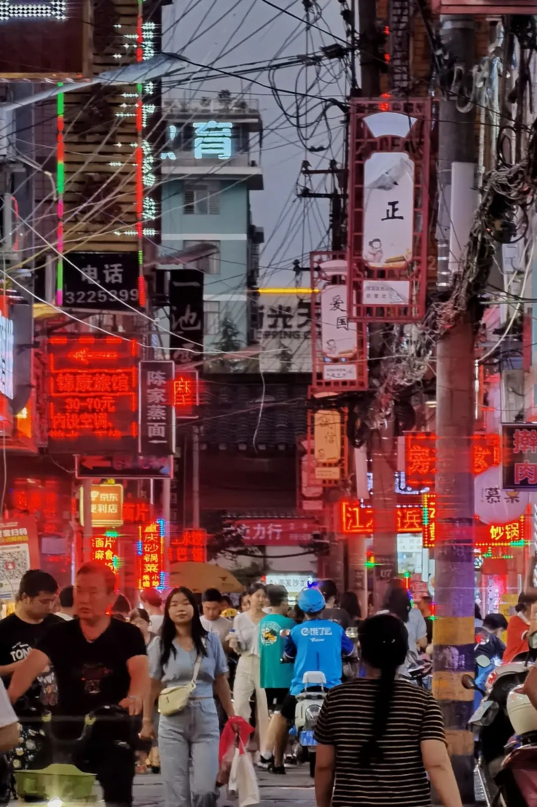
After dinner, take a walk back to the hotel and experience the night of the small town.
The next day, we set off from Ankang at 8 a.m., drove all the way on high speed, and finally arrived in Chengdu at 4 p.m.
For dinner, we found a restaurant called Tao De Clay Pot Restaurant with a good ranking on Dianping. Fortunately, we went there early, otherwise we would have had to wait for a long time for a table.
The food at this restaurant exceeded my expectations, very delicious and cheap. I still remember that friends can search for his signature dishes on Dianping.
Walking on the 318 Sichuan-Tibet Line
On the third day, the trip to western Sichuan officially started. From here on, we also drove on the long-awaited Sichuan-Tibet Line, the most beautiful road G318.
Departing from Chengdu at 8 a.m., the weather was gloomy. Coming out this season coincides with the rainy season in western Sichuan. It has been raining all the way. I hope the weather will improve later.
When passing through Ya'an, we encountered a heavy rainstorm, and the windshield wiper almost had no time to wipe it. We took a short rest at the Ya'an Tianquan Service Area.
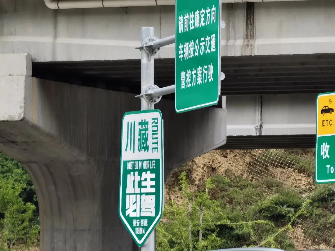
There are many cultural and creative shops in this service area, all related to Sichuan-Tibet self-driving. I saw many tourists buying cars with the "Must Drive 318 in this Lifetime" sign. I also saw many self-driving cars with similar signs in the parking lot.

Erlangshan Tunnel
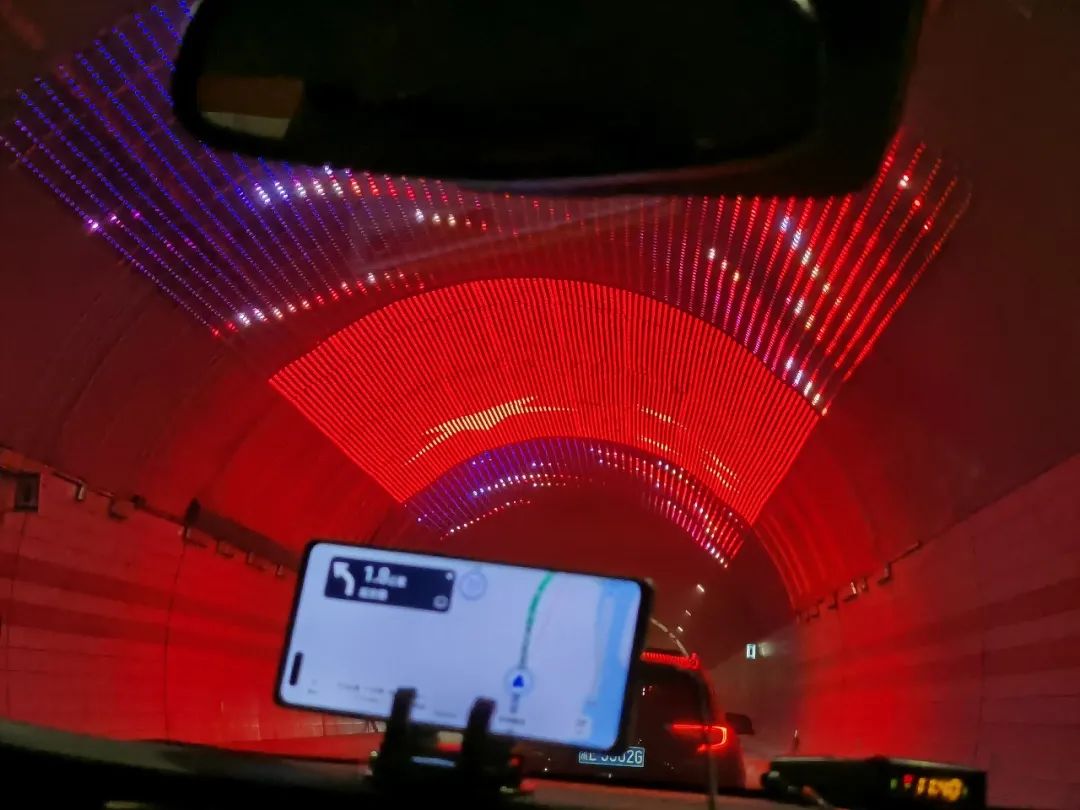
From Ya'an to Luding Bridge, you will pass through the Erlangshan Tunnel. The total length of the Erlangshan Tunnel is 13,459 meters. Once opened, it will be possible to cross Erlangshan in 10 minutes.
The tunnel entrance of the Erlangshan Tunnel is specially designed with a Tibetan architectural style cave door.


When passing through the middle of the tunnel, you can see a national flag pattern made of LED lights on the top. On our return trip, the top of the tunnel was marked by a pattern of party flags.
From here on, you will see many road signs along the way such as: Sichuan and Tibet must be driven in this life, 318 must be driven in this life, etc.
Luding Bridge
Luding Bridge, also known as Dadu Bridge, is located on the Dadu River in western Sichuan Province. It is a suspension bridge built with the approval of Emperor Kangxi of the Qing Dynasty. The area where Luding Bridge is located is an important transportation route from Sichuan to Tibet. In 1935, the Chinese Workers' and Peasants' Red Army "captured the Luding Bridge in flying colors" during the Long March, and the Luding Bridge has since become an important historical memorial site for the Communist Party of China. On March 4, 1961, it was listed as the first batch of national key cultural relics protection units.

Arrive in Luding County at 11:30. Luding County is located on the Dadu River, and the entire county is built along the river. There is the famous "Luding Bridge" here.

Parking outside the Luding Bridge Scenic Area is difficult and there are few parking spaces. When I arrived at noon, I didn't expect there were many tourists. It took me a long time to find a parking space in the paid parking lot of a restaurant.
To visit Luding Bridge, you need to walk across the bridge. After reaching the other side, you can visit the Guanyin Pavilion and then return from the bridge. Tickets are quite cheap.
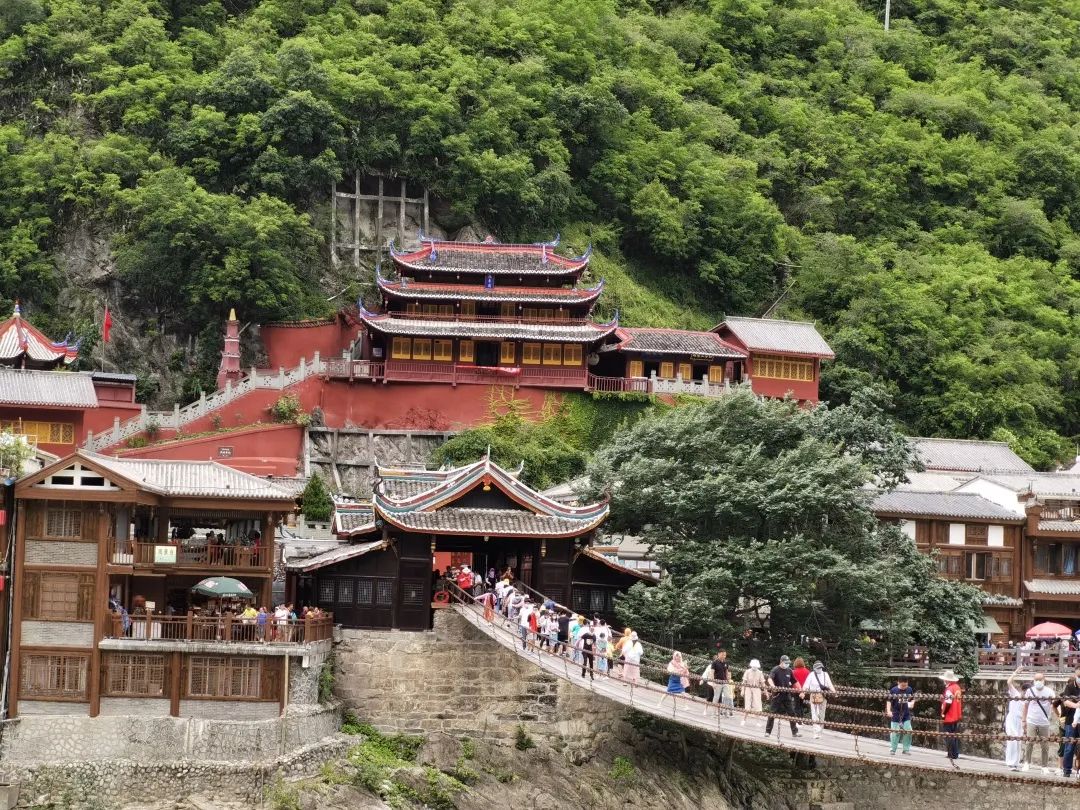
There is a sculpture of the Red Army at the foot of the mountain on the other side of the bridge.

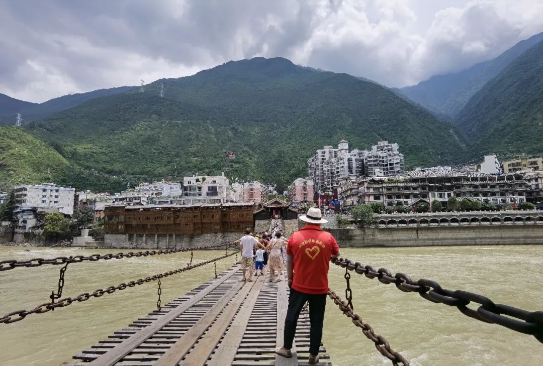
Luding Bridge is a suspended iron cable bridge. The whole bridge is composed of three parts: the bridge body, the bridge abutment and the bridge pavilion.
The bridge body is composed of multiple parallel iron chains. The bridge rails are directly erected by the iron chains. The bottom iron chains are covered with wooden boards to form the bridge deck. The handrails and the bottom chains are connected with small iron chains.
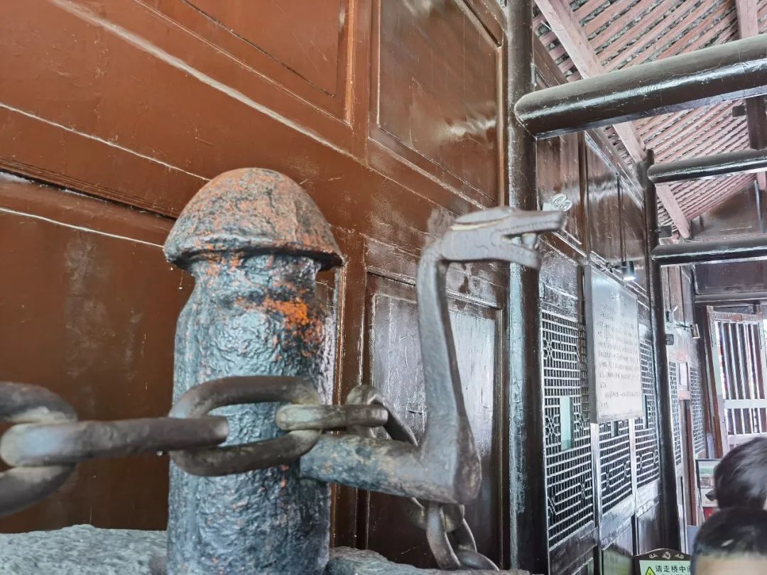
The bridge abutments are located at both ends of the bridge body. Iron piles are fixed in the bridge abutments, and iron chains are fixed in the iron piles of the bridge abutments on both sides.
The bridgeheads on both sides of the bridge are wooden structures; there is a bridge pavilion built on the anchor chain drop well, with cornices and corners, simple and generous.
At the west end of the bridge, there is a plaque inscribed by Kangxi in front of Guanyin.

Due to the limited load-bearing capacity of the bridge, the number of tourists on the bridge must be limited. There are staff at both ends of the bridge to maintain order, and in the middle of the bridge, for safety reasons, there are also staff to protect.
I thought the bridge was quite wide, but I didn't expect that when I actually walked onto the bridge, the bridge was shaking very badly. Looking at the rushing Dadu River under my feet, I was really scared. Wandering, I finally returned to the entrance. You can imagine how difficult it must have been for the Red Army to cross the river.
After visiting Luding Bridge, we set off from Luding Bridge at around 1 p.m. and arrived in Kangding City at about 2 p.m.
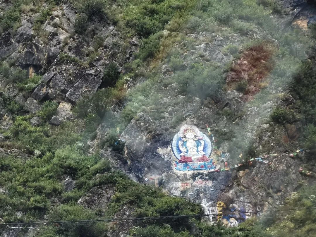
Kangding City is the capital of Sichuan Garze Tibetan Autonomous Prefecture. As the car passed through the city, I saw Buddha statues painted on the huge rocks on the mountain.
Kangding is famous for Kangding Love Songs. If you have time, you can visit Mugecuo Scenic Area, 17 kilometers away from the city, also called Kangding Love Song Scenic Area. The scenic area consists of plateau lakes, virgin forests, hot springs, snow peaks, strange mountains and rocks, and an 8-kilometer-long thousand waterfalls, forming a beautiful and colorful landscape.
We have no such plans for this trip. We will come back when we have the opportunity in the future.
From Kangding to Xinduqiao, you will pass through Zheduo Mountain, which is about 41 kilometers away from Xinduqiao.
Zheduo Mountain is known as the "First Pass of Kham". Only after climbing over Zheduo Mountain can you truly enter the Tibetan area. The winding mountain road with many twists and turns is a veritable "nine twists and turns".
One of the biggest highlights of Zheduo Mountain is that you can overlook Gongga Mountain in the distance. When the weather is good, you can enjoy the scenery of Rizhao Jinshan Mountain at the Zheduo Mountain Pass.
I have seen many netizens recommend taking Provincial Highway 434 on the Internet because it has less traffic and better scenery, so we chose this road to bypass Zheduo Mountain and wait until next time to see "Westward Zheduo".
The road signs starting from Kangding are all Tibetan style.
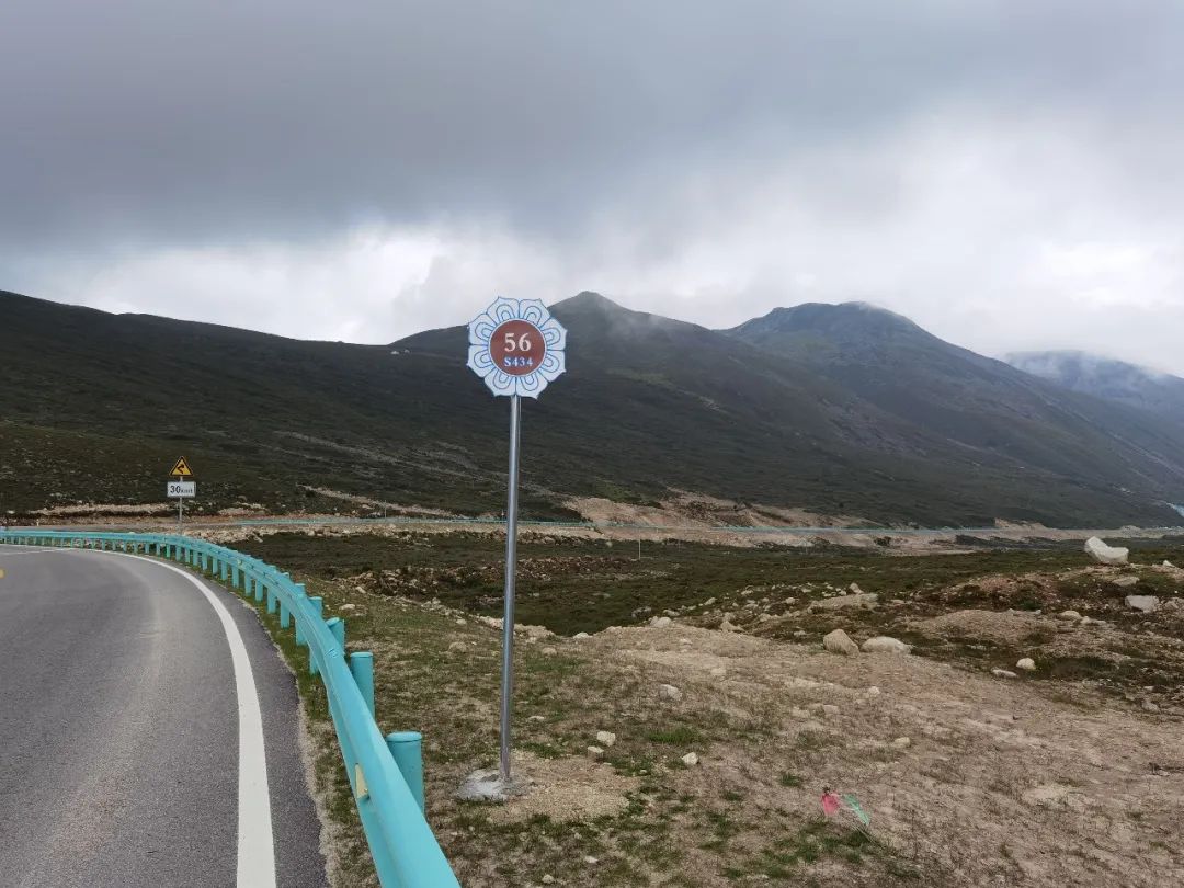
Passed by Honghaizi at three o'clock in the afternoon. Honghaizi is located behind Kangding Airport on Zheduo Mountain in Kangding, with an altitude of 4100m. The weather is gloomy and the color of Haizi is gray.

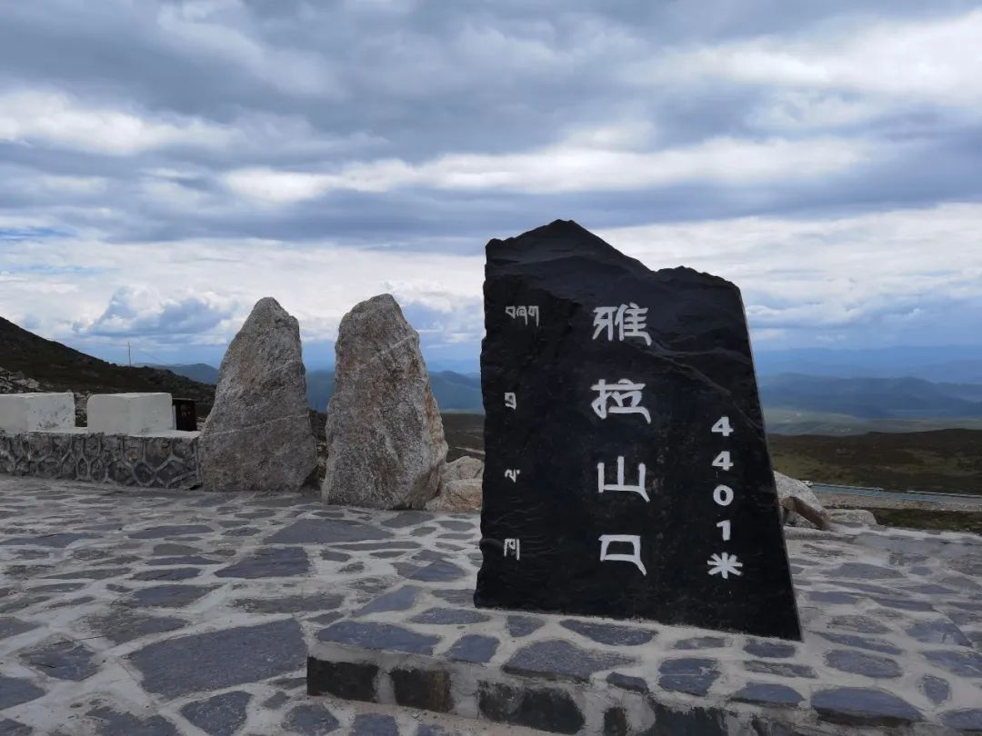
Then pass Yala Pass , with an altitude of 4401m. Due to the thick clouds, the Yala Snow Mountain in the distance cannot be seen.
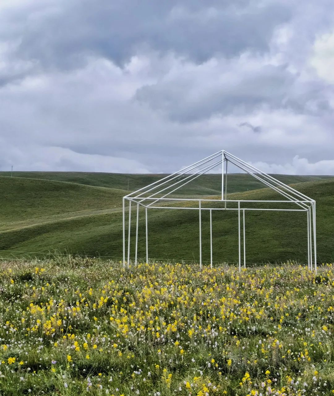
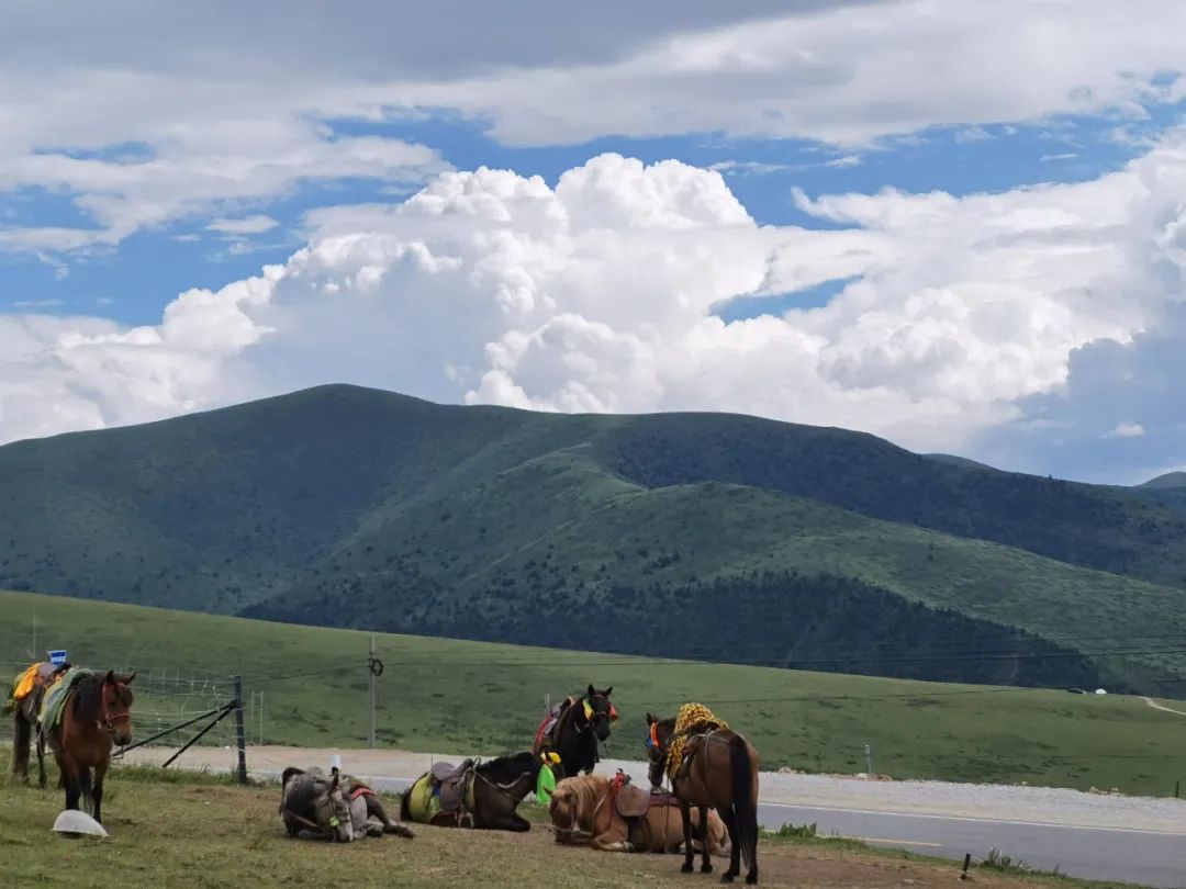
Continuing to set off, the weather started to clear up. I saw the grassland on the roadside full of flowers. Horses are grazing on the grassland, a beautiful pastoral picture.

Xinduqiao
Xinduqiao Town is located in the plateau valley area, with an average altitude of 3,460 meters.
Xinduqiao does not have outstanding iconic landscapes, but there are more than 10 kilometers along the road from Zheduo Mountain to Xinduqiao and Xinduqiao to Tagong, which is called the "Photographer's Corridor". There are winding rivers here. , the mountains are covered with wild flowers in summer, golden poplar forests in autumn, and from Xindu Bridge you can overlook the main peak of Gongga Mountain, the king of Shu Mountain at 7556 meters.
Arrive at Xinduqiao at around 4 o'clock.
Because of the higher altitude here, we did not choose to stay here. In order to avoid high altitude sickness and poor rest, we chose towns with an altitude of less than 3,000 meters for overnight accommodation.
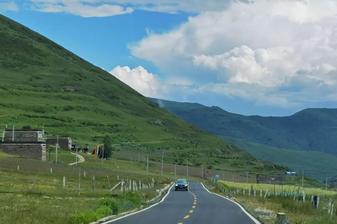
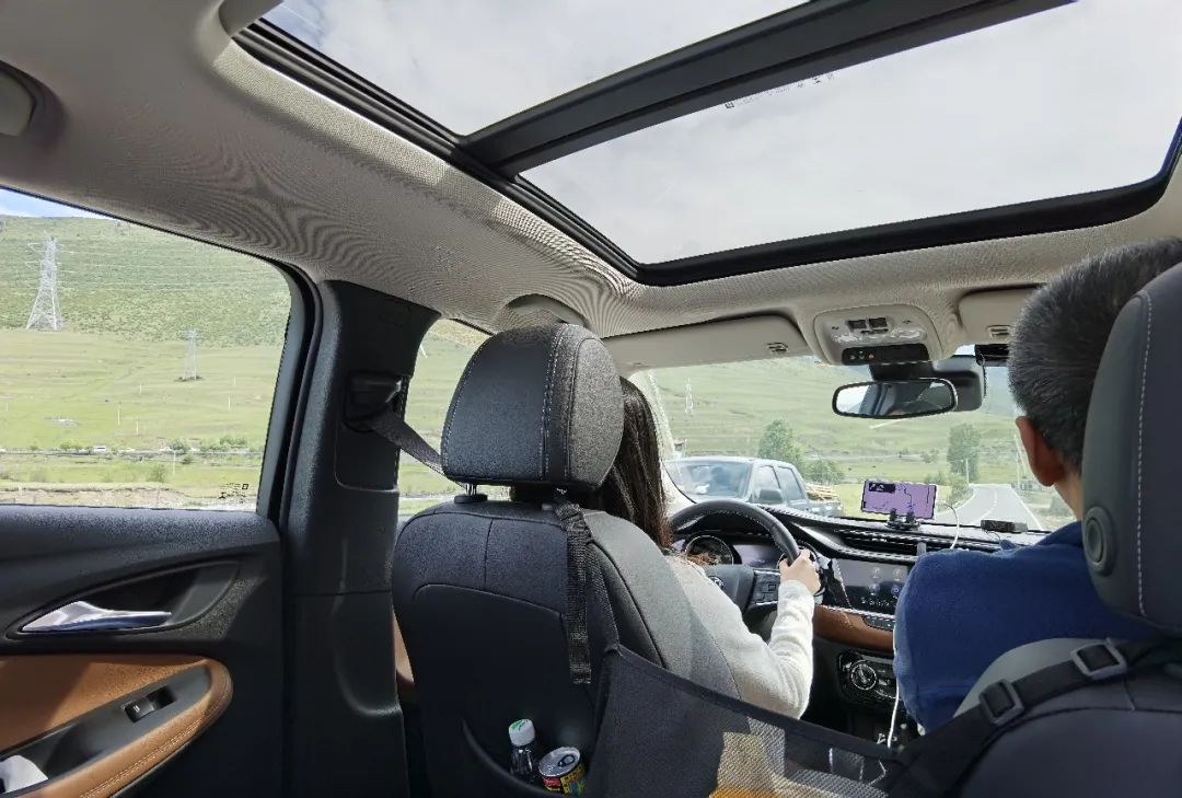
The road conditions on this section are also very good. My daughter has just gotten her driver's license and is experiencing her first self-driving experience on such a beautiful G318.
Look at the scenery along the way, it will be more beautiful in autumn!
Arrive at Yajiang at 6:30 pm. Yajiang is named after its location on the bank of Yalong River. The altitude here is only 2600m. Tourists who are afraid of altitude sickness will feel more comfortable staying here at night.
Yajiang County is located in the transition zone between mountain canyons and grasslands on the eastern edge of the Qinghai-Tibet Plateau. Affected by its complex terrain, it has formed a unique and magical natural landscape; and because Yajiang County is located in the hinterland of the Kham region and stands on the Ancient Tea Horse Road, There are rich Kham cultural landscapes. This is also the hometown of matsutake mushrooms, and there are many shops selling matsutake mushrooms along the way.
Because Yajiang County is close to the river, the county towns are built on the mountains, layer upon layer.
The road is narrow and parking here requires high driving skills. When staying in a hotel here, the hotel owner is responsible for parking.
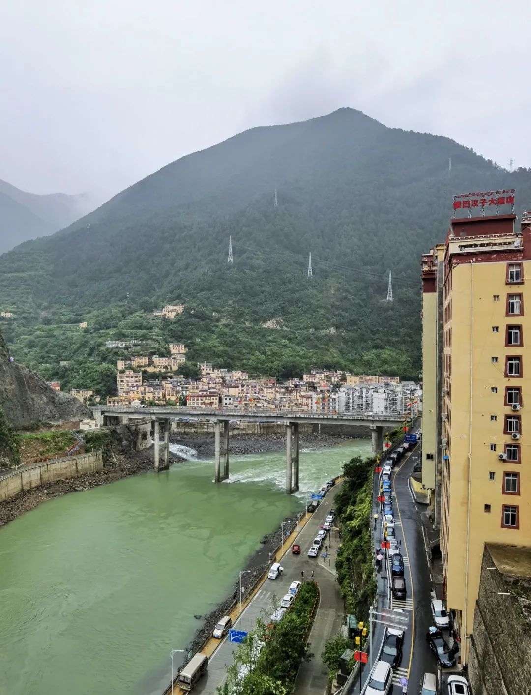
Yajiang County in the rain
Haizishan Sisters Lake/Gem on the Sichuan-Tibet Line
The fourth day’s itinerary is: Yajiang-Litang-Haizishan Sister Lake-Batang.
Along the way, you will cross Jianzi Bay and Kazila Mountain to reach Litang, the "City in the Sky", and then cross Haizi Mountain to reach Batang. This road can pass through the Eighteen Bends of Tianlu, the "City in the Sky", Maoya Prairie and Haizi Mountain Sister Sea, with excellent scenery.
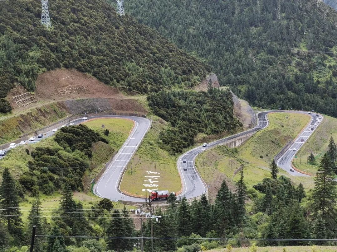
Eighteen bends on the road to heaven
Departing at 8:30 in the morning, heading west along National Highway 318, we arrived at the Eighteen Bends of Tianlu viewing platform at about 9:20.
Looking down from the observation deck, you can see several 180-degree turns on the mountain road, and there are large signs on the ground "Eighteen Bends of the Sky Road". It was still raining at this time, and the mountains were filled with clouds and mist.
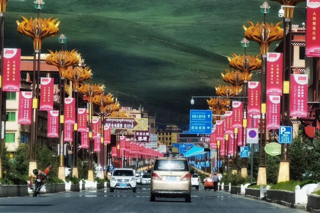
Litang
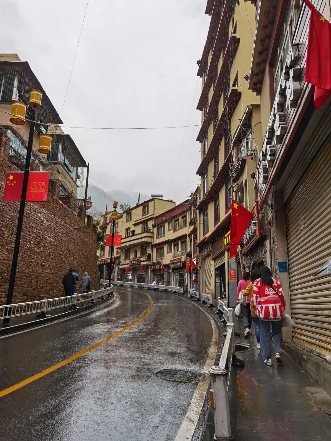
Litang County is 285 kilometers away from Kangding. It is a junction connecting National Highway 318 and Provincial Highway 217, and is an important town on the Sichuan-Tibet Line. Going west is the only way to enter Tibet, going north to Xinlong County and Garze County, and going south to Daocheng Yading. Litang County is 4,014 meters above sea level, 400 meters higher than Lhasa. It is known as the "City in the Sky".
Last year, Litang Tourism Ambassador Ding Zhen used his sunny smile to promote tourism in his hometown of Litang, letting more tourists know about Litang.
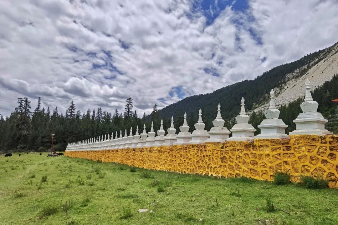
There are many scenic spots near Litang worth visiting, such as the Genie Holy Mountain with an altitude of 6204 meters, 110 kilometers away from the county seat, and the charming Maoya Prairie, which originates from the southern slope of the North Xiasai Snow Peak in Batang County (some say it originated from Litang). The tall white pagoda on the grassland is said to be one of the three pagodas built by Princess Wencheng when she entered Tibet.
There are also the Eye of Genie, which is nearly 3 hours drive from the county seat, and so on.

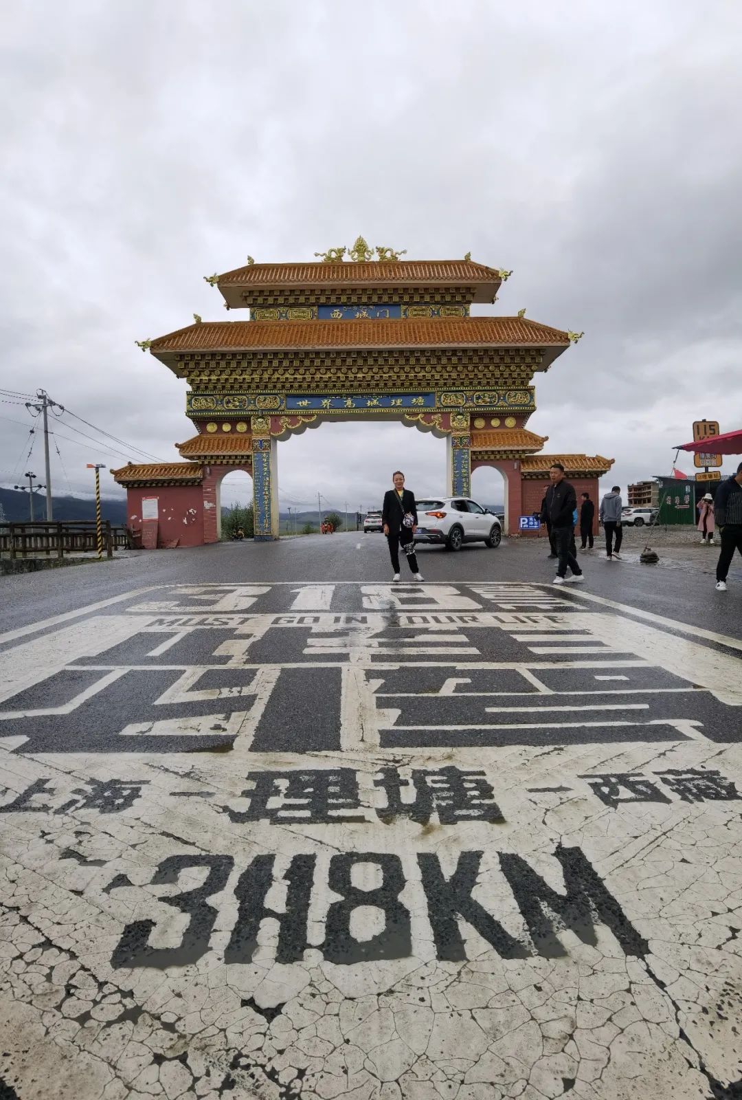
Arrive at Litang at nearly 12 o'clock.
Every tourist driving in Sichuan and Tibet will check in at the first "National Highway G318" landmark at the city gate of Litang in Gaocheng when passing through Litang, and then leave in a hurry.
When we passed by Litang, people checked in at the landmark from time to time. It was too difficult to take a photo without people, and the weather was not good, so I took a photo from a distance and left.
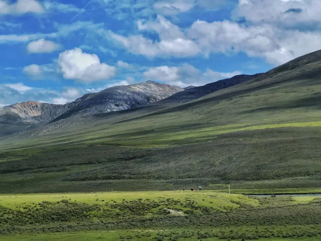
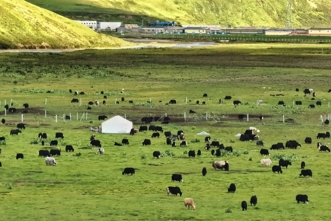
All the way to the west, you can see the snow-capped mountains in the distance.
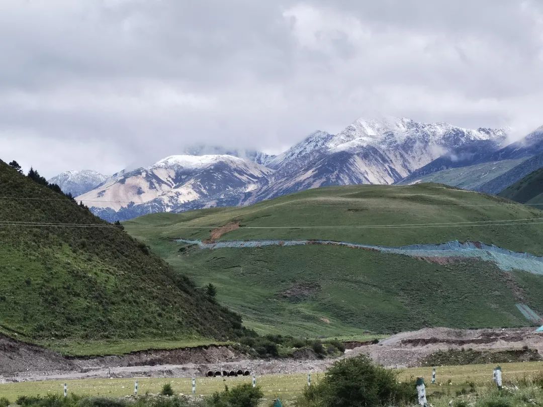
You can see many yaks grazing on the continuous prairie on the road, and local herders set up tents on the grassland to graze.

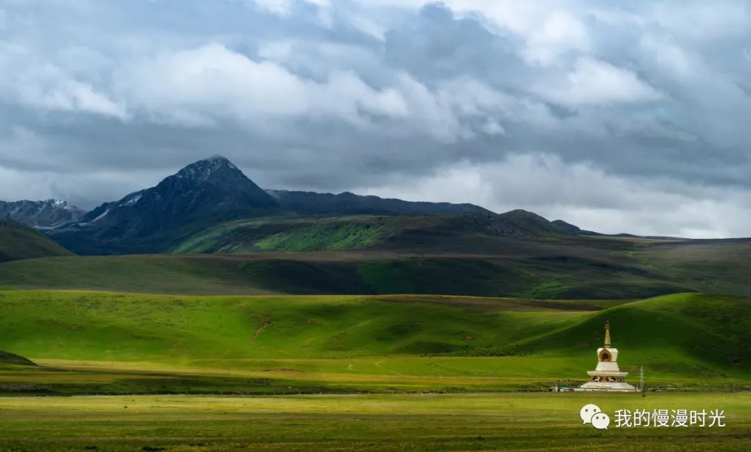
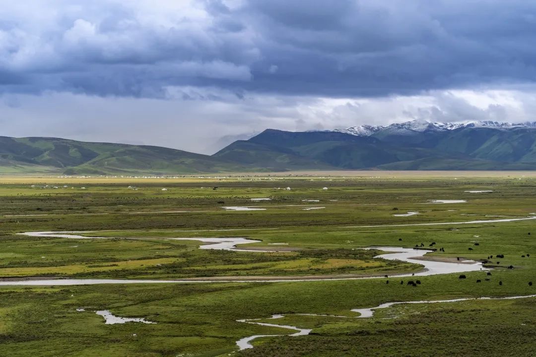
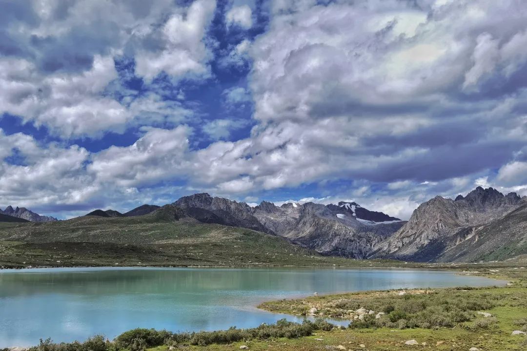
Wulianghe Wetland
After passing Litang County and heading forward, you will find the vast and famous alpine Maoya Prairie with an average altitude of 4,300 meters. "Chinese Geography" magazine once rated the Maoya Prairie as one of the six most beautiful grasslands in China.
Wulianghe National Wetland Park is the most representative attraction on the Maoya Prairie.
The altitude here is 4090m.
Wuliang River is a section of Litang River. It is called Wuliang River in Litang County in the upper reaches. It forms nine twists and turns on the grassland.

We arrived at Wulianghe Wetland Scenic Area at 1:50 pm.
When we arrived, the weather was still a little gloomy, but standing on the grassland, we still felt like we were in a painting: the snow-capped mountains in the distance, white clouds, the grassland nearby, the meandering river, and the dotted yaks on the grassland. in. If the weather is good, watching the sunset here should be beautiful.

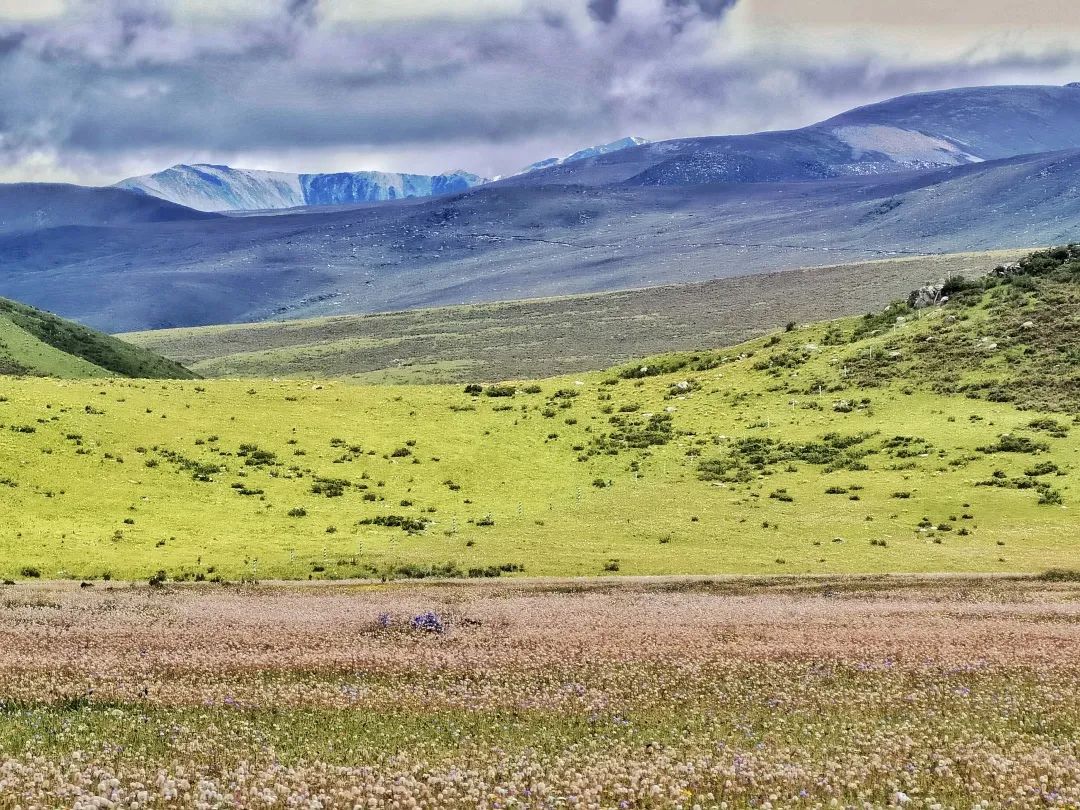
Maoya Prairie
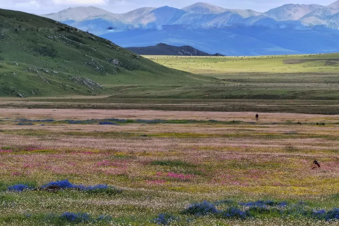
On the way from Litang to Batang, you will also pass through Maoya Prairie. In this season, the Maoya Prairie is filled with flowers, which is indescribably beautiful.

The G318 national road is winding and winding, and we arrived at the Haizishan Sisters Lake Observation Deck at about three o'clock in the afternoon.
Recommended attractions |Haizishan Sisters Lake
Haizi Mountain is the largest ancient ice body relic in my country, with more than 1,000 large and small Haizi. Haizishan Sisters Lake Observation Deck, 4700m above sea level. It is one of the top ten unmissable attractions on the 318 Sichuan-Tibet Highway. Standing on the observation deck, you can see the whole picture of Sisters Lake, as well as the surrounding pastoral scenery and Haizi Mountain. Under the sunlight, the lake sparkles like two emeralds.
The weather was not good on our way out, but the sun was beautiful on our way back.
This was taken during the trip
This was taken on the return trip
Continuing down the mountain along the national highway, you can reach the sister lake, which is 4500m above sea level.
Continuing forward, we will pass by the Cuopugou Scenic Area when approaching Batang County. There are accommodation inns outside the Cuopugou Scenic Area, but in order to avoid altitude sickness, we still chose to stay in Batang.
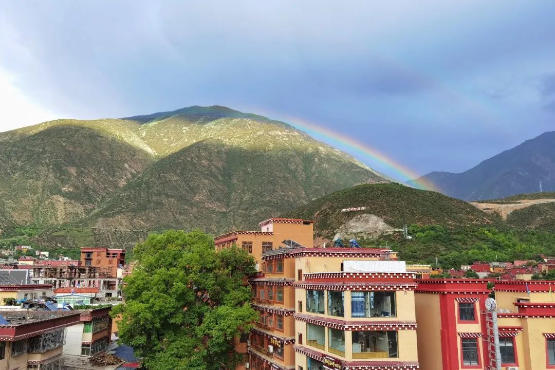
We arrived at Batang at around 5 p.m. The altitude of Batang is only 2,500m.
While dining at the restaurant in the evening, I was surprised to see a double rainbow after the rain.
I watched the news that night. There were new cases of COVID-19 in Chengdu, and two districts were classified as medium risk.
Fortunately we did not pass through those areas, otherwise we would have been quarantined when we returned home.
Due to the sudden epidemic in various places, our subsequent travel plans changed several times, and in the end we had to shorten the trip. We can’t go through Chengdu on our return trip, so we have to take a detour.
Secret Land in Western Sichuan - Cuopu Valley
Recommended attractions|Cuopu Valley
The Cuopu Valley on the Sichuan-Tibet Line is a newly developed niche attraction that I saw online. It is not very famous yet, so there are not many tourists.
It integrates natural and cultural landscapes such as snow-capped mountains, plateau lakes, virgin forests, rivers, canyons, waterfalls, hot springs, grasslands, temples, wild animals and plants, and is highly ornamental. It is called the last secret place on the Western Sichuan Plateau by netizens.
This scenic spot is 4100m above sea level, but you can take a sightseeing bus in. After entering, you can see beautiful mountains and lakes at several scenic spots without having to climb mountains.

Departing from Batang in the morning on the fifth day, it took 1 hour to reach the tourist center of Cuopugou Scenic Area. The tourist center at the entrance of the ditch is 3300 meters above sea level.
The schematic diagram of the entire scenic spot is as follows:
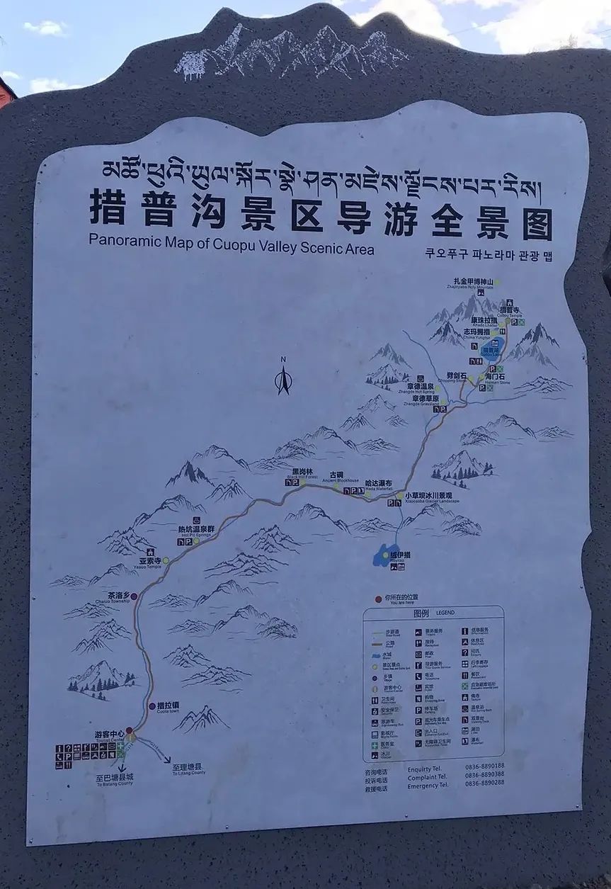
We bought tickets and sightseeing tickets here before going into the ditch. Take the elevator from the visitor center to the third floor and take the scenic bus into the ditch at 9:30 in the morning.
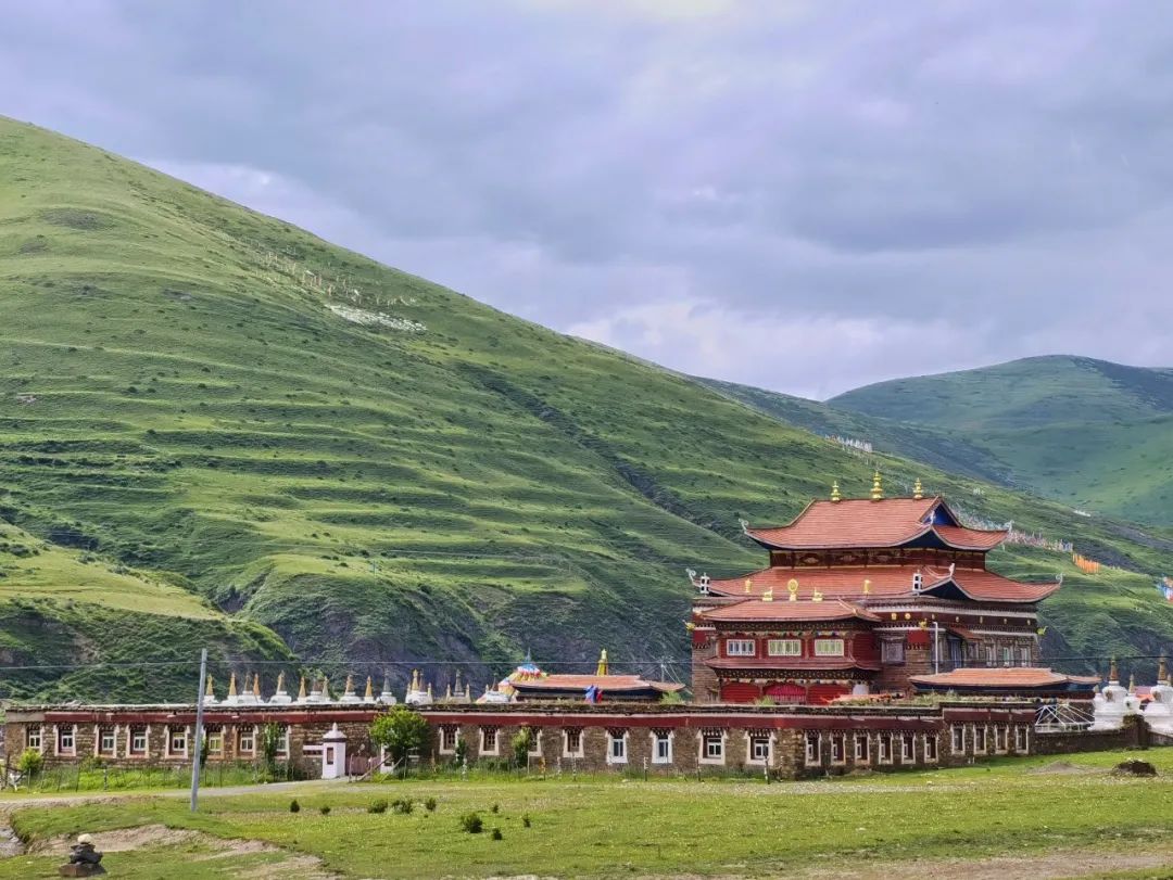
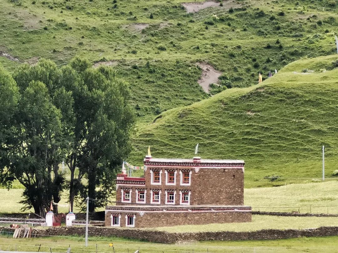
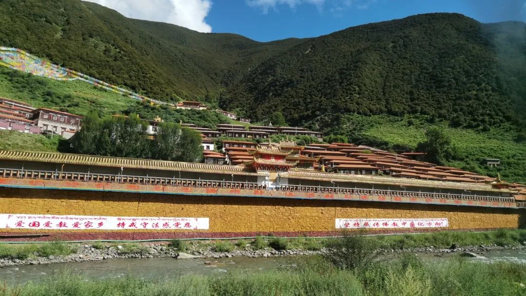
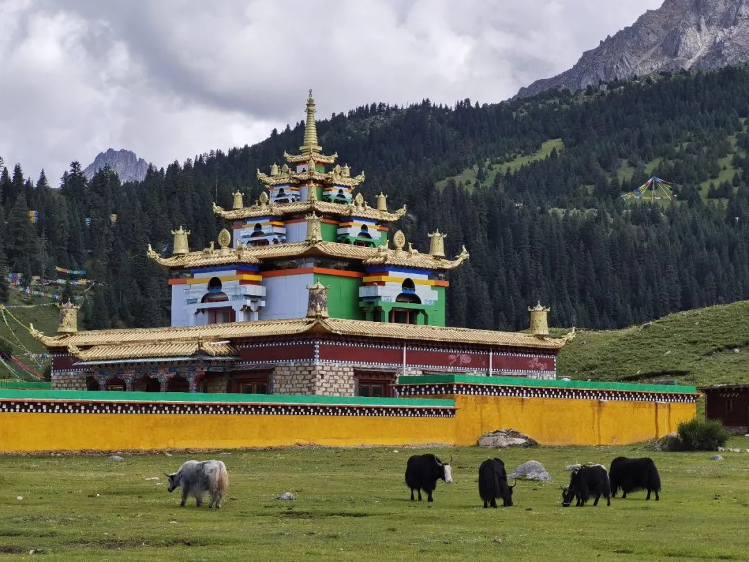
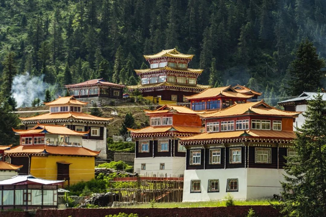
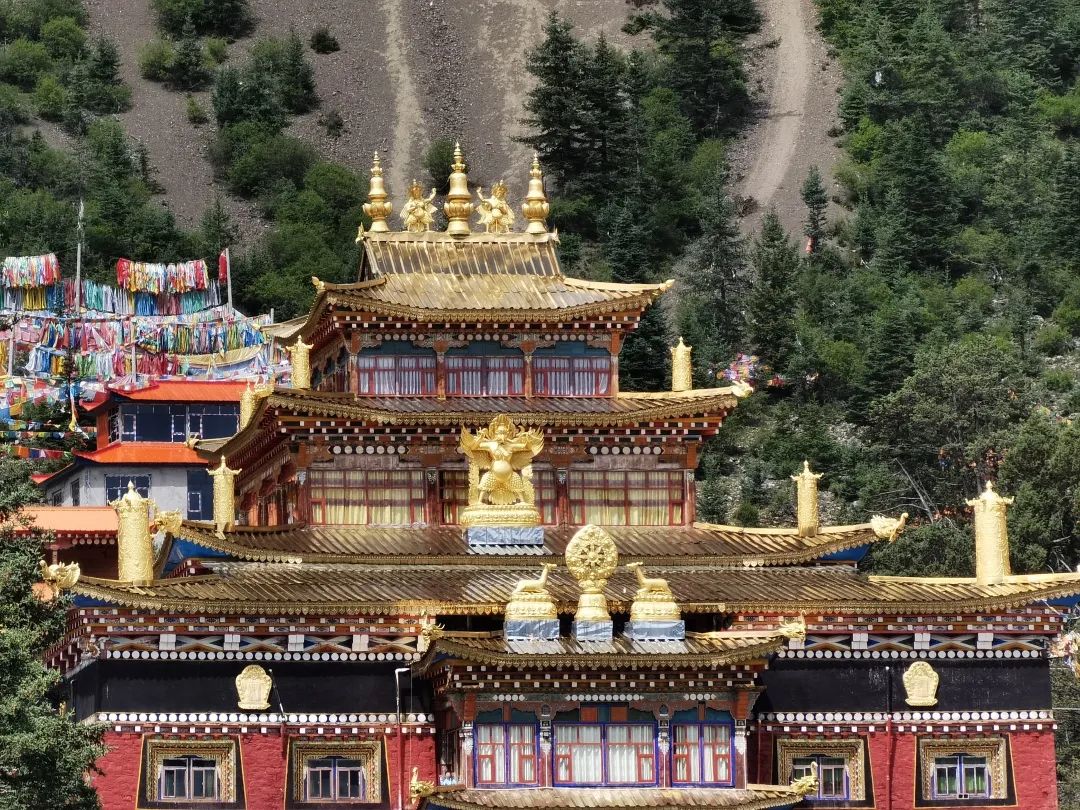
The scenery along the way when you take the bus into the ditch is also very beautiful. You will pass by a temple: Yasuo Temple. The temples are built in layers and are very spectacular. It is said that this temple is more than 1,200 years old and is still in use. Female disciples live in it. But this place is not open to the public, so I took a few pictures in the car.
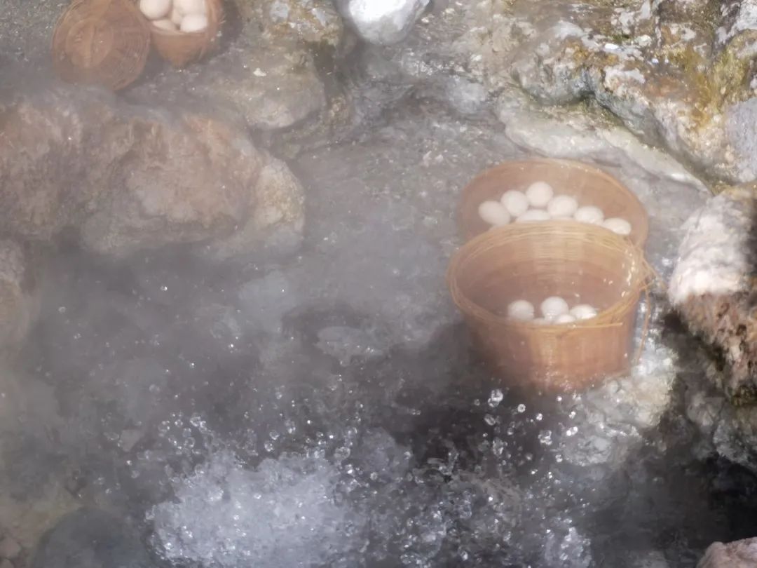
The first parking point is the Geothermal Hot Spring Group . The geothermal heat here is quite rich, and large and small springs are scattered on the hillsides, beside the roads, and along the rivers. Waves of heat filled the entire canyon.

The temperature of this spring is very high, so boiling eggs is no problem. Boiled eggs are 3 yuan each.
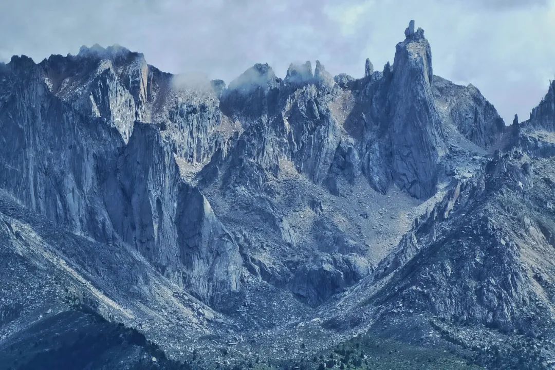
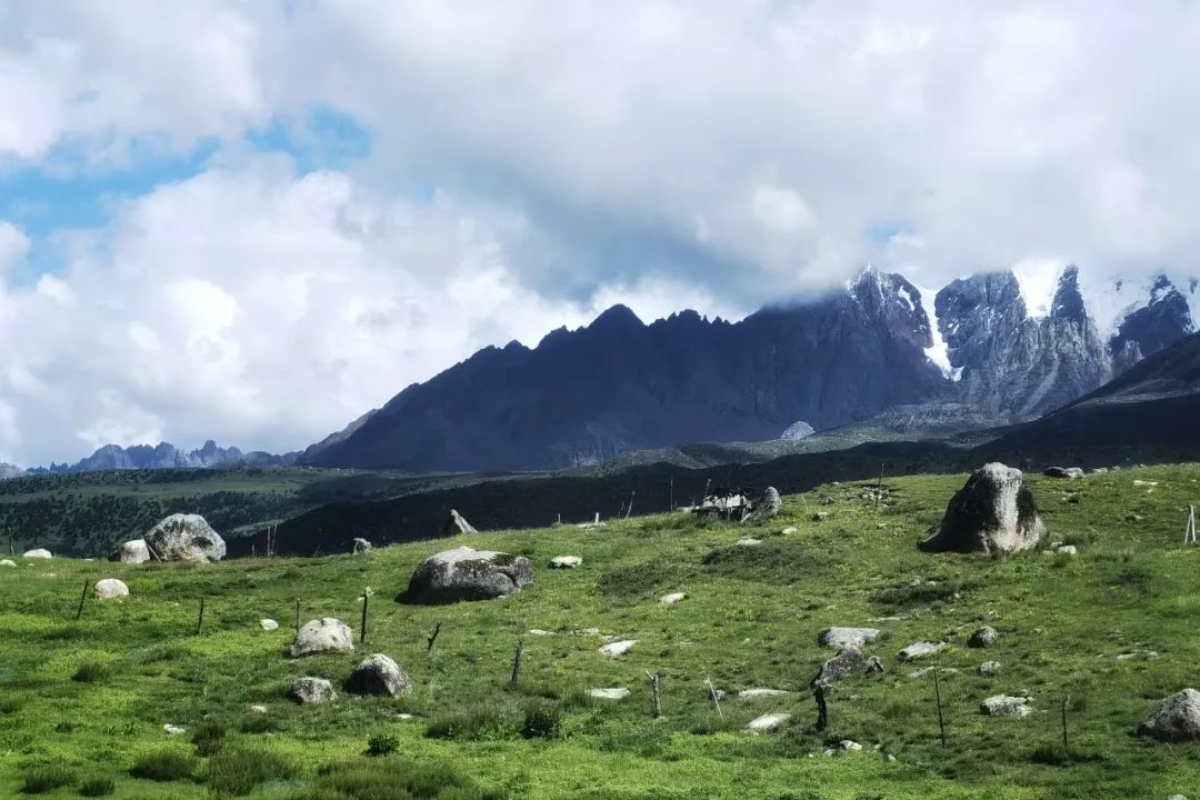
The next stop is Zhangde Grassland, which is very open and can be viewed from a distanceZhajinjia Boshen Mountain The mountain has rugged cliffs and exposed rocks. It is very imposing. At the foot of the mountain is Cuopu Lake.

At this stop, there is a check-in sign indicating that 318 must be driven in this life.

After sitting in the car, we can see the sacred mountain with us all the time.
Below is the scenery taken on the sightseeing bus.

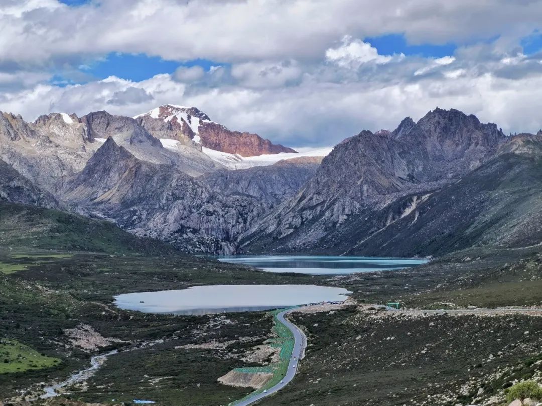
The last stop of the sightseeing bus reaches the foot of the sacred mountain - Cuopu Lake. The color of the lake is clear and blue, and it is beautiful with the towering mountains.
Cuopu Lake is located at the foot of the Holy Mountain and is surrounded by dense forests and grasslands. I'm really lucky today. The weather is nice. The grass beside Cuopu Lake is green and full of flowers.
We stood by the lake, holding our breath and intoxicated.
The lake here is so green that it’s mesmerizing.
The temples by the lake sparkle with gold.
From here, you can take a battery car to the innermost Cuopu Temple, or you can go there by yourself on the lakeside plank road.
If your physical strength allows, it is recommended to take the lakeside plank road all the way to the temple inside and then take a battery car out, so that you can enjoy the different scenery along the way.
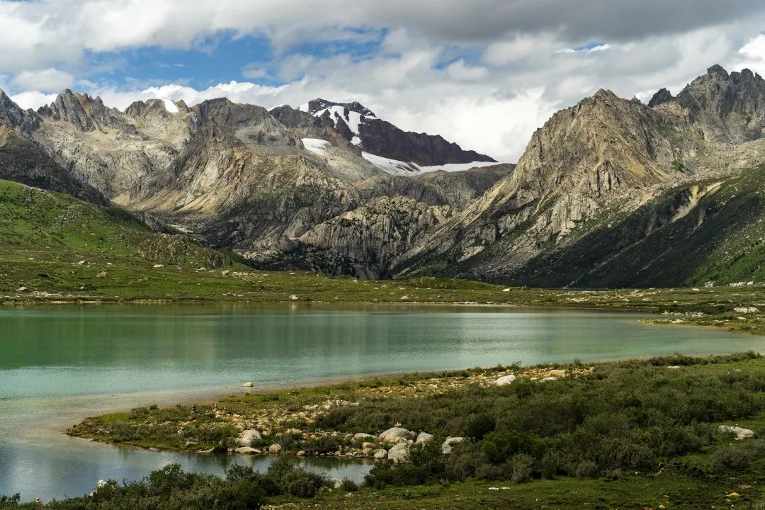
We chose to start hiking from here. After hiking for three kilometers along the wooden plank road, we can enjoy two small lakes: Zhima Yongcuo and Kangzhu Yongcuo.
Maps of several scenic spots around Lake Cuopu are as follows:

Hiking on a mountain with an altitude of more than 4,000 meters is still very tiring. I am a little out of breath and need to walk and take a rest.
Walking along the wooden plank road to the No. 1 viewing platform, you can see swarms of plateau koi in Cuopu Lake.
The fish will swim to the shore to compete for food accompanied by the sounds of local people calling and chanting scriptures.

Then walk to No. 2 and No. 3 observation decks. In this section, you can walk around the lake and appreciate Lake Cuopu from different angles.
You can see the temples by the lake in the distance, and their reflections in the lake are beautiful.


The water of Zhimayongcuo Lake is emerald green, and the weather turns cloudy in the afternoon, so the scenery is slightly less impressive.


Going back to the plank road and continuing forward, there is a smaller lake. Legend has it that it was formed from the tears of the stone woman on the Zhajinjiabo Mountain. Kangzhu Lacuo ", the lake is relatively small, and under the light and shadow the color of the lake water looks like a watercolor painting.


After visiting Kangzhu Lacuo, walk to the nearby sightseeing station and take a battery car to Cuopu Temple.
Cuopu Temple Backed by Zhajinjia Boshen Mountain and facing Cuopu Lake, the temple is majestic, solemn and simple, and is a typical Tibetan-style building.

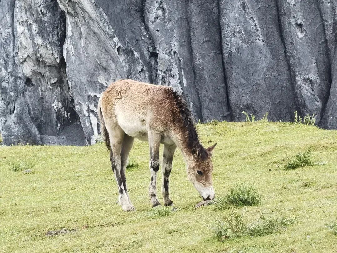
The carvings and murals in the temple hall are exquisitely crafted, and prayer flags flutter in the wind around the temple. Here you can often see wild animals such as argali sheep and Tibetan pheasants foraging for food in the temple grounds.
You can take a battery car outside the Cuopu Temple to return to the sightseeing bus point. The cost of the battery car is also included in the ticket.
Cuopugou travel tips
1. The entrance ticket to Cuopugou is 100 yuan, and the sightseeing fare is 90 yuan. The scenic spot currently implements summer discount fares, tickets are half price 50 yuan, and sightseeing cars are 90 yuan without discount. Sightseeing bus closing time: 19:00 in summer and 18:00 in winter.
2. You must buy a sightseeing ticket. The sightseeing ticket includes two sections:
The first section: from the visitor center to Lake Cuopu. Stop at 2 scenic spots on the way: Rekeng Hot Spring Egg-Zhangde Grassland. Leave 5-10 minutes to browse. Finally, you will drive directly to the lake and have free time.
Section 2: From the Cuopu Lake bus point, transfer from the minibus to the sightseeing battery car to Cuopu Temple. You can stop at a small lake on the way. Basically you can see the beautiful scenery without walking. If you have good physical strength, you can walk along the wooden plank road from Cuopu Lake to Cuopu Temple, and then take a battery car back from Cuopu Temple.
3. The altitude of Cuopu Valley Scenic Area: 3300m at the mouth of the ditch and 4100m inside the scenic area. The overall altitude is relatively high, so you need to pay attention to altitude reflection.
4. Tour time reference: The sightseeing bus takes about 50 minutes one way, and it takes about 4 hours to travel within the scenic area. If you take the plank road, you can shorten the time if you are in good physical condition and don’t have high fever. You can also take the entire journey by car, which will take less time.
5. Suggested tour order: Take the sightseeing bus to Cuopu Lake first, then walk on the plank road to explore the big lake and see the small lake, then go to Cuopu Temple, and take a battery car back to the sightseeing bus boarding point.
If you have enough time, you can go out along the scenic road from here. The scenery along the way is beautiful. If you get tired along the way, you can take the passing sightseeing car out of the scenic area.
We set off from the scenic spot at around three o'clock. We have to rush to Xinlong tonight. We have to first take the 318 National Highway back to Litang, and then take the 227 National Highway north from Litang to Xinlong.
On the way from Batang to Litang, we passed by Haizishan Sisters Lake again.
The weather was sunny today, and at the Haizi Mountain Pass I could finally clearly see the snow-capped mountains in the distance. At this time, the two dependent sister lakes exuded intoxicating beauty in the sun, like two gems. Next to the lake is National Highway 318.

Passing byMaoya Prairie, the Maoya Prairie is even more beautiful under the sun, and it deserves to be named one of the six most beautiful in China by National Geographic Magazine One of the grasslands.
I saw many tourists taking photos in the sea of flowers. The weather is good and the snow-capped mountains in the distance are clearly visible.


Recommended|G227 Litang-Xinlong
Return to Litang at around 5 pm and have dinner.
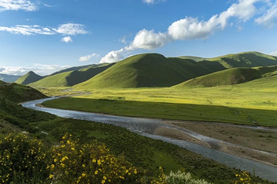
Start walking north from Litang G227 National Highway , about 6.30-7.00, the sun sets in the west, and there are white clouds in the blue sky, on the grassland Casting light and dark shadows, groups of yaks graze on the grassland, the river meanders, and flowers are everywhere on the roadside. Such quiet beauty is exclusive to us at this time.


Then climb the mountain and reach an altitude of 4120m. The undulating valleys and towering coniferous forests on the roadside make people feel as if they are in the Tianshan Forest Farm in Xinjiang.

The section of the G227 National Highway from Tang to Xinlong is as beautiful as the G318 National Highway. I recommend everyone to take a trip.

We finally arrived at Xinlong County at around 10pm, which is 3032m above sea level. There were almost no lights in the county town at night. When I looked up, I saw a sky full of stars that I had not seen for a long time, and I could clearly see the Big Dipper.
Jiutian Yaochi-Coka Lake
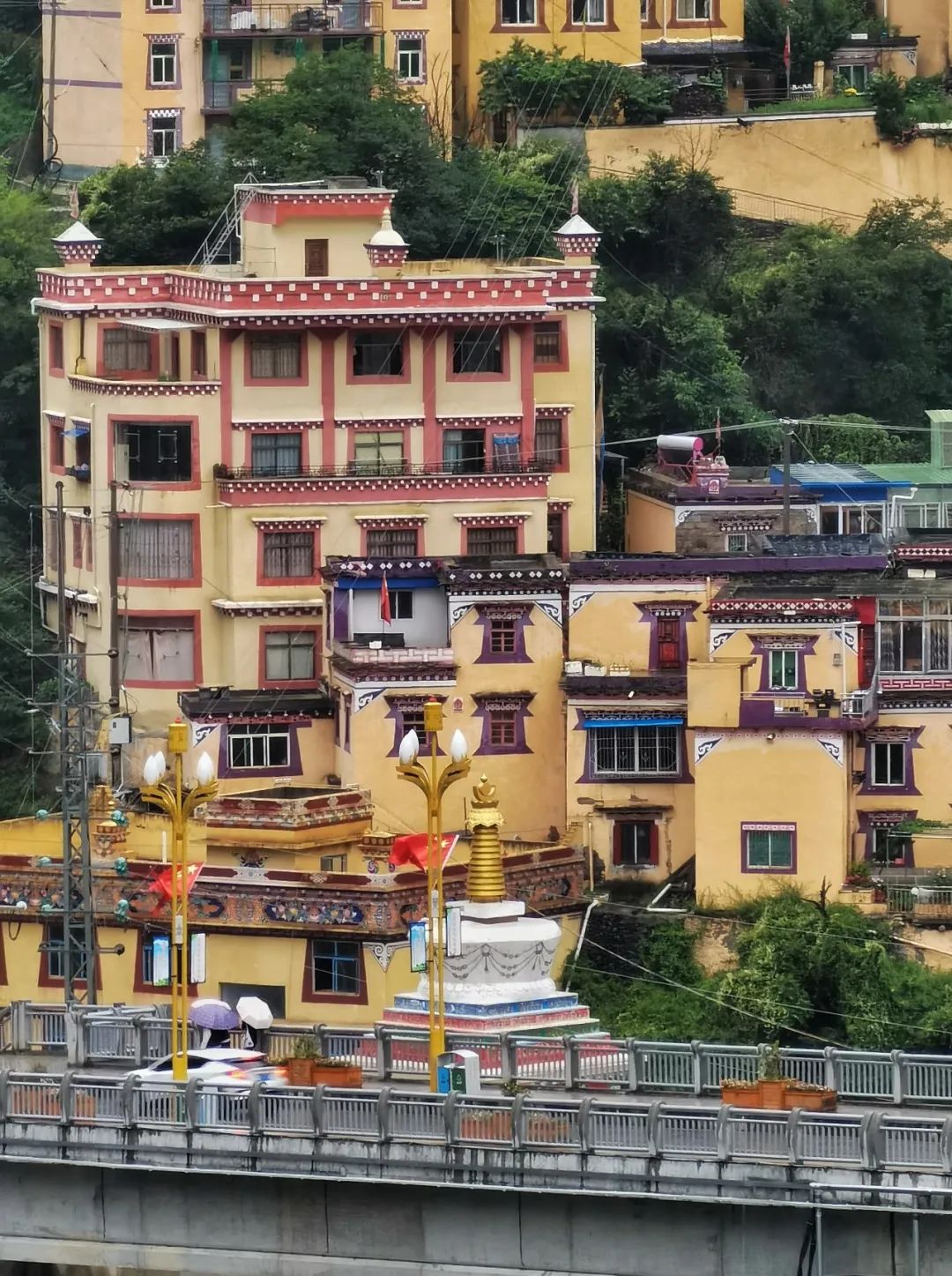
When I woke up in the morning, I could clearly see what this small county town looked like. We live right by the river. The roofs here are very colorful.

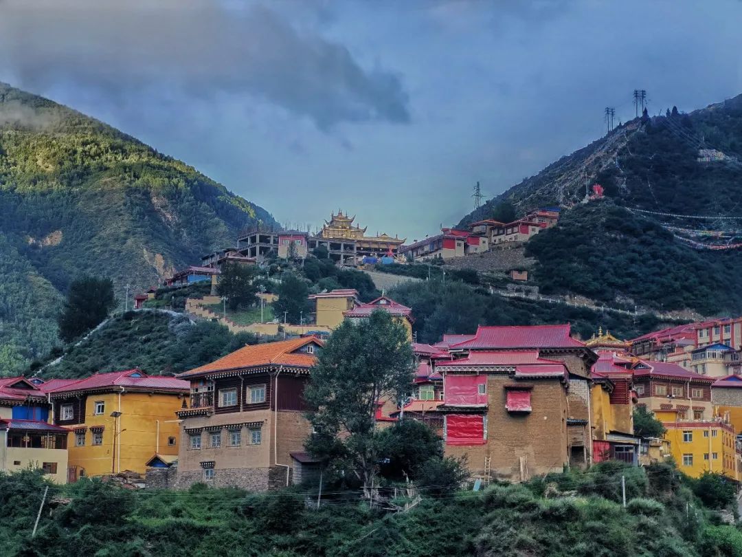
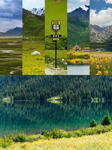
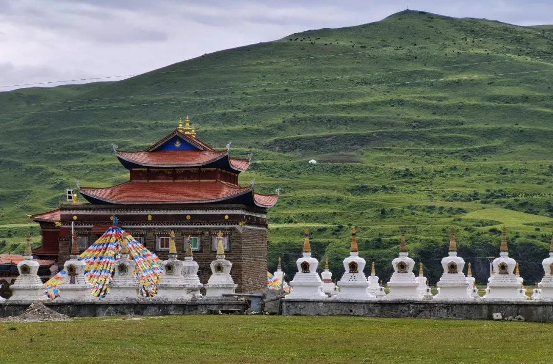
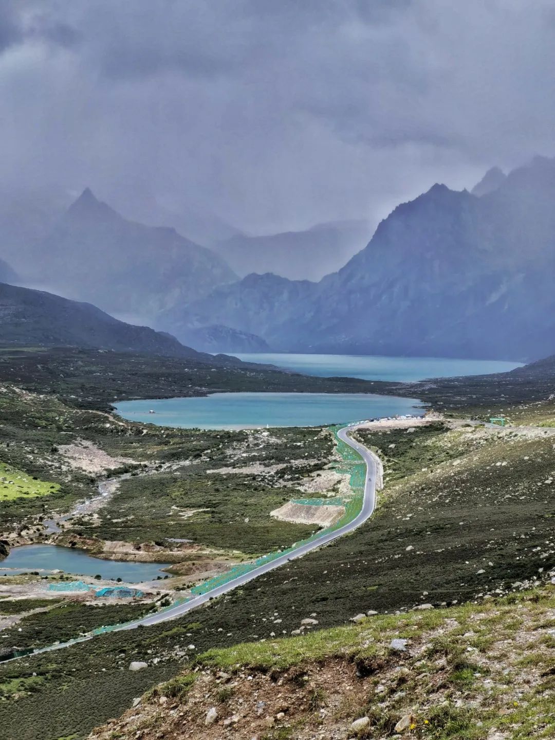
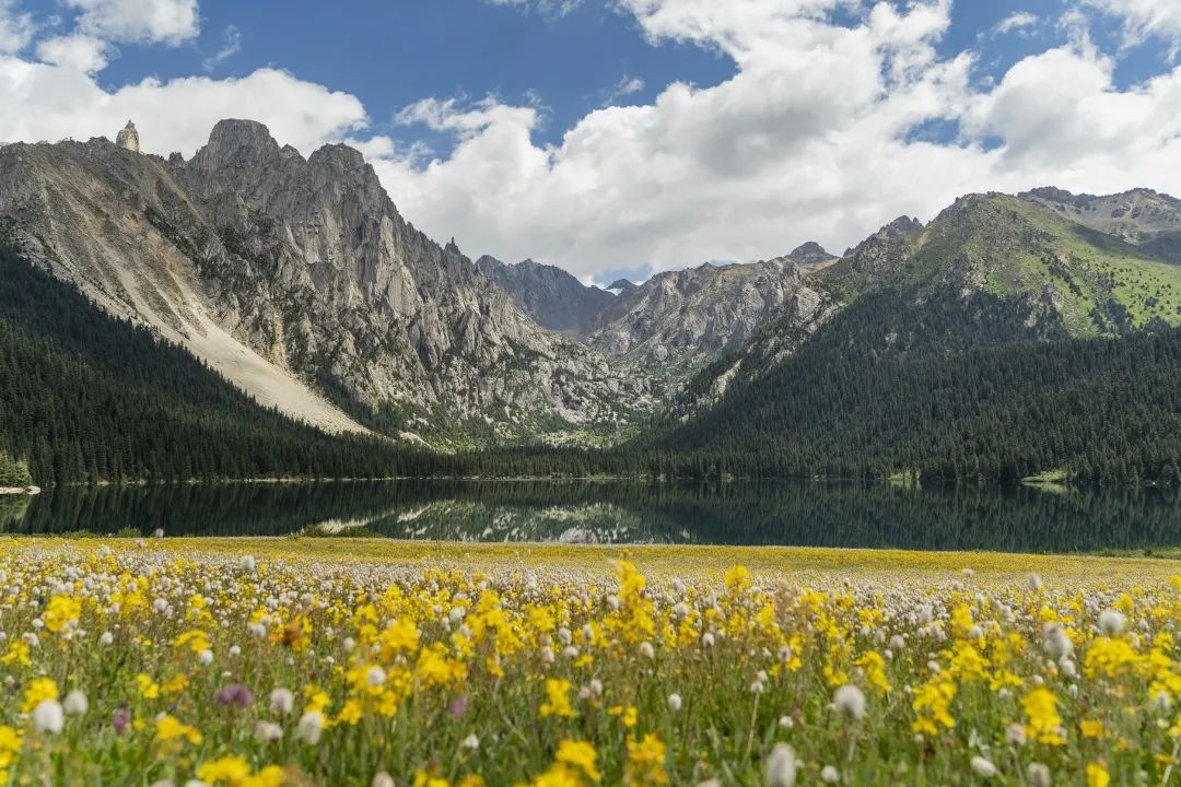
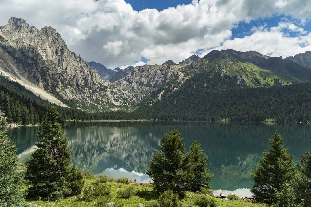
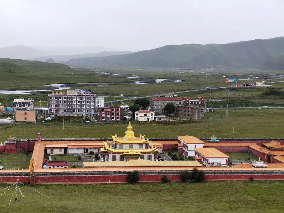
Recommended attractions|Tsokha Lake
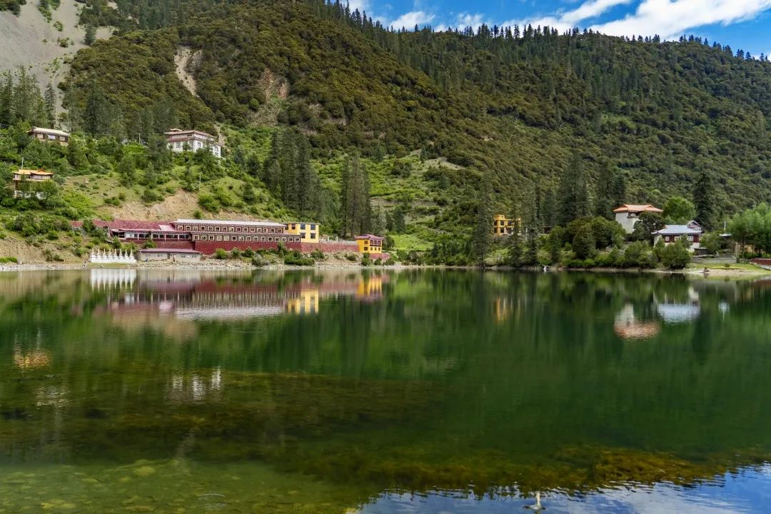
Cuoka Lake is located in Mali Township, Xinlong County, Ganzi Prefecture, Sichuan Province, 32 kilometers away from the county seat. It is known as the "Wonderland on Earth, Nine Heavens Yaochi". Cuoka Lake, locally called Cuoka Haizi, is a freshwater lake with a surface area of about 3 square kilometers, meaning "emerald". In the hearts of local people, it is the embodiment of the holy lake.
In 1358, Puba Denzi, the successor of Tibetan Buddhism, built a Kagyu sect temple by the lake and named it Tsokha Temple. Cuo is the lake and Ka is the edge, which means the temple by the lake.
On the sixth day, we went to visit Tsokha Lake .
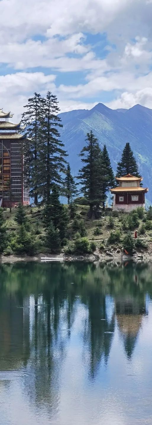
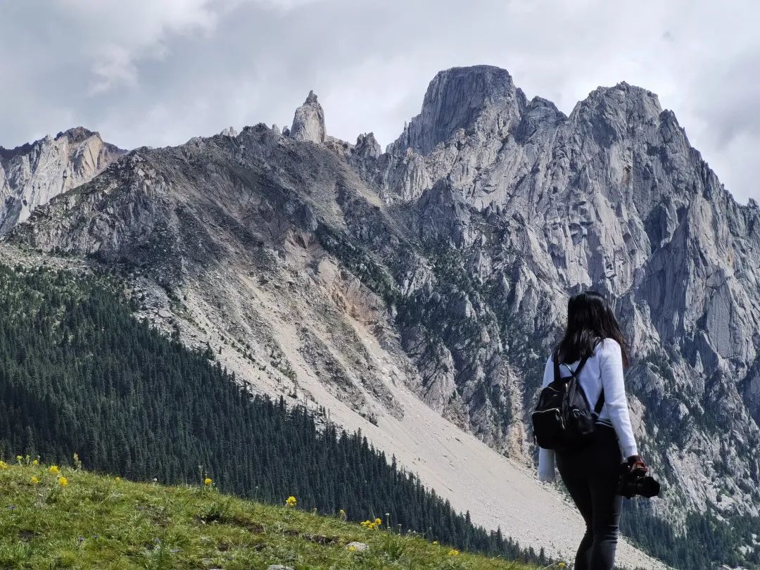
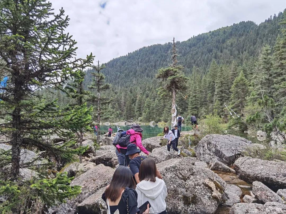
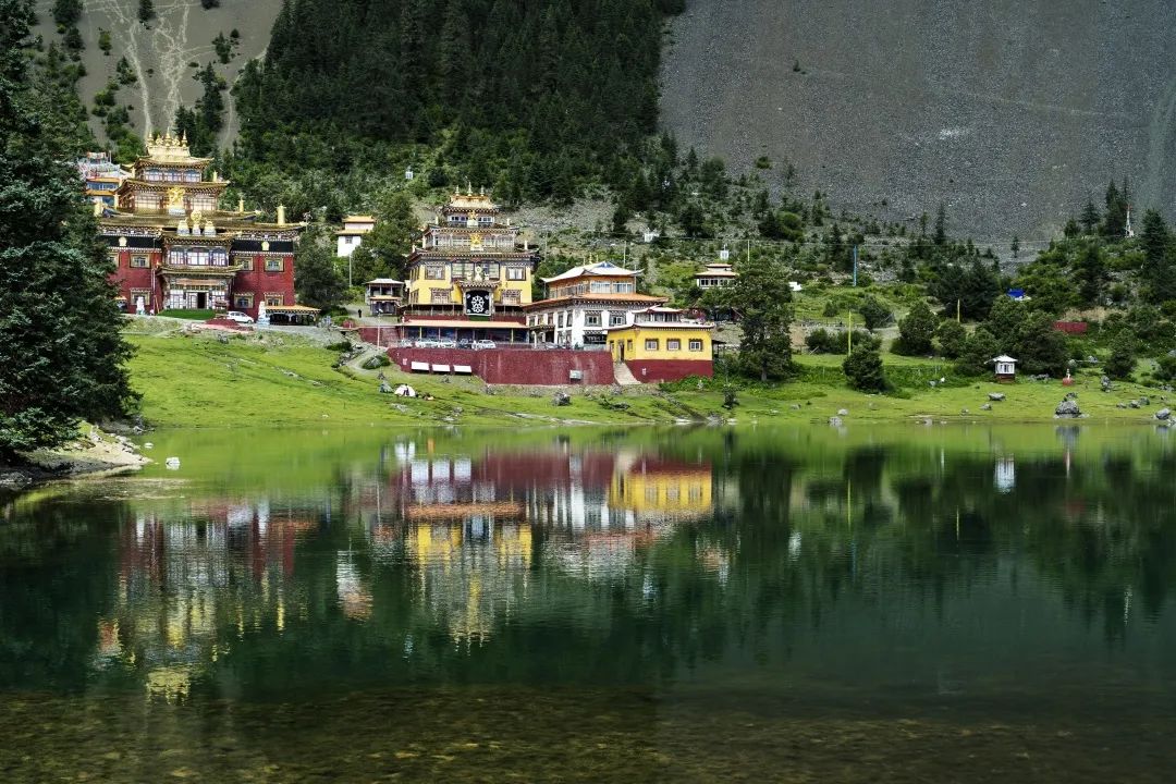
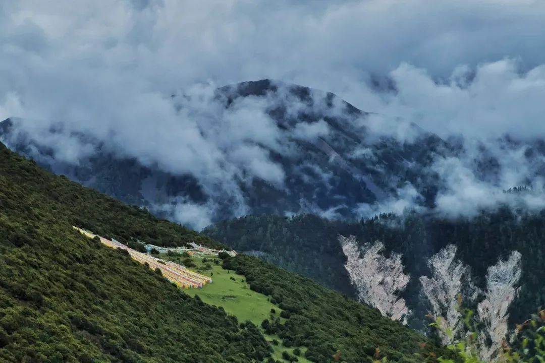
I saw pictures of this place on the Internet. The turquoise lake is surrounded by magnificent temples. The blue sky, white clouds, green mountains and temples are reflected in the lake. It is like a fairyland on earth, and I am attracted by its beautiful scenery.
Departing from Xinlong at around 9 a.m., we first take a section of the national highway, and then we need to walk more than ten kilometers of winding mountain road. The road is very narrow, very steep, and has many twists and turns.
There are some residential houses on the mountain. Looking at the surrounding mountains, climbing higher and higher, I never imagined that there is a beautiful lake hidden inside.
We arrived at the top of the mountain at around 10 o'clock. Although this is not an official scenic spot, the locals have set up a checkpoint here. 10 yuan per person.
As the car continues to drive in, you can see a green lake on the right, which is Tsoka Lake. The altitude here is 3900m.

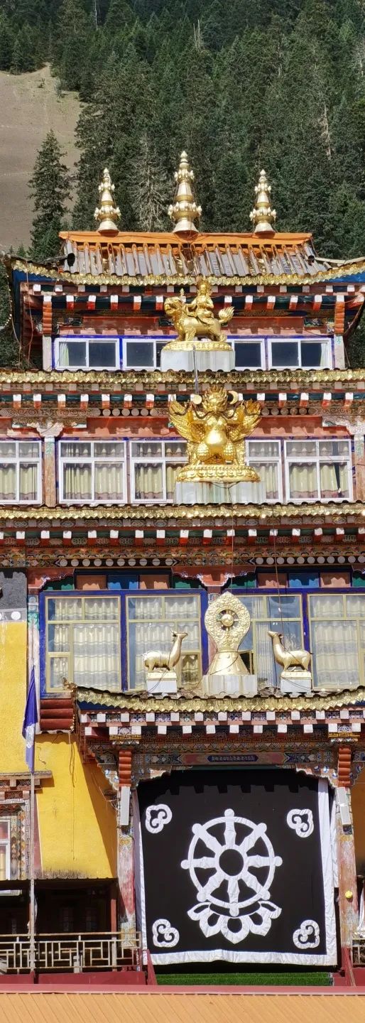
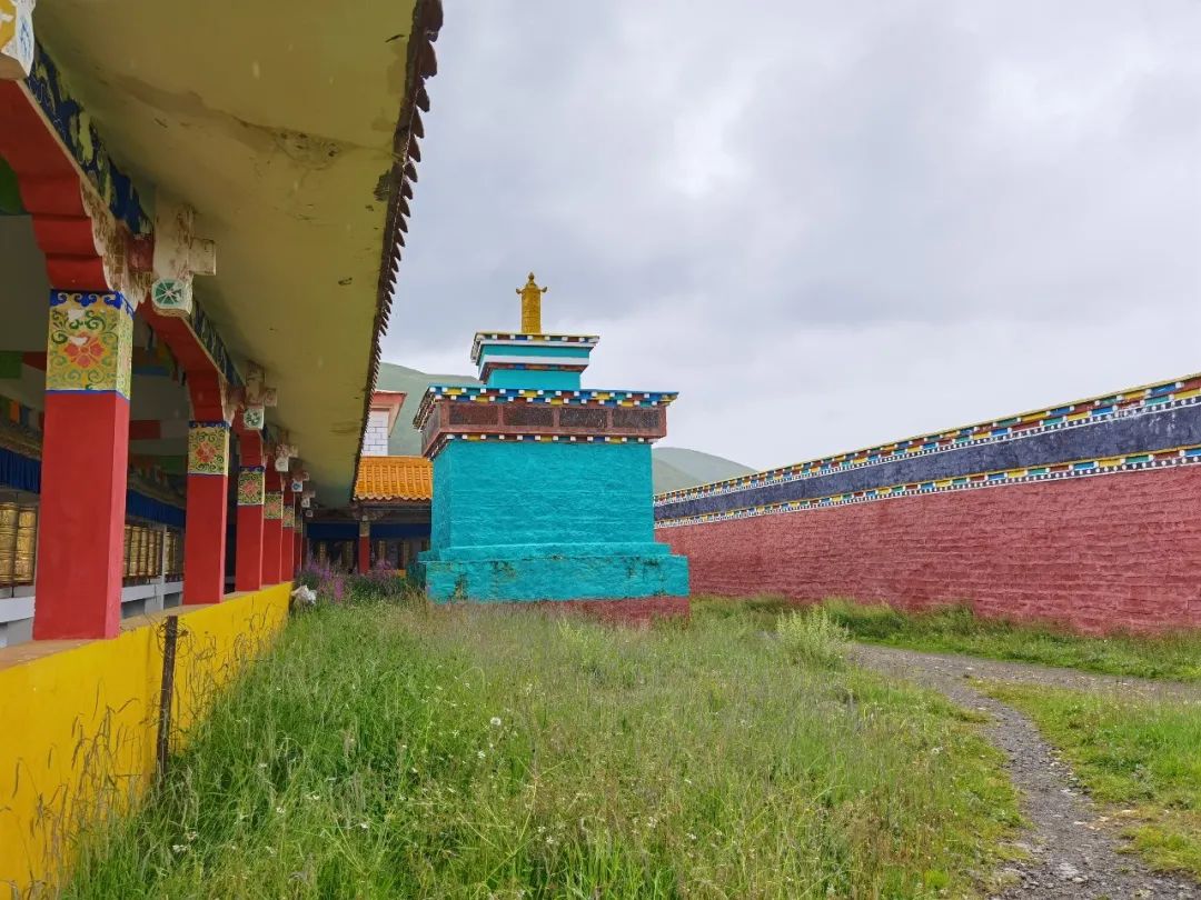
The tallest temple in the middle of the picture above actually houses a giant Buddha. We didn't see it when we went there. When we came back and checked online, we found out that the Buddha statue was temporarily covered there.
The pictures of the Big Buddha found on the Internet are as follows:

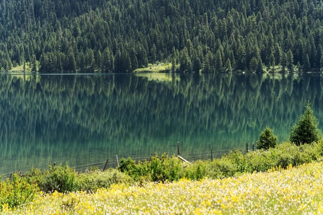
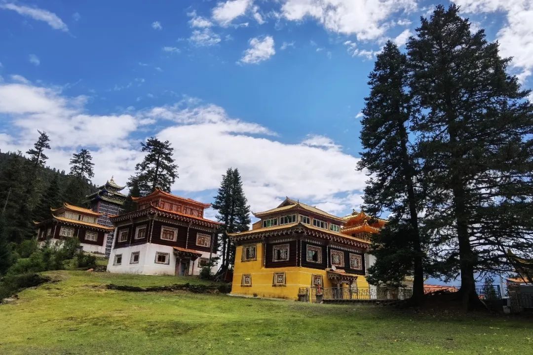
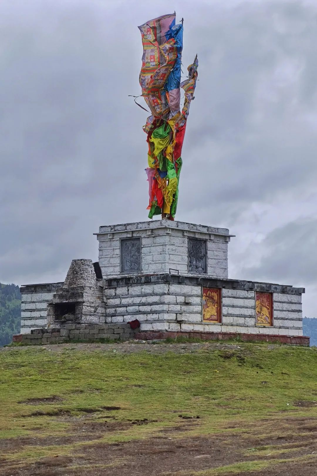
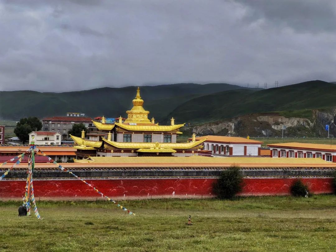
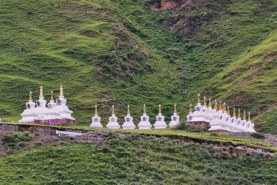
Lake Cuoka is located on a flat land on the top of the mountain, backed by green mountains and surrounded by dense forests. Surrounding the lake, many magnificent temples have been built, high and low, in a well-proportioned manner.

We walked around the lake and watched the colorful and mottled reflections in the water, which reflected the blue sky, white clouds, green trees, green mountains and temples. It was so beautiful! From different angles, the color of the lake water is also different.
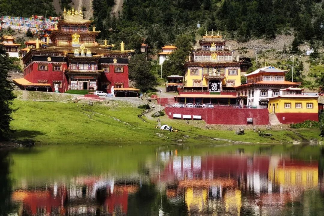

The temples by the lake are colorful. Standing here and looking at them, you feel like you are in Bhutan.
From time to time, I saw squirrels jumping around on the grass by the lake.
We didn't visit the temple, we just wanted to stand quietly by the lake, see more of the beautiful scenery here, and enjoy the tranquility.
Descend from Cuoka Lake and arrive at Yajiang County to check in at night.
Tagong Grassland and Moshi Park
On the seventh day, we will go from Yajiang to Danba, passing through Tagong Grassland and Moshi Park on the way.
We set off at around 9 o'clock in the morning. The weather was not good and it started to rain again.
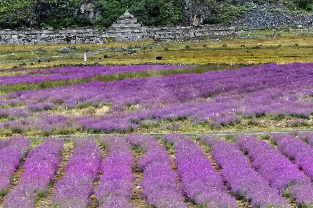
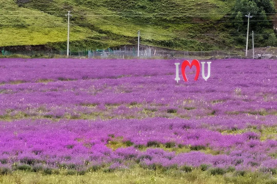
Passing Xinduqiao on the way, I saw a lavender garden on the roadside.
After crossing Xindu Bridge, we headed north, and from here we had to leave National Highway 318.
Although we only ran a short section of National Highway 318 along the way, we were really delighted to see the grasslands, mountains, lakes, canyons, forests, seas and other colorful scenery along the way. We plan to go there again in the future.
Recommended attractions|Tagong Grassland
Tagong Temple is a famous Sakya Sect (Flower Sect) temple in Garze Prefecture. Tagong means "the place that Bodhisattva likes" in Tibetan. Tagong Temple is one of the famous temples of the Sakya sect of Tibetan Buddhism. It is also known as the "Little Jokhang Temple" and is one of the holy places for Tibetans to worship in the Kham area.
The rivers, grasslands, forests, mountains, temples, Tibetan buildings and rich Tibetan customs along the Tagong Temple constitute the Tagong Grassland.
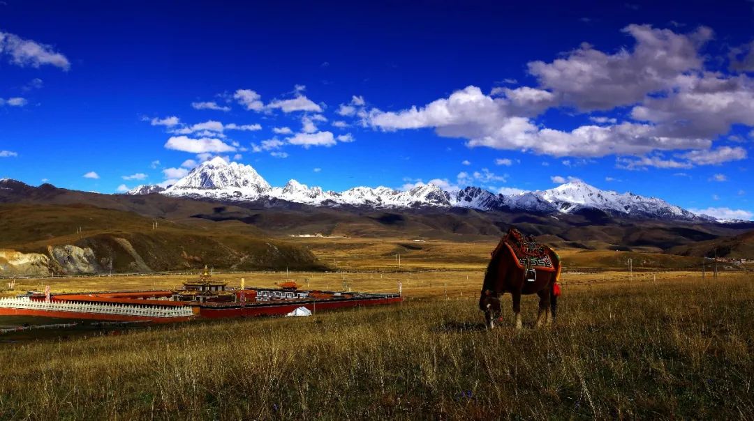
Yala Snow Mountain is a famous sacred mountain in the Kham region, which can be viewed from the Tagong Grassland. It sets off against the vast green grassland and the resplendent Tagong Temple, showing a beautiful plateau scenery. The picture below is a picture of the Yala Snow Mountain from the Internet.
We did not go to Tagong Temple, but went directly to the viewing platform of Tagong Grassland .
Unfortunately, it was raining and we couldn't see the snow-capped mountains in the distance.
You can overlook the Muya Golden Pagoda on the grassland.
Muya Golden Pagoda
Muya Golden Pagoda, also known as Muya Zunsheng Pagoda, is a pagoda built by Dorje Tashi Living Buddha to commemorate the tenth Panchen Lama’s initiation and teaching here. More than one hundred kilograms of gold were used in its construction.
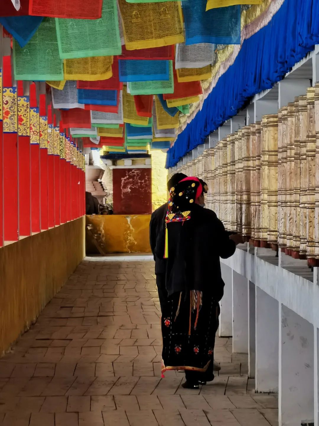
The golden top of the pagoda is divided into three floors. On the outer eaves of the pagoda, there are also gold decorations such as golden deer, Aotou, garuda, and treasure pillars. Outside the pagoda, there is a 383-meter-long prayer corridor equipped with 470 prayer wheels.
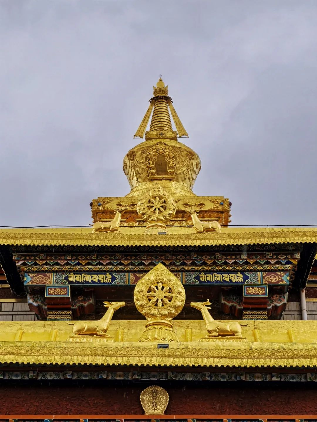
Walking into the Muya Golden Pagoda, even if you don't understand Tibetan Buddhism, you can still appreciate its architecture.


I saw Tibetans coming here to pray devoutly.
The purple flowers blooming outside the yellow wall are so contrasting in color.

Recommended attractions |Moshi Park
Moshi Park, 3500m above sea level. It is 6 kilometers away from Bamei Town. You can see the exposed stone forest in the valley from a distance on the road.
The stone forest here is comparable to the lime karst stone forest in Yunnan.
Affected by the Quaternary neotectonic movement and the uplift of the Qinghai-Tibet Plateau, the rocks in the Xianshuihe fault zone were squeezed, sheared, broken, and militized, forming a mylonitic rock forest.
The stone forest contains calcium salts. Affected by the air humidity, the stone forest appears light gray or light blue in the dry season, and pale black in the wet season. It is also called the color-changing stone forest.
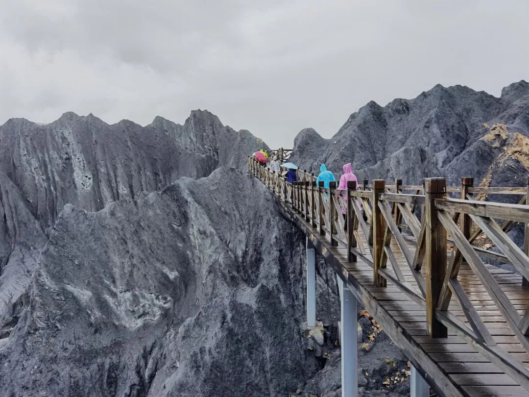
When we arrived at Moshi Park , it was still raining, so we took a sightseeing car up the mountain from the entrance of the scenic spot. The sightseeing bus will take tourists to the highest point of the stone forest.
After getting off the bus, walk along the wooden plank road in the scenic area to tour around and return to the sightseeing bus parking point.
The first thing I saw was the Tibetan pastoral scenery. There are green fields, colorful rapeseed fields, and Tibetan courtyards.
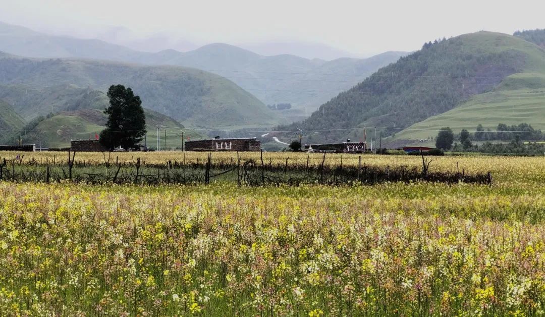
Then, you can overlook a large area of black rocks. It's like a gathering of peaks and mountains.

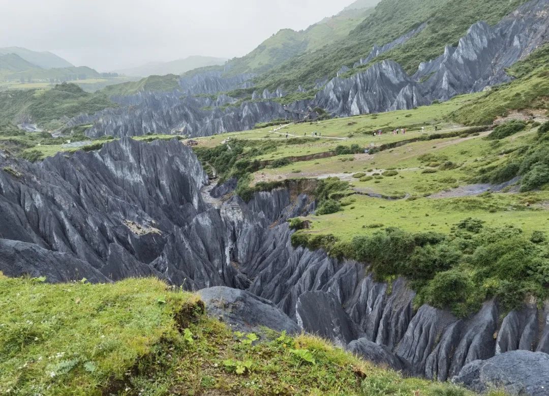
Walking along the plank road, the stone forest is right next to you, within reach. The stone forest has various shapes, and there are many names based on the shapes of the stones, such as Ten Thousand Swords Pierce the Sky, One Pillar Holding the Sky, etc.

Walking into the depths of the stone forest, because it was a rainy day with dense clouds and the dark stone forest, it felt like stepping onto a foreign planet.
After coming out of Moshi Park, take the G248 National Highway through Bamei Town to Danba. It is said that before going down the mountain and entering the canyon, you can view the Yala Snow Mountain. It's a pity that God is not kind and we can't see the true beauty of Yala Snow Mountain. wait for next time!
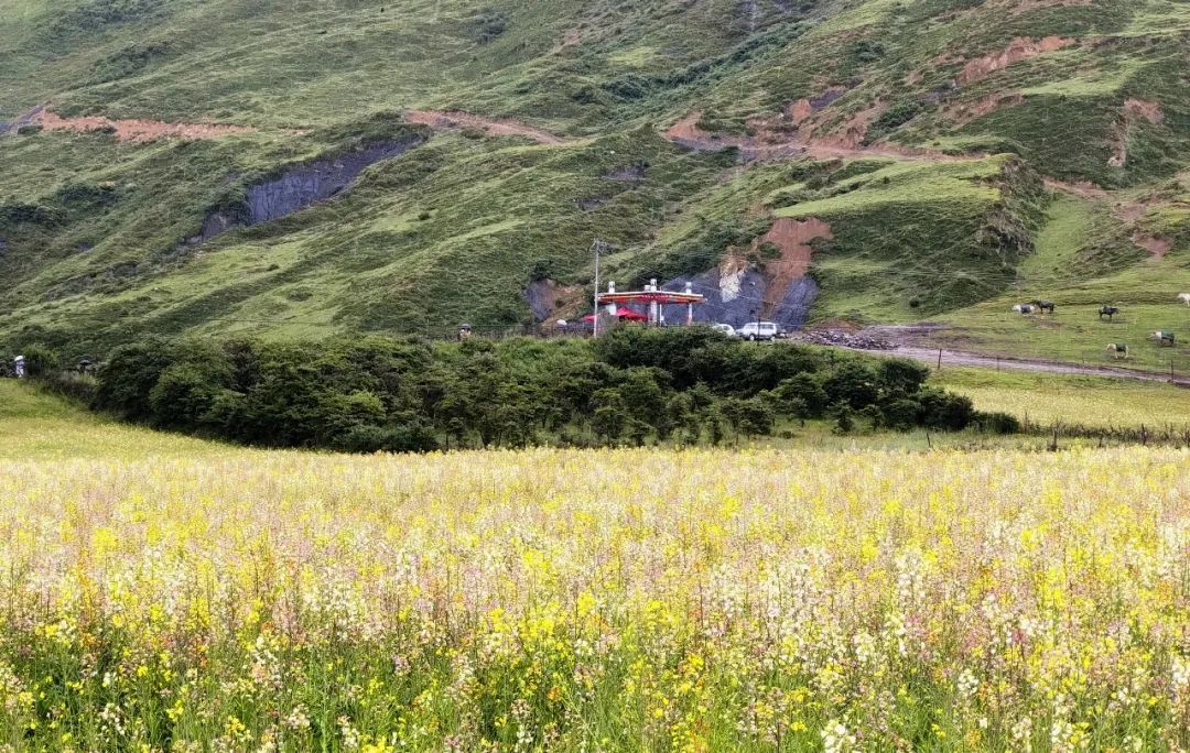
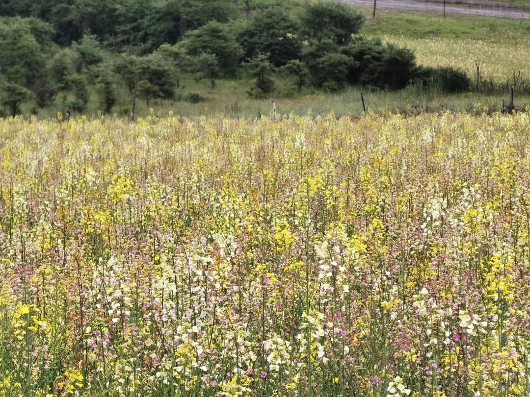
As soon as you leave Bamei Town, you can see a large area of rapeseed flowers in full bloom in the valley, which is 3200m above sea level. The scenery along the way is also good.


After going down the mountain to an altitude of 2,300m, the scenery on this Panda Avenue is also very good. The car has been walking in the dense forest, and a green river on the right has been accompanying us.

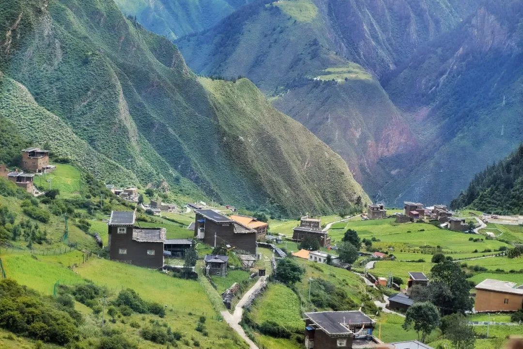
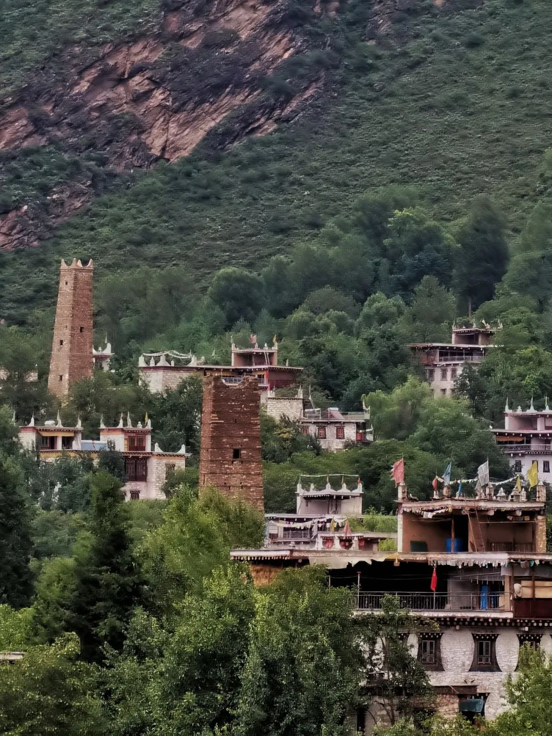
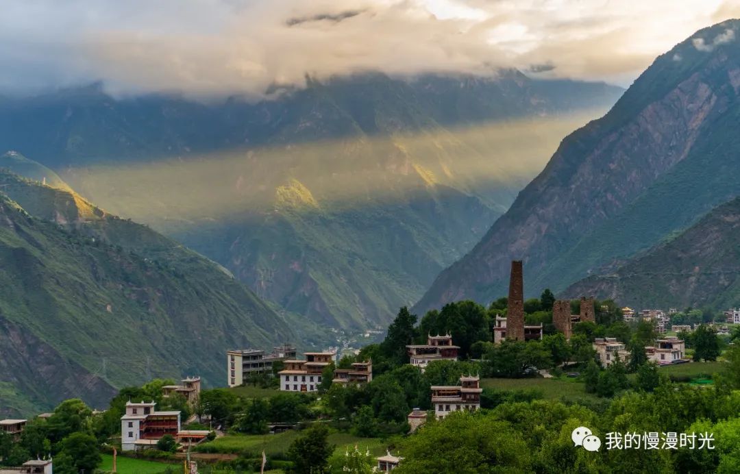
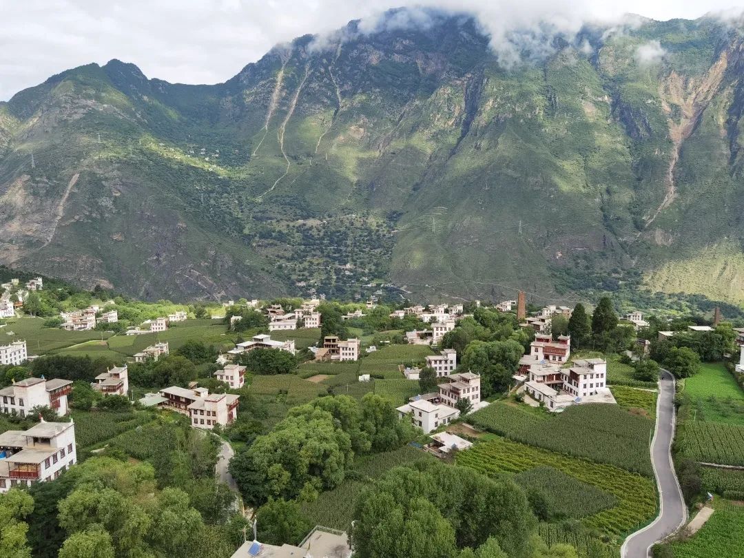
A place longed for by humans and gods-Zhonglu Zangzhai
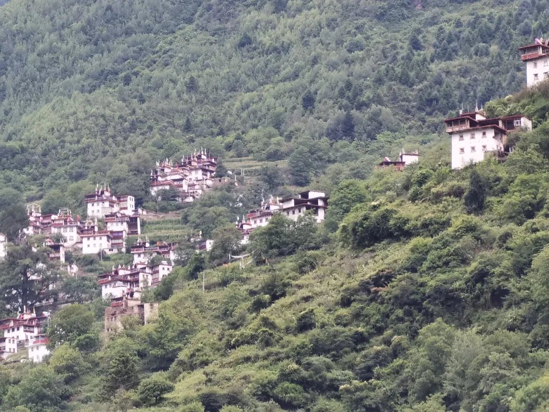
As we approach Danba, we can already see many Tibetan villages on the high mountains on both sides. The architectural style of the Tibetan villages here is different from the Tibetan village styles we saw in Batang and Litang before.
We finally arrived at Danba County at 6 pm. The owner of the inn where we stayed overnight told us that due to road construction on the mountain and traffic control, cars could not go up the mountain until 6 pm. So we finished our dinner in the city first.
After eating, set off up the mountain to Zangzhai Village on the middle road.
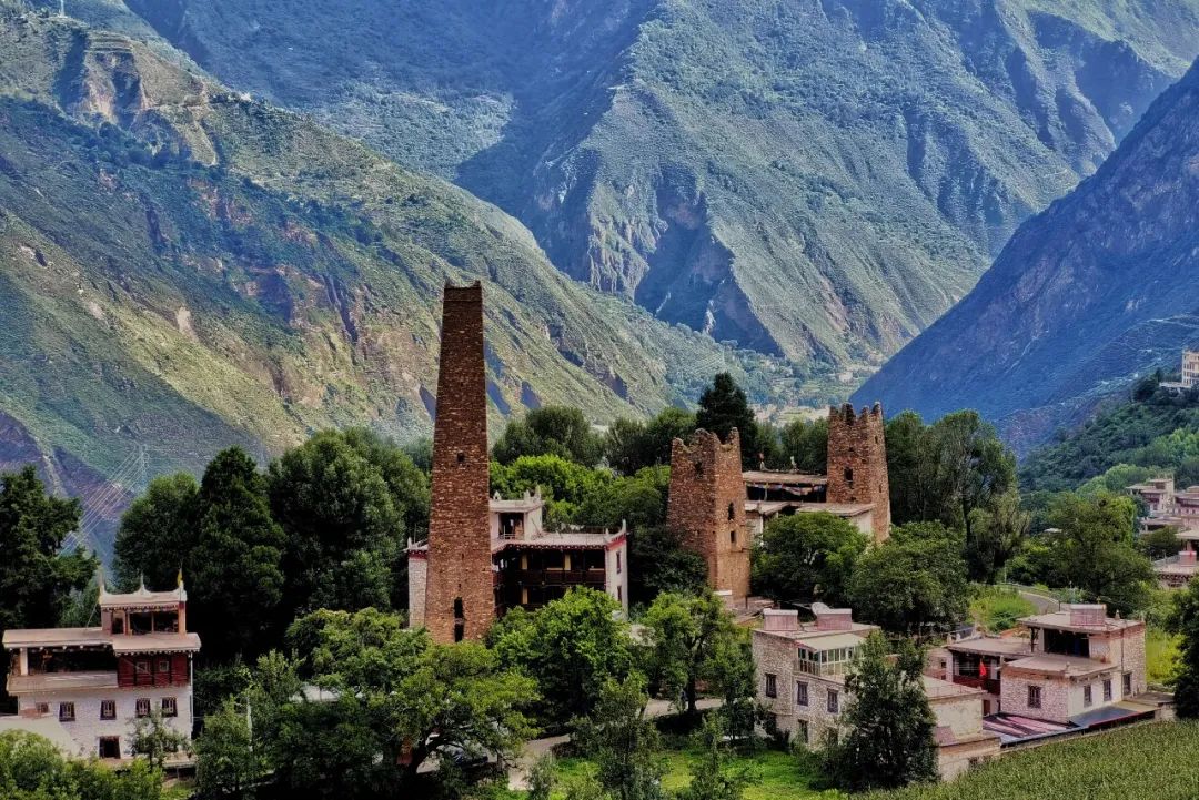
Recommended attractions |Zhonglu Zangzhai
Danba Zangzhai is divided into Jiaju Zangzhai and Zhonglu Zangzhai. Tibetan villages are generally built according to the mountain topography, with high and low heights, and are well-proportioned. The villages are generally composed of dozens to hundreds of households. Each house has a uniform style of house.
Jiaju Tibetan Village is the most representative Tibetan village in Danba and has been rated as the most beautiful village in China by "China National Geographic". It was developed earlier and already has a good reputation. Now you have to buy scenic spot tickets before entering the village.
However, Zangzhai on Zhonglu has not been developed yet and looks quiet and primitive compared to Jiaju. Zhonglu means in Tibetan: the place where people and gods yearn for.
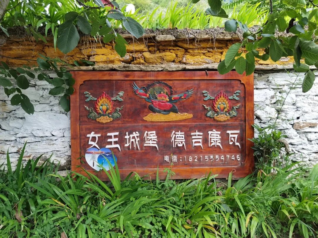
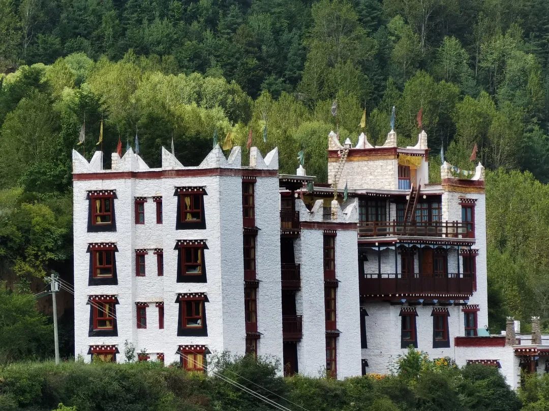
In Zangzhai on Zhonglu, it is recommended to live in a residential building at a high place with a good view and a good landscape. Recommended: Deji Kangwajia.
When entering the Zangzhai Village on Zhonglu, I saw that the gate of the scenic spot was being built at the foot of the village. Tickets will be charged here in the future.
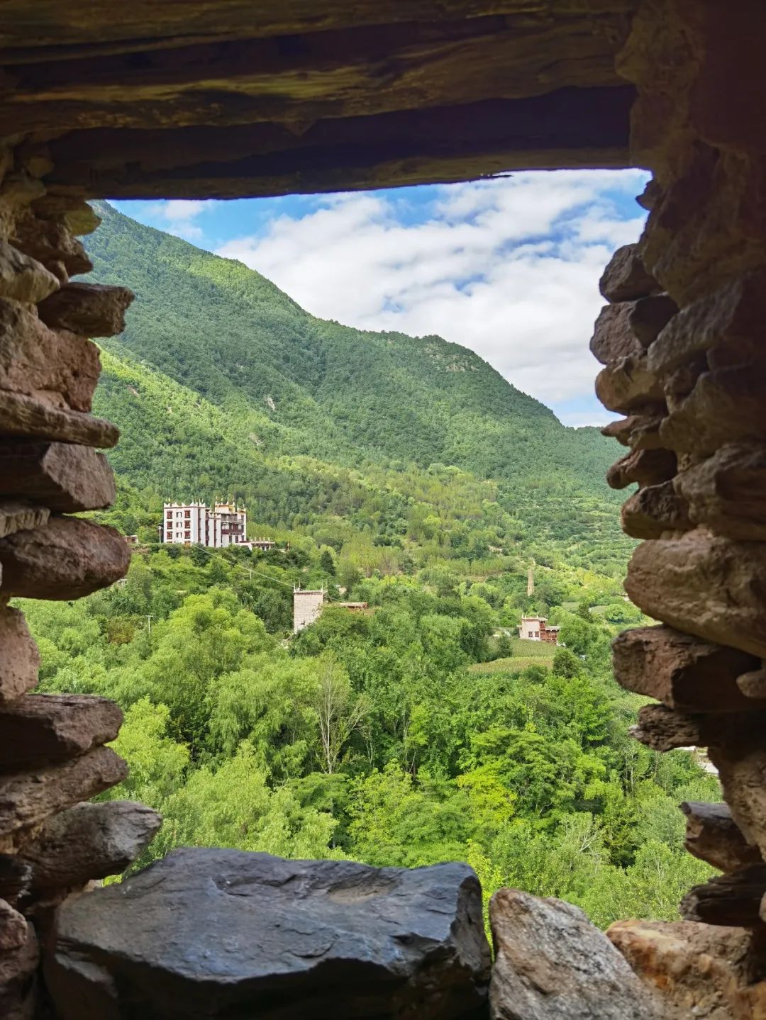
There are several viewing platforms in the stockade, where you can overlook the entire stockade from different angles.
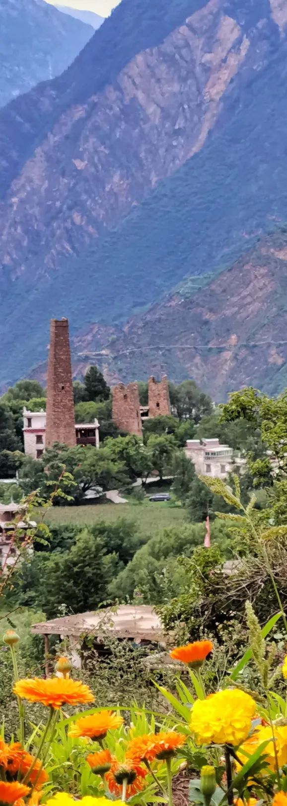
On the way up the mountain, we passed the first observation deck - the Grand Canyon Observation Deck. Here you can overlook the entire canyon and the Mordor Mountain opposite. The scattered Tibetan houses and several watchtowers scattered on the hillside are really beautiful pastoral scenery.
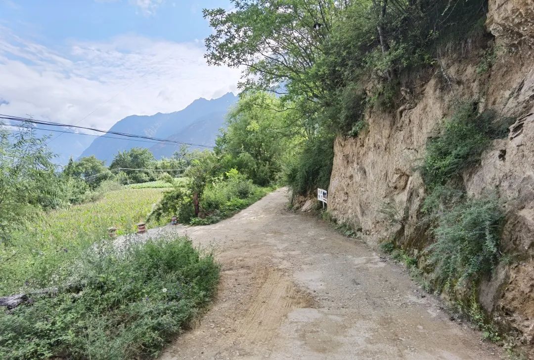
It was getting dark, and we stayed at the B&B inn - Dejikangwa. It's just that the road to his house is not easy to walk, and it will test the driver's driving skills.
Park your car in an open space downhill from his house, then call and someone from the inn will come and help you carry your luggage up. Climb a short flight of steps to reach the door of the B&B.
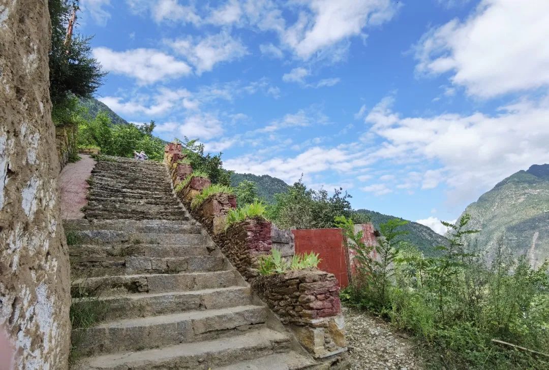
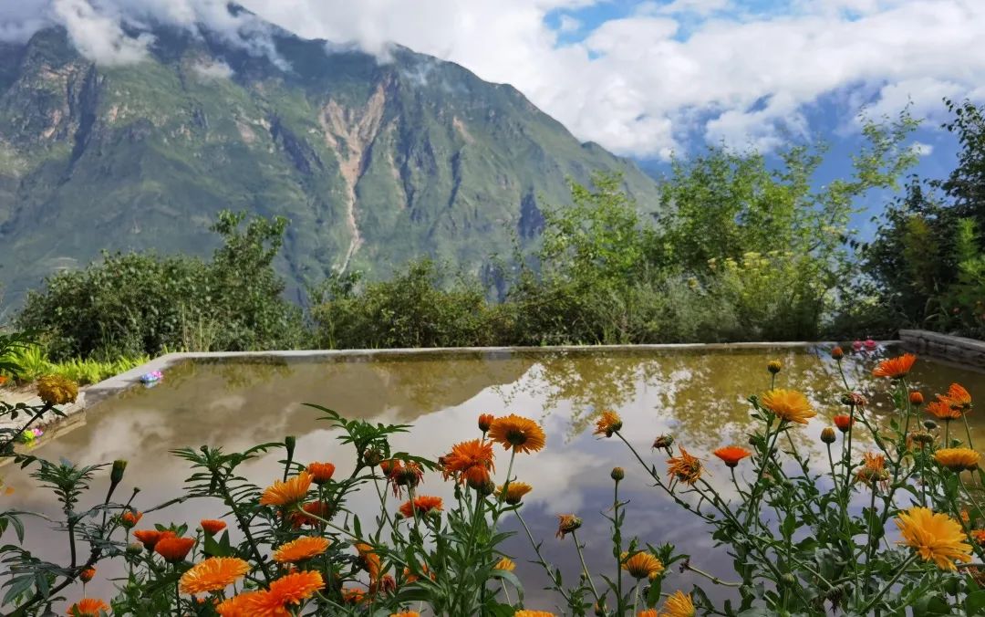
As soon as you enter the gate, you can overlook the entire Tibetan village. The location of his home is great, and the angle is better than the previous Grand Canyon observation deck.

There are many flowers and plants planted in the yard.


The front desk and the restaurant are together, which is very large and has a strong Tibetan style.

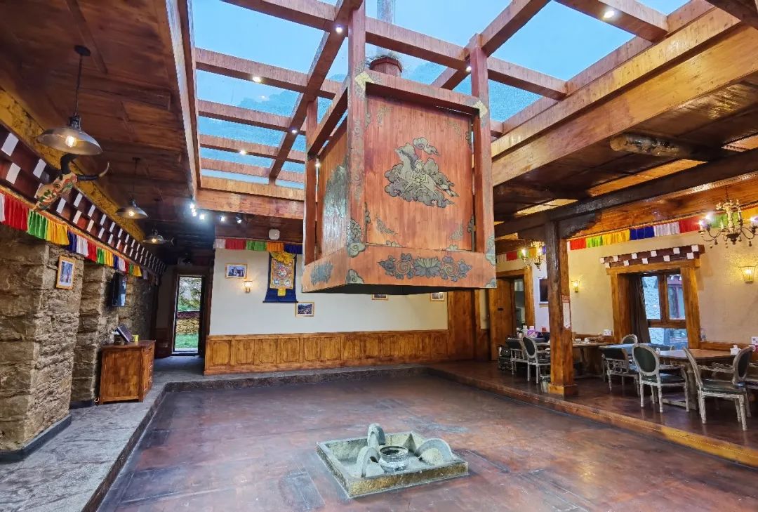
The B&B also upgraded us to a view room, so we can enjoy the view from the room. The room is also a Tibetan wooden structure house, very comfortable.
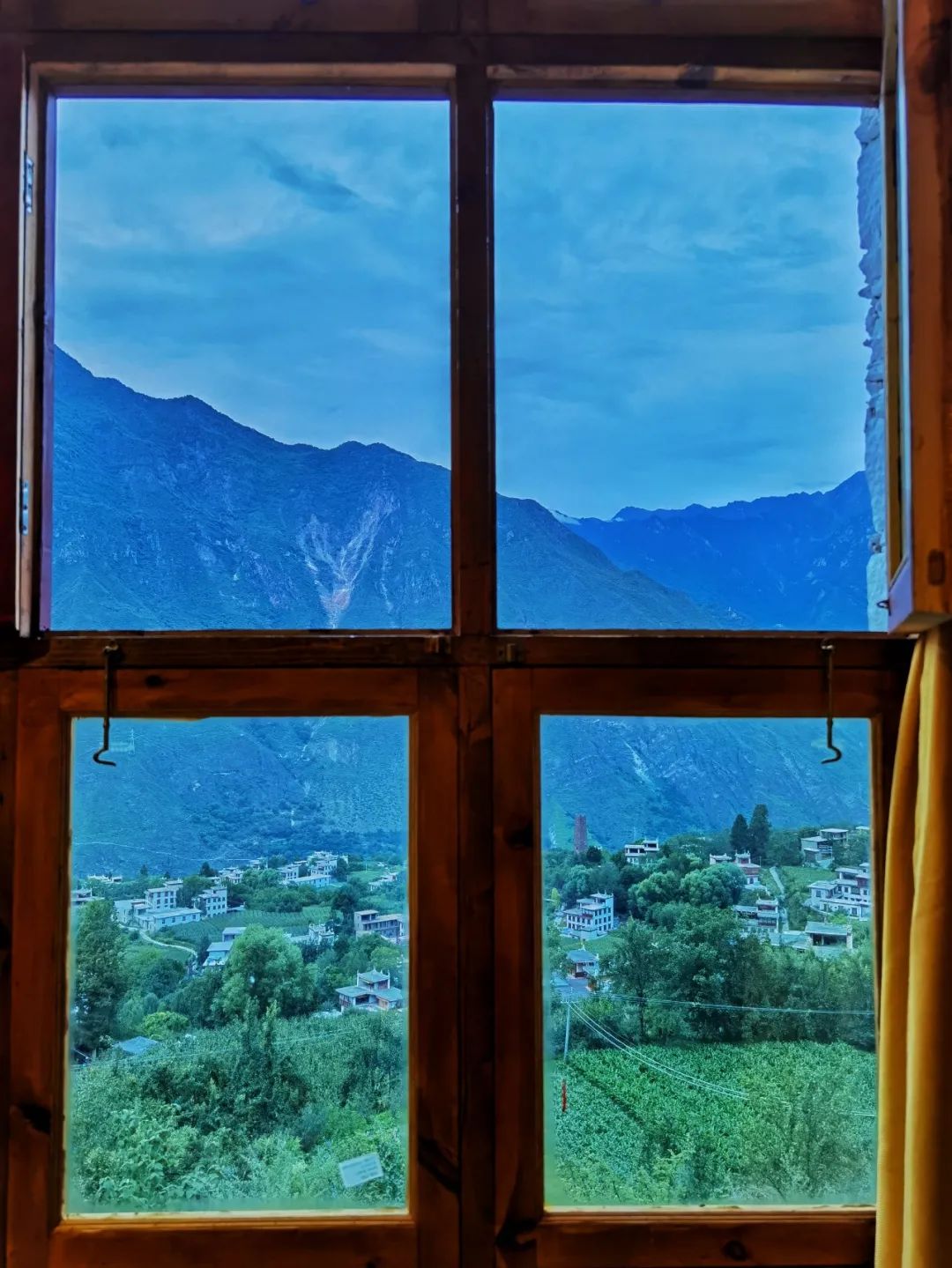
After checking in, we strolled around the yard again and sat in the corridor outside the door overlooking the entire canyon.

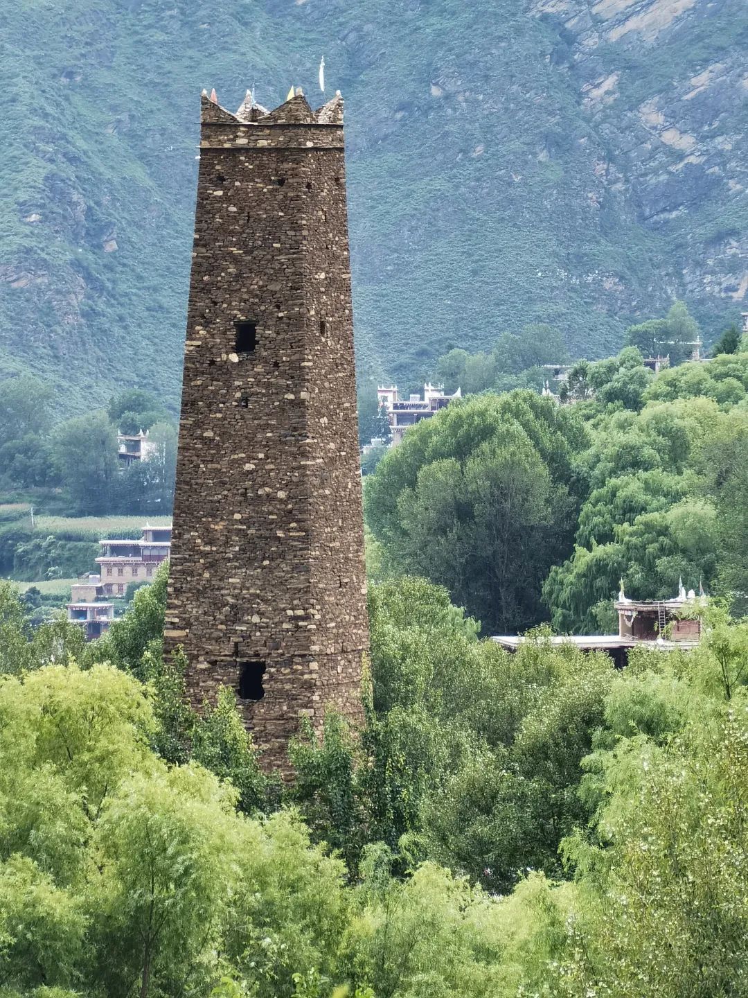
This watchtower is located in a Tibetan home. She said that this watchtower belongs to her family, and if she wants to climb the watchtower, each person needs to pay 10 yuan.
Out of curiosity, we entered the interior of the watchtower, where simple ladders were set up on each floor.

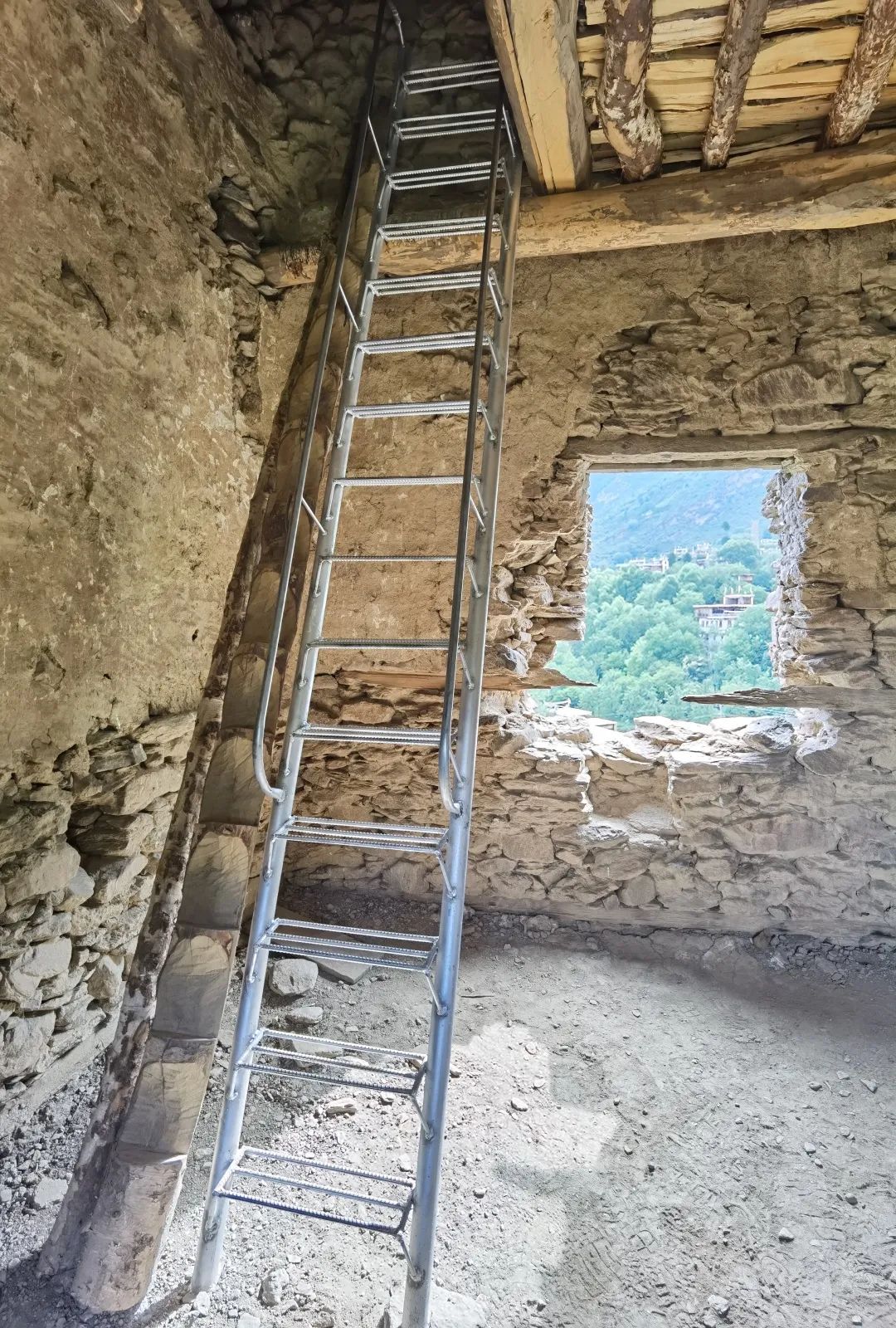
After climbing 10 floors in total, we finally reached the top.
Standing here, you can enjoy a 360-degree panoramic view of Zangzhai on Zhonglu.
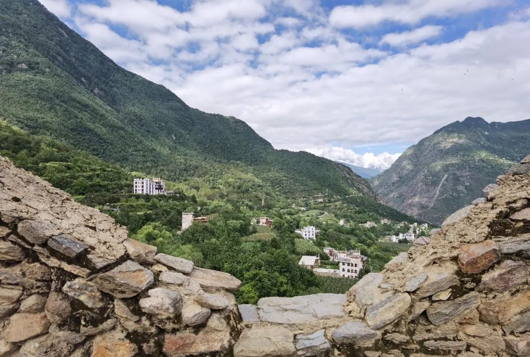

From here, you can see the B&B where we stayed in the distance.
When we came down from the watchtower, we saw an old man from this family standing in the yard in high spirits and invited us in for tea.
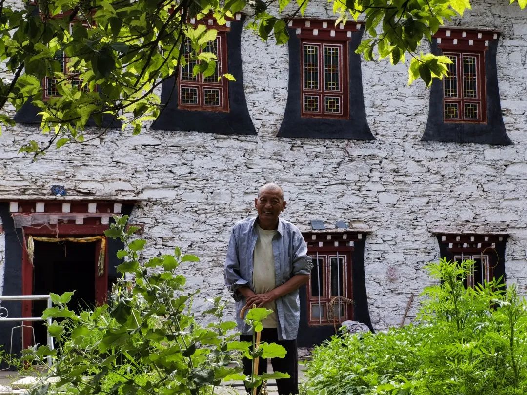
There are also many pear trees planted on this mountain. When spring comes, the mountain will be dotted with white pear flowers, which will definitely make it more beautiful.

After visiting the watchtowers, we returned to the B&B and checked out before going down the mountain.
The path down the mountain was indeed not easy to walk, and we encountered a convoy on the opposite side. The road was too narrow and it took a long time to get on the wrong bus.
return trip
After descending the mountain from Zangzhai on the middle road, we embarked on the return journey.
There is an epidemic in Chengdu and I cannot go back to Chengdu. I chose Leshan for the return trip, mainly to taste the Leshan food.
Leshan's Chuanmei Ice Noodles is well-deserved. I ordered three fresh ice noodles, fancy bean curd, and mango-flavored snowflake ice. They are highly recommended. Don’t miss it when you come to Leshan.

There is also Fangfang Qiaoji Beef on the side. The beef is very smooth and tender. It is delicious to eat with their sesame cakes.


After dinner, we came to the riverside. At this time, the Minjiang River at the foot of the Buddha was flowing rapidly. It was the flood season, and the plank roads along the riverside were closed.
I have visited Leshan Giant Buddha twice before. The official name of Leshan Giant Buddha is Jiazhou Lingyun Temple Maitreya Stone Statue. It was built in the Tang Dynasty to slow down the water potential at the confluence of three rivers during the summer flood season and calm down floods.
Now we can only admire the Leshan Giant Buddha from a distance. Although the perspective is very biased, we can still vaguely see the kind-faced Maitreya Buddha under the sunset. Looking at its face can bring people peace.

On the ninth day, we first drove from Leshan to Dazhou, passing by Suining for lunch, and found that Tao De casserole was also available here, so we came here to satisfy our craving.
Dazhou night view in the evening
I bought some local snack cakes at a small shop on the street in Dazhou. They were delicious. I really liked the words printed on the plastic bag containing the cakes. This is the joy of finding delicious food on the road:
Life is always like this,
Traveling all the way across the sea,
Calm down your mind,
In some quiet and comfortable leisure time,
Share simple and delicious food,
Remembering the long and fragrant time in the years,
Discover the flavor you have been looking for.
On the tenth day, I went from Dazhou to my parents' home in Shiyan. Unexpectedly, an epidemic suddenly appeared in Wuhan. I couldn't go back, and I was stuck in Shiyan for half a month.
This trip, due to the weather and the epidemic, affected our plans. We did not go to some places, which is a bit regretful. However, the joy of traveling lies in being able to be with family, see scenery that we have never seen before, and experience all the things on the way. Accidents, surprises, and regrets give us reasons to start again.
Western Sichuan, its beauty is addictive, I will go there again!