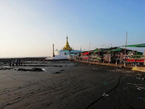
I arrived at Zijar Village in the southwest corner of Myanmar at dawn. The village is close to the seaside. There is a pagoda at the corner of the gorge. There is also a temple, Maw Tin Soon Pagoda, on the mountain next to the gorge. This is the only public building in this small village. building.
The pagoda at Kok Kok
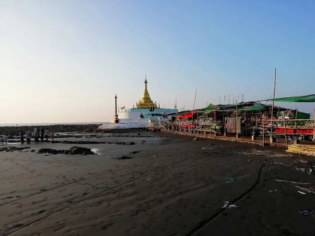

Rocky beach near Gap Point as the sun just rises


After walking for a while, I looked back at Xiajiao

The hill opposite the gorge corner

Come to Maw Tin Soon Pagoda


View of Gorge Point from the mountain

It took an hour and a half to visit Zijar Village. When I came to the bus station, the driver told them that they would leave at four o'clock in the afternoon. Sometimes the journey is so uncontrollable that I could only stay here in a daze.

Fortunately, the climate here is summer all year round, so I can swim every day. I found a resort and spent most of the day soaking in the water. If I were in China, I would be alone on the entire beach. What a luxurious "vacation" it would be. Thinking of this, I felt at ease.


Cottage by the beach

I finally got on the train at four o'clock in the afternoon and arrived at Pathein in the evening. I changed train again at four o'clock in the middle of the night and arrived at Pyay Station at noon.


Pyay is a city in southern Myanmar. A river port on the left bank of the lower reaches of the Irrawaddy River. Pyay has a long history and is the cradle of the civilization of the Pyu people, the ancestors of today's Burmese people. It was the royal capital in the eighth century AD. From 1541 to 1542, a battle took place in Pyay between the Toungoo dynasty army led by Mangshweti in southern Myanmar and the Arakan coalition army of Ava dynasty in northern Myanmar, which ended in the victory of the Toungoo dynasty army. Since ancient times, Pyay has been the trade link between the middle reaches of the Irrawaddy River and the delta region and the main transportation route from north to south.
The ancient city of Phimu is one of the three ancient cities of the Pyu Kingdom. It represents the glorious history of the Pyu Kingdom for more than a thousand years from 200 BC to 900 AD. It is the birthplace of Myanmar’s earliest urban culture and the earliest place where Hinayana Buddhism was introduced. One of the earliest ancient city ruins in Southeast Asia, it was listed as a World Heritage Site in 2014, becoming one of only two World Heritage Sites in Myanmar (the other project is in Bagan).

After getting off the bus, I rented a tuk-tuk and went to Bawbawgyi Pagoda. It is a landmark building in the ancient city of Phava Gyi. It is located in the Phava Gyi Stupa temple. It was built in the 5th and 6th centuries AD and is made of red bricks. It is 46 meters high and bell-shaped.


Then I came to the Shishantha Pagoda in the city center.
Pyay Shwe San Daw Pagoda is located on a hill in the center of Pyamyu. It is one of the most important pagodas in Myanmar. It was first built in 589 AD. The tower is 113 meters high, which is higher than the Shwedagon Pagoda in Yangon. one meter.
Gates, corridors and elevators

The corridor has become a stall.

Go up to the top platform. The layout here is similar to the Shwedagon Pagoda in Yangon. There is a tower in the middle and there are corridors and small temples around it.


There are two golden umbrellas on the top of the pagoda. The inner umbrella was donated by the Mon rulers, and the outer umbrella was donated by Yong Ji Ya, the first emperor of the Konbaung Dynasty, when he conquered Pyay. The two umbrellas coexist in the same pagoda, symbolizing the Mon and Bamar peoples. peaceful coexistence among them.


From the tower, you can overlook the whole city and the Irrawaddy River, and you can also see the seated Buddha statue facing the tower on the east side.

another corridor

another door

Bogyoke Statue, the statue of General Aung San in the central square

TRAIN STATION


Then I came to the banks of the Irrawaddy River, the largest river in Myanmar.

During the dry season, the riverbanks are cracked.

pier

bridge

climb to high places

See the bridge here

Snake temple on the mountain

When passing a Chinese cemetery, it is also marked with the words "Republic of China".


In the evening I took a ride to Naypyitaw.
Naypyitaw, formerly known as Pyinmana, is the capital of the Republic of the Union of Myanmar, located 400 kilometers north of Yangon. On November 6, 2005, Myanmar moved the capital from Yangon to here. On Military Day in 2006, the new capital was officially named Nay Pyi Taw (ancient Myanmar language, meaning "Kyoto, capital"). Nay Pyi Taw urban planning is divided into different areas such as hotel area, residential area and government area. It covers an area of about 6,450 square kilometers, more than 9 times larger than Yangon City, but is relatively empty. The new government buildings are scattered in a valley, covering an area of about 10 square kilometers. It is surrounded by mountains and dense woods nearby, and is not far from the nearest town. There are also 30 kilometers.

Nay Pyi Taw gives many netizens the impression of a "ghost town", which is used to describe the small number of people here. The main roads in the city are at least two-way six lanes, but there are almost no cars on the road and few people are encountered. I originally planned to visit the Parliament Building, map The navigation was 5.4 kilometers away from the bus station. After walking 3.5 kilometers, we were blocked by railings. Guards with guns and soldiers prevented us from going any further. I had no choice but to return sadly.


The entrance to the Capitol is actually 2 kilometers away from the core building.


Roadblock

All government departments here have fences with barbed wire, and they all keep dogs. Before they even get close, the dogs start barking. Even if the monks give alms, they have to go through iron railings. There are no buses in the city. It is difficult to understand the thinking of Myanmar's leaders. Is the government moving the capital just to isolate itself from the public and enjoy this empty space to itself?


The only place with many cars is the long-distance bus station.

I hitched a ride to Inle Lake and when I left Naypyitaw, I still saw very few people.

Passing by Naypyitaw Peace Pagoda Uppatasanti Pagoda

Trip map (1020 kilometers)
