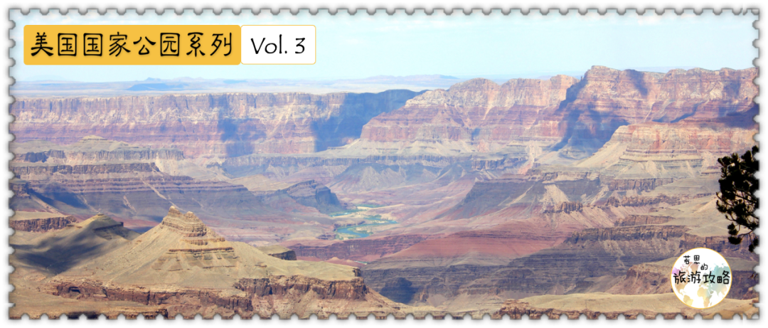
This article is a supplement to the American National Parks Series Vol. 3: Grand Canyon National Park.

4Hiking in 8.8 degrees Celsius
8 hours16 kilometers
Return to the South Rim of the Grand Canyon
9
5 a.m. hike
At 4:30 in the morning, when the alarm went off, I quickly reached out to press it, then turned over and planned to go back to sleep.
Half awake and half dreaming, a voice came from beside me: "Everyone else has set off. If we don’t set off, we will start hiking at noon. "
I suddenly lost all sleep. Sure enough, what can wake a person up is never an alarm clock, but a threat to survival, such as hiking under the scorching sun, or having your salary deducted for being late.
Just when I was about to get up, I was horrified to discover the fact that my legs were completely out of control, so I had no choice but to lie on the bed for more than half an hour, until I could move my lower body before slowly getting up.
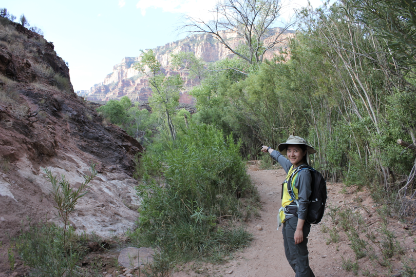
Before setting off, we filled the camel bags with water outside the Ghost Villa and then prepared to set off.
After all this trouble, by the time we set off, it was already 5:30 in the morning.
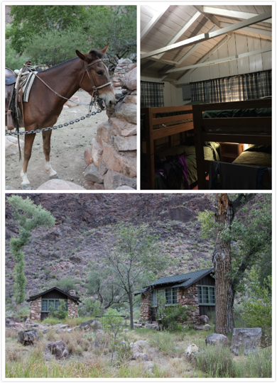
Under the morning light, we could finally get a glimpse of what the camp looked like - we arrived too late last night, and it was already dark when we came out of the lounge, so we couldn't see what the camp looked like at all.
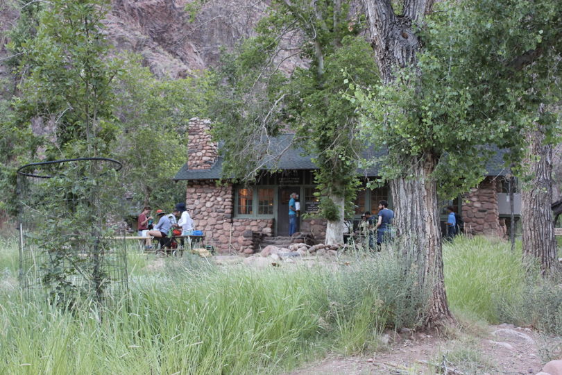
There are also mules fed in the villa.
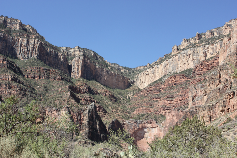
Not long after leaving Ghost Villa, we saw a fork in the road, one leading to the South kaibab Trail we took yesterday, and the other leading to the Bright Angel Trail we were going to take today.
There is a bridge on both planks connecting the two banks of the Colorado River, and the two bridges are not far apart.
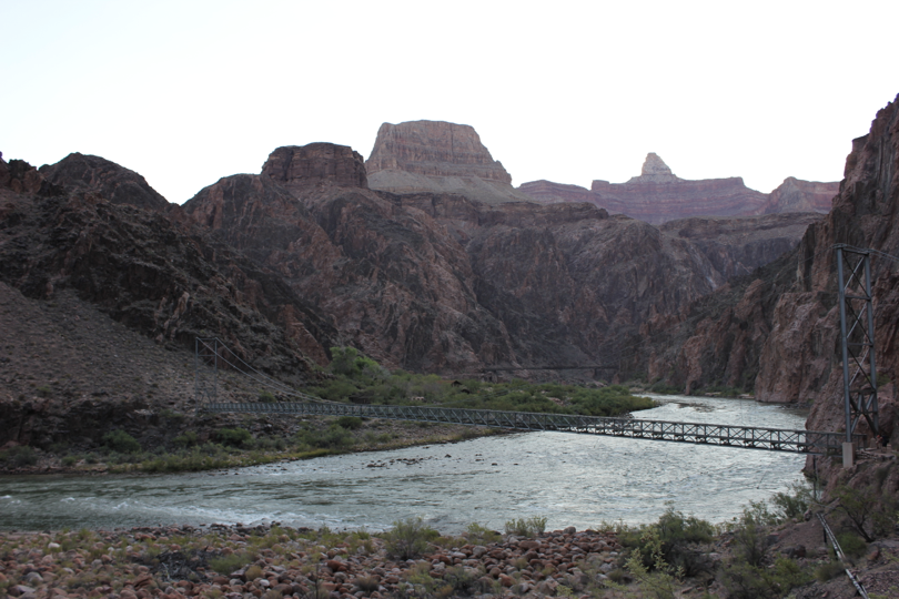
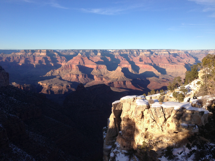
The Grand Canyon looks particularly gentle in the morning light, completely different from the cold and hard style seen from the edge of the canyon yesterday.
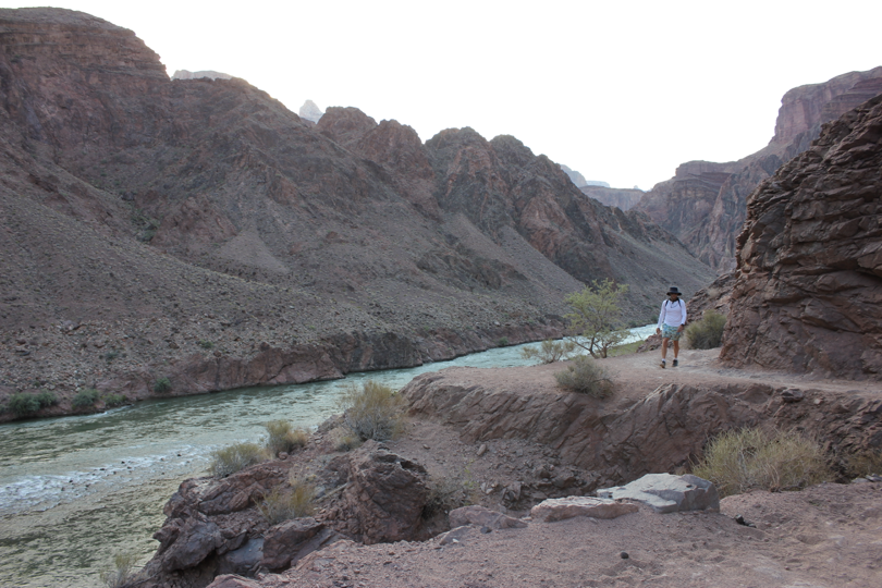
This gentleness made me relax my vigilance, and I kept walking and taking pictures. I was soon surpassed by others, but I still didn't feel a sense of crisis in my heart.
Within a few hours, I paid the price for my underestimation.

10
Starting to heat up
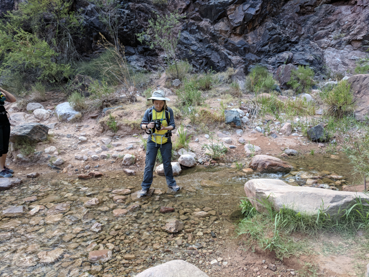
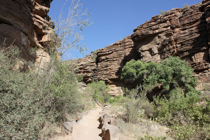
Compared with the South Kaibab Trail, which is barren of grass, the Bright Angel Trail is much gentler and encounters streams from time to time along the way. Many people fetched water from streams and even wet their shirts to cool down.
Before 9 o'clock in the morning, we kept playing around, taking pictures of everything we saw, and even playing with the pushcarts we saw on the roadside. After 9 o'clock, when the sun shines directly into the valley, the temperature here begins to rise sharply. I can't bear it anymore. I feel like a frost-beaten eggplant, and I refuse to move any time I get to a shady place.
At this point I deeply regretted wasting so much time in the morning.

Fortunately, there are shade trees from time to time on the Bright Angel Plank Road, which gave us a lot of opportunities to breathe.
11
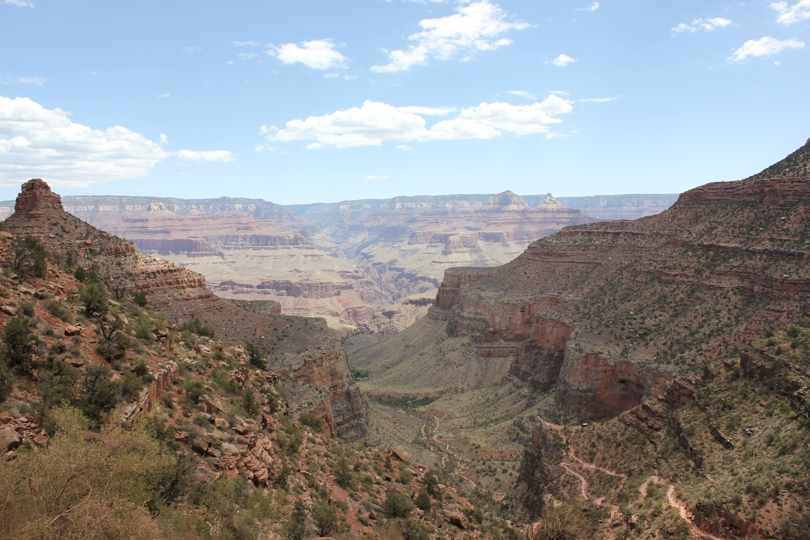
Indian Garden
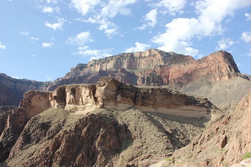
Along the way, the scenery in the valley changed differently. The rock formations in the Grand Canyon were formed over a long period of 2 billion years, and each layer tells a story. I don’t know which layer of rock formation I walked to or when it was formed.
The cutie I met on the road:

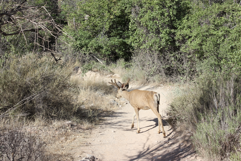
Continuing upward, the leaf-like rock formations disappeared and were replaced by dense bushes. There is also a small mule deer foraging in the bushes.
Mule deer is the most common animal in the Grand Canyon. It is named because its ears are shaped like a mule. It is the favorite prey of Mountain Lion.
The mule deer we saw was small and looked like a teenager, but in fact, even when it is an adult, a mule deer is not that big, only 1/3 the size of a moose.
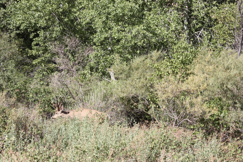
After a while, the mule deer came out of the bushes, walked to our plank road, and searched for a while on the left. Mule deer will eat anything, including flowers, nuts, raspberries, and even bushes.
But there was obviously no good food on the left side. It wandered around, walked back to the plank road again, walked slowly in front of us, then slowly walked back to the right, and ran to rest in the shade of a tree.
Not long after passing this bush, we finally arrived at the legendary Indian Garden.
Indian Garden is the midpoint on the Bright Angel Trail, located at 7.7 kilometers (4.8 miles) of the plank road, so no matter which end of the plank road you start from, as long as you reach Indian Garden, you will know that half of the journey has been completed.
This is also one of the only three places on this plank road that provides drinking water. Many people choose to rest here, and we are no exception. Here we filled the camel bags with water, and then took out various foods to replenish energy.
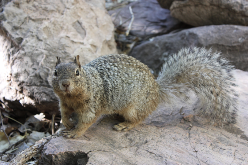
Our food immediately attracted a few uninvited guests——
A squirrel accidentally bit a tourist's butt while trying to steal food, and a wonderful battle ensued.
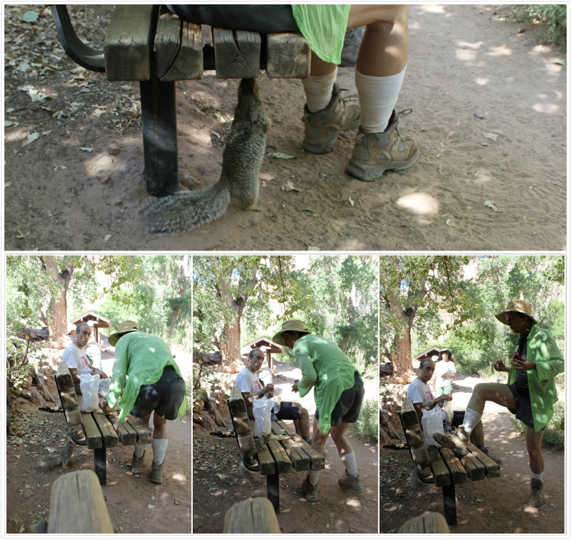
Looking at this innocent little look, can you imagine that it just brutally attacked humans?
To demonstrate the effect of sunlight on temperature, two thermometers are thoughtfully displayed here. One is located in the shade of a tree, indicating that the temperature at this time is 85 degrees Fahrenheit (29.4 degrees Celsius).
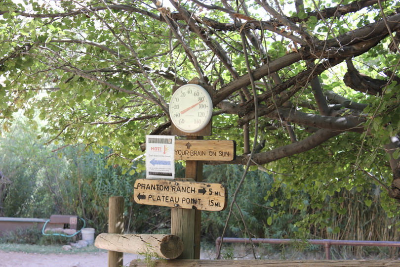
There is another thermometer 3 meters away, in direct sunlight, showing a temperature of 120 degrees Fahrenheit (48.8 degrees Celsius).
Seeing this mark, I silently converted to degrees Celsius in my mind, then silently climbed back into the shade of the tree and never came out again.
12
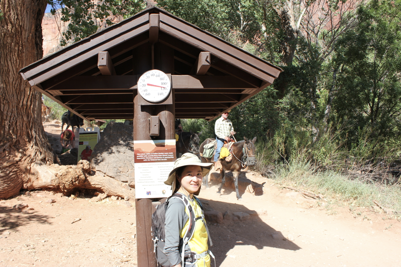
Hiking in 48.8 degrees Celsius
When I left Indian Garden, it was only ten o'clock in the morning, but I felt like I had finished a long day. The next 7.7 kilometers were not so easy to walk. There were fewer and fewer green areas and the temperature was getting higher and higher.
Hiking in 120F/48.8C was a real pain, my pace was getting slower and slower and I felt like a fish in a frying pan every second I was in the sun.
If I encounter a shady spot on the road, I will stay there.
I finally understood why people who come here to hike have to set out early in the morning. A couple we met at the valley bottom camp stayed at Ghost Villa for 3 or 4 nights to recuperate. We set out at 3:30 this morning. I guess they are almost out of the Grand Canyon now.
I also met an old man in Indian Garden. His leg had been injured not long ago. He was walking hard with a splint and a cane. We met him once and had a chat as we approached Indian Gardens. While we were eating and resting, he caught up again and continued limping forward.
A rare trace of human activity in the valley——

It obviously feels like I will be able to get out of the Grand Canyon soon——

After turning a corner, I saw an even steeper mountain wall and realized that I still had a long way to go before the edge of the valley.

13
reach destination!
In the midst of this ordeal, we passed two more rest stops, called the Three Mile Rest Stop and the One and a Half Mile Rest Stop. As the name suggests, it is 3 miles (5 kilometers) and 1.5 miles (2.6 kilometers) away from the valley rim.
At the three-mile rest stop, we encountered a large number of hikers we had seen last night or this morning, including the one who had jumped into the stream to wet himself this morning.
It seems no one can survive this intense heat.
We are on the same starting line again.
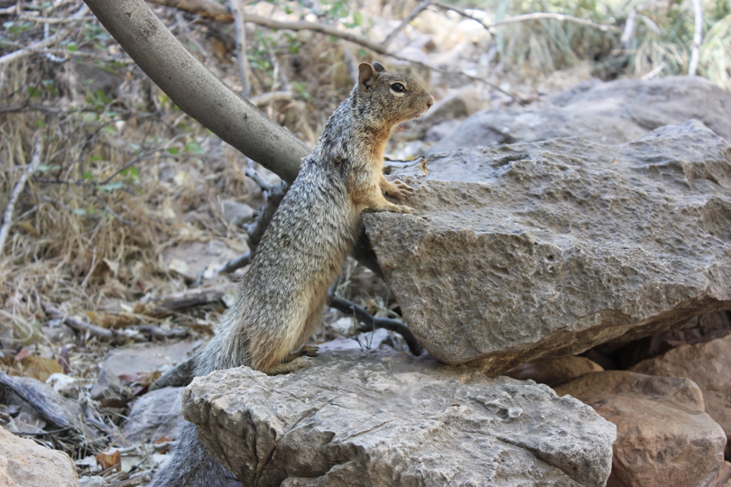
The Three Mile Rest Stop is much more popular than the Indian Gardens, as evidenced by the squirrels here - there are more of them than before, and they are more aggressive. They are not afraid of humans. As long as we dare to take out food, they will snatch it.

There were more people at the one and a half mile rest stop, and most of them were those who came here for a short hike. The rest stop was very lively.
The stretch from the one-and-a-half-mile rest stop to the edge of the valley was crowded with people, especially those sitting under the shade of every tree, without even a place to stay. In this case, I changed my previous situation of dawdling and refusing to move when I encountered the shade of a tree. Instead, I rushed up to the edge of the valley with all my strength.
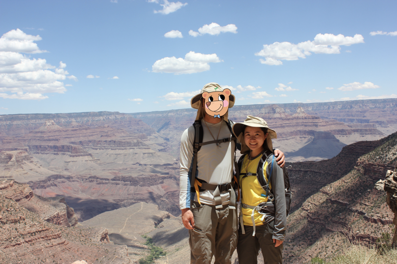
When I reached the edge of the valley, my watch had stopped counting steps because it was out of battery. I checked my phone - at 1:30, we walked for 8 hours to get out of the Grand Canyon.
We took a break at the Bright Angel Inn at the edge of the valley, then jumped on the shuttle bus to the visitor center. When we arrived at the visitor center, we found that our car was still there - our illegally parked car overnight had not been towed away, not locked, and not ticketed!
Our excitement at this time is no less than when we successfully came out from the bottom.
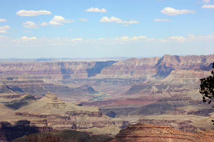
As we left the Grand Canyon, there was traffic in the park due to road construction. In this case, we also took a detour to see the observation deck with great interest.
I thought that after two days and one night of hiking, I had seen enough of the Grand Canyon from all angles and there would be no more surprises. Unexpectedly, the scenery from this observation deck shocked me, especially when I saw the shadowy figures in the distance. Colorado River time.
Standing on the observation deck, I remembered the first time I came to the National Grand Canyon in the winter of 2012. I also went to the South Rim at that time. Most of the rim of the Grand Canyon was covered with snow, and all hiking trails were closed due to heavy snow. Because the distance is too far, we can't see clearly the situation on the north edge, but it is said to be colder there and closed every winter.
That time, on the way out of the Grand Canyon, we also witnessed a car skidding out of control in the snow and sliding down the road, plowing into the low shrubs next to it.
Since then, the Grand Canyon has been equated with plateau and cold in my mind. If it weren’t for this summer hike, I would never have imagined that there would be a high temperature warning here in the summer.
The Grand Canyon in the winter of 2012——
14
indian reservation
After leaving the Grand Canyon National Park, you can still see the scenery of the Grand Canyon along the way. In fact, the Grand Canyon and the Grand Canyon National Park are two different concepts - the entire Grand Canyon is 446 kilometers long, and the U.S. Congress passed a bill in 1919 to designate the deepest and most spectacular 170 kilometers of it as the Grand Canyon National Park. Management Office.
The 276 kilometers that are not included in the national park are managed by indigenous tribes - the west side of the Grand Canyon belongs to the Hualapai tribe, where the famous Grand Canyon Glass Bridge is located, while the east side belongs to the Navajo tribe, which is also the largest and most populous tribe in the United States. The largest number of Indian reservations.
It covers an area of 27,000 square miles, larger than the 10 smallest states among the 50 states in the United States. Of course, this is also because when the American invaders divided this land, they divided the eastern provinces too finely, and the western provinces too roughly.
Among the Navajo tribe, there is also a small Hopi tribe. Due to the close distance, the two tribes often competed for territory and resources, almost becoming a feud. For this reason, the disadvantaged Hopi tribe even petitioned the U.S. government, which in the last century sent troops to station in this area to control the disputes between the two tribes.
The most mysterious thing about the Navajo people is their language. It is said that they have no written language and can only pass it down orally. The ingredients are quite complicated and almost no one can decipher them by outsiders. Therefore, they were used in codes during the Pacific War, which the Japanese army could not crack. , which is about the same level as Wenzhou dialect in my country.
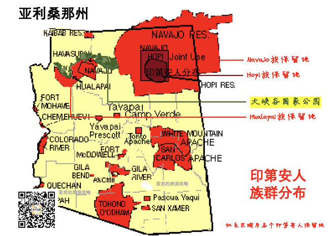
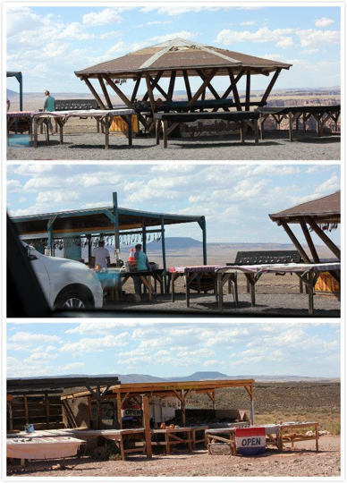
The areas of the Grand Canyon outside the national park are monopolized by local Indians. This area is the territory of the Navajo people. After leaving the national park, you can see some unofficial viewing spots from time to time, allowing tourists to explore the Grand Canyon. I was not sure about the safety and scenery of these viewing spots, because at this time we were both too tired and had no energy. We just wanted to quickly go to the hotel to rest tonight, and did not stop at the viewing spots set up by these Indians.
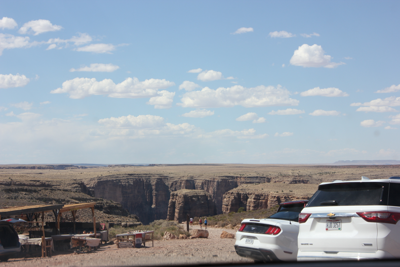
There are a bunch of simple sheds next to each viewing point, selling some Indian handicrafts.
In the evening we stayed in the small town of Moab next to Arches National Park. I put on a thick mask on myself to nourish my skin that had been damaged by the Grand Canyon. But I was so tired that I just fell asleep with the mask on.