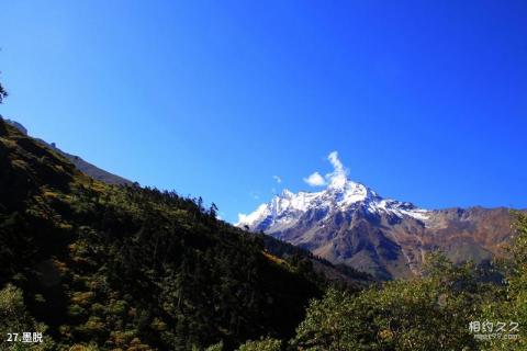
Introduction to Medog: Medog County is located in southeastern Tibet, on the lower reaches of the Brahmaputra River and in the south of the Rigab Mountains, a mountain range in the Himalayas. The total area is 34,000 square kilometers (one estimate is that the total area is 30,553 square kilometers), of which Medog actually controls 10,000 square kilometers and India accounts for 24,000 square kilometers. The cultivated land area is 20,000 acres and the forest area is 32 million acres. Modog Tibetan means "the place where the hidden lotus blooms". Due to the unique natural conditions, there are more than 3,000 higher plants in the Medog Nature Reserve alone, including about a dozen species of bamboo plants and more than 80 species of wild orchids. There are 42 species of wild animals under national key protection. There are also more than a thousand species of insects. Medog County has superior natural conditions and is known as "Xishuangbanna, Tibet" and "Natural Museum of Vegetation Types". There are many types of primitive forests, including evergreen broad-leaved forest, mixed coniferous and broad-leaved forest, and dark coniferous forest. Water conservancy resources, animal and plant resources are abundant (see Medog Nature Reserve), and the vertical band spectrum is obvious. In 1982, we began to carry out key protection of eight vertical natural zones from the southern slope of Duoxionla Mountain to Bunun Mountain.
Things to note when traveling in Medog County:
1. There are natural disasters such as insect infestations, floods, landslides, mudslides and earthquakes in Medog County.
2. Bring more plastic bags to prevent water-proof, heat stroke and diarrhea. Therefore, daily medicines need to be equipped.
3. It is best to hire a guide. Those with poor physical strength may consider hiring horses to share the load.
Transportation in Medog:
(Walking) There are two main roads for local people to enter and leave Medog on foot: one is from Pai Township, Milin County, across the Himalayas at the Duoxiong La Pass, and along Duoxiong La to Medog After returning to Bengxiang, go north up the Yarlung Zangbo River to Medog County. The whole journey is about 115 kilometers and takes 4 days to walk. This road is passable from June to October every year; the other is along the Zhamo Highway from Bomi County, with a total distance of 141 kilometers. Due to the obstruction of Galong Mountain, this road can only be passed to 80 kilometers after the ice and snow on the mountain melts from August to early October every year, and then walk for two days to Medog County. At other times, it can only cross the Galong Mountain at an altitude of 4,640 meters. Longla Pass takes about 5 days to walk under normal circumstances.
(Highway) On April 20, 2009, the foundation laying ceremony for the new reconstruction project of the Medog Highway, the last county-level highway in my country, was held at the Galongla Snow Mountain Pass. The official start of this project marks the end of the history of no roads in county-level administrative regions in my country.
