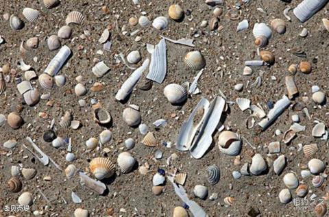
Introduction to shell embankments: There are four shell embankments in Tianjin, which are known as the three most famous shell embankments in the world together with the shell embankments of Louisiana in the United States and the shell embankments of Suriname in South America. These four shell banks were formed by tides and wind waves transporting, accumulating and wave-building offshore seabed shells, and they run basically parallel to the current coastline. The total span of the four shell embankments is about 36 kilometers, and they are respectively called the IV, III, II and I shell embankments. The higher the number, the earlier they were formed. The first shell embankment starts from Laotougu, Hangu District, Tianjin in the north, passes through Tianjin Development Zone, Lvju River, Gaoshaling, Baishuitou and ends at Mapengkou, Dagang District, about 700-500 years ago; the second shell embankment It starts from Baishaling in Dongli District in the north, passes through Deng Cenzi and Banqiao Farm Sanfenchang in Jinnan District to the ancient forest area in Dagang District, about 2500 years ago; the third shell embankment starts from Huangcao Tuo in Dongli District in the north and goes to the Shanggu Forest area in Dagang District. It passes through Cuijia Wharf, Juge Village, Zhongtang and Xuewitai in the south, about 4,000 years ago; the fourth shell embankment is distributed from north to south in Tianshuijing, Dasu Village, Shuyuanzi, Dagang District and into Hebei Province, dating back to present time. About 5000 years ago. The age of the shell embankment marks the approximate location of the ancient coastline on the west coast of the Bohai Bay. It is an important evidence and precious relic of the ancient coast, sea and land changes, and is a true record of the vicissitudes of life.
