Changsha self-driving sharing, Chenzhou Dongjiang Lake self-driving tour guide
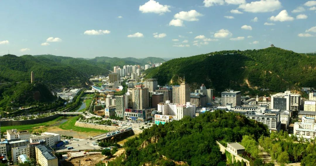
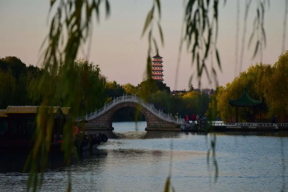
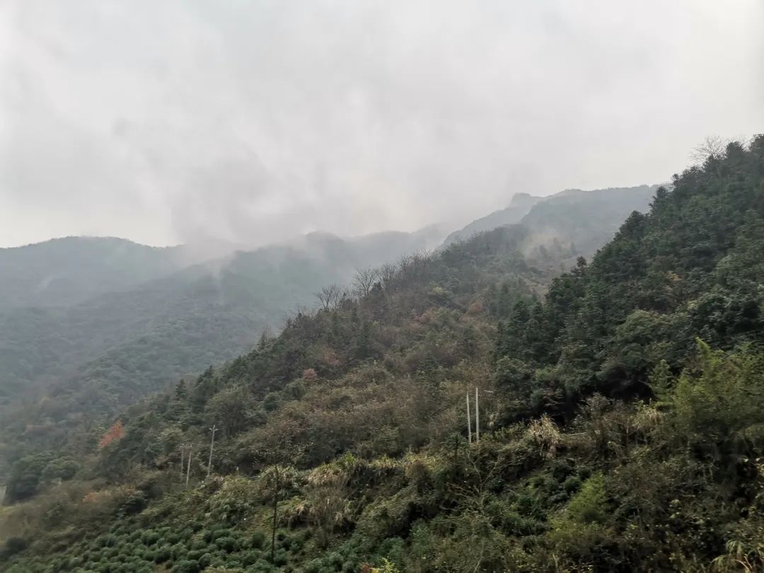
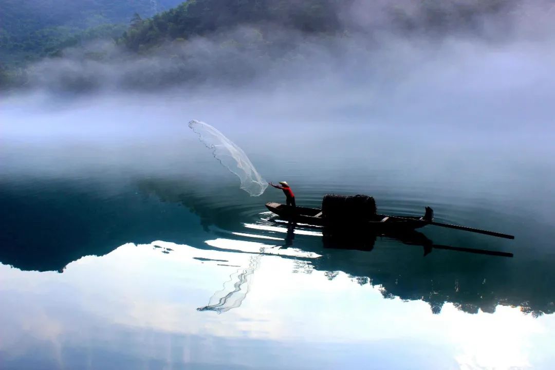
I originally planned to go to Chenzhou with my friends in 2019 or 2019, but due to the traffic jam on the expressway, it was close to the Chinese New Year. This plan is expected to be postponed.Today I am staying at home and working on a self-driving travel guide.Xiaodongjiang River in Chenzhou has long been famous. After checking the travel guide online, Dongjiang Lake is indispensable, including Gaoyiling and Yangtian Lake. City impression: is located in the southeast of Hunan Province, in the area where the Nanling Mountains and the Luoxiao Mountains intersect, and the Yangtze River system and the Pearl River system diverge. "Looking at the beauty of Hengyue Mountain in the north and facing the collision of the Five Ridges in the south", it has been the "throat" from the Central Plains to the coast of South China since ancient times. It is both "a battleground for military strategists" and "a place of outstanding humanities". It borders Ganzhou, Jiangxi to the east, Shaoguan, Guangdong to the south, Yongzhou, Hunan to the west, and Hengyang and Zhuzhou, Hunan to the north. It is known as the "Southern Gate" of Hunan.Because it is geographically adjacent to Guangdong, Chenzhou feels like the back garden of Guangdong. 80% of the tourists visiting Chenzhou are old Cantonese. You can hear familiar Cantonese everywhere, as if you are in Guangdong. The beautiful landscape of Chenzhou can be summarized as "one mountain, one lake, and one forest", which respectively refers to the three beautiful scenery of Mangshan Mountain, Dongjiang Lake and Chenzhou Stone Forest. Our trip was not all for these three beautiful views. We only went to see Xiaodongjiang River, and we chose Gaoyiling and Yangtian Lake for other itineraries.The reputation of Xiaodongjiang River has long spread far and wide, and the beautiful scenery of Xiaodongjiang River locked in fog has made countless photography enthusiasts wait silently by the plank road since 4 o'clock in the morning.(1) Dongjiang Lake Tourism GuideDongjiang Lake Scenic Tourist Area is located in Zixing City, Hunan Province. It is a national scenic spot, a national AAAAA tourist attraction, and a national wetland park. The scenic spot has excellent location conditions, close to the Beijing-Hong Kong-Macao Expressway, Beijing-Guangzhou Railway, National Highway 107, Xiamen-Chengdu Expressway, and Wuhan-Guangzhou High-speed Railway. It is only 28 kilometers away from the urban area of Chenzhou City and can be reached in 20 minutes via Chenzhou Avenue.Dongjiang Lake is pure and vast, with a surface area of 160 square kilometers and a water storage capacity of 8.12 billion cubic meters, which is equivalent to the water storage capacity of half of Dongting. Its water quality has reached the national first-class drinking water standard. Dongjiang Lake combines the elegance of the mountains and the charm of the water. It combines the beauty of the South and the history and civilization. It is known as "a lake on earth and in heaven, with thousands of scenes in it."Dongjiang Lake Tickets:Tickets are divided into lines A and BLine A is 90 yuan (85 yuan when purchased on the official website of the scenic spot) and includes the following attractions: Fog-filled Xiaodongjiang River, Hougushan Waterfall, Dongjiang Dam exterior, Longjing Canyon, and Guandong River Lake.Line B is 149 yuan (purchased on the official website of the scenic spot is 139 yuan). Tickets for line B (Doustu Cave) include car and boat transportation fees in the scenic spot, and sightseeing tours (tourists need to take the bus (15 The bus departs every minute or so, and the specific time depends on the tourist flow in the scenic spot that day)Take a boat to Dongjiang Dam Pier (one bus takes about 15 minutes, the specific time is determined according to the tourist flow of the scenic spot on that day), Dongjiang Lake Tourism Guide; Tourist attractions are as follows: Fog-filled Xiaodongjiang, Hugushan Waterfall, Dongjiang River Dam exterior, Longjing Canyon, Youdong Jianghu, Tushita Cave).Xiaodongjiang, her beauty not only comes from the ripples of the blue waves and the endless green, but also comes from the mist that changes day and night, dusk rises and morning sets.When the girl in the red dress gets on the fishing boat and the boat rows into the river, you will see a picture of fairies flying in the mist, dancing lightly on the river surface, giving you a fairyland-like dream and shock that makes you unable to tell the difference. Is it in a painting or a fairyland! The fisherman cast his net on the No. 3 Bridge . Later, due to the excessive number of people filming on the Third Bridge, which affected the traffic, the fisherman's net cast performance has now been moved to the plank road between the No. 2 Bridge and the No. 3 Bridge. . So the host recommends staying between Bridge No. 2 and Bridge No. 3. You can walk directly to the plank road in the morning.Chenzhou Dongjiang Lake self-driving tour guide2. Transportation2. It is 35 kilometers from Dongjiang Lake to Gaoyiling and takes an hour’s drive.1. The scenery of Gaoyiling can only be seen after climbing to the top of the mountain. There are multiple routes to the top of the mountain. The author only introduces the fastest and most energy-saving route, but the scenery you see is the same.Gaoyiling can only be regarded as an entry-level hike in outdoor hiking, and it is not difficult.2. Self-driving friends directly navigate to the Gaoyiling Village Committee of Qiaokou Town (you will see another climbing entrance on the way up the mountain. There are tents on both sides of the mountain road for shopping, so don’t park here! !!!Continue driving up the mountain, and there is a farmhouse almost at the top of the mountain. There is a large parking space, but you don't park here!There is a repaired concrete road on the left hand side of the open space. Keep walking along this road and pass by a fishing ground. Continue walking. Go in and ask them and they will tell you how to hike up to Gaoyiling. It only takes a few steps to go up to Gaoyiling. In 30 minutes, you will see the most beautiful scenery.3 Dongjiang Lake to Yangtian Lake is 84.18 kilometers, and the journey takes 2 hours and 25 minutes.Yangtian Lake is at the top of the mountain. The winding mountain road is very exaggerated and has many hairpin bends. If you are a novice driver, you should definitely not go there by yourself. There are not many bends there.3. Itinerary ArrangementTravel time: Dragon Boat Festival, 3 days from June 9th to 11thDay1: Changsha —Zixing City Dongjiang Lake Scenic Area—Stay at Dongjiang Lake Fenglinwan Farmhouse—Visit Dongjiang Lake Scenic Area—Photograph the misty Little Dongjiang River in the evening—DinnerDay2: Get up early and take photos of the misty Xiaodongjiang River - Breakfast - Gaoyiling - Xianya Farm - Rest -Day3: Breakfast—Yangtian Lake Grassland—Lunch—Return to ChangshaFog-filled Xiaodongjiang River: Xiaodongjiang River is 12 kilometers long and is a scenic spot formed by the cascade development of the Dongjiang Dam. The water quality of Xiaodongjiang River is clear and clean, and all indicators have reached the national first-class drinking water standards.From April to October every year, whenever the sun rises in the east or sets in the west, the entire Xiaodong River is filled with clouds and hazy veils, as if entering a fairyland. This magical and spectacular scene is a Chinese wonder - the foggy Xiaodong River.The best time for fog viewing in Xiaodongjiang River:May-OctoberEarly morning: 6:30-9:00 Evening: 5:30-7:30The fisherman's net performance is at 7:30, and the specific time will change. It depends on the weather. If the weather is bad or there is no fog, the fishermen will not perform the net performance.For example, when I went to the Dragon Boat Festival this time, I got up at 5 o'clock in the morning and it was already dawn. The entire Xiaodongjiang River was foggy, and the fog spread over the No. 2 Bridge. At 5:30, it was completely bright. This time is the most beautiful. , the sky is reflected on the water, and the fog is not too big. It only occupies half of the river surface, so you can see both the reflection and the fog.(2) GaoyilingIntroduction: Gaoyiling Village is located in the west of Qiaokou Town, Suxian District, Chenzhou City, Hunan Province. It is separated from Feitian Mountain and borders Bianjiang River in Yongxing County. The terrain here is dominated by mountains and forests, with pleasant scenery and a forest coverage rate of 95%. Gaoyiling is an undeveloped virgin land with Danxia landforms, complete with mountains, water, springs, caves, villages, cliffs and tunnels. Its biggest feature is that the Danxia landforms are dotted with beautiful puddles and red rocks. The green water, dangerous villages and strange streams are absolutely beautiful.Tickets: This is not a scenic spot, no tickets are required! ! ! But this place is about to be developed into a scenic spot, so if you want to see the most original ecological Gaoyiling, you should go there quickly.Transportation: It is recommended to drive there by yourself or charter a bus. There are no buses.1. The super beautiful Danxia landform, highly recommended by five stars! Got it.2. Climbing Gaoyiling will be quite strenuous. It is recommended to wear sportswear and never wear flip-flops! During the mountain climbing process, you have to pass through a bamboo forest and a mountain forest. There will be all kinds of bugs in the mountains. It is best to have long sleeves and long trousers, which can protect you from the sun and insects.In summer, it is recommended to wear hiking boots or sneakers, a hat, short sleeves inside, sun protection clothing outside, and a bottle of water. In fact, trekking poles are not needed. If you follow the author's route up the mountain, the difficulty level is not high. It is just like normal mountain climbing. When you climb to the top of Gaoyiling, there will be a short section of stairs of about 10 meters down to the core scenic area of Gaoyiling. , the stairs there are a bit steep, but the author thinks the difficulty level is 2 (out of 10 points), not as scary as everyone said.3. When viewing the core area of Gaoyiling, be careful not to go too far to the edge. It is a bit slippery. Safety first. In addition, the garbage you brought up must be taken down the mountain by yourself to protect the environment.(3) Yangtian Lake Grassland
All pictures come from the Internet, thanks to the original authors for sharing
Introduction: Yangtian Lake has a total area of 40 square kilometers and is known as "the prairie closest to Guangzhou". The scenic area starts from the mouth of Yongchun Gorge in the east, reaches Anyuan Stone Forest in the south; reaches the top of Jinxian Village in the west and reaches the source of the river mouth in the north. In the hinterland of hundreds of thousands of acres of mossy platform grassland, there is a pool of green water, known as "Yangtian Lake".The scenery of Yangtian Lake Prairie generally refers to the scenic area with an area of about 40 square kilometers and a golden triangle distribution based on the Giant Buddha, Tianhu Grassland and Anyuan Stone Forest. Yangtian Lake is an extinct volcano crater gifted by the Quaternary Ice Age. It has a natural water area of more than 20 acres and an altitude of 1,350 meters. It is suspended next to the intersection of the Yangtze River and Pearl River waterlines and the Beijing-Zhuhai Expressway. A shining pearl. It is surrounded by grass and moss and reeds. The lake is surrounded by lush sub-primitive forests, which act like a natural barrier surrounding the pasture into a paradise.Tickets: 50 yuan/person


![[Travel Note Sharing] 2018 Kyoto Red Leaves + Utada Hikari Live (2)](https://bh2255.static.gitbeta.eu.org/bh2255/body_images/frc-e92c7d24a1507fed4a96dfa3261486d8.jpeg)