Dali-Bingchacha 219-Bomi Linzhi 318-Lhasa Travel Notes
Because of the description of the Bingchacha Line by "China National Geographic": "A complete record of the extreme challenges of the new Yunnan-Tibet Passage (Bingchacha Line)" and "Bingchacha Line: The most difficult journey into Tibet", it became I secretly thought about planning a trip to Bingchacha. I am such a person: I plan because I like it. Therefore, this trip was actually planned for a long time. After my daughter’s college entrance examination ended in June 2021, I contacted the driver online to make the itinerary and date. Everything was ready and just waiting to go.


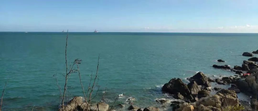
The first day of the itinerary is July 4th (today’s itinerary: meet in Dali). The first stop of this trip is Dali. I don’t know how many people are like me. Their only understanding of Dali is that it is the capital of the Bai Autonomous Prefecture and the capital of the ancient Nanzhao Kingdom and Dali Kingdom. They know that the ancient city of Dali has a long history. They know that Dali has Cangshan Mountain and Erhai Lake. Know what the four scenery of Dali’s scenery refers to (the four scenery of Dali’s scenery refers to Xiaguan wind, Shangguan moon, Cangshan snow and Erhai moon). At 14:30 pm on the 4th, a group of 6 of us arrived at Dali Station by high-speed train. The driver picked us up and sent us directly to the booked inn ~ Dali Guancanghai Art Seaview Inn (there is an Internet celebrity photo spot on the fifth floor. It is recommended to stay there. Meituan can Book a room). After resting for a while at the inn, the driver took us around the Erhai Lake and around 8pm to Dali Ancient City for dinner.


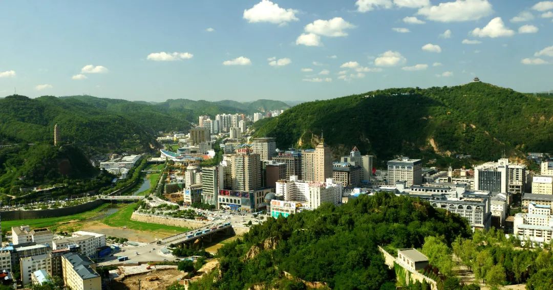
The second day, July 5th (today’s itinerary: Shuanglang Ancient Town ~ Xizhou Ancient Town ~ Lushui). We gathered with 6 other friends at 8:30 in the morning and set off for breakfast in three off-road vehicles with 12 people (the driver took us to a snack bar on the Erhai Lake, which is said to be the more authentic Yunnan rice noodles eaten by locals), and then went to Shuanglang along the way. Visit Yang Liping’s Sun Palace and Xizhou Ancient Town in the ancient town. After lunch in Dali, we took the expressway to Lushui City. After driving on the highway for a while, we gradually narrowed the distance from the Nu River. We arrived in Lushui City at about 6:30 pm and checked into the Lushui Zuoan Hotel on the bank of the Nu River (the hotel has a good environment and a good view. It is recommended to stay there. You can book it with Ctrip). Free evening. Note: Lushui City, located in the Nujiang Grand Canyon, is located in the west of Yunnan Province. The general terrain is dominated by one river and two mountains, with high north and low south. It is located in the West Yunnan Longitudinal Valley area at the southern end of the Hengduan Mountains. Because the urban area is built along the Nu River Gorge, the city as a whole is relatively long and narrow. The expressway from Dali to Lushui was built not long ago, and traffic was once blocked. Lushui City has been one of the key counties and cities for national poverty alleviation in recent years.


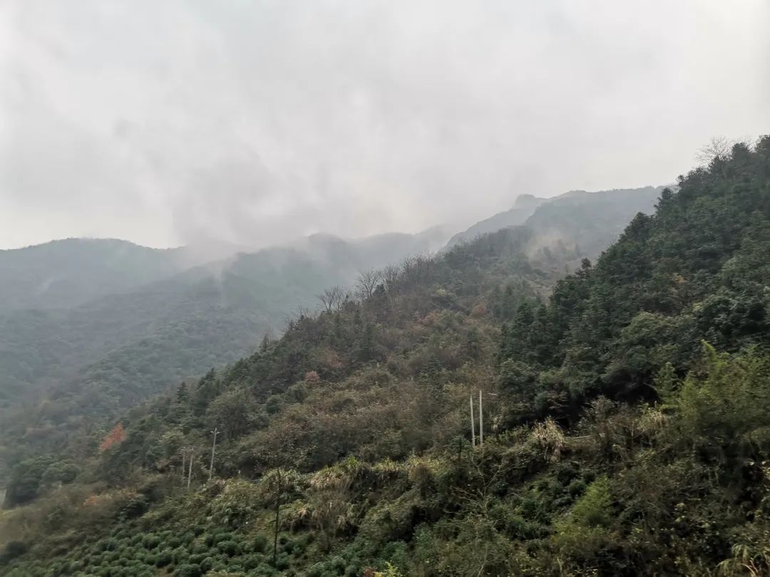
The third day of July 6th (today’s itinerary: Lushui~Denggeng Bathhouse~Nujiang Tiger Jump~Bingzhongluo). Today’s itinerary is a day trip along the Nujiang Grand Canyon. The Nu River surges through the Nu River Grand Canyon. It originates from Jire Paige at the southern foot of the Tanggula Mountains on the Qinghai-Tibet Plateau. It is called the Nagqu River above Jiayu Bridge in Tibet. After entering Yunnan, the scene was shocking because of its constant collision and flow between Biluo Snow Mountain and Gaoligong Mountain. It was also called Anu Rimei among the local Nu people. "Anu" is the name of the Nu people. "Rimei" is translated as river in Chinese, and "Anu Rimei" is the river in the area where the Nu people live, so it is called Nujiang. The Nu River flows south into Myanmar and finally into the Indian Ocean. The Nujiang River is an international river with a total length of 3,240 kilometers, and its section in China is 1,540 kilometers long. However, this wild river is not alone along the way. The main ethnic group in the canyon is the Lisu people. There are also Bai and Nu people living in Nujiang Prefecture. There are 22 ethnic groups including , Pumi, Dulong, Yi, Han, Naxi, Tibetan, Dai, Hui and Jingpo.


Along the way along the Nu River Gorge, the roads have just been repaired. The village houses on both sides of the road are neatly repaired, with red flags on the roofs. The driver is a native of Dali, and he introduces local customs and the origin of these new houses. , are all benefits provided by the country's poverty alleviation policy to the local people. When you come here, you can truly understand that the government is really the people's government, and feel how much the local people love and support the party and the country. Today’s place of stay is Bingzhongluo Village, the starting point of the Bingchacha Line. All accommodation in Bingzhongluo Town is basically concentrated on the main streets of the town, and most of them are farmhouses opened by local villagers (can be booked with Ctrip). PS: It is said that there are many natural hot springs along the Nu River. Shortly after setting off from Lushui, we went to the Denggeng Natural Hot Spring Bathhouse on the Nu River to take a dip.


The fourth day of July 7th (Today’s itinerary: Bingzhong Luo Nu River First Bend Observation Deck ~ Shimen Pass ~ Wuli Village ~ Tea Horse Road ~ Qiunatong ~ Tiger Mouth ~ Big Quicksand ~ Chawalong). China Geographic Magazine recommends Bingzhongluo, a great hidden place. Anyone who has been to Bingzhongluo says that it is a paradise where humans and gods coexist. Along the Grand Canyon and tracing the Nu River northward, traces of the caravans of the past can still be traced on the ancient post roads along the Yunnan-Tibet line. Various religions are integrated here, and multiple ethnic groups live together here. There is the thousand-year-old Tea Horse Road here,there are tall and beautiful churches, you can see the rushing Nu River in the cliff Shimenguan Canyon, the quiet and peaceful cottages in Wuli Village among the fields, and it is surrounded by the dense virgin forest. Walk the Tea Horse Road and enjoy the scenery of the canyon. The three parallel bridges on both sides of the Nu River quietly interpret stories from different eras.


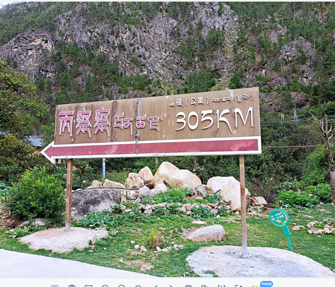
The Bingchacha Line refers to Bingzhongluo Township in Gongshan, Yunnan - Chawalong Township in Tibet - Chayu County, with a total length of 287 kilometers. It is the most difficult section to transform in the new Yunnan-Tibet Corridor. Among them, it is only a dozen kilometers from Qiunatong in Bingzhongluo Township to Chawalong Township. This section is almost the worst road in the entire Bingchacha route. After entering the Tibetan border from Bingzhongluo, the road became obviously narrower, and it was no longer a cement or asphalt road, but a bumpy mud and gravel road. Today we are still traveling along the Nujiang River, with steep cliffs and the rushing Nujiang River. The place to stay tonight is Chawalon (Chayu Kelai Xuan Hotel, which can be booked on Ctrip. It is an affordable hotel with acceptable sanitary conditions and affordable prices. The food from the boss’s wife’s family is moderately priced and tastes good, recommended).


The fifth day of July 8th (today’s itinerary: Chawalong ~ Muruo Village ~ Chayu). Tsavalong is particularly quiet in the morning. Chawalong is a township in Chayu County, Tibet. It is located at the foot of the Meili Snow Mountain in the southeast of Chayu County. The terrain is high in the north and low in the south. It is a typical alpine canyon landform. The Nu River runs through it from north to south. Jiaying Village in Chawalong Township is the best viewing point for viewing the back mountains of Meili Snow Mountain. Due to time and weather reasons, we gave up going to Jiaying Village this time. The auspicious number of 6666 kilometers of National Highway 219 is in Chawalon Township. We climbed three passes with an altitude of more than 4,000 along National Highway 219. The sudden increase in altitude made our partners a little uncomfortable and had a little altitude sickness. The total distance from Chawalong Township to Chayu County is 220 kilometers, and a normal journey takes about eight hours. Stay at Chayu Hot Spring Hotel in the evening (it is not recommended to stay in a hot spring hotel in July and August because the hotel is built on a mountain. There are flying insects everywhere in July and August, and the experience is too bad. After October, it is a good choice to soak in the hot spring in the hotel. relatively affordable).


The sixth day, July 9th (today’s itinerary: Zayu~Demla Mountain Pass~Renlongba Glacier~Ranwu Lake~Bomi). Departing from Zayu County in the morning, we climbed all the way over the Demla Pass at an altitude of 4,900 meters and passed through the Renlongba Glacier. The climate here in July is ever-changing. This season is not the best period for glacier viewing, and it is drizzling again. We chose to go further. View glaciers. Arrive at Ranwu Lake for lunch at noon. Ranwu Lake is officially integrated into Route 318. Vehicles on the road begin to gather. On the way to Bomi, traffic jams occur from time to time. After passing through Bomi County, our plan tonight is to stay at the Guxiang Lake Manor by the Guxiang Lake (the manor has a first-class environment and a moderate price. The restaurant provides breakfast and dinner, and the taste is good. It is recommended to stay. You can book it with Ctrip) .


The seventh day of July 10th (today’s itinerary: Bomi Ancient Village Lake ~ Tongmaite Bridge ~ Lulang ~ Sejila Mountain Pass ~ Nyingchi). Because today's itinerary is easy, I can sleep until I wake up naturally in the morning. The humidity in Pomi is relatively high in this season. Because of the rainy season, you can often see the mist-shrouded lakes and mountains in the early morning. After breakfast, we set off at ten o'clock, and there was a lot of traffic all the way. The area next to the Tongmaite Bridge has entered the commercial era, and 318 is no longer the original scene of its early years. The repaired asphalt road is filled with private, group, and self-driving fleets. Several internet celebrity check-in points have been built on both sides of the road. The check-in points are crowded with people, making people have no desire to stay. At noon, we had lunch in Lulang, then passed through the crowded Sejila and stopped for a while before going directly to Linzhi to check in (Lingzhi Nuoyanglin Boutique Inn ~ Ctrip reservation).


Day 8, July 11 (Today’s itinerary: Nyingchi ~ Mila Mountain Pass ~ Lhasa). Linzhi is a prefecture-level city under the jurisdiction of the Tibet Autonomous Region. It was called Gongbu in ancient times. Linzhi has beautiful scenery and is known as "Tibet Jiangnan". March and April are the best seasons to visit Linzhi when the peach blossoms are in full bloom. After setting off on the expressway in the morning, we were surrounded by blue skies and white clouds all the way. After getting off the expressway, we had lunch and crossed the Mira Mountain. We arrived in Lhasa around 4 p.m. and checked into the Weijin Hotel in Lhasa (the Weijin Hotel is located between the Potala Palace and the Jokhang Temple In between, it only takes a few minutes to walk to the Potala Palace and Jokhang Temple. The hotel has friendly service and a good sanitary environment. It is recommended to stay here). Here, I would like to thank my old friends in Lhasa again for their warm hospitality this night. I am so lucky to have traveled thousands of miles away and received such warm hospitality from my old friends!


The ninth day of July 12th (today’s itinerary: visit the Potala Palace in the morning ~ wander around Barkhor Street in Lhasa’s Jokhang Temple in the afternoon). This morning at 8:20, we queued up to enter the Potala Palace to pay homage to Tibetan history and culture. It was another day full of people. The Potala Palace seems to have a power that not only carries the beliefs of Tibetans, but also deeply attracts groups of people who come to Tibet to explore. In the afternoon, we went to Barkhor Street for a stroll. The most shops on Barkhor Street are probably street photography shops. In the evening, we inquired all the way and found the famous shooting spot of the Potala Palace. Unfortunately, the weather was not good. A dark cloud came just at sunset, and we missed the snow-covered palace under the golden light.


At this point, the Dali~Bingchacha~Integration into 318~Lhasa itinerary comes to an end. The main landscape features along this road are relatively primitive natural scenery, from the life changes in the folk villages on both sides of the Nujiang River to the speed difference between the Tea Horse Road and modern transportation. Whether it’s the four-season scenery of alternating red, yellow, green, and white as you climb over several mountains above 4,000 meters above sea level, or the quicksand soil along the steep mountains along the Nu River that may cause landslides at any time, it should be a place worth visiting for nature lovers.


The second half of the wandering journey from Lhasa to Lijiang will be continued separately. If you need other information, please leave a message for consultation.


Related Articles
![[Travel Note Sharing] 2018 Kyoto Red Leaves + Utada Hikari Live (2)](https://bh2255.static.gitbeta.eu.org/bh2255/body_images/frc-e92c7d24a1507fed4a96dfa3261486d8.jpeg)

Comments
No comments yet