
During the National Day holiday, I discussed with my wife about traveling eastward along Jilin. The special content is to prepare the strategy and application for Vladivostok in advance, so that other domestic parts will be easier to handle.
We set off from Changchun on the morning of the 1st. Unfortunately, due to road construction on the Changji Expressway, we had to pass through the Changji South Line. It took several hours to reach Jilin City on the expressway. The journey was uneventful. It was already the afternoon when we arrived at Dunhua. , after lunch in the city, we set off to Liuding Mountain.
Park your car in the parking lot, walk inside, buy a ticket and enter, it takes a long time.
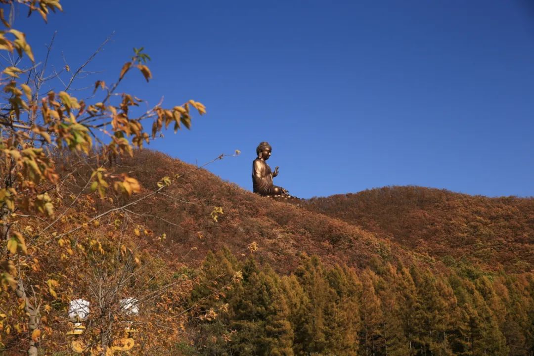
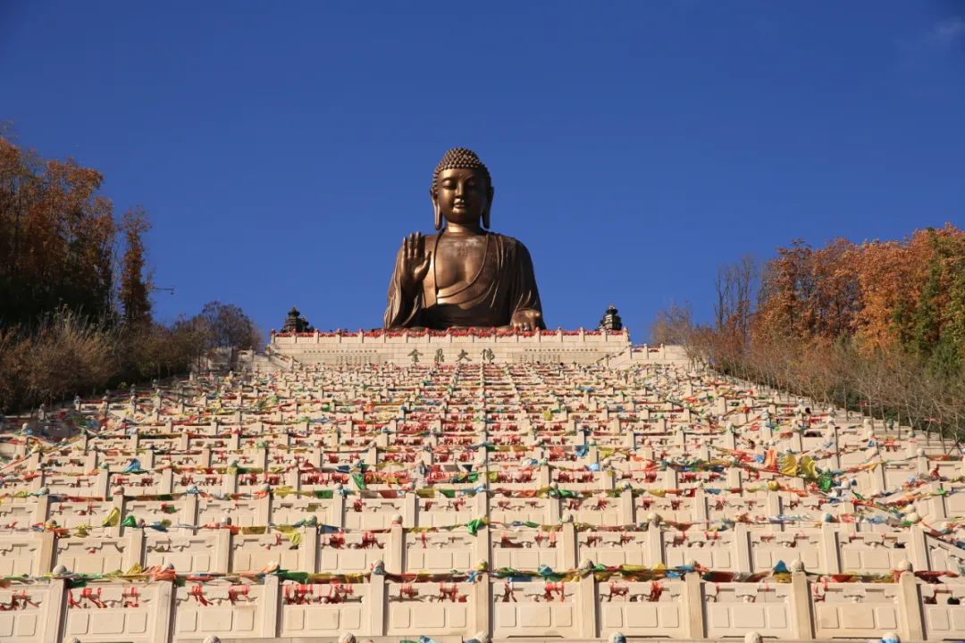
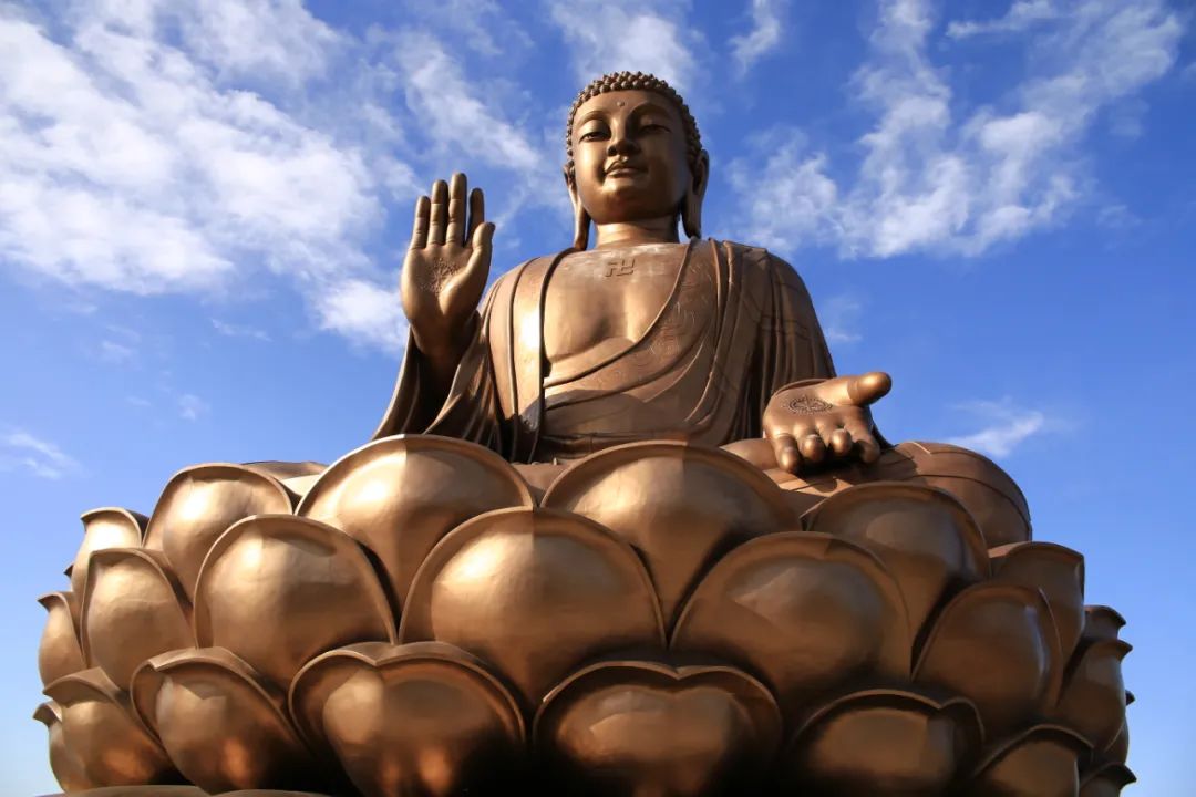
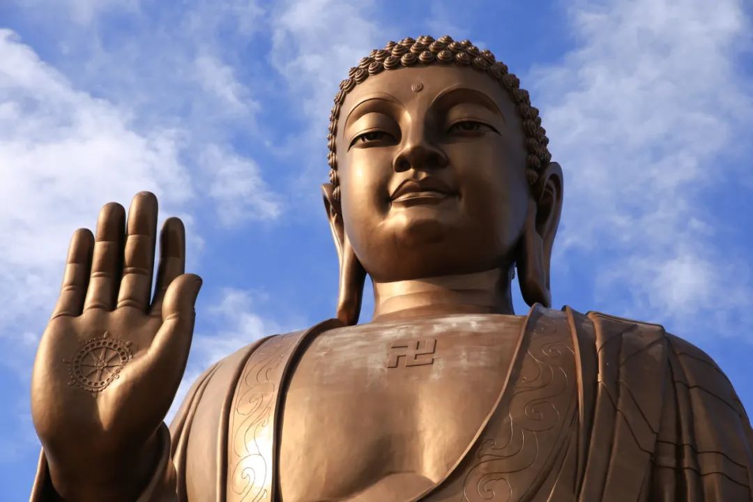
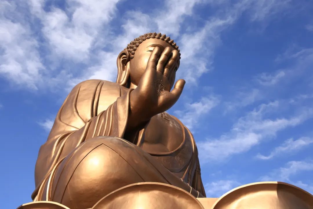
This giant Buddha can always be seen

There is a dam halfway, and the lake in front

When you enter the gate of the scenic spot, you see this big hand.


There is also this Falun in the south
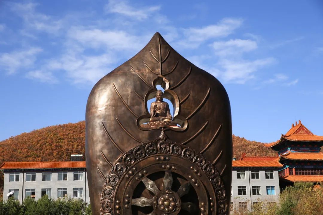
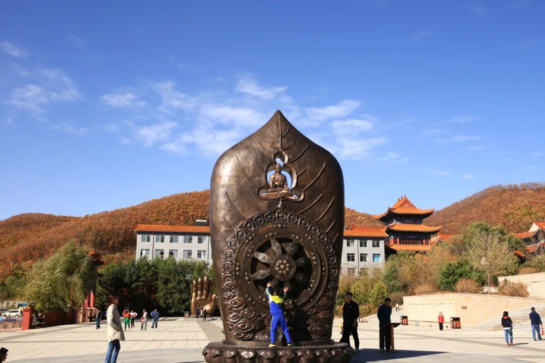
The key point is here.

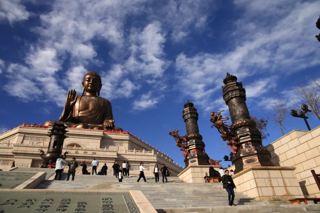
Photographed facing the Big Buddha, there are two Buddha statues, one big and one small, with the same visual effect.
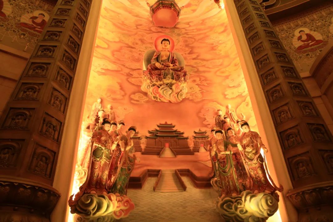
Enter the temple gate


After passing the two main halls, go up the long corridor next to it. The one in the middle is called Guanyin Hall.
It's tiring to go up this level

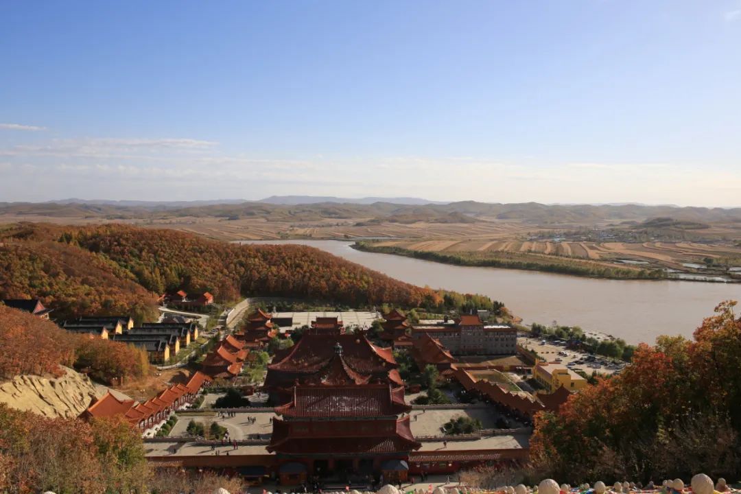
It took a lot of effort to go up and look back at the scenic spot

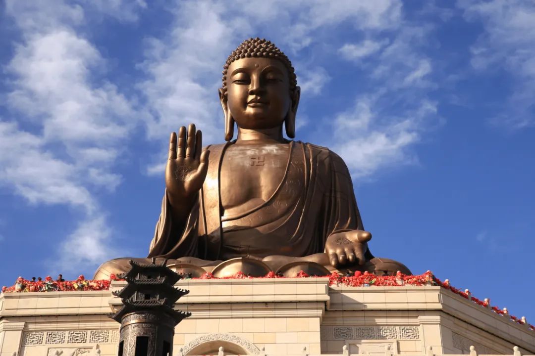
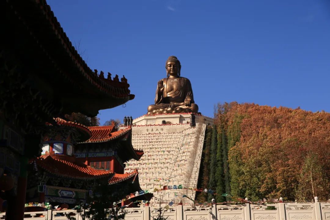
Watch the Big Buddha at Guanfo Square


Looking back at the foot of the Buddha.
You can enter under the Big Buddha, which contains Buddhist cultural propaganda.

Strong sense of three-dimensionality

mountains next to


Walk around the Buddha statue
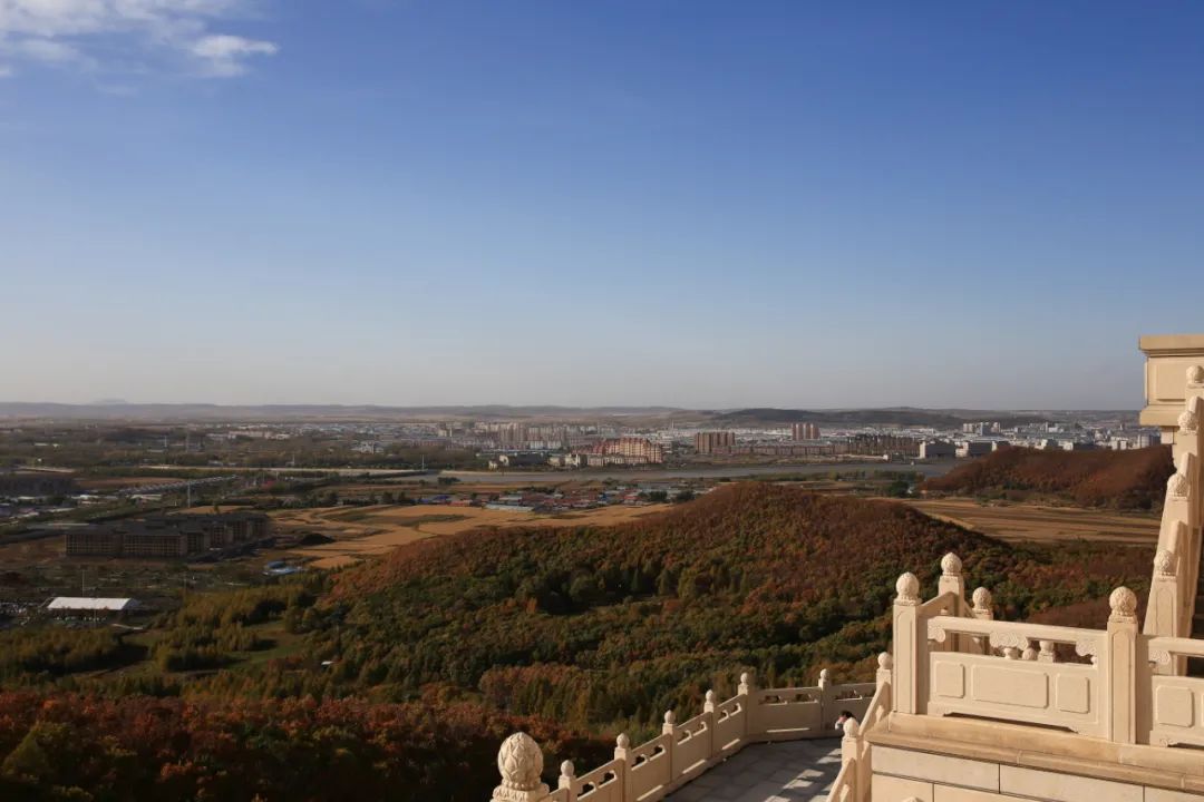
Dunhua City in the distance
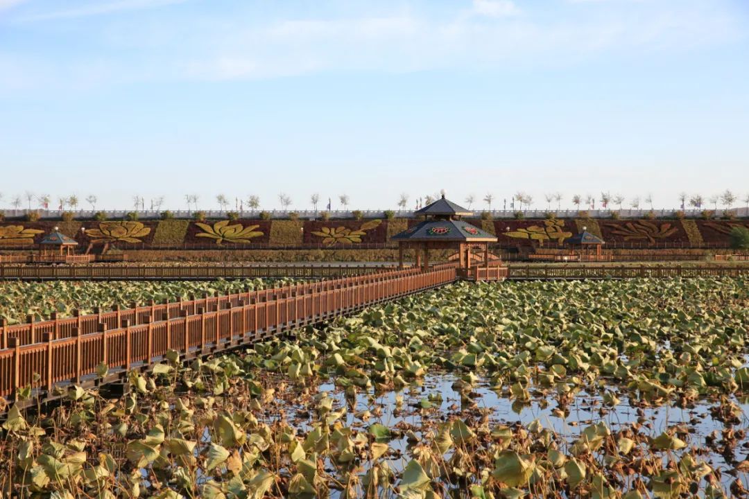
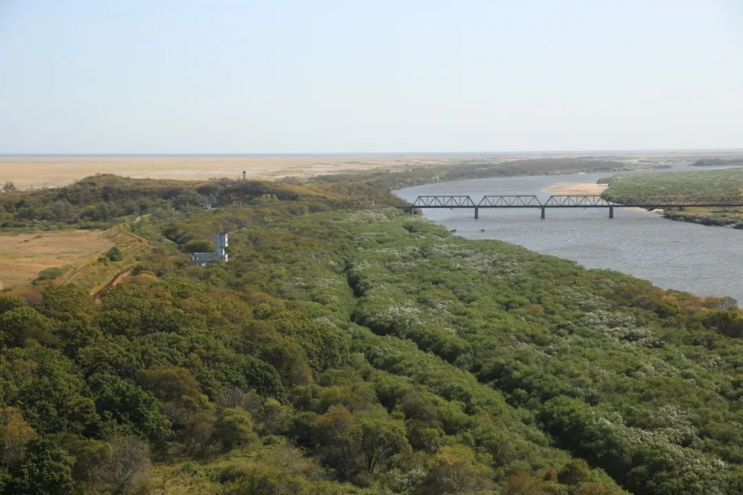
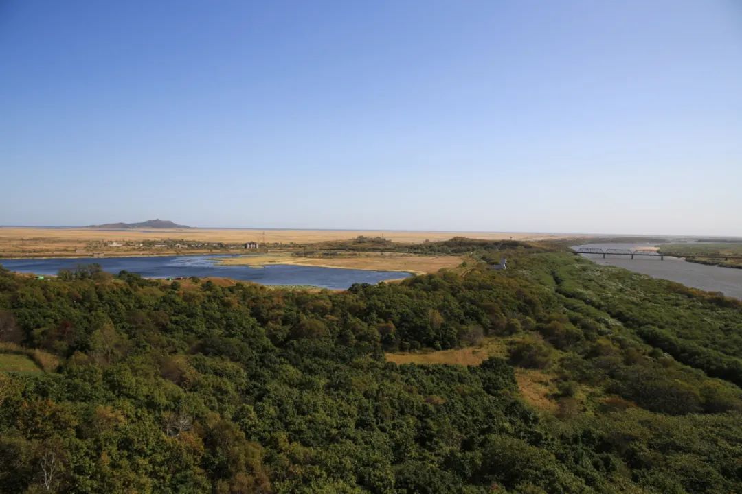
We walked down a wooden plank road from the mountain and then passed a large lotus pond.
After the scenic spot, we continued driving and stayed in Yanji City at night.
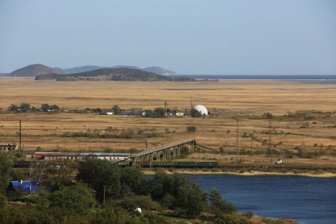
Get up early the next day and continue driving to Hunchun, a distance of more than 100 kilometers. From the Hunwu Expressway to the Touxia Expressway, someone was handing out national flags on the side of the road, one to each car. The navigation map in the border area is not very good, so you don’t need to read too much. It’s just one road anyway.
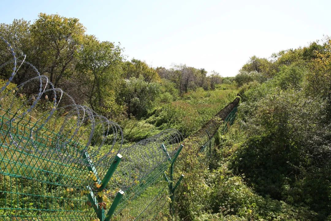
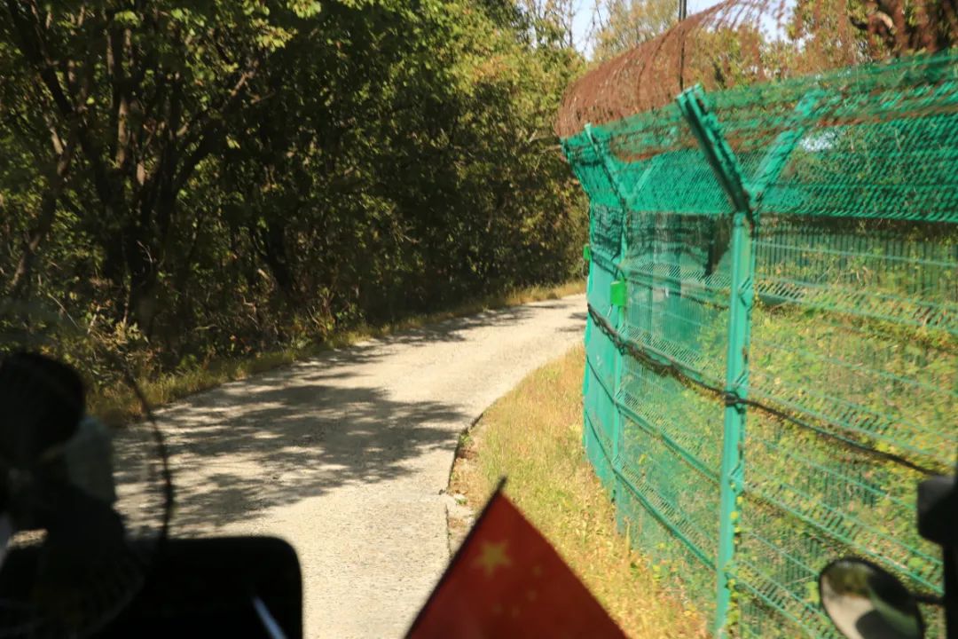
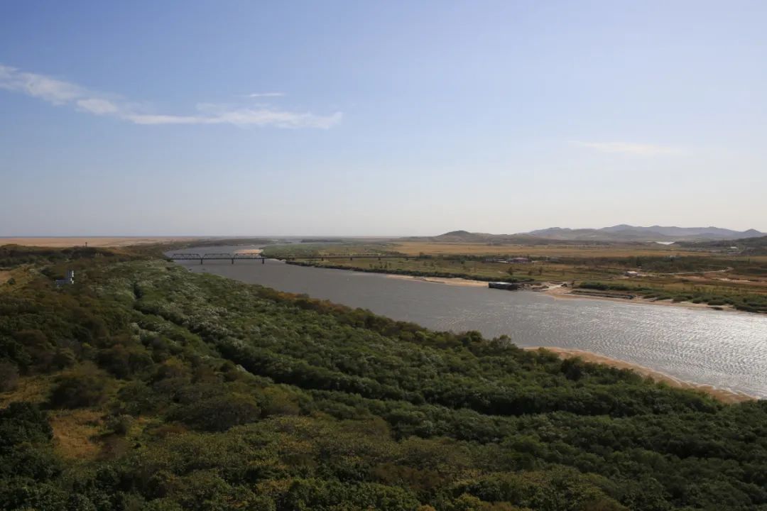
We still have to drive more than 60 kilometers inward to reach our destination. The last road we passed was called Yangguanping Embankment. This section of the road is so narrow that only the highway is our country's territory. The road is actually the embankment of the Tumen River, and the south side of the road On the side is the Tumen River, whose shore is blocked by barbed wire. Under the highway embankment on the north land side, another barbed wire fence runs alongside the highway. The other side of the barbed wire fence is Russian territory. When driving past, you can see a sign saying "Climbing the Border is Strictly Prohibited" hanging on the barbed wire fence.
Historically, Fangchuan was isolated in only two "narrow places" between overseas and inland areas. In 1957, the narrowest section of Yangguanping was cut off by the Tumen River. Chinese citizens borrowed the territory of the former Soviet Union to enter and exit the area for a long time, and the Fangchuan area became an "enclave" of our country. On August 8, 1983, the Yanguanpingdi Road filled with bluestone in the Tumen River was opened to traffic. Only then did this "enclave" have its own passage. In 1992, the government invested in the construction of Yangguanping Embankment, which completely solved the traffic difficulties.
There shouldn't be many people in the scenic area normally, but this time during the festival there were suddenly so many people that the management couldn't keep up. First of all, our car was guided to a parking lot on the ground. At first glance, this parking lot was temporary and not usually needed. Then queue up and take the scenic bus to enter the ticket office. We bought tickets online in advance, but there is no separate ticket exchange window here. Everyone queues up together, which loses the meaning of buying tickets online. After queuing for a long time, it was finally our turn to enter. Scenic spots that could be walked in before can now only be entered by minibus in the scenic spots.
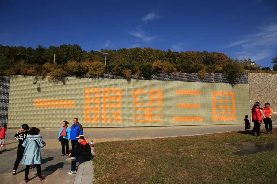
China and Pakistan drive all the way to the innermost part, which is the easternmost part of China's territory. The main thing here is to look at the Tu character sign, which is the boundary monument at the junction of the Three Kingdoms.
The national border, with Russia on the left.

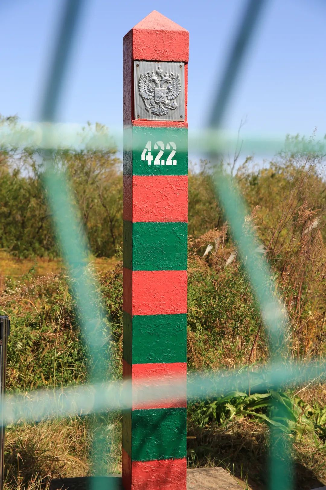
This is a Russian border monument.


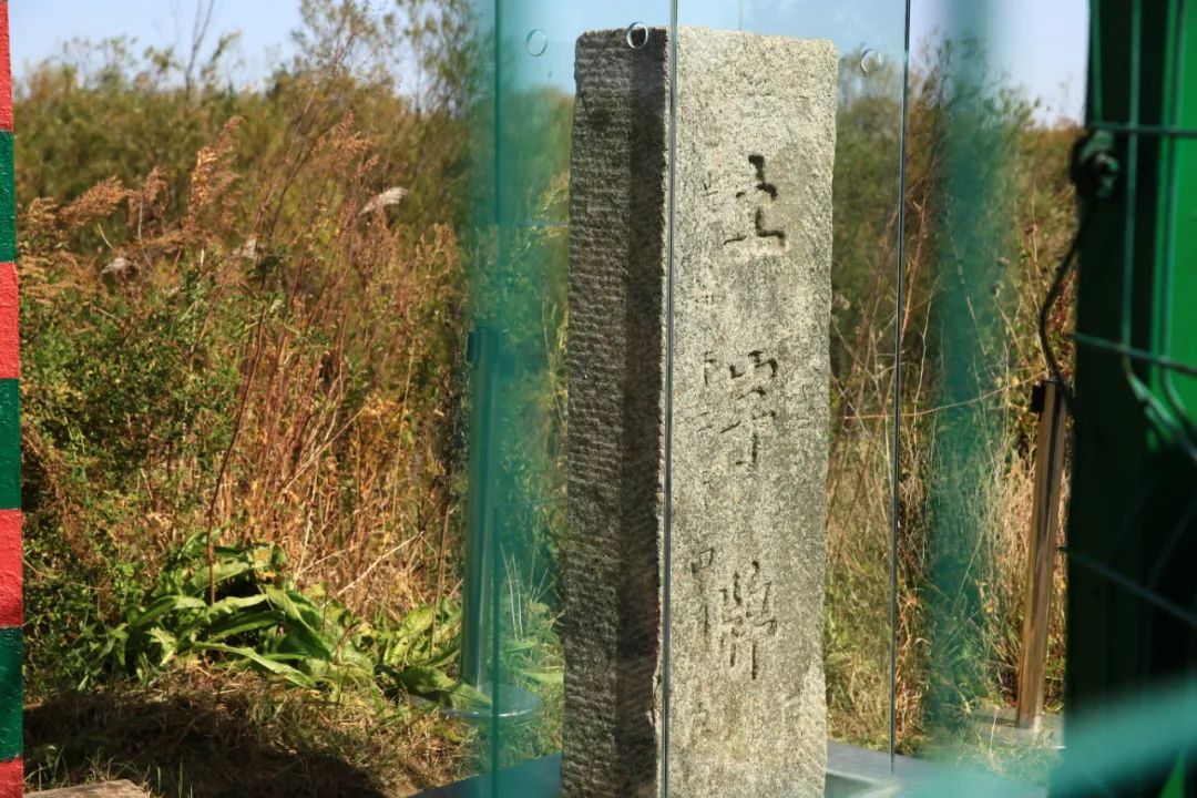
This is the "Tu" brand established in the Qing Dynasty.
The "Tu" sign is 1.44 meters high, 0.5 meters wide and 0.22 meters thick. It is made of granite. There are three big characters "Tu" on the Chinese side, and eight small characters "Li in April of the twelfth year of Guangxu" on the left side. On the Russian side there are "T" and "Tu" on the Russian side. The body is complete and the handwriting is clear. In 1960, in order to protect this historic and complete territorial symbol from being washed away by the river, the Chinese government built a riverbank berm ranging from 6 to 8 meters high and 1,860 meters long. The "Tu" plaque is a national first-class cultural relic and is also a provincial-level patriotism education base and national defense education base.
Speaking of Tuzipai, we must first talk about a man named Wu Dacheng. Wu Dacheng is one of the few officials worthy of praise in modern Chinese history. In 1860, an unequal treaty allowed Tsarist Russia to seize more than 400,000 square kilometers of land east of the Ussuri River from the mouth of the Tumen River to the mouth of the Heilongjiang River and all the long coastline along the Sea of Japan. However, in that era when weak countries had no diplomacy, there were still some patriots who fought hard for the interests of the country and the nation, and Wu Dacheng was one of them. In 1886, Wu Dacheng, the Minister of Supervision and Border Affairs of the Qing Dynasty, the left deputy governor of the Supervisory Council, and the famous epigrapher, was ordered by the Qing court to come here to survey the border. Through on-site investigation, he discovered that according to the 1860 Sino-Russian Treaty of Beijing, after the Qing court ceded a large area of land in the Northeast, the border here should be 20 miles away from the mouth of the Tumen River. However, when the boundary monument was erected in 1861, Russia erected it without permission on Shacao Peak, 45 miles away from the mouth of the Tumen River. So Wu argued with Tsarist Russia, and Tsarist Russia agreed to move the boundary sign 15 miles south, which was to its later location. Wu Dacheng's awe-inspiring struggle finally won back Heidingzi (today's Jingxin Town) for his country and China's navigation rights in the Russian-Korean border section of the Tumen River. This is the origin of the earth-character plaque.
This place actually doesn’t take long, it’s more of a historical significance. We drove back, still along the border.
The car returned to Longhu Pavilion, which is the main selling point of the scenic spot, where you can see the Three Kingdoms at a glance.
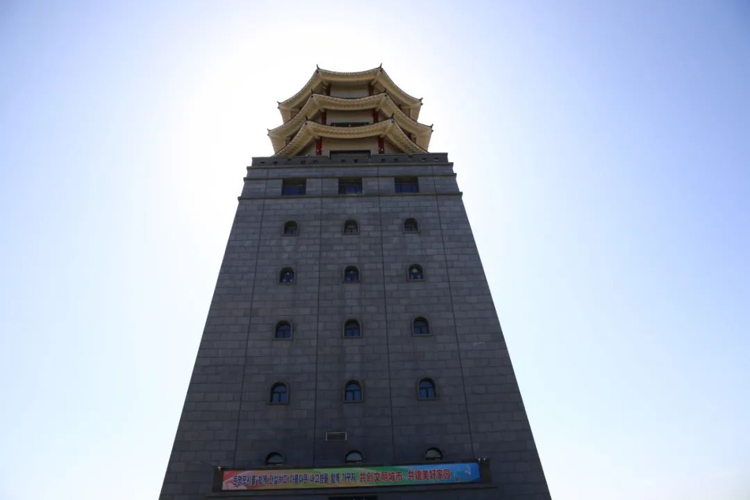
There is an elevator to the top.

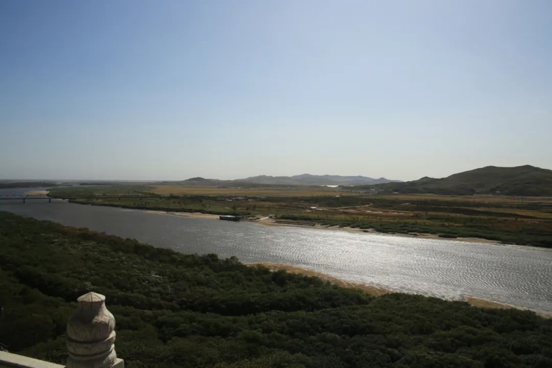
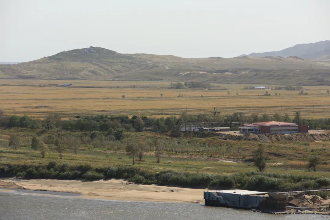
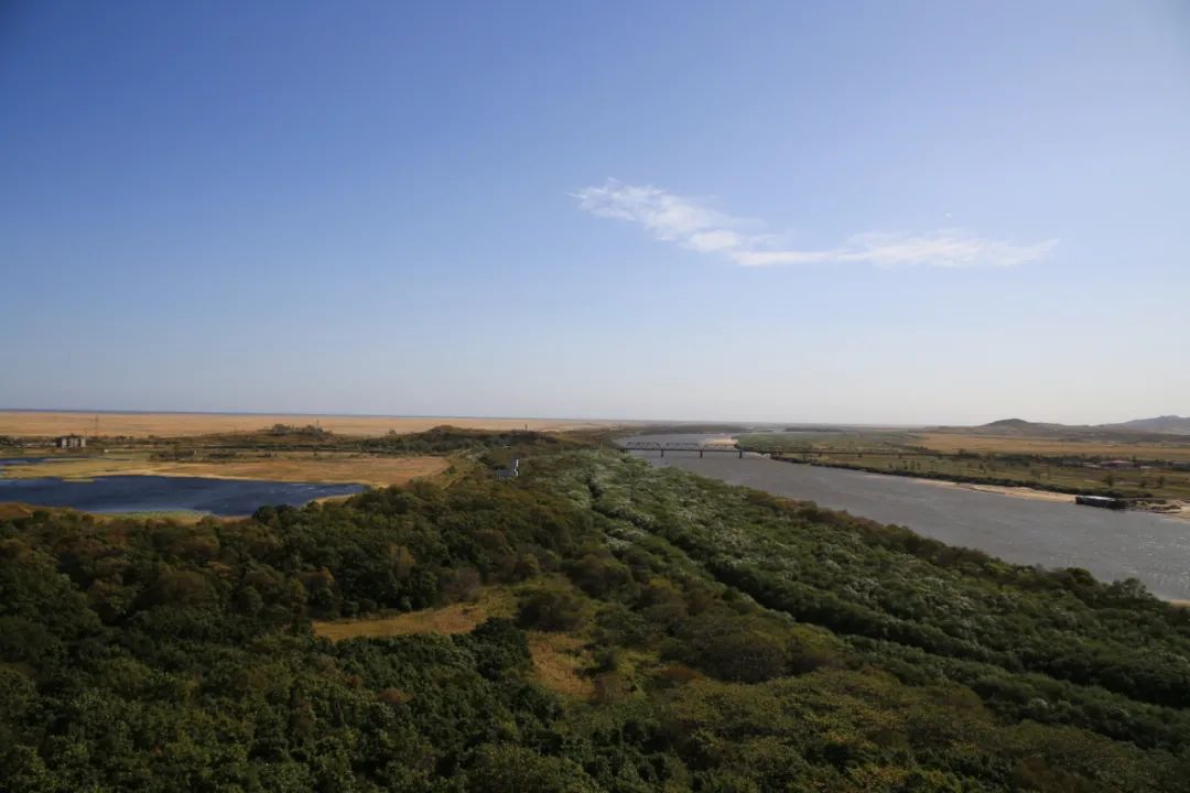
Looking back inland, the road below is where we came from, with the Tumen River on the left and North Korea on the other side.

In the direction of the seaport, as far as the eye can see is the Sea of Japan, only fifteen kilometers away.
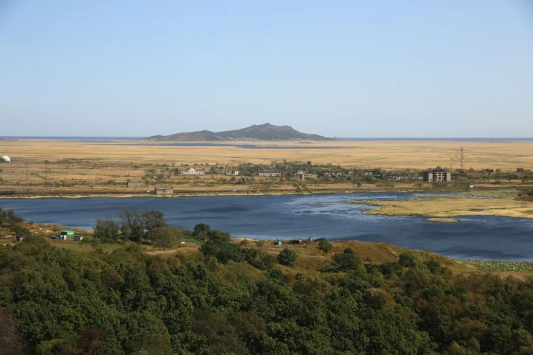
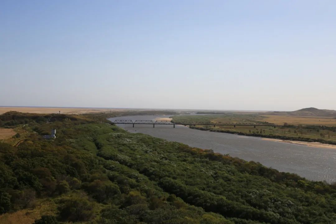
Across the river on the right is Domanjiang City in North Korea.
That bridge is a railway bridge connecting Russia and North Korea. Theoretically, our country has the right to go to sea from the Tumen River, but due to water depth, bridges and other reasons, this right exists in name only.
The first whistle in the East. This is a military institution and not open to the public.
North Korea side

both sides

The small building on the left is the Tuzipai sentry post.
On the left is the Soviet border town of Bodgornaya

bridge

The outlet to the sea is within easy reach, but history has not favored the Chinese nation. Russia occupies the north bank of the Tumen River estuary, and North Korea occupies the south bank of the estuary. Russia and North Korea, each on its own side, acted like an iron pliers, cutting off the connection between the land and the sea at the eastern end of China, turning Jilin Province into an inland province that is closest to the sea but has no sea area.

tuzipai post
North Korea
Russia


Come down from Longhu Pavilion and take another picture of the whole picture


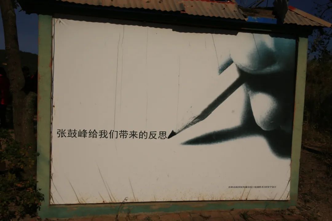
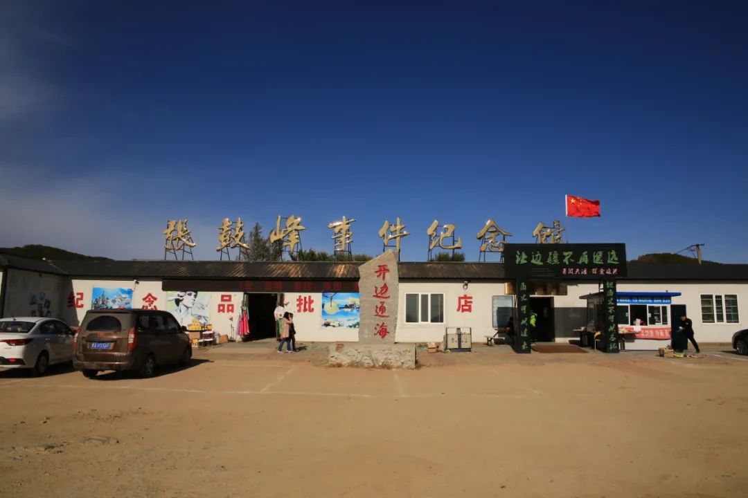
From here, return to the ticket office and drive back. You were in a hurry when you came here, but you should take your time when you go back. During the process, you passed by the Zhang Gufeng Memorial Hall. After all, there is a history here, so you might as well go in and take a look.
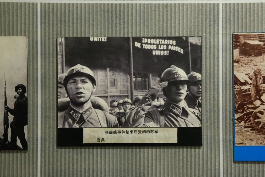
In July 1938, Japan deliberately provoked the Battle of Zhanggufeng in order to test the military strength of the former Soviet Union in the Far East. The battle lasted for 13 days. During the war, Japan and the Soviet Union suffered 5,940 casualties. In the end, Japan and the Soviet Union concluded the Zhanggufeng Battle in Moscow. The armistice agreement at Gufeng came to an end. After the incident, the Japanese army blocked the Tumen River channel. Since then, China has suspended its maritime activities. Zhang Gufeng is famous for the "Battle of Zhang Gufeng" between Japan and the Soviet Union. Relics of the war can still be found on its slopes.


The original well

The mountain in the distance is Zhanggu Peak (also known as Knife Mountain), located on the Sino-Russian border 1.5 kilometers northeast of Fangchuan Village and 20 kilometers up the east bank of the Tumen River. It is the commanding heights of the border areas between China, Russia and North Korea. 152 meters above sea level. The watershed on the top of the mountain is the border between China and Russia. It is the main mountain peak in the north. The mountains and forests are unique, and the top of the mountain is flat, making it easy to overlook.


"Katyusha" was actually born out of the Zhang Gufeng incident.
During the campaign, Stalin sent a strong team of military reporters, shot a large number of documentary films and news photos, and wrote many battlefield reports. At that time, it was summer in Hunchun, and pear blossoms and wild roses were blooming all over the mountains and plains. The clear Tumen River was like a ribbon, floating in the vast wilderness, and a gauze-like mist blew from the Sea of Japan—— The famous Soviet poet Isakovsky got inspiration from this wonderful picture of nature and wrote the popular poem "Katyusha":
Leave here and go back

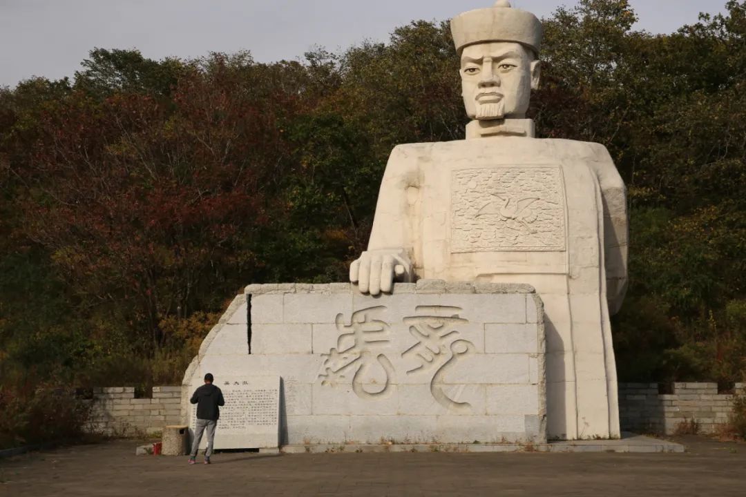
The statue of Wu Dacheng is located on the north side of Sand Dune Park.

Sand Dune Park is a golden sand dune covering an area of more than 1.2 million square meters. It is nestled among green mountains and green waters. It can be called the "desert in an oasis". It is located on the way to Fangchuan.

On the way back, we passed by Quanhe Port, where we stayed at night was Hunchun . We found a hotel within walking distance of Hunchun Railway Station and were planning to stay here tomorrow. Departing for Russia.