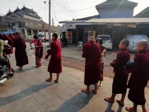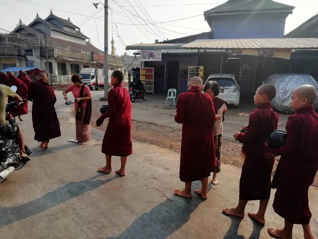
Theravada Buddhism stipulates that male monks cannot cook food for themselves, so every morning they need to go to nearby communities to ask for alms from believers. The believers will prepare cooked food (rice, vegetables, meat, etc.) for the male monks and put them into the alms bowl. Monks cannot choose the food donated by believers, and monks are not said to be vegetarians. While shopping today, I was lucky enough to encounter such a scene.


I rushed to the Dawei Jetty pier on the Salween River to get on the boat to Hpa-an.

The Salween River, also known as the Nu River in China, originates from the Tanggula Mountains in the central part of the Qinghai-Tibet Plateau in Amdo County, Tibet Autonomous Region, China, flows into Myanmar through Yunnan, and flows into Madaban Bay. The total length of the river is 3,200 kilometers, 1,540 kilometers in China and 1,660 kilometers in Myanmar (including about 130 kilometers of the national border between Myanmar and Thailand). Due to the rapid water flow, most of the rivers are not suitable for navigation. Only the downstream Mawlamyine-Hpa-an section is suitable for navigation. It is a good experience to take a long and narrow motorized wooden boat and sail between the rivers and sandbars surrounded by the karst valley for 3-4 hours.


The river here is so wide that it is difficult to imagine the rough waves of the Nu River upstream.

Banana trees on both sides of the Taiwan Strait

Stopping at a small village on the way, you can see the houses and life scenes of the locals.
pier

women doing laundry

cottage


temple


Continue on board


The scenery on the shore

karst mountains

encountered ship


Arrive at Hpa An at noon


Hpa-An is located on the banks of the Salween River. It is the capital of Kayin State and the settlement area of the Karen ethnic group. In the past, the local Karen ethnic armed forces and the central government of Myanmar were in conflict. Foreign tourists rarely came here until In the past two years, the confrontation has eased, and Hpa-an has slowly entered the horizons of foreign tourists.

Hpa-an travel map

Pa'an is surrounded by beautiful and steep karst peaks. Its landform is very similar to Guilin in my country. Many caves on the mountain are decorated by local people with "Buddhist elements", showing the landscape of "Foshan, Buddha Cave", which has become Pa'an. Ann's tourist theme, in addition to some characteristic buildings in the old city, have also become places for tourists to visit. After getting off the boat, I rented a bicycle and crossed the river to visit Mount Pabhu.


Mt. Hpa Pu is the best viewing point overlooking the Salween River and Hpa-an city. This hill is across the river from the city. You can take a boat across the river near the UBS Pagoda to reach Pabhu Village. Then follow the path to the back of the mountain to see the hiking trail leading to the top of the Pagoda.


Then I continued riding and came to Yatai Side Cave.


Yathaypyan Cave was built by King Manuaha. There are many pagodas and Buddha statues placed in the Kast Cave.


Looking out from the hole

Stalactites in the cave


There is a trail leading to the viewing platform

You can overlook the paddy fields in the distance

pagoda on the mountain

Continue riding to the Batcave.


The Bat Cave is located on a hill next to the Salween River Bridge. Every day at sunset, tens of thousands of bats fly out of the Bat Cave to look for food, and do not return to Hpa-an until early the next morning.
The observation deck is halfway up the mountain. Every evening, tourists will come here first to wait. The staff of the scenic spot will sit on the boat and play drums to urge the bats to come out of the cave. Tourists can see thousands of bats flying out of the cave. spectacular scene.


I stayed in Hpa-an city at night.
I visited the city early the next morning, and first came to the Clock Tower, which is the city's landmark.

Kan Thar Yar is a lake in the city of Hpa-an, with trails and trestles around the lake.


Government buildings by the lake

University


Continue riding and arrive at Kejiatao Cave.


Kaw Ka Thaung Cave was excavated in the 4th century AD and is about 53 meters deep. In addition to Buddha statues, there are many cliff carvings inside, which are the achievements of the Karen and Mon people.
The first thing that catches the eye is the sculpture of a long line of monks giving alms.


entrance of cave


Inside the cave


Then I walked through the village and cycled up the mountain, but there were no roads and I finally gave up and went back to the city.


I left Hpa An in the afternoon, took the bus to Chai Tok, then took a motorcycle to Chin Bang and stayed there


Early the next morning, we took a truck to the foot of the Golden Stone.


Kyaiktiyo Pagoda (or Golden Rock) is a famous Buddhist holy place in Myanmar. It is located on the mountain next to the seaside town of Zhai Tochen Bang. It is a huge rock standing on the edge of the cliff, with an altitude of 1,100 meters. The stone weighs about 611 tons, is about 8.15 meters high, and is covered with gold foil. There is a 7.3-meter pagoda built on the stone. The place is a pilgrimage site for Myanmar Buddhists, but women are prohibited from touching it.

The Big Golden Stone stands firmly on the edge of the cliff with an almost smooth surface. Even if believers built a 7-meter-high golden pagoda on top of it, the stone has never crumbled. Just because of its unusual geographical structure, it is enough to amaze people. In addition, it is said that the hair relics of Buddha are hidden at the bottom of the stone, which can attract countless Buddhists to come here for pilgrimage. Now the gold foil donated by believers has turned the stone into a golden color and shines brightly. At night during the pilgrimage season, many believers will light candles, pray and chant, and the atmosphere is extremely pious and solemn.


Temple next to the golden stone


believer


In addition, since the top of the mountain where the Golden Stone is located is 1,090 meters above sea level, the platform is also an observation deck. When the weather is fine, you can overlook the vast coast from Yangon to Mawlamyine.


You can hike to the top of the Golden Rock via the village, which takes two to three hours.


I returned to the foot of the mountain at noon. Drive to Bago.

Three-day itinerary map

