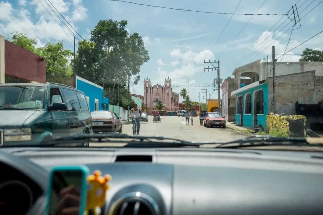
Leaving Merida and the Puque Road, the wheels head eastward, getting closer and closer to the Caribbean Sea. The roadside is shaded by flowers, occasionally revealing the low stone walls of Mayan ruins. In this slightly desolate land, Chichen Itza and Tulum gave birth to a new level of Mayan civilization; however, the surprises are far more than that: Under the land of Yucatan, Caves, Underground rivers and natural wells are intertwined. After millions of years of evolution, the world's most fascinating underground karst landscape is also worth exploring.
Chichén Itzá Chichén Itzá
There are no words to describe this place except the crowds. Chichen Itza is to Mexico what the Great Wall is to China, with more than 2.6 million tourists flocking here every year. Chichen Itza symbolizes the highest level of the Mayan calendar. The main pyramid and observatory ruins all show the Maya's proud talent. Because it is backed by Cancun, the European and American resort paradise, if you don't want to get up early but want to find a quiet place here It may be a bit difficult to see the ruins from the ground up.
The main pyramid of the site - the Pyramid of Castillo , also known as the Pyramid of Kukulkan, the Mayan Quetzalcoatl. This stepped pyramid is about 30 meters high, with a 6-meter-high temple at the top. The pyramid has 9 levels, each level is divided into two parts by a step, forming 18 separate platforms, symbolizing the 18 months with 20 days in the Mayan calendar (a year has 365 days, and the other 5 days are in the 19th month) , there are 91 steps on each side of the pyramid, plus the platform on the top, 91×4+1, which is exactly 365 days in the solar calendar. There are 52 stone slabs on each side of the pyramid, which is equivalent to 52 years in each cycle of the Mayan calendar. In admiring the Mayan While people have accurate astronomical calendars, they also have to admire Mayan craftsmen. Much like Uxmal, which was introduced before, the structure of most Mayan buildings will be built on multi-layer structures, and the Pyramid of Kukulkan is no exception. Directly below this pyramid, there is There is an underground pit about 34 meters long and 20 meters deep, and there is another temple ruins under the pit.
Every year around the spring and autumn equinoxes, at sunrise and sunset, a series of wavy shadows are cast on the railing on the north side of the northwest corner of the pyramid. The part illuminated by the sun is just connected to the snake-shaped head at the bottom, which reminds people of a snake coming from The staircase that winds down is considered by most theories to be a representation of the Quetzalcoatl god Kukulkan.

Next to the Kukulkan Pyramid is the largest Mayan stadium in Chichen Itza (Gran Juego de Pelota), with the main court being 70 meters long. There are 8-meter-high walls on both sides of the court. There is a ring carved in the shape of Quetzalcoatl in the center of both sides of the wall. This is the goal. During the game, the first team to hit the rubber ball into the stone ring wins. The rules of the game can only touch the ball with the thighs, head, shoulders and buttocks, not with hands and feet. Imagine what this action is. . . The winning side will receive the highest honor - the captain will have his heart taken out and sacrificed to the gods, while the losing side will be beheaded. As for how people know it, the reliefs on the inner wall of the stadium show the scene at that time. The loser was beheaded, and his blood flowed into a river. The raging blood transformed into seven giant pythons. The captain of the winning side was escorted to the altar, and his heart was taken out alive and sacrificed to the sun god. To find these reliefs, you can find places where people gather, or where there are tour guides.

 The Sacred Cenote is in the northernmost part of the entire site. To get to the stadium from the golf course, you need to walk through a long avenue, with vendors selling souvenirs on both sides. The tiankeng is a place for Mayan sacrifices. According to historical records, the ancient Mayans would perform sacrificial activities here during the dry season. Modern archeology has also confirmed this, with thousands of sacrificial objects salvaged from the sinkholes, including gold, jade carvings, copper, pottery, obsidian and other materials, as well as human remains.
 After exiting the tiankeng, return to the intersection and arrive at the Temple of the Warriors. The palace consists of a huge stepped pyramid with rows of pillars carved with warriors in front and on the sides. This architectural complex has many similarities with the Toltec civilization* (Toltec), and there seems to be some form of cultural connection between the two areas. At the top of the pyramid, there is a half-lying stone statue of the god Chac-mool.
On the south side of the site is the observatory. Its construction history can be traced back to 906 AD, belonging to the Mayan postclassical period, and its shape is very similar to that of a modern observatory.
Mayan astronomers observed the movement of the sun and stars over a long period of time and invented an accurate calendar. The Mayans called the year "haab". There were 18 months in a year, each month had 20 days, and an additional 5 days each year were called Vazeh. Taking 360 days as one "tun" (tun), 20 tuns as one "katun" (katun) as 7200 days, and 20 katun as one "baktun" as 144000 days, this is The largest unit for calculating the calendar is called "alautun", which has a total of 23 billion 40 million days, or more than 63 million years. Let’s talk about the solar calendar we use now. The Mayan astronomers at that time calculated it as 365.2420 days. According to the calculations of current astronomers, a year should be 365.2422 days. From this point of view, the lunar calendar used by the ancient Mayans is more accurate than the lunar calendar we use now. The error is only 0.0002 days. When converted into seconds, the difference is only 17.28 seconds in a year. The Mayans accurately calculated the length of the solar year, which was beyond the reach of European colonialists in the 16th century, because the much cruder Caesar calendar was still commonly used in Europe at that time. Not only that, the Mayans also formulated a lunar calendar, calculated the time it takes for Venus to orbit once (i.e. 584 days), and found a way to correct the accumulated errors between the solar calendar and the lunar calendar.
In addition to the solar calendar, the Mayans also used a Tzoljin calendar for religious purposes. The Tzolkin calendar consists of 260 independent days with 20 day names and a trecena cycle of 13 day numbers. It is used to determine the time of religious and ritual events, and for divination. Each date is numbered sequentially from 1 to 13, and then counting starts again from 1. In addition, each date is also marked with the following 20 day names in order. The Mayans believe that each Tzolkin day has a symbol of the things it affects. The Mayans have a shaman called a day keeper who predicts the future by studying the Tzolkin calendar. When a child is born, the Date Keeper analyzes the Tzolkin Calendar to predict the child's future destiny.
It’s hard to imagine how the Mayans in ancient times invented this set of precise astronomical calendars, relying solely on the naked eye and counting. Unfortunately, these calendars only remained on the surface of words and counting, and most of them were used in religion. Sacrifice has not developed into a complete scientific system. No matter how much was said, it was not applied in actual combat. The development of the entire society was stagnant and relied entirely on God's orders. This led to European civilization catching up from behind and being eventually conquered, which is lamentable.
Near the observatory, there are also the Church (The Church) and Las Monjas (Las Monjas). These two buildings are the few buildings built in the Puc style in Zichen Itza. Their walls are decorated with exquisite carvings of the rain god Chaac mask.
A 5-minute drive from Chichen Itza, there is also a very popular cenote - Ik Kil Cenote. Generally, a day trip from Merida/Cancun to Chichen Itza will cover this attraction. Tickets need to be paid for at your own expense, 70 Peso per person. The attraction does not provide swimsuits, but there are bathrooms and changing rooms. During the peak period at noon, the place is full of people, just like dumplings. I think it was also the place where the Mayans made sacrifices to pray for rain to Chaac, the rain god. Now it is crowded with European and American bikini beauties. Chaac must be happy.
After exiting the tiankeng, return to the intersection and arrive at the Temple of the Warriors. The palace consists of a huge stepped pyramid with rows of pillars carved with warriors in front and on the sides. This architectural complex has many similarities with the Toltec civilization* (Toltec), and there seems to be some form of cultural connection between the two areas. At the top of the pyramid, there is a half-lying stone statue of the god Chac-mool.
On the south side of the site is the observatory. Its construction history can be traced back to 906 AD, belonging to the Mayan postclassical period, and its shape is very similar to that of a modern observatory.
Mayan astronomers observed the movement of the sun and stars over a long period of time and invented an accurate calendar. The Mayans called the year "haab". There were 18 months in a year, each month had 20 days, and an additional 5 days each year were called Vazeh. Taking 360 days as one "tun" (tun), 20 tuns as one "katun" (katun) as 7200 days, and 20 katun as one "baktun" as 144000 days, this is The largest unit for calculating the calendar is called "alautun", which has a total of 23 billion 40 million days, or more than 63 million years. Let’s talk about the solar calendar we use now. The Mayan astronomers at that time calculated it as 365.2420 days. According to the calculations of current astronomers, a year should be 365.2422 days. From this point of view, the lunar calendar used by the ancient Mayans is more accurate than the lunar calendar we use now. The error is only 0.0002 days. When converted into seconds, the difference is only 17.28 seconds in a year. The Mayans accurately calculated the length of the solar year, which was beyond the reach of European colonialists in the 16th century, because the much cruder Caesar calendar was still commonly used in Europe at that time. Not only that, the Mayans also formulated a lunar calendar, calculated the time it takes for Venus to orbit once (i.e. 584 days), and found a way to correct the accumulated errors between the solar calendar and the lunar calendar.
In addition to the solar calendar, the Mayans also used a Tzoljin calendar for religious purposes. The Tzolkin calendar consists of 260 independent days with 20 day names and a trecena cycle of 13 day numbers. It is used to determine the time of religious and ritual events, and for divination. Each date is numbered sequentially from 1 to 13, and then counting starts again from 1. In addition, each date is also marked with the following 20 day names in order. The Mayans believe that each Tzolkin day has a symbol of the things it affects. The Mayans have a shaman called a day keeper who predicts the future by studying the Tzolkin calendar. When a child is born, the Date Keeper analyzes the Tzolkin Calendar to predict the child's future destiny.
It’s hard to imagine how the Mayans in ancient times invented this set of precise astronomical calendars, relying solely on the naked eye and counting. Unfortunately, these calendars only remained on the surface of words and counting, and most of them were used in religion. Sacrifice has not developed into a complete scientific system. No matter how much was said, it was not applied in actual combat. The development of the entire society was stagnant and relied entirely on God's orders. This led to European civilization catching up from behind and being eventually conquered, which is lamentable.
Near the observatory, there are also the Church (The Church) and Las Monjas (Las Monjas). These two buildings are the few buildings built in the Puc style in Zichen Itza. Their walls are decorated with exquisite carvings of the rain god Chaac mask.
A 5-minute drive from Chichen Itza, there is also a very popular cenote - Ik Kil Cenote. Generally, a day trip from Merida/Cancun to Chichen Itza will cover this attraction. Tickets need to be paid for at your own expense, 70 Peso per person. The attraction does not provide swimsuits, but there are bathrooms and changing rooms. During the peak period at noon, the place is full of people, just like dumplings. I think it was also the place where the Mayans made sacrifices to pray for rain to Chaac, the rain god. Now it is crowded with European and American bikini beauties. Chaac must be happy.
 Several hotels and resorts at the entrance to Chichen Itza and the Ik Kil Cenote natural well scenic area provide dining services. The restaurants include: Hacienda Chichen Resort and Yaxkin Spa and Pavarotti etc. , these restaurants are expensive. Pisté, a 3-minute drive from Chichen Itza, has a handful of affordable restaurants: Las Mestizas is one of them, and it is also my first choice for self-driving; see below Is that the cup of green juice in the middle of the picture? This is the best juice I have ever tasted. The name is Cha-Ya. It is similar to aloe vera and pineapple juice. It is one of the specialties of Chichen Itza. During the rest of the trip, except for a very unauthentic Cha-Ya in Palenque, I never encountered this kind of drink again. If you come to this restaurant, you must not miss it.
 Because there are too many people visiting Chichen Itza, the European and American resort town of Cancun. Most of these tourists come from the surrounding Cancun and Merida on day trips to Chichen Itza. Tour groups usually arrive at 10 in the morning. Arrive after clicking. In order to avoid the huge crowds of tourists, if possible, you can stay around the scenic area: although the resorts at the front entrance of the Qichen Itza Scenic Area are expensive, you can enjoy the deserted ruins early in the morning. The nearby town of Pisté has a large number of B&Bs, and there are more accommodation options in the town of Valladolid, about 35 minutes' drive from Chichen Itza.
Like Chichen Itza, Valladolid, a 35-minute drive from Chichen Itza, is also the hardest hit area for tour groups. Tour buses surrounded the central square. Fortunately, most tour groups only treat this place as a temporary stop. A small town to stay in. The tourist area revolves around a block near the central square, which I really like. There are all kinds of bars, restaurants and markets around.
There is another Mayan city-state 30 kilometers north of Valladolid: Ek Balam, a Mayan ruins submerged in the jungle that has not yet been fully developed. You can see To the well-preserved palace, Ek Balam reached its peak in the 8th century AD and then suddenly declined. The site closes at 17:00, so you need to plan your time in advance.
The distance from the Cathedral of Valladolid to Tulum is 103 kilometers and takes about an hour and a half by car. There is also a ruins called Cobá on the way. There is a 42-meter-high Great Pyramid (Nohoch Mul) in its ruins, which is the tallest building in the Mayan civilization. In its heyday, it is estimated that Coba had about 50,000 residents or even more. It is another place in the Yucatan Peninsula. One of the important sites.
Heading east from Valladolid, you will soon reach the seaside of the Yucatan Peninsula, where the famous resort Cancun is located. Perhaps tired of the noisy European and American tourists on the beach, Cancun was not planned on this trip, but instead went to Tulum, more than 100 kilometers south (although there are also many tourists here).
Built in the Mayan postclassic period, Tulum was the last city built by the Mayans. It reached its peak from the 13th to the 15th century. It was not until the Spanish occupied Mexico 70 years ago that Tulum finally perished. The reasons for its demise have been attributed. Diseases brought by the Spaniards. Tulum was once called Zama, which means City of Dawn, probably because it is located at the easternmost point of the entire Mayan world and is the first city to bathe in the sunrise. The walls and cliffs surrounding Tulum made it more vulnerable to enemy invasion. This was the port of foreign trade for the Maya. Goods from the Caribbean and Belize were transferred through Tulum to places such as Coba and Chichen Itza inland. At its peak, the Tulum dynasty's trading reach extended into Guatemala and Honduras.
 The same name as the main pyramid of Chichen Itza: the Pyramid of Castillo (El Castillo) is the tallest building in Tulum and a veritable watchtower. There are totems of Quetzalcoatl Kukulkan on its four corners. There is a small altar on the top of the pyramid, which is used as a lighthouse to guide canoes to land. The beach at the bottom is regarded as the beach where ancient traders landed. Maybe it's because of the rainy season that the sky isn't beautiful and the Caribbean water doesn't look blue at all, but the temperature is much cooler.
The Temple of the Winds (Templo del Dios del Viento) is located high on the coastline of Tulum. It is said that this is also the world's first hurricane warning system. Whenever there is a hurricane on the sea, strong airflow passes through the Temple of the Wind and creates a roar, alerting the Mayans of the approaching hurricane.
The same name as the main pyramid of Chichen Itza: the Pyramid of Castillo (El Castillo) is the tallest building in Tulum and a veritable watchtower. There are totems of Quetzalcoatl Kukulkan on its four corners. There is a small altar on the top of the pyramid, which is used as a lighthouse to guide canoes to land. The beach at the bottom is regarded as the beach where ancient traders landed. Maybe it's because of the rainy season that the sky isn't beautiful and the Caribbean water doesn't look blue at all, but the temperature is much cooler.
The Temple of the Winds (Templo del Dios del Viento) is located high on the coastline of Tulum. It is said that this is also the world's first hurricane warning system. Whenever there is a hurricane on the sea, strong airflow passes through the Temple of the Wind and creates a roar, alerting the Mayans of the approaching hurricane.
There are not many attractions in the town of Tulum. The town does not even have a decent main square. Restaurants and travel agencies are lined up along the 307 main road. The most lively area is near the Tulum ADO bus station (Terminal Autobuses Tulum ADO). There is a restaurant in the town: El Camello, Lonely Planet’s star recommendation. It is a seafood shop jointly opened by local fishermen. The ingredients are very fresh and many locals are eating it. It looks very authentic at first glance. The portions of their seafood are generous, and one serving of Mixed Seafood is enough for three or four people.
Guide to Cenotes in the Yucatan Peninsula
When traveling in the Yucatan Peninsula, especially during the rainy season, you will definitely be curious; with such a heavy rainfall, there is very little water on the road. Whether it is visible or from the map, there is not even a natural building in such a large area of land. Lake, where did all the rain go?
The secret lies in the underground of the Yucatan Peninsula. The Yucatan Peninsula is almost entirely composed of coral layers and porous limestone. During the Ice Age, the limestone platform on the Yucatan Peninsula was exposed to the sea level, and a large amount of natural rock formations developed over millions of years. Karst landforms such as wells, caves and underground rivers form one of the largest underground river cave systems in the world. Tiankeng(Cenote) is one of the most fascinating landforms in this huge underground river system. The top of the tiankeng, an underground cave, has collapsed and exposed many times It is formed out of the ground, with an open top and a large open water area. You can see the sky when you look up.
For thousands of years, the tiankeng was the only source of water for the Mayan civilization in the jungle. The Mayans believed it was a sacred existence. Almost all Mayan city-states were built near the tiankeng (except for the Puke area mentioned earlier). They believed that the tiankeng was a sacred place. The pit is the entrance to the "underworld" where the gods they believe in live, and the resting place of their souls after death. The Mayans also regularly threw young girls into wells as sacrifices to Chaac, the rain god. The remains of sacrificial girls excavated from cenotes can still be seen in some museums in Yucatan and Quintana Roo. Nowadays, many sinkholes in the Yucatan Peninsula have been developed for tourism. Except for a few that cannot be entered into the water, most of the sinkholes that have been developed can be used for snorkeling or cave diving.
 There are many cenotes in the Yucatan Peninsula, especially all the way from Merida to Tulum. Around the towns of Chichen Itza, Valladolid and Tulum, there are a large number of cenotes for viewing only and cenotes for diving: From photos only There are everything from the cenote filming locations in "Coco" to Cenote Diving, which does not require a diving certificate, or Technical Diving, which requires at least dozens of dives before you can try it. , the caving around Tulum is some of the best in the world. Here are the 13 most wonderful natural wells in the Yucatan Peninsula for your reference.
1.Cenote Tza-Ujun-Kat & Cenote Santa Cruz
(Cave-like, sinkhole in nature, the sinkhole in the travel agency signs in the streets and alleys of Merida)
There are many cenotes in the Yucatan Peninsula, especially all the way from Merida to Tulum. Around the towns of Chichen Itza, Valladolid and Tulum, there are a large number of cenotes for viewing only and cenotes for diving: From photos only There are everything from the cenote filming locations in "Coco" to Cenote Diving, which does not require a diving certificate, or Technical Diving, which requires at least dozens of dives before you can try it. , the caving around Tulum is some of the best in the world. Here are the 13 most wonderful natural wells in the Yucatan Peninsula for your reference.
1.Cenote Tza-Ujun-Kat & Cenote Santa Cruz
(Cave-like, sinkhole in nature, the sinkhole in the travel agency signs in the streets and alleys of Merida)
(Suitable for taking pictures, open style, not suitable for entering the water)
(Suitable for taking pictures, semi-open, suitable for snorkeling)
(Suitable for taking pictures, cave-like, sinkhole-like, not suitable for swimming, filming location of "Coco")
(Suitable for taking pictures, cave style, not suitable for entering the water)
(Suitable for taking photos, open style, suitable for snorkeling and professional cave diving)
(Suitable for taking photos, open style)
8.Cenote Aktun Ha, also known as Car Wash
(Suitable for taking photos, cave diving in cenotes, viewing underwater lotuses, suitable for snorkeling and professional cave diving)
(Suitable for taking photos, 10 minutes’ drive from Tulum, suitable for snorkeling)
(Suitable for taking photos, popular cave diving and cenotes)
The following are professional cave diving tiankeng (suitable for AOW and above, the price per dive is 250-300 yuan)
(Professional cave diving, there is a halocline at 30 meters)
12.Dos Ojos Cenote&Cenote Bat Cave
(Suitable for photography, open style, cave diving)
(Professional cave diving, there is a sulfide layer at a depth of 25 meters)
The positional relationship between each natural well and its surroundings is as shown below
Practical information
There are day trips to Chichen Itza + Ik Kil Cenote, Tulum + Coba, and cave diving around Tulum from major cities in the Yucatan Peninsula. There are several theme parks around Tulum where you can enjoy zip lines, bungee jumping, snorkeling and other water sports. These rides can be purchased one day in advance in the streets and alleys of Cancun and Tulum When booked through a travel agency, the price is mostly US$150-200.
Tulum Bus StationTerminal Autobuses Tulum ADO is located in the center of the town. There are intensive buses to Cancun and Chichen Itza every day. Chetumal, about 2 hours' bus ride south, is also an unpopular destination. From here you can also go south to Belize.


