In the mist-shrouded Bipenggou, Siguniang Mountain obscures your pretty face.


The sound of the beach is more urgent in autumn, and the air in the gorge is more cloudy at dawn.


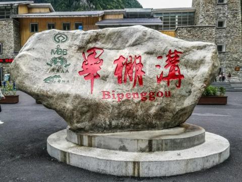
After visiting Penggou, go to Gurgou Town for accommodation.
There is a huge hot spring called Gurgou Hot Spring near the town.
The next day, continue on the G317 National Highway towards Malkang.


The colorful trees and light mist in the mountains and forests make it like a fairyland.


Passing by Miyaluo Town, Miyaluo, which means "Fun Bazi" in Tibetan, was originally one of the largest red leaf scenic spots discovered and opened in China, but now there are not many red leaves left.

There are completely two worlds on both sides of the Partridge Mountain Tunnel. After the gloomy weather at the east end passed through the tunnel, blue sky, white clouds and snow-capped mountains were greeted.


In the colorful forests all over the mountains and plains, I saw pink leaves for the first and only time, and they were pink and girlish.

Yellow is still the main color.

Partridge Mountain, which is more than 4,000 meters above sea level, is shrouded in cyclonic clouds.

Driving all the way through the colorful forests of western Sichuan.


At the Suma intersection, go north and take the G248 National Highway towards Aba.


The itinerary was changed when we went to Hongyuan. The original itinerary was to turn eastward at Rangkou, pass through Naizigou, Dagu Glacier, Heishui County, then turn back to the G213 National Highway, and stay overnight in Maoxian County or Songfan. But the driver always recommended heading north to Hongyuan, to Gali Terrace, then connecting to the G213 National Highway, and staying overnight at Chuanzhu Temple. The reason is that the scenery of the Heishui Colorful Forest is similar to that of the Colorful Forest along the way, while the Red Plains all the way has the autumn colors of the grassland.
(Actually, the driver is a local from Chuanzhu Temple, so he hopes he can go back to spend time with his family, hehe)
Go straight from Rangkou, aiming for Hongyuan!

Chazhenliangzi, with an altitude of 4,345 meters, is the only passage from the southern part of Aba Prefecture to the grasslands of northwest Sichuan. The mountain is not an extraordinary place, but it is the dividing line between the hilly plateau and the mountain canyon area. It is also the watershed of the two major river systems of the Yangtze River and the Yellow River.


It flows from Yangkouqu (Tongguo River) in the north of the mountain, to the south into the Xiaomo River, a tributary of the Dadu River, and belongs to the Yangtze River system. In the south of the mountain is Gaqu (White River), which meanders north to the Yellow River in Tangke Township, Ruoergai County.

After passing Hongyuan Airport, we first arrived at Moon Bay Scenic Area, 3 kilometers away from Hongyuan County.


Moon Bay is a section of the Baihe (Gaqu River), an important water source in the upper reaches of the Yellow River, with an altitude of 3,471 meters. In this open grassland wetland, the Baihe River meanders in a continuous S-shape, and each meander is like a stream in the sky. It has a crescent moon, hence the name "Moon Bay".


After lunch in Hongyuan County, drive 40 kilometers to Riganqiao National Wetland Park.


Hongyuan Riganqiao Wetland Scenic Area is an important part of the Zoige Wetland Reserve, the largest plateau wetland in the world, with an altitude of 3,441 meters.


From 1935 to 1936, the Long March of the Red Army of Chinese Workers and Peasants passed through this place. It was the most difficult section for the Red Army to cross the grassland. Many Red Army soldiers died in the swamp. Stories such as "Seven Matches", "Golden Fishhook" and "Red Army Willow" happened here.

In 1960, Premier Zhou Enlai personally named Hongyuan County, which means "the prairie where the Red Army marched through".

Go east at the Waqie Sanjiakou, (north to Tangke, the first bay of the nine bends of the Yellow River)


There is no mobile phone signal throughout the 100-kilometer journey from Waqie to Galitai.
Most of the hills along the way only grow shrubs, mostly red and yellow, but purple shrubs are found.


Galitai was connected to the G213 national highway, and in a group of large trucks, we arrived at Chuanzhusi Town safely.

Chuanzhusi Town is 2,980 meters above sea level and is located at the crossroads of Songpan, Hongyuan, Jiuzhai and Huanglong highways. It has a very advantageous geographical location.