Breaking into the Qaidam Basin | Traveling across the Qinghai Salt Lake | The end of the wilderness, Obo Liang Yadan | The mysterious devil's eye in the Kunlun Mountains | Hoh Xil no man's land | Sanjiangyuan Nature Reserve | Real photos of Tibetan antelopes TibetanRat and rabbit hiding wild ass
 
Qinghai's five major salt lakes
Dachaidan Emerald Lake, Dongtai Jinai Lake, Xitai Jinai Lake, Mangya Emerald Lake, Qarhan Salt Lake
2020 ☀ National Day 8 days


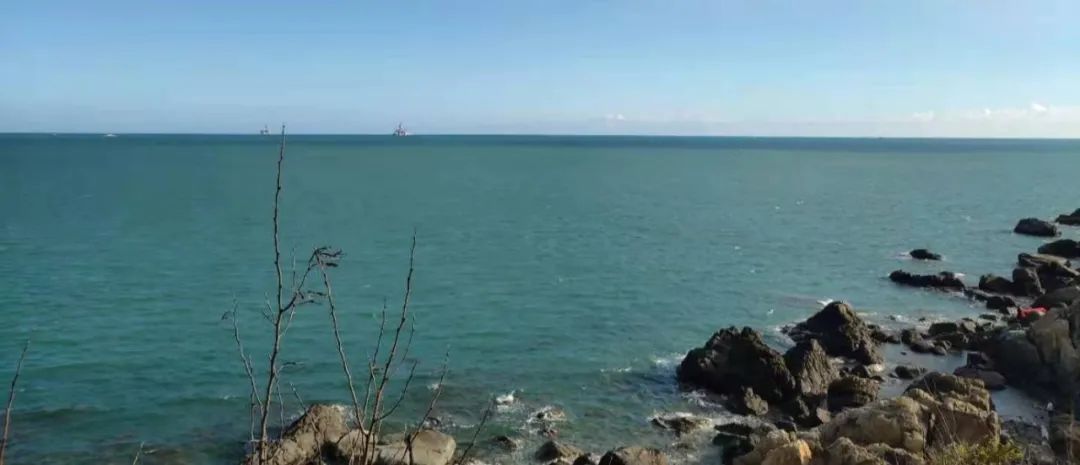
Every journey allows me to understand a place. I didn’t know much about Qinghai before. After returning from this trip, I read the geography & history of Qinghai and discovered that Qinghai is really a “treasure boy” with a God-given treasure.


  • How was QinghaiQaidam Basin formed?

  • China's four major basins - "Treasure Bowl" Chai What is in the Damu Basin?

  • Why are there so many salt lakes in Qinghai?


Qinghai ranks 4th among all provinces in China in terms of area (Xinjiang, Tibet, Inner Mongolia, Qinghai) ,big 4/5 of Qinghai is plateau and mountainous. How was this geographical environment formed? In ancient times, Qinghai was a vast ocean. The crustal movement caused the overall terrain of Qinghai to rise. Now Qinghai is high in the west and low in the east, and it is tilted, just like the left hand embracing the strongest glacier mountain range. (Qilian Mountains, Kunlun Mountains, Altun Mountains, Tanggula Mountains) , the right hand side has the strongest water resources of the three rivers (The source of the Yellow River, Yangtze River and Lancang River) There is also a Qaidam Basin in the middle, where the most valuable oil and water are deposited. The most expensive oil and salt are in the basin. (Oil and Salt Lakes) , it seems that the cornucopia means that all the fat and water will not flow into other people's fields.


P1

The best of Qinghai


  • The world's largest rare and rich mineral land - Qaidam Basin (God-given treasure)

  • China's largest inland saltwater lake - Qinghai Lake

  • China’s No. 1 Sacred Mountain—Kunlun Mountain

  • The area with the most glaciers in China is the Kunlun Mountains Glacier

  • The largest salt lake in China - Chaerhan Salt Lake (enough salt for the whole world to eat for a thousand years)

  • The place that produces the most Cordyceps sinensis in China (plateau climate)

  • The largest devil city in the world - Yadan Devil City (the masterpiece of the wind)

  • The world's largest wetland reserve - the source of the three rivers (the Yangtze River, the Yellow River, and the Lancang River are called the Mekong River abroad)

  • The world's largest original ecological reserve - Hoh Xil

  • The tallest highway bridge in the world is the Tuotuo River Bridge

  • Golmud City is the largest city in the world by area, covering an area of ​​123,460 square kilometers. It is larger than the entire Zhejiang Province.

  • The area with the highest concentration of salt lakes in the world

  • The region with the largest number of yaks in the world is Qinghai, accounting for about one-third of the world's total yaks.


Hand-caught lamb chops


Beef consumption
Every meal is meat

China’s largest inland saltwater lake

Qinghai Lake


Qinghai Lake was actually a tributary of the Yellow River 130,000 years ago. However, due to the uplift of the Riyue Mountains, it was disconnected from the mother Yellow River and was surrounded by Datong Mountain (north), Riyue Mountain (east), and Nanshan Mountain. (South), it formed a plateau lake basin. The terrain was higher in the east and lower in the west, forming a trumpet-shaped inverted river. After N centuries, it was slowly closed into Qinghai Lake. So Qinghai Lake is a closed lake. If it continues to be closed for centuries, it will shrink, dry out and condense into a salt lake sooner or later.

From the tributary river-->Daitang River-> closed lake


Qinghai also got its name from this
Qinghai means "blue ocean" in Tibetan


The salt lake is like the sea, and there are also seagulls

Qinghai Lake, Yadan, Xitai

The clever guy is waiting for someone to feed him by the lake.

Qinghai seagull

2020


But such a beautiful Qinghai Lake is inaccessible. The fact is quite disappointing, because I only went to a charged captive rapeseed field where everyone and the plane were crowded together. Take photos in the flower fields and the "beach" which is trampled and is not so beautiful. There are strings of red aunties in the cauliflower, cows and horses are posed for a fee, and even lambs, alpacas, mother and child are forced to "operate" 10 yuan for a photo.


Qinghai’s Multi-Ethnic Groups


The area north of Qinghai is called Haibei. Tibetan Autonomous prefecture, with Hainan to the south Tibetan Autonomous Prefecture, Haixi Mongolian Tibetan Autonomous Prefecture, Haidong District, referred to as Haibei, Hainan, Haixi, Haidong. If you take a closer look at these names, you will know that Qinghai's multi-ethnic structure is not simple. In addition to the Han people after the Han Dynasty, the population settled here includes the Han and Jin Dynasties Qiang , Wei, Jin, Southern and Northern Dynasties and the early Sui and Tang Dynasties Xianbei During the Mongol Yuan Dynasty, there were Mongolian , and then intermarried with the locals, and through reproduction and integration, they formed Tu people, Then later Tibetan Its special geographical location has made it a Mixed races area.


Wild reeds on the roadside,
It's too late for the cool autumn breeze.


This trip departs during the National Day, it’s already autumn, and the temperature varies greatly by 1-20°C, so be sure to pack your clothes from head to toe.
 
Salt Lake in Qinghai


Qinghai is the area with the highest concentration of salt lakes in the world. There are more than 150 large and small salt lakes, among whichthe most important salt lake areas are concentrated in the Qaidam Basin. Inside.
 

How were salt lakes formed?

The salt lake was the sea in ancient times. Sea–>Lake–>Salt Lake–>Salt Lake, when the evaporation of the lake water is much greater than the recharge, all the evaporated water is water, leaving behind dissolved minerals in the water and salt, it condenses into a salt lake.


Salt Lake - The mineralization of the lake water is greater than 35g/L, which means that one liter of lake water can produce more than 35 grams of various minerals.


Why are there so many salt lakes in Qinghai?


Qinghai was the Tethys Sea 230 million years ago. (Salt first) Later, the crust rose and the sea retreated, The Erjin Mountains, Kunlun Mountains and Qilian Mountains surround an inland plateau basin. The Qaidam Basin is the highest basin in China. The high mountains block the water vapor, and the annual precipitation Very little water, form Inland flow area, plus Extreme drought finally The water in the basin is getting less and less. The salt value is getting higher and higher, and finally Salt lakeization.
 
"Qaidam" means "salt lake" in Mongolian.
 
Now those The salt lakes that are open to you are actually abandoned pits that have been mined. Composed of halides (water) and minerals (crystals). brine Because it contains metal elements such as potassium, magnesium and lithium, it appears as mouthwash blue, Maldives blue, emerald green, and White salt flowers have become a popular item on the Internet Fairy color, The salt pit was upgraded to salt lake!
  • Dachaidam is called Yikeqaidam in Mongolian, which means Great Salt Lake.

Daqaidam has a typical inland plateau desert climate. It was inhabited as early as the Paleolithic Age 20,000 years ago. It belongs to the Qaidam inland water system, with 33 large and small rivers. It is very rich in groundwater resources and is also a major salt lake sedimentation area.


Dachaidan Emerald Salt Lake

The Dachaidan Emerald Salt Lake is the mining area of ​​the former Dachaidan Chemical Plant Salt Lake Mining Team. After years of mining, a bunch of mining pits were formed and turned into the current Emerald Lake, so it is actually a visit to a "abandoned" construction site . These potholes are formed by years of salt lake mining mining pits .


These fairy-colored saltpools are highly concentrated salt water, also known as "brine" Do they look like various brands of mouthwash?


If you don’t look at it from God’s perspective, the site is more like a mining site (bad land), so my fun is to fly a small plane in the salt pools to find some interesting things shape.


Found a parrot

The sacred dog taking off

alien glasses

This is a big shark

Salt Lake Circle——There is a silver-white circle around the water body, which is a salt collar.
The color of each layer of salt belt may be slightly different. This is because the salt composition of each ring is different and precipitates in different supersaturated states, forming different rings.
Many people want to lie on top of this beauty and take aerial photos. But now there is a charge for shooting with chairs (10 yuan) and glass boats (50 yuan/person)


This place has not started charging fees this year, but the scenic area gate and small train are soon being built, and this place will soon become the next "tea card".

Note for aerial photography: The Salt Lake area is very large and the restrooms are far away. You have to drive in.

Aerial photography height: no limit, about 200 meters

Aerial photography positions: Most are in Pool 4 and Pool 3

Dongtai Jinair Lake and Xitai Jinair Lake, these two brothers are referred to as "East and West Taiwan". East and West Taiwan used to belong to the same lake, but later separated into independent lakes due to water evaporation and the lake retreated. The lake salt in East and West Taiwan is rich in lithium and is the upstream lithium raw material for the lithium battery industry (mobile phone lithium batteries and new energy vehicle batteries) >. CITIC Guoan (SZ000839) invested and developed in the East and West Taipei Salt Lakes as early as 2006.


Dongtai Jinair Lake

Dongtai Jinair Lake is known as the Chinese version of the Maldives. This publicity is a bit exaggerated. The biggest feature of this place is the pseudo-"white beach" . In October, the brine sea also "ebbed" due to the interception of water upstream, leaving only a strip of green water in the middle and the surrounding area deserted.


This can't be compared with the Maldives where you can see little animals everywhere.

Note for aerial photography: Do not go into the water, do not cross the border, there are security guards

Aerial photography height: no limit

Aerial photography position: On the shore

xitaijinel lake
Xitai Jinair Lake is characterized by a two-color lake separated by a road. There are seagulls in the left lake and there are wild ducks in the right lake. Xitai Jinair Lake was formed 2.6 million years ago. Originally, the left and right lakes merged into one lake, but later they gradually split into two halves.


Note for aerial photography: The stop time is very short and too much time is spent on the scenic spots in front.

Aerial photography height: no limit, seagulls fly everywhere, be careful not to get too low

Aerial photography position: Center of the road

Charhan Salt Lake, the largest salt lake in China


Qarhan Salt Lake
Qarhan Salt Lake is the lowest and most core area in the Qaidam Basin. It is also the most fertile (valuable) water . It silently turns the Kunlun Mountains’ glaciers and snow All the water and minerals in the Golmud River flowed into this "fertile field". Therefore, it is also the most valuable salt lake in China. Qarhan Salt Lake is mainly composed of potassium and magnesium resources. The development value is more than 12 trillion yuan! President Xi Jinping also visited here as early as 2016.


  • How big is Qarhan Salt Lake?

Hangzhou West Lake has 49 square kilometers, Taihu has 2445 square kilometers, China's largest lake Qinghai Lake has 4583 square kilometers, and Qarhan Salt Lake has 5856 square kilometers. kilometers, the largest in China and the second largest in the world.
 
  • How high is the "salt value" of Qarhan Salt Lake?

The lake stores 50 billion tons + of sodium chloride. The bottom of the lake is 20 meters thick and can be consumed by people all over the world for 1,000 years! There is so much salt that it is used to pave a 32-kilometer road on the lake. This road suspended on the lake is called the "Wanzhang Salt Bridge"
Although the above scores are perfect, I personally feel that the viewing value here is the lowest among all the salt lakes. The key is that it took 6 hours to come here to this factory. The restrooms are not as good as those on the roadside, and small planes cannot be used.
Erboliang Yadan landform


  • Whose masterpiece is the Oboliang Martian landform?


The Oboliang Yadan Group was actually a mountain ridge on the vast Gobi in ancient times. When the Qaidam Basin was still an ancient lake, this ridge might have been a lake bottom island . Due to fractures and water erosion, the ground on the island was split into a number of earth and rock piles. In addition, the repeated blowing of strong winds for millions and tens of millions of years took away a large amount of gravel on the earth and rock piles, thus forming the current appearance. ,Mars Camp.


  • "Ebo" means "Aobao". "Aobao" is Mongolian, meaning "duizi".


The most beautiful part of the G315 line is actually the Yadan group along the way. Erboliang This area has the largest Yadan group in China, and it is the most diverse in form, including the Yadan group on the water mentioned later. There is also an alien base nearby, a huge crop circle and the legendary entrance to the center of the earth.


Note for aerial photography: the wind is relatively strong

Aerial photography height: 300 meters

Aerial photography position: On the roadside in no-man’s land

G315 National Highway
The G315 National Highway passes through the Qaidam Basin from Qinghai to Xinjiang. The core attractions of this trip are all on this stretch of road. From Daqaidan - Dongtai Ji Nai Lake - Shuang Yadan - Xitai Ji Nai Lake - to Mangya Huatugou. There are plateaus, lakes, Gobi, and Yadan along the road, but there is no signal and it is no man's land. This U-shaped highway has become popular recently and is known as China’s Route 66.


G315
U-shaped highway

There are a lot of cars on the road, so taking pictures is dangerous and requires someone to look out.


The world's only floating Yadan

Shuiyadan Geopark


As mentioned before, Qinghai was a sea in prehistory. The main body of Qinghai's yadan now is actually the sea/ lake deposits thousands of years ago. Objects, geological movements, gradually lifted up, the water body of the lake shrank or even disappeared, and was eroded by strong winds for a long time and sculptured into thousands of strange shapes. So the entire Northwest region speaking, just stopping on the highway is elegant Dan style . The Qaidam Yadan landform group covers tens of thousands of square kilometers with an average altitude of 3,000 meters.
 
  • Why did the Yadan on land form the Yadan on water? Yadan ?

This is explained by going back to the Qaidam Basin. The fertile water in this large basin does not flow into other people's fields, allowing the lake water from Qinghai Lake and surrounding areas to flow through the underground back into this unique Yadan territory, so Slowly, the unique wonderland of Yadan, a desert like the sea, was formed ! So this water is salty.


Usut Yadan Geopark is very large, and it is the only scenic spot that requires a ticket in the whole journey. You need to take a battery car to get in. It is recommended to spend most of the day to see it slowly.


The camel and his shit

This is camel dung

Smooth and delicate, strong and non-stinky

CamelThe whole body is a treasure. Camel urine can wash hair and eliminate lice. Camel excrement can be used as fuel and used as medicine to treat asthma. So delicious!


If you look carefully in the sand, you will find many lizards, which are as big as geckos.

A vision of half sea water and half desert.


Note for aerial photography: The camel walking route is at the westernmost end

Aerial photography height: about 200 meters high

Aerial photography: Go to the deepest point of


AikenFountain-Evil Eye
  • "Aiken Spring" means "terrible" in Mongolian.


This terrifying "eye" under the snow-capped Kunlun Mountains, is Guangxu of the Qing Dynasty Period One Discovered by Russian explorers. The scientific explanation is that the Qinghai crust is moving actively, the underground water layer is broken, and the geothermal water bubbles up. come out , so the spring water is hot, the main component is sulfur, so This is A hot spring?


Doesn't it look like an eye socket? The overflowing green spring water is an eyeball with magic power. Moreover, if you shout loudly, the spring water will surge and spurt high ! Spring The sulfur minerals have been precipitated for a long time, and the colors are reddish brown, golden yellow, rust..., when viewed from above, it looks like a eye shedding blood and tears. can be seen in aerial photography at a height of 500 meters. The fire unicorn that only raised its head!
 
The sulfur spring water precipitated in the surrounding soil, corroding the surrounding vegetation and soil, making the place desolate and barren of people, and even birds were unwilling to fly over. Therefore, the spring water must be not drinkable, and cannot be approached. It is a swamp. Are you afraid of being sucked away by the devil? !

This is on the way to Aiken Springs


Note for aerial photography: The image transmission will be lost in the most vulnerable places throughout the process;

Aerial photography altitude: Flying height 500 meters, water will spray out at the spring;

Aerial photography position: stay away


  • Mangya (ái) is a homophone of Mongolian.

  • "Mangya" is Mongolian, meaning "forehead".


Mangya is located in the Haiyang Mongol and Tibetan Autonomous Prefecture, located in the hinterland of the Eurasian continent. Because this area has been eroded by the drought and strong winds from Lop Nur for a long time, the mountains have become "wrinkled". Arid climate, annual rainfall is less than 50 mm. The sunshine lasts long and the sun doesn’t set until 8pm.


Mangya Emerald Lake


Both are called Emerald Lake. The biggest difference between Mangya Emerald Lake and Dachaidan Emerald Lake is that the color of Mangya's "brine" is uniformly emerald green, while Dachaidan's dan each y5>The mining pits all have different colors. Maybe it’s because there are few people coming to Mangya, so taking photos here is more photogenic.


There is a common phenomenon of salt lake circles, that is, there is a silver-white salt collar around the water body. There are also less obvious dividing lines on the collar, one layer at a time inward. The color of each layer of salt belt may be slightly different. This is because each ring of salt has different compositions and precipitates in different supersaturated states, forming different rings.


The same place, is not the same as machine is ,

Looking up at blue, looking down at green .


Note for aerial photography: There are man-made stairs where you can get close to the lake;

Aerial photography height: The height limit is 120 meters because there is an airport nearby.

Aerial camera position: The lake near the mountain, the T-shaped position at the end of the road.


P2

Hoh Xil

Kunlun Mountains


Kunlun Mountains, which run across Xinjiang and Tibet and extend into Qinghai, are also known as The first sacred mountain in China, the mountain of all ancestors. The ancients called Kunlun Mountain the "ancestor of the dragon veins" of China. Famous Kunlun Mountain Snow Mountain Mineral Water, in order to insist on bottling at the water source, the factory was built at 4115 meters above sea level in the middle of the mountain, which is the highest mineral water factory in the world. Everyone who comes here can receive a bottle of Chinese high-end water—— Kun Lunshan mineral water.

 
Kunlun Mountains


The world's largest original ecological reserve

Hoh Xil Nature Reserve
(Great World Natural Heritage)
Hoh Xil, Qinghai It was declared a World Natural Heritage in 2014. It is one of the largest, highest-altitude and most abundant wildlife reserves in China. Any unit or individual is prohibited from entering the reserve at will to carry out illegal crossing activities. ID cards and facial recognition registration are required for each person entering the mountain. The total area is 4.5 million hectares. The itinerary takes 7 days Grim Departure, entry After 4 hours in the mountains, we have to return along the same route .


When entering the mountains you should put on the thickest clothes, bring Red Bull, 50% glucose water, and drink rhodiola an hour in advance. The highest point is 4768 meters. You will feel short of breath after standing for 10 minutes, so you have Feeling like your heart is racing! I feel very sleepy after going up the mountain. The more I want to sleep, the more I want to sleep. The leader said that I would fall asleep and then I would not be able to get up.

The world’s largest wetland reserve

Sanjiangyuan Nature Reserve
(The birthplace of the Yangtze River, Yellow River, and Lancang River)


The white fox that a group member photographed in Chaka wore eyeliner and knew how to pick up bottles.


pika

rabbit like rat


The plateau pika has the appearance of a 🐭rat, but lives like a rabbit. It is a small non-hibernating herbivorous mammal. It is a unique species of the Qinghai-Tibet Plateau and has a large number. Firstly, it is eaten by wood wolves Tigers and leopards are the prey of tigers and leopards. Secondly, they dig burrows and are considered to be the culprit of grassland degradation, so they have been targeted for extermination. Looks cute and but pitiful!


Yellow antelope

A heart on the butt

Yellow antelopes live in groups and have shorttailsloving butt. It is said that once frightened, the white hair on their buttocks will stand up and turn outwards.


wild ass

StupidlyStupidly digging on the ground


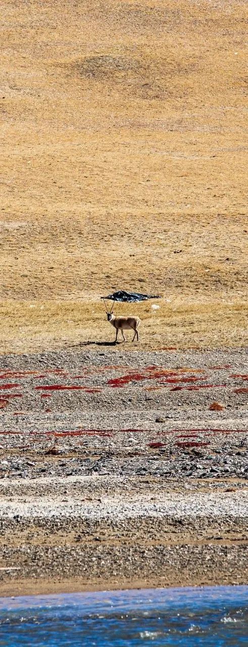
The visibility of Tibetan wild ass is very high, and they roam in small groups.

consume cattle

The best of Qinghai

The region with the largest number of yaks in the world is Qinghai, accounting for about one-third of the world's total yaks, with a total of more than 5 million yaks.

Tibetan antelope

"Specialty" of Hoh Xil


The male antelope did not receive wages that day and was "closed". Only one male Tibetan antelope was found.


The 200 telephoto lens is completely insufficient when it comes to Hoh Xil. This is already a picture magnified N times in RAW format.


Note for aerial photography: Aerial photography is not allowed in Hoh Xil

Aerial photography altitude: 0

Aerial photography positions: 0


journey


During this trip, I gained a new skill - aerial photography.
A small plane bought specifically for this trip.
↓ Click to view the video, the highlights of the 8-day itinerary ↓


01
DAY
GuangzhouXining
Featured Attractions: Eat!
02
DAY
Xining
Featured attractions: Beichen Temple (Cliff Temple is not open)
03
DAY


Xining—Hadering
Key attractions: Qinghai Lake
04
DAY
Hadling—Da Qaidan Emerald Lake
Key attractions: Emerald Lake No. 3 and No. 4 Pools
05
DAY
Dachaidan—Dongtai Jinai Lake—Shui Yadan—Xitai Jinai Lake—Mangya Huatugou
Key attractions: Shuiyadan
06
DAY


Mangya—Aiken Spring—Mangya Emerald Lake
Key attractions: Devil’s Eye, Mangya Emerald Lake
07
DAY
Mangya—Chaerhan Salt LakeGolmud
Featured attractions: G315 Erboliang Yadan Landform
08
DAY
Golmud-Kekexili Sanjiangyuan Reserve
Key Attractions: Looking for Tibetan antelopes and various animals in Hoh Xil
09
DAY


Golmud—return trip
Souvenirs: Black wolfberry, red wolfberry


Note , the whole process UV rays are strong ! SkinStrong! Public toilets on highways and scenic spots are dry toilets, and the higher they are, the drier they are.


Leave a Reply