Japan Kamikochi Travel Guide
Scenic spot introduction:
Kamikochi is known as Japan's Alps and is also affectionately called Japan's Jiuzhaigou Valley by Chinese tourists. It is famous for its magnificent lakes and mountains. Kamikochi is a valley in the Hida Mountains. It is a landform formed by alluvial rocks after volcanic eruptions. It is rare to see such a large plain in such a high place in Japan. Kamikochi's beautiful natural landscape is formed by its unique topography and various flora and fauna. The clear river water is surrounded by green woods, and the slopes are covered with dense coniferous forests. There are also many rugged rocks in the river, which is dizzying for people to see. Kamikochi will be covered by glaciers during the winter ice age, and will wake up with breathtaking beauty in the coming year. In recent years, Kamikochi has attracted many tourists from all over the world with its unique charm, and has gradually become a base camp for hiking and mountaineering enthusiasts.Attractions distribution:
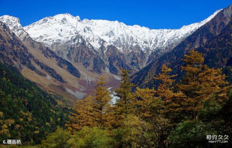
Kamikochi is a valley surrounded by the 3,000-meter-level Hotaka Mountain Range, Mount Yaki, and Mount Kasumizawa, with an average altitude of 1,500 meters. This area is surrounded by primeval forests such as white birch and larch, and is dotted with Taisho Pond, Tashiro Pond, Tashiro Bridge, Hotaka Bridge, Kappa Bridge, Myojin Pond, Myojin Bridge, Tokusawa, Shinmura Bridge, Yokoo, and Weston Monument. Together with the majestic appearance of the towering mountains, it constitutes an extremely beautiful natural scenery.Scenic spot qualifications:
Chubu Mountains National ParkScenic spot features:
Photography, hiking, mountain climbing, sightseeing, hot springs, mountains, forests, lakesTransportation
Scenic spot location:
Asia>Japan
How to get there:
Just take the Chuo Main Line Limited Express from Shinjuku Station (Tokyo) to Matsumoto Station, then take the Matsumoto Electric Railway to Niijima Station, and finally take a bus to Kamikochi Station.
Scenic area map:
Click to expand the scenic area map
Tickets
Kamikochi ticket prices:
No tickets
Scenic area opening hours:
Mid-to-late April to mid-November, closed in winter
Travel Tips
travelling guideline:
Most backpackers spend one or two days in Kamikochi, staying overnight in the Hirayu Onsen or Shin-Hotaka Onsen areas. Or you can stay in Takayama that night and take the morning and evening buses back and forth on the same day. The Hotaka Mountain Range is a famous hiking trail, but it requires sufficient equipment and two or more people.
Tour route:
The Kappa Bridge, the symbol of Kamikochi, is the starting point for the walk. Walk along the Tashiro Wetlands, which is surrounded by native forests and is full of clear water. You will see the reflection of the Hotaka Mountain Range reflected on the Taisho Pond Lake, which represents Kamikochi. The mysterious Myojin Pond surrounded by coniferous forest.
Best time to visit:
Red leaf season from mid-May to July and mid-October
Gallery
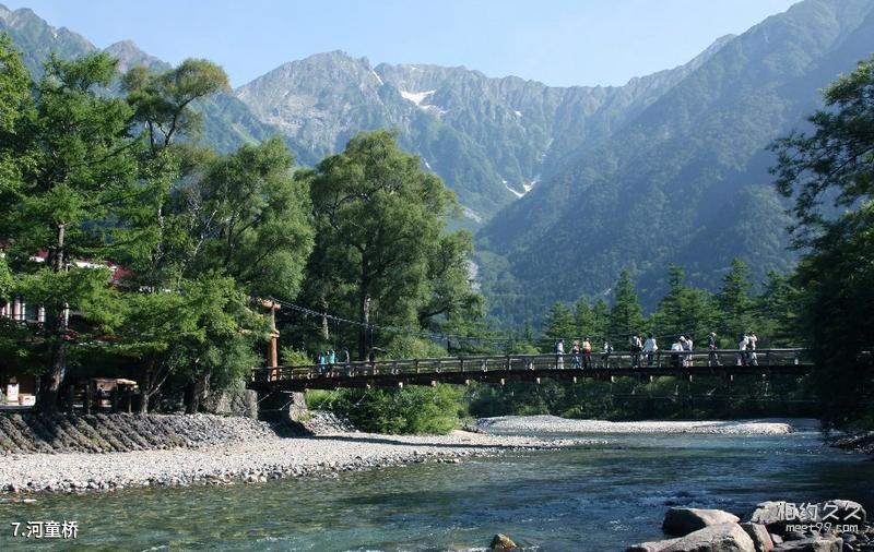
Japan’s Kamikochi Travel Guide - Kappa Bridge
Japan’s Kamikochi Travel Guide - Hotaka Bridge
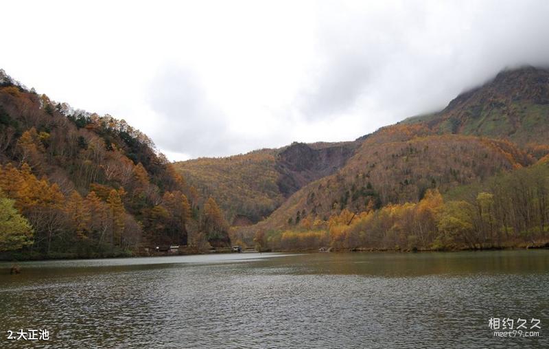
Japan Kamikochi Travel Guide - Taisho Pond
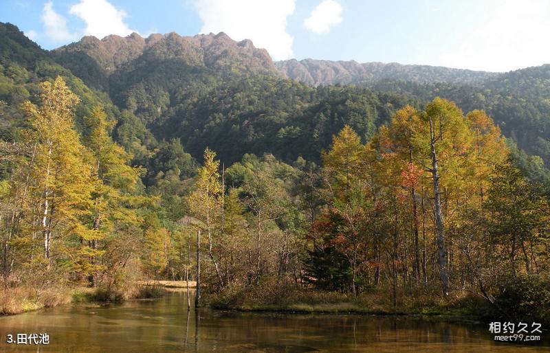
Japan’s Kamikochi Travel Guide: Tashiro Pond
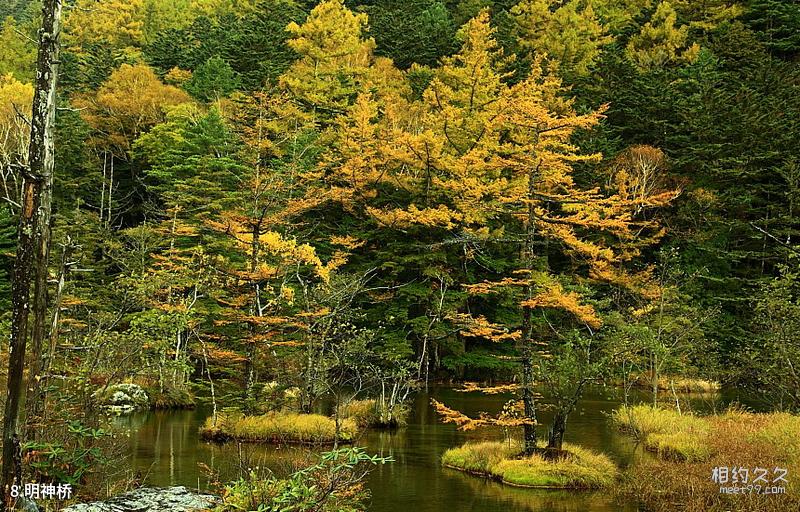
Japan’s Kamikochi Travel Guide: Myojin Bridge
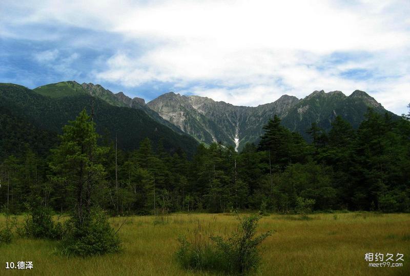
Japan’s Kamikochi Travel Guide: Tokusawa
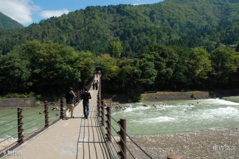
Japan Kamikochi Travel Guide - Sinchura Bridge
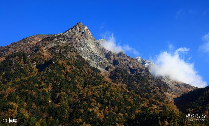
Japan’s Kamikochi Travel Guide - Yokoo
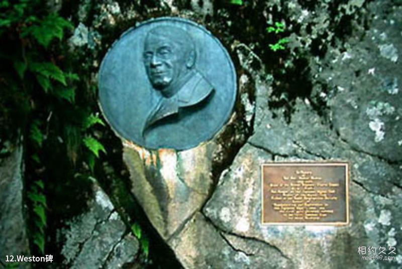
Japan’s Kamikochi Travel Guide - Weston Monument
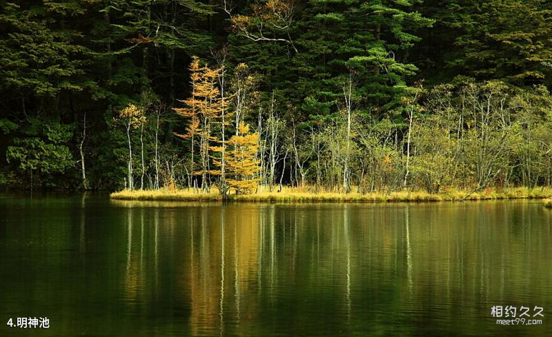
Japan’s Kamikochi Travel Guide: Myojin Pond
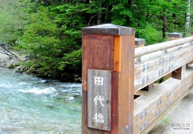
Japan Kamikochi Travel Guide - Tashiro Bridge
Comments
No comments yet