Xinjiang K2 travel guide
Scenic spot introduction:
With an altitude of 8,611 meters, K2 is the main peak of the Karakoram Mountains and the second highest peak in the world. It is also known as K2 Peak abroad and is recognized by the international mountaineering community as one of the more difficult peaks to climb. K2 is located in the middle section of the Karakoram Mountains, at 35°53′ north latitude and 76°31′ east longitude. It belongs to Yecheng County, Xinjiang Uygur Autonomous Region. It means “tall and majestic” in Tajik language.Attractions distribution:
The Karakoram Mountains stretch for thousands of kilometers and run from northwest to southeast. Generally, the altitude is above 6,000 meters. There are dense peaks on the mountains, including K2. There are 4 world-famous peaks above 8,000 meters closely connected here: K2. On the east side is Broad Peak, 8051 meters above sea level; followed by Gasherbrum Mountain, 8068 meters above sea level; Gasherbrum II Peak, 8035 meters above sea level. Nearly one-third of the world's 14 peaks above 8,000 meters are located here. There are more than 20 peaks above 7,000 meters. Skyankanli Peak on the north side is 7,545 meters above sea level; Spande Peak on the west side is 7,385 meters above sea level; and further down there is Coronet Peak, 7,295 meters above sea level. Therefore, this has become the second mountaineering center that attracts the attention of mountaineers around the world. There are six main ridges in K2. The northwest-southeast ridge is the main ridge of the Karakorum Mountains and is also the national border between China and Pakistan. Others include the north ridge, the west ridge and the northwest ridge.In 1902, the British mountaineering team failed to climb K2 for the first time. In the following 50 years, humans tried many times but failed. It was not until July 31, 1954, that two members of the Italian mountaineering team, Rino Resdri and Achille Compagnoni, set a record for the first ascent of the summit from the Pakistani side along the East Ridge, which took nearly 100 days. . In 1976 and 1977, the Chinese Mountaineering Association twice organized teams to enter the north side of K2 to conduct route reconnaissance. On August 4, 1982, the K2 mountaineering team of the Japan Mountaineering Association climbed to the summit from the north slope along the north ridge for the first time. After that, the Italian team, the Japanese Yokohama Mountain Association mountaineering team, the American mountaineering team, etc. successively successfully conquered K2 from the Chinese side.
Scenic spot features:
Mountaineering, adventure, rock climbing, mountains, snow mountains, glaciersTransportation
Scenic spot location:
China>Xinjiang Uygur Autonomous Region>Kashgar Prefecture>Yecheng County
How to get there:
Starting from Yecheng County in the Kashgar region, drive over the Akazda Ban and Sailiyak Daban (about 3,500 meters above sea level) to Yilik (the total distance is 290 kilometers). Starting from Ilik, the entire hiking route is about 120 kilometers long and takes 6-8 days. It is necessary to travel with a pack team throughout the hiking route in order to cross dangerous sections such as rivers. The camel caravan was assembled from nearby herdsmen. Eight kilometers westward from Ilik is Rezikam Nationality Township (which belongs to Taxkorgan County). Two days later, we cross the Aglada Ban and descend about 3 to 4 kilometers from Daban into the Kelqing Valley. On the south bank of the river, we are close to Camp on the big beach on the hillside, which is the No. 1 Hongliu Beach. After a day's rest along the No. 1 Hongliu Beach, passing through the No. 2 and No. 3 Hongliu Beach, you can reach the "Yinhong Beach" climbing base camp. After resting at Yinhongtan Camp, you can reach the starting point of the climb after passing through the Forward Camp (Italian Camp).
Scenic area map:
Click to expand the scenic area map
Tickets
K2 weather forecast:
Understand in advance the latest weather forecast for K2, where K2 is located Xinjiang>Kashgar>Yecheng, and make perfect preparations for a pleasant journey ^-^
| Yecheng seven-day forecast |
Today: Sunny→Cloudy -12℃ / -3℃ Breezy |
Ming: Cloudy -12℃ / -1℃ Breezy |
The day after tomorrow: Cloudy -12℃ / -1℃ Breeze |
| dressing: | cold | The weather is cold, so it is recommended to wear thick down jackets, fur coats, thick sweaters and other mid-winter clothing. The elderly and the weak should pay special attention to keeping warm and preventing freezing. |
| Comfort: | Less comfortable | The weather will be fine tonight, but you will still feel a little cold and uncomfortable. Please remember to add clothes in time to prevent a cold. |
| Morning Exercise: | Not suitable | The weather is cold in the morning, so please try to avoid outdoor morning exercises. If you insist on outdoor morning exercises, please keep warm and prevent frostbite. It is recommended that the elderly and weak people reduce the time of morning exercises appropriately. |
Travel Tips
Best time to visit:
The K2 area not only has a dangerous terrain but also a very harsh climate. From mid-September to mid-April of the following year, the lowest temperature at the peak can reach -50 degrees and the maximum wind speed can reach 5 meters/second, making it a climatic restricted area for mountaineering. The local rainy season is from May to September every year. Due to rising temperatures, melting snow and precipitation, it is often difficult to enter the mountains due to the surge in water levels in the valleys. However, although the river water rises in May and early June, it is not serious and is a good time to enter the mountains; July → In September, the temperature at the top of the mountain is slightly higher and the good weather lasts longer, making it a good time to climb to the top.
Gallery
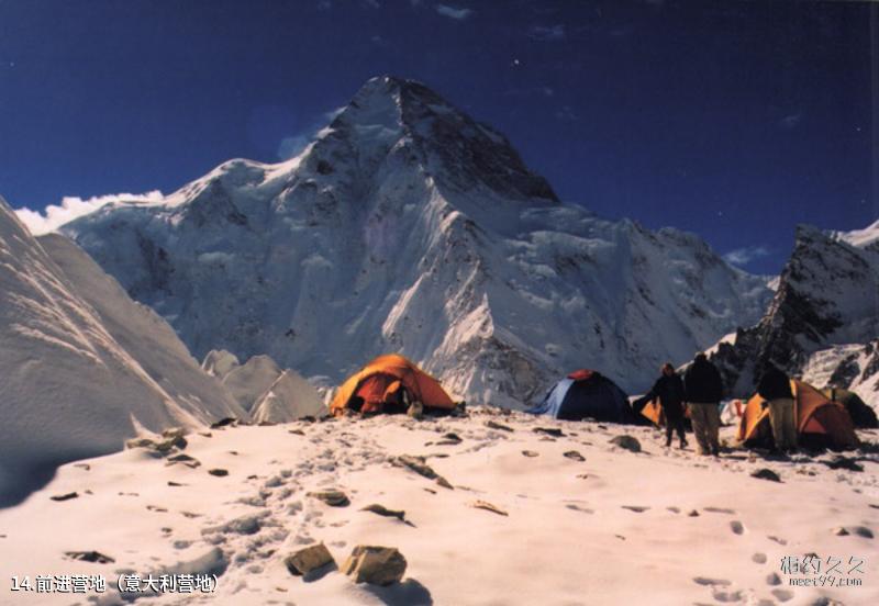
Xinjiang K2 Travel Guide - Qianjin Camp (Italian Camp)
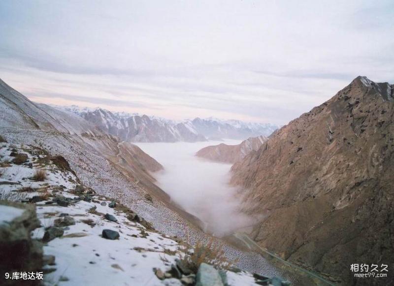
Xinjiang K2 Travel Guide - Kudi Daban
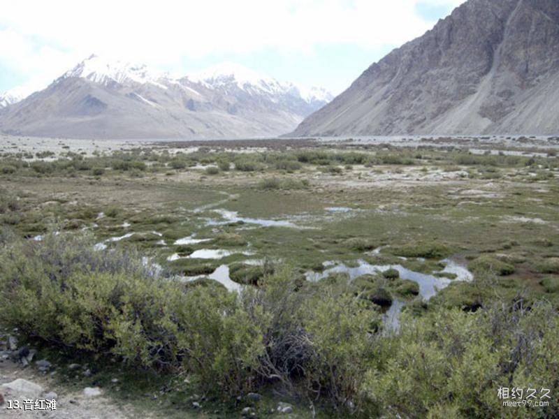
Xinjiang K2 Travel Guide - Yinhongtan
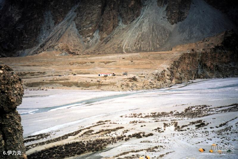
Xinjiang K2 Travel Guide - Yilik
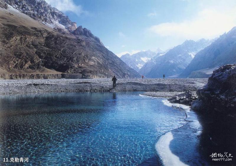
Xinjiang K2 Travel Guide - Keleqing River
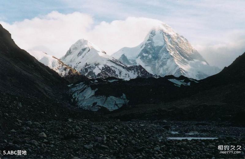
Xinjiang K2 Travel Guide - ABC Campground
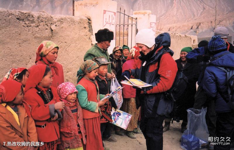
Xinjiang K2 Travel Guide - The Ethnic Township of Rezikam
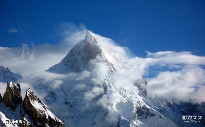
Xinjiang K2 travel guide - K2
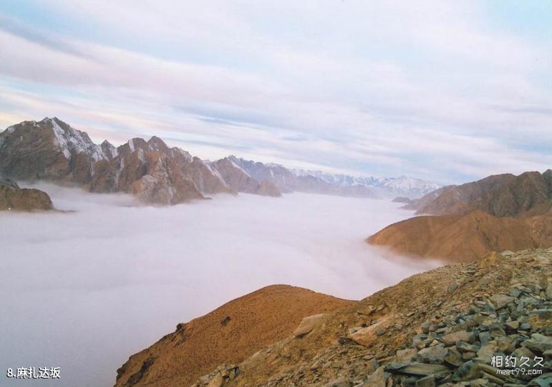
Xinjiang K2 Travel Guide - Mazada Ban
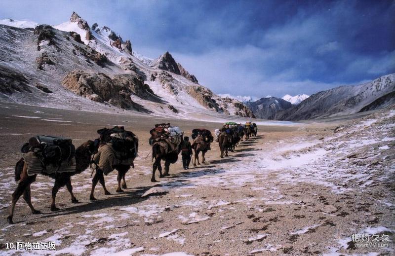
Xinjiang K2 Travel Guide - Agrada Ban
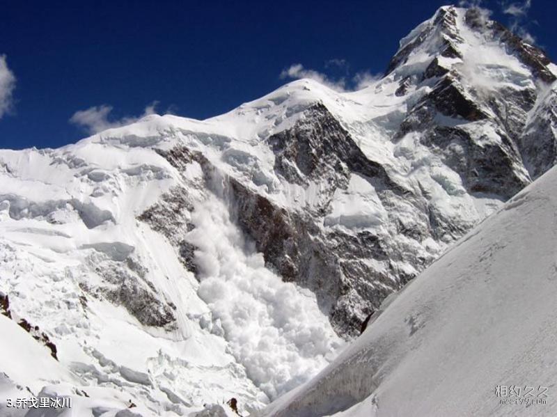
Xinjiang K2 Travel Guide - K2 Glacier
Comments
No comments yet