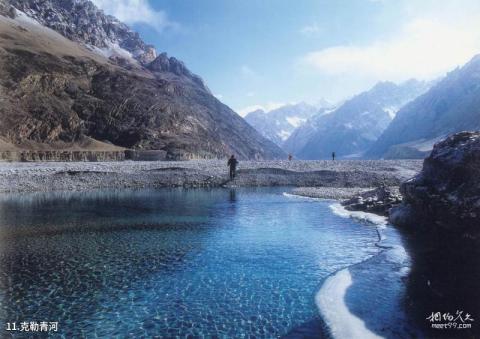
Introduction to Keleqing River: Keleqing River originates from the huge glaciers on the north slopes of Gasherbrum Peak and Broad Peak. It first flows from south to north, then turns to the west, and finally ends in Taturugou. It turns eastward and merges into the Yarkand River, which is another major upstream tributary of Yarkand River. The Keleqing River has a large volume and rapid flow. The river valley has been repeatedly diverted and cut by the river. The widest point is about 1-2 kilometers. In summer, even camel teams cannot wade through it. Therefore, many mountaineering teams cross the river in spring to enter (K2) Or the Gasherbrum Mountaineering Base Camp, and go out to the mountain in autumn when the water flow is low. Many teams drive sheep and other livestock across the river to graze in BC and slaughter them when needed. Some teams bring rapeseed to cultivate in BC and pick fresh vegetables at any time. The difficulty of crossing the Keleqing River is also a major reason for the difficulty of climbing K2.
