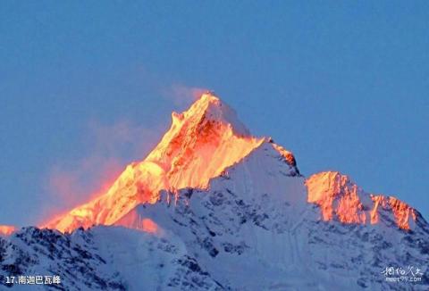
Introduction to Namjagbarwa Peak: Namchagbarwa Peak is the highest mountain in Linzhi region of Tibet, with an altitude of 7782 meters. It ranks 15th among the highest peaks in the world, but the 14 mountains in front of it are all 8000 meters above sea level. With peaks above 7,000 meters, Namjagbarwa is the highest peak among the 7,000-meter peaks. "Namjagbarwa" means "spear piercing the blue sky" in Tibetan. It is known as the "Father of Icebergs". It also has another name "Muzhuobar Mountain". Its huge triangular peak is covered with snow all year round. , shrouded in clouds and mist, never easily reveals its true face, so it is also known as the "Shameful Girl Peak". Most of the three major slopes of Namjagbarwa Peak have been cut by ice and snow into weathered and denuded steep rock cliffs, with the west slope being the highest. The bedrock on the slope wall is exposed, with ditches and chutes left by avalanches remaining, and the canyon is filled with huge glaciers. The rainy season in this area is long, generally extending from May to September, especially in the three months of July, August, and September. It rains almost every day. At the same time, the cloud cover is also very heavy, and the peaks are shrouded in clouds and mist all day long. The dry season is from November to April of the following year. The weather is mainly sunny. February to April and October to November are the alternating periods of the dry season and the rainy season. It is also a good time to choose mountain climbing. But the high-altitude wind on this day was strong, with a wind speed of about 40 meters/second, about 40 meters per second, and a temperature of -20°C to -30°C, with a relatively large temperature change.
Transportation to Namjagbarwa Peak: Starting from Lhasa, go east along the Kangzang Highway to Bayi Town, a total distance of 404 kilometers. Along the Niyang River, passing through the Zhilujiabhuigangga Bridge to Milin County, the journey is 75 kilometers. From Milin County, travel 91 kilometers east along the Yarlung Zangbo River to the Pai District at an altitude of 3100 meters. From Pai District, go north along the simple highway for 18 kilometers, passing through Daduka Township to Gega. Then walk to the Namjagbarwa Mountaineering Base Camp with an altitude of 35l2 meters above sea level.
