Although today is only 60 kilometers, it is mainly climbing. Today I have to cross the first Daban on the Xinjiang-Tibet Highway - Kudi Daban . It is 11 kilometers of steep uphill slope after leaving the village. From then on, I plunged into the Kunlun Mountains. embrace. Arrive and then go down the mountain for 15 kilometers, and then go up slowly on the 34 kilometer ups and downs road all the way to Kudi. The road conditions will be slightly worse along the way, because of the The road is known to be prone to geological disasters , and it happened to be the worst one I've encountered in years (more on that later), so the road condition was even worse.
A ray of coolness penetrated my tent in the morning. I slept well last night and my fever was gone. I felt relaxed and full of energy. And the weather was good, so I was back to full health instantly.
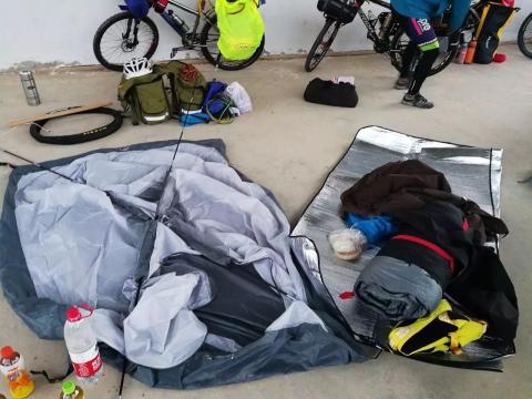
The first thing you do when you get up is to pack your luggage and put away your tent, because it will take a long time.

I packed my tent and sleeping bag, brushed my teeth, washed my face, and cooked breakfast. (There is a faucet in the center of the square where you can collect water. You don’t need to bring your own water, so you can be a little more luxurious)
Stoves and gas tanks are very practical on the road. I mostly use them to boil water and cook instant noodles, and they have enough firepower.

Because I didn’t eat well yesterday, I felt very hungry when I woke up this morning. Two packs of instant noodles were my most delicious “meal”

After breakfast, pack up and get ready to hit the road! Such a heavy burden cannot be dealt with without spending an hour every morning, so we must develop the habit of getting up early.

The tripod can hardly support it ...

A new day’s journey has begun, full of fighting spirit!

When I met a local armed policeman grazing cattle on the roadside, I greeted him friendly. (Popular science: "Yaximu" means "Hello" in Uyghur language) He also said "Yaximu" back to me! interesting.

Just after leaving the village, there is a long steep slope. The altitude has to be increased by about 500 meters, which is not easy. However, the weather was very comfortable in the early morning and the climb was exciting. The surrounding environment is also much better than yesterday.

Lao Fang seems to be in very good condition!

K104There is an abandoned military rest point. I didn’t go in to see it, but the appearance is still intact. However, I heard from predecessors that it is full of cow and sheep dung, making it impossible to camp and rest.

After passing k105, we started to go up a super steep steep slope (if you saw the road above, the height may not be visible in the photo, but the visual drop is about 80 meters)

It looks like a flat road, but it is actually a steep slope. This is an "illusion" that often occurs on cycling roads.

Looking back at the road I rode on, I instantly felt a sense of accomplishment.

Looking down at the abandoned military resting place we just passed by

Continuing to walk forward, we found an abandoned small village, about a kilometer away from the military rest point. The house is very complete and looks like a pretty good environment. It has probably been used as a temporary residence by local herders.

If you go up steeply, the speed will be very slow, and it will be difficult to balance the front of the car. There are no guardrails on the roadside, so you must always pay attention to safety. Falling is no joke.
As we approached the pass (the pass means the top of the mountain), the road conditions began to deteriorate. It seems that natural disasters have been frequent recently


After climbing a long steep slope, we are getting closer and closer to the top of the mountain. When you reach the turning point, look at the way back and feel a great sense of accomplishment!


If you see the little blue sign, it’s the pass. There is still one kilometer (yes, one kilometer is that long ...)

After two and a half hours, we finally climbed up to Kudida Ban.

Kudi Daban is called "Seriak Daban" in the Uyghur language, which means "a cliff that even monkeys cannot climb" . The reason is that its steepness is too high and its slope is long. The reason why it is called Akaz Daban is because there is an Akaz Road Ban nearby, which is a military station responsible for protecting the road. This brand was also established by the soldier brother of the Akaz Military Station.
The altitude of Kudidaban is 3150 meters, and most people don’t have obvious altitude sickness when they come here. Look at Sister Yang, who has never been to the plateau, how happy she is and in good condition!

I was very happy to have successfully climbed the first Daban.

Keep walking forward, and you will see the Kunlun Mountains in front of you, and you can vaguely see the snow-capped mountains!

Altitude boundary monument, take a photo as a souvenir

After taking the photo, we immediately went down the mountain. The road condition down the mountain was not ideal. Always pay attention to control the speed, otherwise you will plunge into the embrace of the cliff.


It is a long, serpentine downhill road, and there are no guardrails on both sides of the road. The road width is very small, so always remember safety!

Along the way, wild goats can be seen everywhere. interesting!

It’s nice to enjoy riding in the mountains.

Go all the way downhill to K126, to Akaz Road Ban . There is a fork in front of the road. Turn right to go to Xihexiu Township, which is close to the border between China, India and Pakistan. .

Going downhill to the river valley, we meet the famous Yarkand River in Xinjiang. This small river is now called the Harastan River. After it merges into the Tizhnav River downstream, it then merges into the Yarkand River. We turned left and went upstream along the Harastan River.

The road conditions were average, with a lot of sand and dust. When I passed a large truck, I ... (look at the picture to get a feel for it)

K130, to Akaz Service Area, there is actually no supplies and accommodation here, but there is shade, you can rest next to the military station and eat some dry food

A few of us are having lunch together here (for introduction, the one in red clothes on the left is called Angkor, and the one in yellow clothes on the right is called Hua Ge. They are both from Lianyungang, Jiangsu, and they met at the camp site yesterday)

After lunch, we moved on. The road conditions behind are all ups and downs with a gentle ascent, all the way upstream along the river.

We were riding in the valley. It was hot in the afternoon and there were cliffs on the roadside. During the rainy season, mudslides are common.

Two funny wild donkeys on the roadside

Looking back, it was indeed a slow climb.

The road conditions ahead are getting worse and worse, we have officially entered the section prone to mudslides . Looking at the road conditions, there must have been a lot of mudslides and landslides recently.

Walking forward, suddenly a big stone rolled down , which scared me to death. I have to watch the situation on the mountain at all times to prevent being hit by stones.

The road conditions began to change from dirt road to mud road, and the riding became more and more difficult.

When encountering such a muddy road, you must decisively put on the gear and speed up. Once the speed slows down, the wheels will get stuck in the mud and you will be unable to ride, and people will fall off and plunge into the mud ...

I got caught and didn't speed up decisively, so I quickly got down to push the cart and my feet were completely stuck in the mud. (Fortunately, the person didn’t fall, but the shoes were awkward ...)

There are still several sections behind this muddy road.

After walking for a while, I saw a bunch of cars blocking the road ahead. It looked like there was a landslide. But it does not affect the passage of bicycles.

Sister Yang and Lao Fang were marching hard


My car has completely turned into a "clown"

I quickly pushed through the landslide section. I came here running. I looked back at Lao Fang and Sister Yang who were walking hard (bicycles are much better than motor vehicles, so I can cross the border at any time!)

Later we continued all the way to Kudi, the road condition was good.

Take a rest at Xiaokudi Bridge and arrive at Kudi in about 5 kilometers.

At K160, arrive at Kudi.

Kudi is a small oasis in the Harastan Valley. Kudi is a medium-sized accommodation point on the Xinjiang-Tibet Line. It has several small hotels and a military depot. It mainly provides supply conditions for passing large trucks and military vehicles. Unfortunately, due to the landslide in front, the signal base station was washed away, so there is no signal for mobile phones today , and according to the feedback from the checkpoint, all vehicles (including bicycles) will not be able to pass tomorrow, so We were forced to rest in Kudi for one day . According to locals, this is the most serious landslide in history. Many large truck drivers and self-driving tourists have been trapped here for more than a week.

Lao Fang and I chose to stay at Gansu Hotel. The boss has been living here since he retired from the army. He is kind and capable. He cooks delicious food and the room is very clean. 30yuan per night

Later, several cyclists also successfully arrived at Kudi, and everyone discussed having dinner together to get to know each other.

The accommodation environment is pretty good (it should be said that it would be nice to have a bed). The entire village only generates electricity at night, so the charging must be fully charged in time when power is generated.

You can't take a shower here, but you can wash clothes.

Afterwards, everyone sat together for dinner (me, Lao Fang and members of the Hubei team). We had a splurge and ordered a portion of Xinjiang’s famous large plate chicken (120 yuan per plate), which was quite delicious. , if there are a lot of people, you might as well order one. (To introduce, the one on the left is Uncle Liang, the one in the middle is called Brother Dalong, and the one on the right is Sister Yang. They are all from Huanggang, Hubei)

The one on the far left is the captain of this motorcade, called Luozi. Especially good at studying history

Then Brother Hua came over (Brother Hua didn’t live with us, but lived in another house). We just sat and talked all night. Anyway, we have a rest tomorrow, so feel free to have fun! We talked to each other about our past experiences and what might happen on this line. The age difference made me feel out of place with them and my lack of life experience. But we are all good people and we take care of each other. , especially they treat me like their own child (they don’t even ask me to pay for this meal, it’s like treating me to a meal, I thank them from the bottom of my heart). I admire their experiences, and they admire my high starting point in life.

After dinner, I returned to the room and had to go to bed early because there was no signal on my phone.
(To be continued...)