▼Road Book

▼
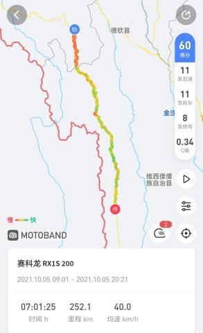
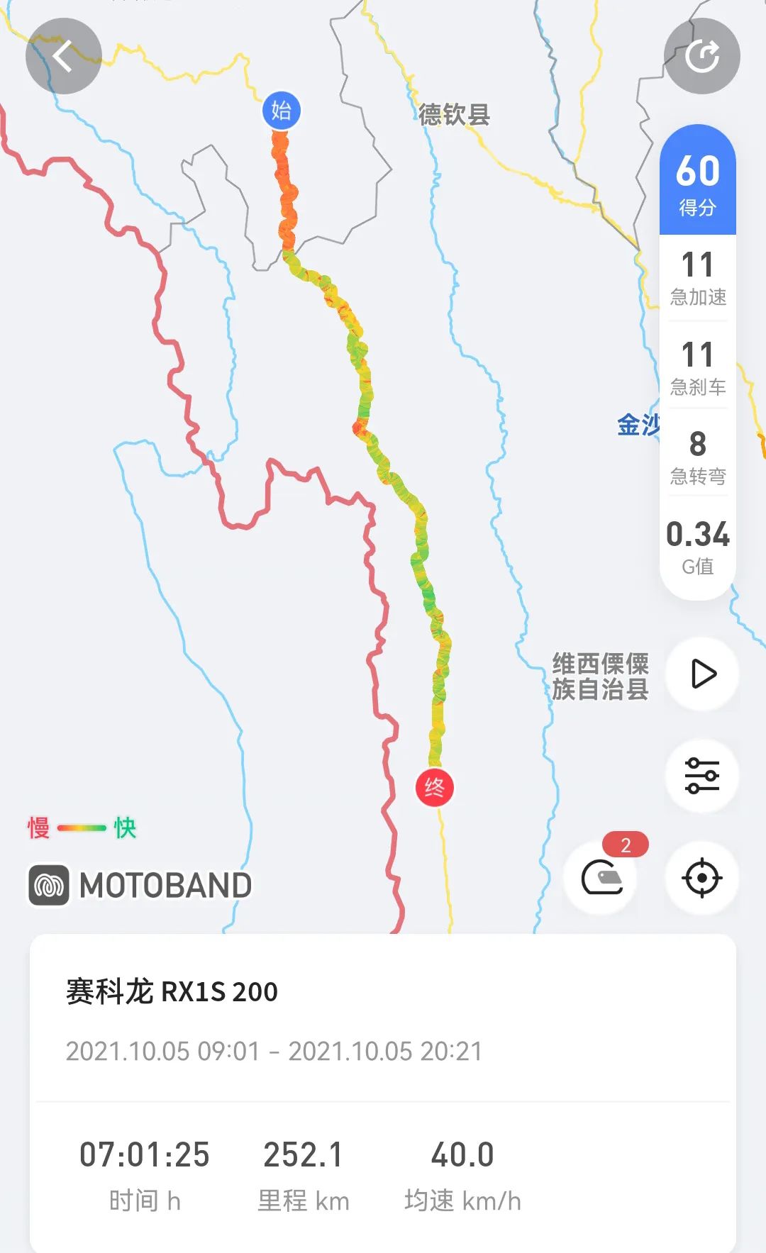
▼On October 5, 2021, Chawalon-Bingzhongluo-Fugong, sunny to showery. Chawalon is 1,920 meters above sea level and has a subtropical climate. It only takes one day from cold winter to midsummer.

▼When I wake up in the morning, the first thing I see when I open my eyes is clouds and mist swimming in the mountains, submerging the surrounding mountains and only revealing some faint outlines.

▼There is only one street in Tsavalong, the national highway. There are many breakfast stalls along the street. The diners are all in short-sleeved shorts.

▼Photo taken at the 6666 km milestone

▼Chawalong means hot canyon in Tibetan. It is indeed dry and hot, and is very suitable for the local climate.

▼

▼The foot of Chawalong Meili Snow Mountain attracts countless tourists and a large number of devout Tibetan Buddhist believers every year, and thus forms the famous Meili Snow Mountain turning path. The natural and cultural scenery is very spectacular.

▼

▼Leaving the city is another endless gravel road

▼The cactus forest, with lignified rhizomes, is one of the plants unique to the Rego Valley. After taking the photo, I found that the mountains along the way were full of cacti.

▼

▼

▼Daliusha is 9 kilometers away from Chawalon. The wind blows flying rocks from the sky and hits pedestrians. Feishi Road is 200-300 meters long. The locals call this section of the road the death zone.

▼The big quicksand looks like a bleeding heart, and the raised hills on the opposite side look like snake heads staring covetously. According to legend, the big quicksand is the heart of Meili Snow Mountain. The devil turned into a giant snake and wanted to devour the heart. Zhawangfeng, the god of war who conquered demons in Meili Snow Mountain, arrived in time and used his divine power to turn the giant snake into a hill and seal it. Unfortunately, the heart was The teeth of the giant snake scratched it, and the blood it shed turned into cursed flying stones. Once there is any disturbance, they will fly out and harm pedestrians. Walkers who can successfully use this path will have good fortune and a safe life.

▼Waiting for bulldozer construction, the gravel road is about 100 meters long.
The bulldozer master waved for me to pass. The excavator left a step at least 30 centimeters high. It was visually impossible to pass through this situation. I tried to crash the car. I rushed the accelerator to the landslide area and reversed the car again. Dense gravel fell from a height of hundreds of meters, and the small The ones ordered are as big as eggs, and will break if hit casually.
I reversed the car on the right side, with the wheels in the air. The rubble pile of the landslide was loose. The motorcycle and I slid towards the Nu River along with the rubble. I couldn't react at all. I only had one thought at the time. I will tell you this in my life. Less than half a meter away from the Nu River, the rubble stopped. Move, get in the car and escape

▼Looking back at the big quicksand, I felt sluggish for a long time and couldn’t get over it.

▼

▼In the next two hours, there were no vehicles coming from behind. They should be waiting for the roadblock to be completely cleared.

▼

▼

▼Bingchacha walked along the way and saw different scenery in Chawalong.

▼

▼The steepness of Laohukou, the momentum of the V-shaped canyon, and the winding Nu River will all make you marvel at the magical charm of nature.

▼

▼

▼

▼

▼Songta Village, Bingchacha’s first village in Tibet, means leaving the Tibetan area

▼

▼

▼At the junction of Yunnan and Tibet, the gravel road ends, and the long-lost asphalt road ahead is

▼Looking back at Tibet, I always thought about it in the past, but this time I just wanted to escape. Tibetan areas have undergone tremendous changes in the past three years. New high-rise urban areas have been built, and tourist public toilets and parking areas have been added. However, most public toilet doors are locked. During the special period, most of the tourists were reduced, and the price of gas and rice bowls also dropped a lot compared to the previous three years.

▼

▼Bingchacha, I will not take the route to Tibet for the second time. Check the condition of the vehicle. The road conditions are poor, the car is reversed frequently, and the suitcase and bumper screws are all loose.

▼ Bingchacha was expanded and renovated in 2019, which is said to have cost tens of billions of funds. Compared with Tibet, the Yunnan section has asphalt roads, green belts, small parking areas every few kilometers, and large service areas 20 to 30 kilometers away. The level of luxury is no less than that of expressways.

▼The trees are dense, the flowers are blooming, and the moist air blows towards you.

▼

▼Gaoligong Mountain and Biluo Snow Mountain, two cliffs rise from the river, straight into the sky, forming a huge stone gate. The Nu River gushes out from the stone gate and rushes down. The locals call it Nanli Wall, and according to the The topography is given a vivid name - Shimen Pass

▼

▼The first bay of the Nujiang River is formed because the Nujiang River is blocked by the hillside and makes a 270º bend. The first bay of the Nu River is located on the way to Bingzhongluo. It is blocked by the cliff of Wangqing Rock. The flow of the river changes from north to south to east to west. After flowing out for more than 300 meters, it is blocked by Danla Mountain and turns around again. Turning sharply from west to east, a large semicircular bay is formed here.

▼Bingzhongluo was originally the place where the Nu people lived. Since the Daoguang period of the Qing Dynasty, Tibetan Buddhism was brought to Bingzhongluo by the Tibetan Lama Du Gongji and took root. Tibetans have gradually migrated from Tibet, Deqin, Zhongdian and other places. Come and become the main resident here

▼Bingzhongluo was originally called "Bizhong", which means "Tibetan Village" in Tibetan. The local Nu people called it "Mabai Keluo". After the Lisu people migrated from the Lancang River Basin and the lower reaches of the Nu River to settle here, they settled in the original "Bizhong" On this basis, the sound of "Luo" was added, which means "Qing" or "place", so it evolved from "Bizhong" to "Bijuluo"

▼Bingzhongluo, literally the last stop of Bingchacha

▼

▼

▼The various ethnic groups in Bingzhongluo have developed unique architectural methods because they have lived in the Grand Canyon for a long time.

▼Gongshan Dulong and Nu Autonomous County, is located at the junction of China, Myanmar, and Yunnan and Tibet. Multi-ethnic people live together. Catholicism, Christianity, Tibetan Buddhism, and primitive religions coexist, making Gongshan a multi-ethnic culture with Eastern and Western religions. A place where cultures meet. There are many national festivals here and the national culture is colorful.

▼

▼

▼

▼

▼

▼On the 3,300-meter-high peak in the middle section of the Gaoligong Mountains, there is a huge marble cave formed by dissolution. The cave is a hundred meters deep, about 40 meters wide, and about 60 meters high. It goes north along the Nu River, a hundred miles away. You can see this stone cave with white clouds and blue sky. It has a nice name, called Stone Moon.

▼It seems to have stood there since the beginning of the world. It has already existed in the ancient flood myth of the Lisu people. It is called "Ahaba" in Lisu language, which means stone moon.

▼The sky is getting dark, and the rain is evenly distributed. Each shower is several kilometers apart, so hurry up and get on your way.

▼

▼

▼

▼Arrived at Fugong at night, a city with dimly lit mountains and rivers. The hotel is close to the Nu River. I lay on the bed and fell asleep listening to the roar of the Nu River.

▼

