
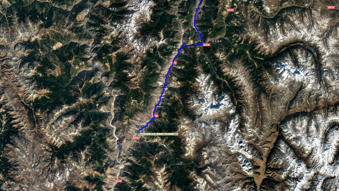
July 11, 2022 | Sunny | Holiday Inn Batang | 385 kilometers
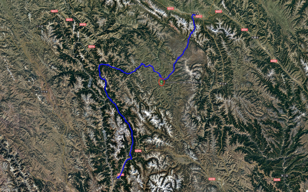
This is today’s route. The red circle in the picture is Yaqing Temple. Unfortunately, tourists are not allowed to enter for the time being.
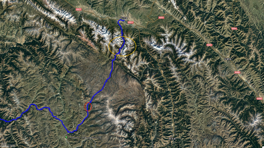
Garze County is located at the eastern starting point of the Shaluli Mountains. To the south of the county is the Zhuodala Mountain. A row of tall snow peaks (yellow circles) carefully defends the county. This is the first section of the road, from Garze County to Lalongcuo (red circle)
Let’s take a closer look at the continuous peaks of Zhuodala Mountain
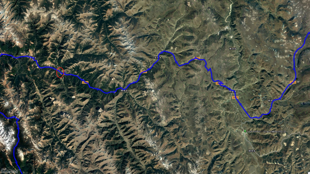
The second section of the road is from Lalongcuo to Zhangdu Township. The red circle in the picture is where we had lunch and took aerial photos of the valley.
The third section of the road leaves Ganbai Road and heads to Batang. This section of road is numbered G215. It is an upright national highway, but some sections are still under repair and paving.
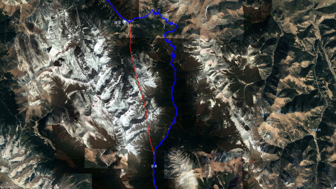
Before the red line, there was a smooth asphalt road; the red line was the Myla Mountain Tunnel under construction; the blue track was the actual direction we took over the mountains. If the tunnel is opened, this section of road can be passed in up to 15 minutes, while it will take an hour to go over the mountain on a dirt road.
I originally thought that after going over the mountain, it would be the same asphalt road as before, and it would be as smooth as skiing to reach Batang. However, it turns out that this section of the road is still under repair, sometimes good or bad, and sometimes it needs to be detoured. At the red fork, we encountered a temporary road closure. This letter lasted for 2 hours.
At 6:30 pm, the lockdown was lifted, and we headed south to National Highway 318, and then to Batang County.
*************************************
My sister, the one who drives FJ like a scooter for the elderly, has always wanted to go to Yaqing Temple.
I wanted to go too, so I asked her to travel with me this time.
However, she is more powerful than me. She asked a friend who was familiar with the Tibetan area of Sichuan and received important news: Yaqing Temple has been undergoing renovations recently and has been temporarily closed to tourists.
Rectify? Fix what?
Although I was puzzled, I had to accept the result.
For this reason, this guy doesn't want to go out. So, on July 10, I had to face what I thought were ruts in the swamp alone (of course, it turned out that I was overly worried).
However, today, I still plan to go to Yaqing Temple.
What if?
*************************************
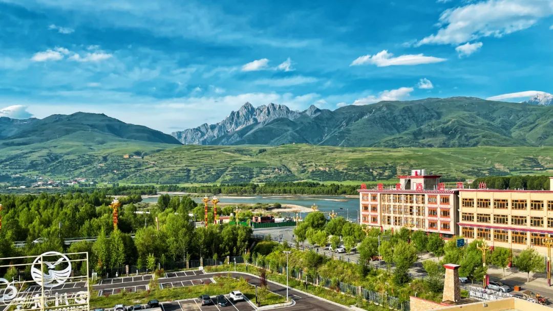
I got up at 8 o'clock in the morning, opened the curtains and saw another beautiful sunny day.
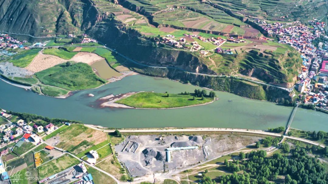
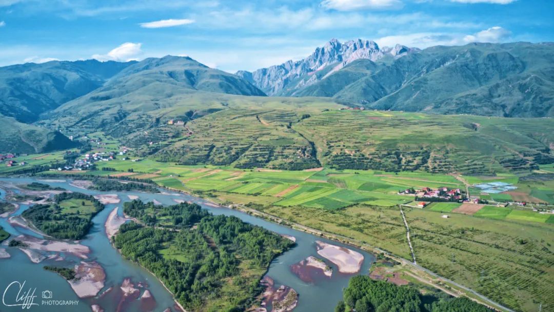
Outside the window, the Yalong River is sparkling; on the other side of the river stands a row of peaks, which belong to the Zhuodala Mountains.
At the moment, they don't look very good when they are naked, but in winter, when they are covered with snow scarves, they will probably be as beautiful as the sky.
Here, it already belongs to the territory of the authentic Shaluli Mountains.
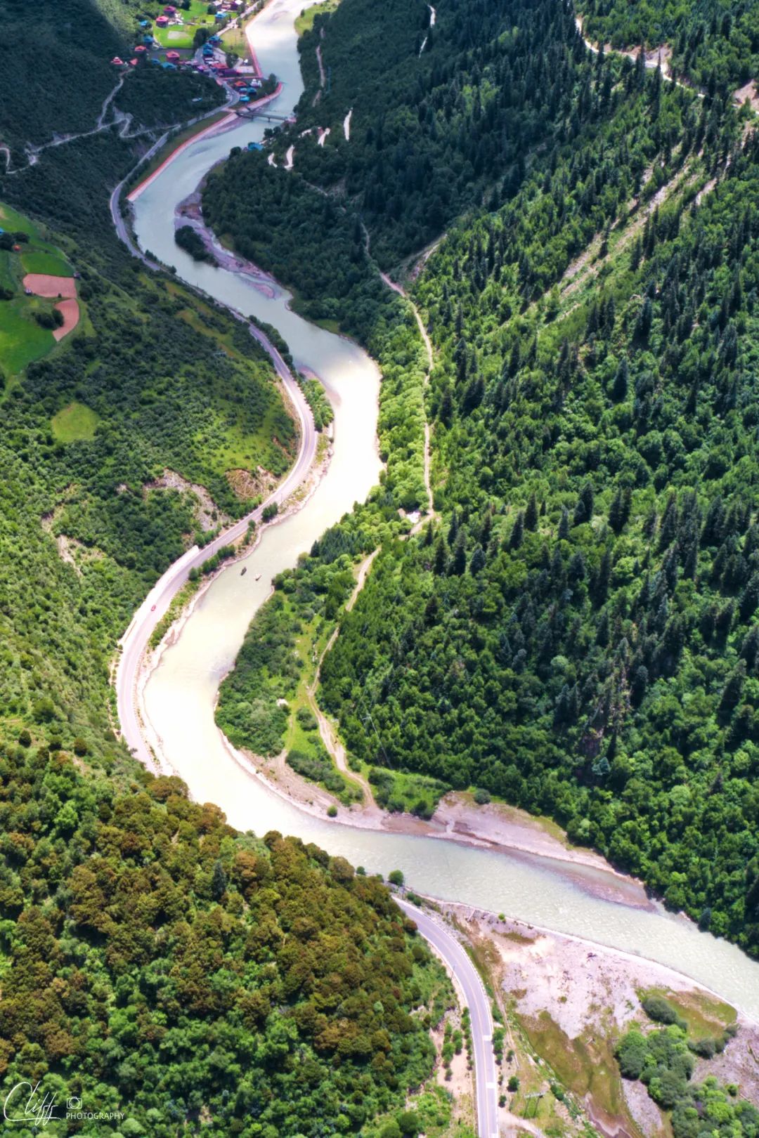
I looked at the map last night and found that the Yalong River in front of the hotel is wide and full of oases. The river twists and turns in sexy curves.
This is also great for aerial photography!
So I got up 20 minutes earlier than everyone else, went to the hotel square, and started taking aerial photos of the beautiful river, the peaks on the other side of the river, and the prosperous small town on the riverside.
The first thing I do after opening my eyes every morning is to open the curtains and check the weather.
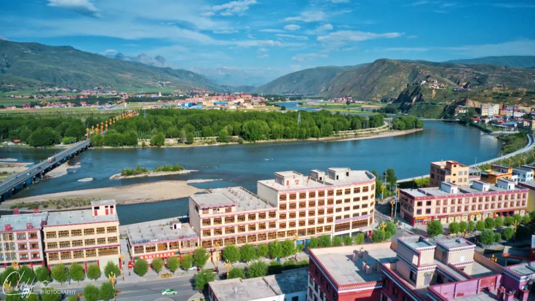
Directly in front of the hotel is the Yalong River, which comes slowly from the valley on the right (west)
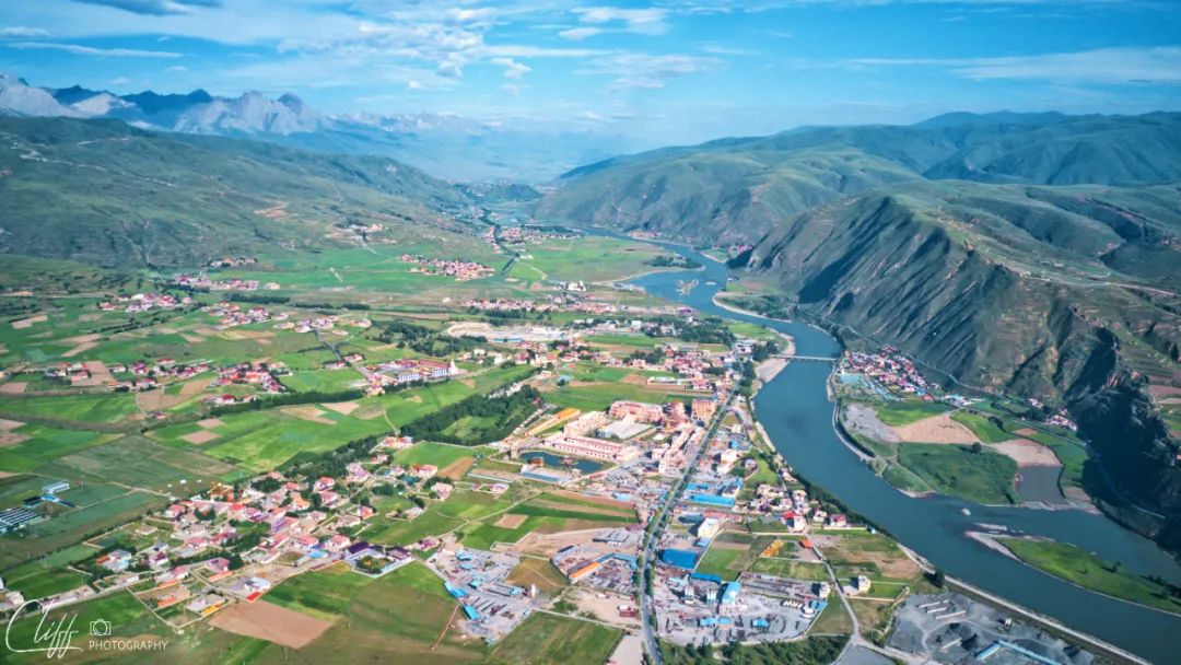
Flying higher, you can clearly see the landform here: this is a relatively open basin, which is the basis for prosperity.
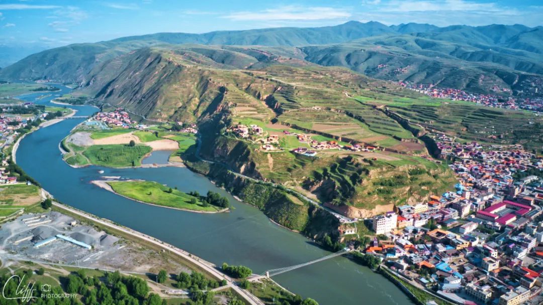
The city starts from the riverside
On the left (east), there is a large flat land, and the city is built on this open area. Between the river and the city, there is a large area of wetland, which must be a paradise for birds.
On the other side of the river are the peaks of the Chodala Mountains. In autumn and winter, this place must be absolutely beautiful.
The Yalong River suddenly became deflated in this open area and lost the spirit it had when it was galloping in the canyon.
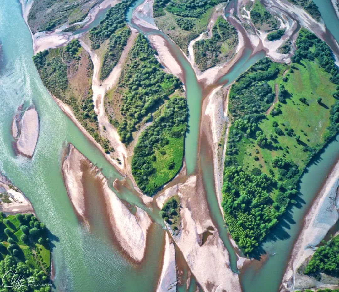

What a beautiful and sexy river bed
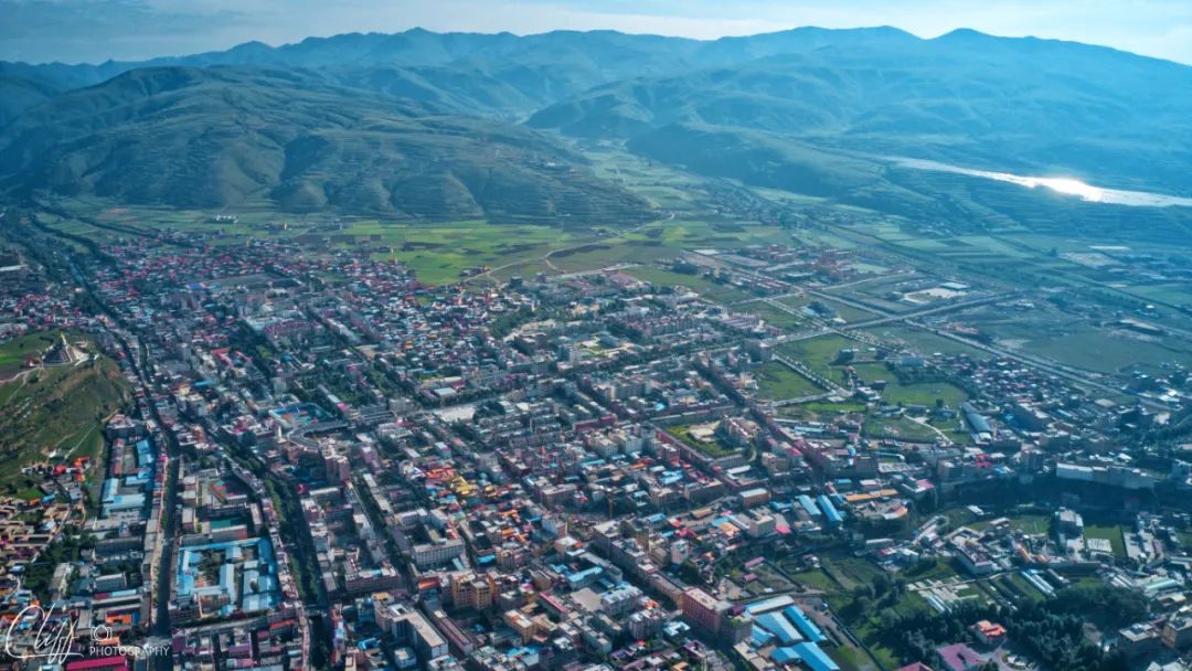
This is Ganzi County, which is quite large.
Video: Aerial photography of the Yalong River and Garze County on the riverside in the early morning on July 11, 2022
*************************************
After finishing the aerial photography, we took back the plane and went to have breakfast. These guys had just gotten up.
At 9:17, we set out on our journey.
We continued westward along National Highway 317, crossed the Yalong River, and a few minutes later arrived at the intersection of Ganbai Road.
Ganbai Road, connecting Ganzi County and Baiyu County, is known as "China's most beautiful self-driving county road".
However, it has now been upgraded to Provincial Road 455. I don’t know if it is worthy of the title of “China’s Most Beautiful Provincial Road”.
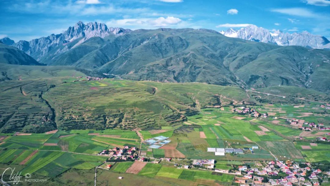
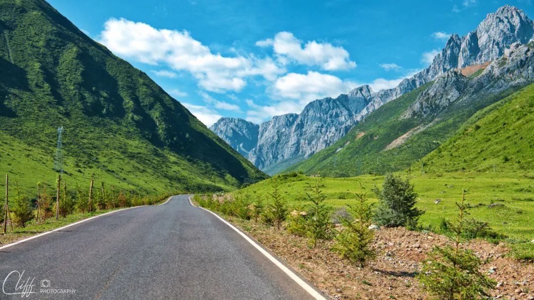
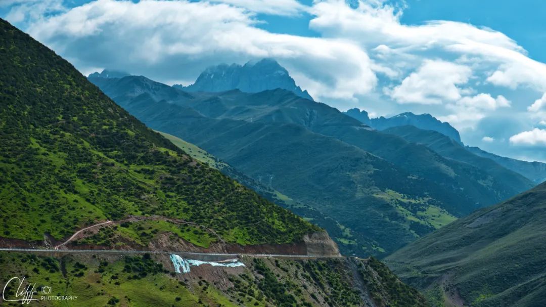
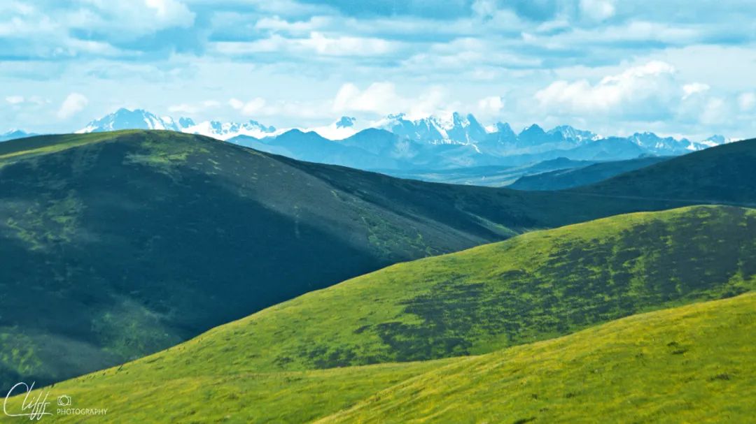
Moving forward and continuing to climb, we slowly approached the peaks.
After turning a corner, a taller mountain appeared in front of us. There was still thick snow and glaciers on the top of the mountain, which made it stand out among the abrupt peaks.
In this situation, we must come down and take random photos.
After taking photos and continuing forward, the road cleverly passed through the gaps between the peaks. After a while, we came to the south of Zhuodala Mountain.
This is the way to climb Zhuodar Mountain, looking back at Ganzi County. At this moment, the city has been obscured by the dirtbags in front of us.
This sparkling river most likely originates from Zhuogel Mountain
Entering Zhuogeer Mountain, looking back, you can see the peaks lined up in rows.
Looking ahead are rows of mountain peaks.
The ice and snow on this mountain peak are still holding on
These bare mountains must look beautiful in winter
The shining river I saw before is the one in front of me
Arriving at the south side of Zhuogeer Mountain, I looked back
The small river in the mountain col and the seemingly abandoned cattle pen next to the small river
*************************************
Further ahead is Haizi Mountain (we might as well call it Haizi Mountain A).
I'm a little confused.
If you take National Highway 318, you will encounter Haizishan B (and Sister Sea); if you take Provincial Highway 217 (National Highway 227) from Litang to Daocheng, you will also encounter Haizishan C. Are these three "Haizi Mountains" the same one?
It is understandable if B and C belong to the same mountain. After all, the distance between them is not far. However, it is a bit unbelievable that A and BC belong to the same mountain.
Open the satellite map and see that A and BC are far apart. From a geographical structure point of view, they are not connected together.
Therefore, A and BC should not belong to the same mountain.
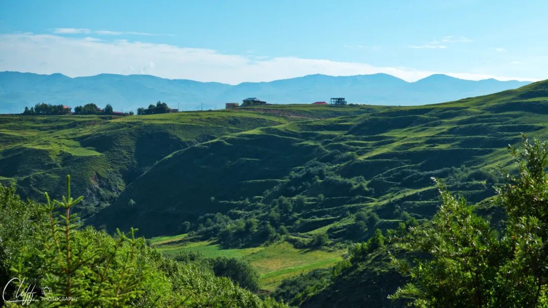
But if they are different mountains, they look too similar: none of them have tall snow peaks, the slopes are relatively gentle, and the low places are dotted with deep lakes of different sizes; the mountains are full of round mountains. There are rocks and the remains of ancient ice caps; among the rocks, there is lush green grass and strange-shaped flowers.
Do you think it's strange?
However, we do not have the time or ability to study these, so we can only keep moving forward with doubts.
At 10:41 am, we arrived at Lalongcuo.
This is a great place to park and rest, Leo said.
As he spoke, he began to rummage through the cabinets to find napkins.
The appearance of Haizi Mountain
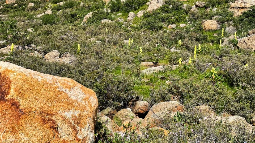
The hillside is densely covered with large and small stones, and between the stones are lush grass and strange flowers.
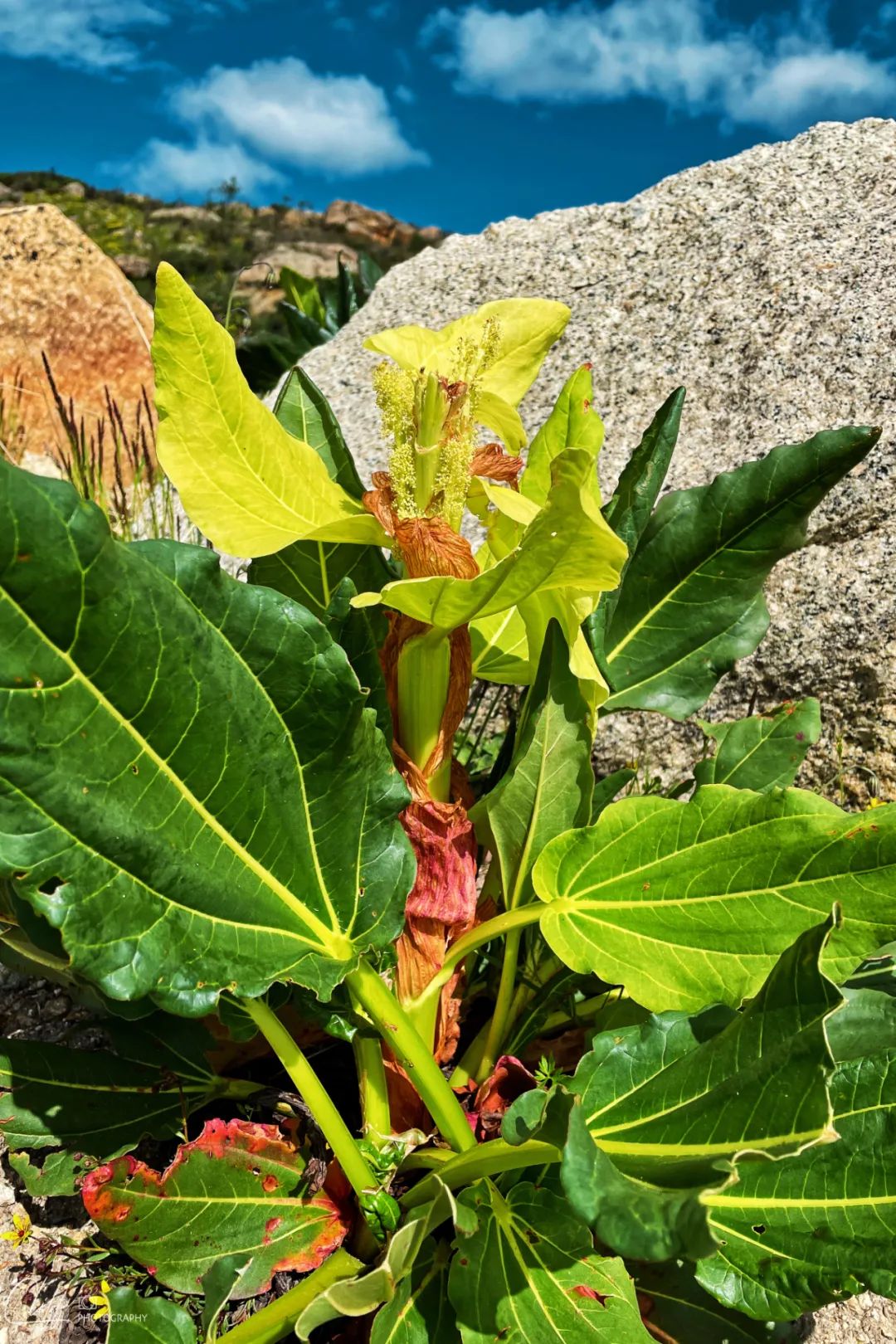
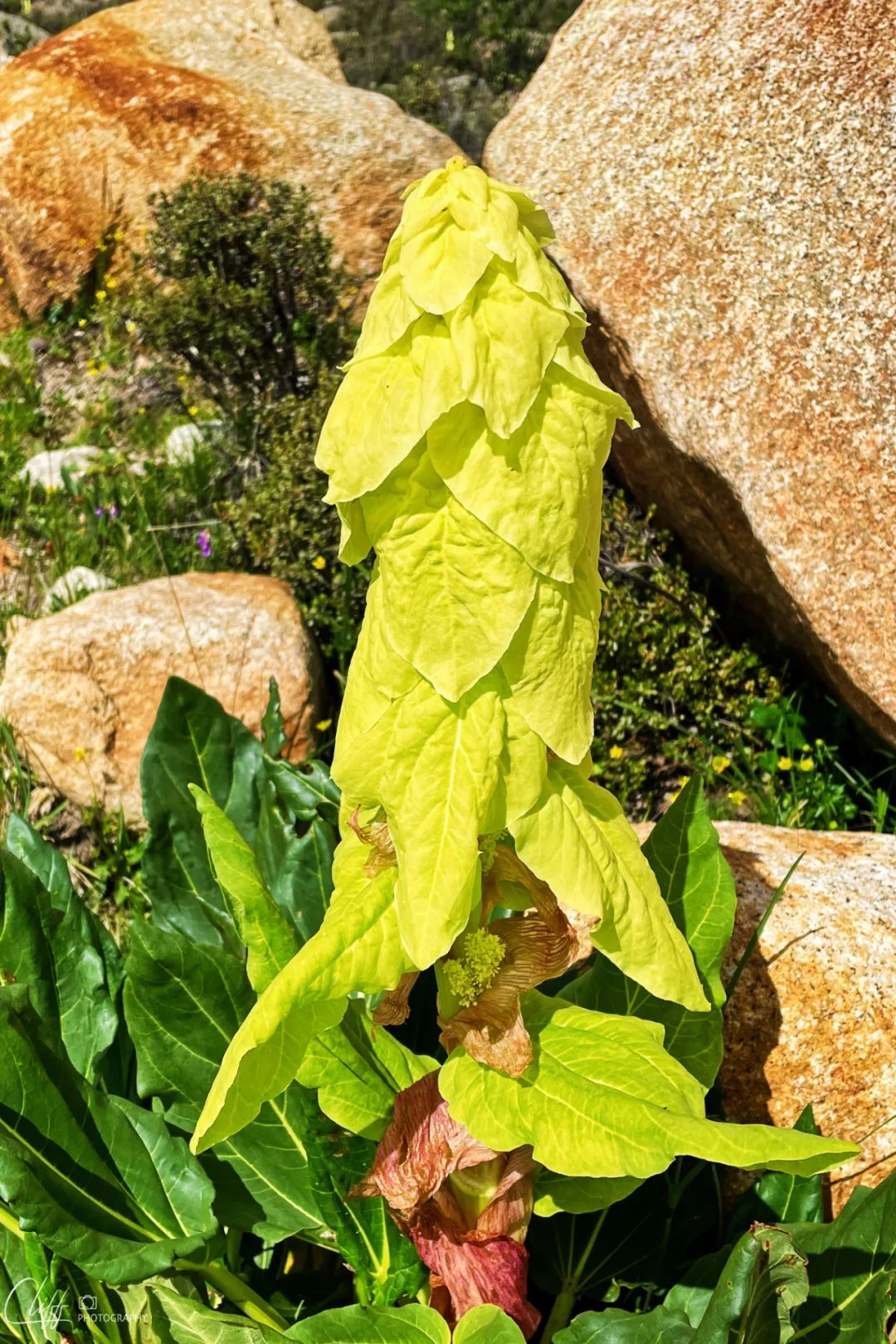
Who knows what kind of flower this is?

This is Lalongcuo, the largest lake in Baiyu County. It is also the typical landform of Haizi Mountain.
This small river flows down from the opposite mountain and enters the arms of Lalongcuo
Video: July 11, 2022 We left Ganzi County and took the legendary White Jade Road to Batang. Near 11 a.m., we arrived at Lalongcuo
*************************************
I took a few photos, and this guy also successfully fertilized, so we continued to set off.
At 11:15, we arrived at the intersection of County Road 037. From here, turn left and go 7 kilometers ahead to the legendary Yaqing Temple.
Yaqing Monastery and the Wuming Buddhist College in Seda are both large-scale Tibetan Buddhist learning and practice centers in Tibetan areas. The difference is that those who practice in Yaqing Temple are almost all Juemu, that is, female practitioners.
When I came to the intersection, I turned over with anxiety. Unfortunately, an existing railing had already been put down.
The Tibetan guy guarding the railing asked me where I was going, and I told him to go to Yaqing Temple.
We can’t go to Yaqing Temple, he said, waving his hands resolutely.
Although I had expected the ending, I was still quite disappointed.
When will it open? I continued to ask.
I don’t know, he shook his head, it would probably take at least a year or two. He said.
just in case? No chance!
Hey, come on, let’s go.
I backed out and continued walking.
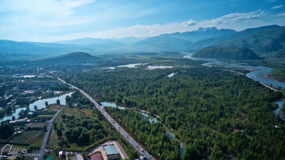
The terrain ahead is flat, and Ganbai Road turns into a long straight road, leading all the way to Acha Town.
It can be seen from this that this is a large prairie with a large area. Dots of yaks are scattered on the grassland, growing meat on their own without competing with the world.
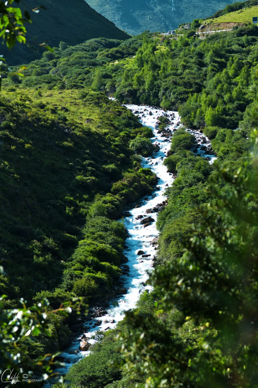
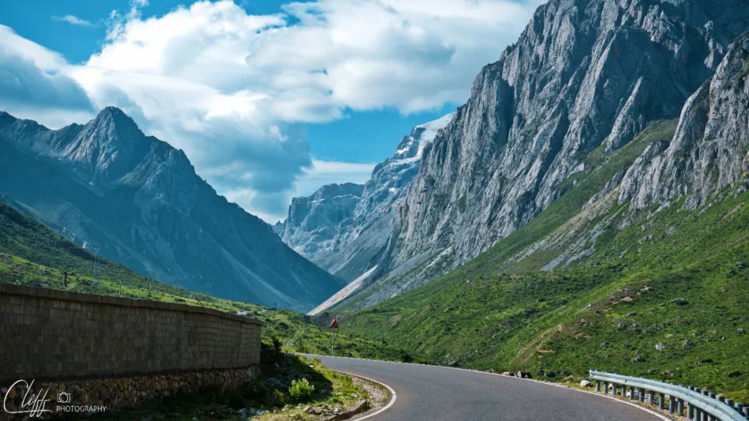
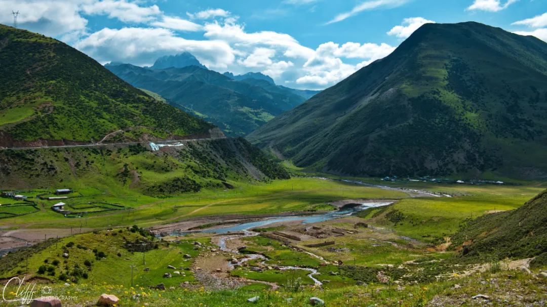
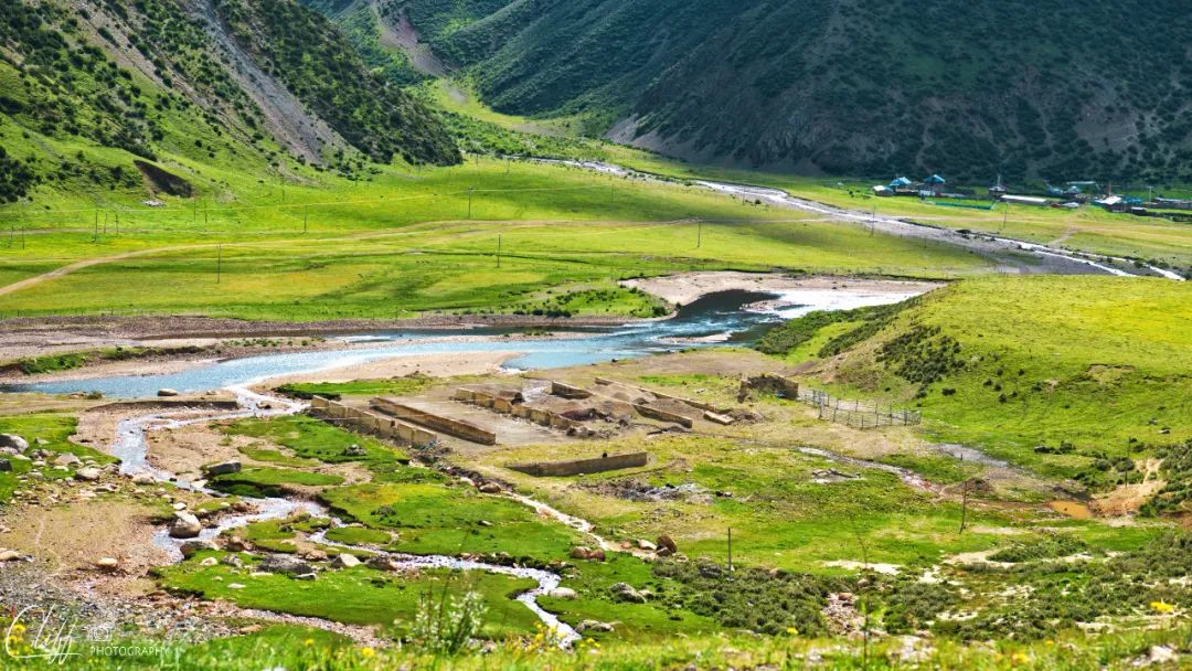
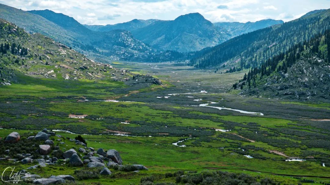
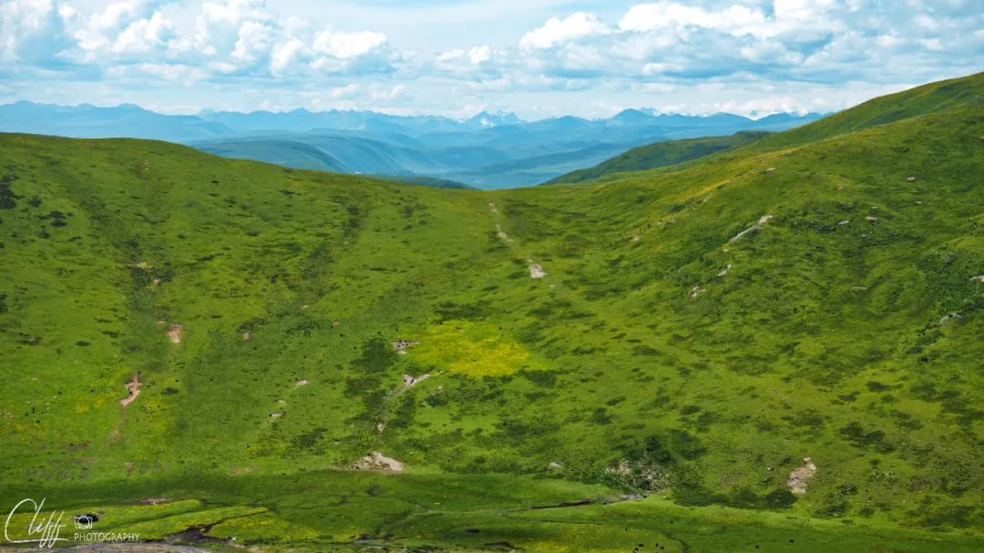
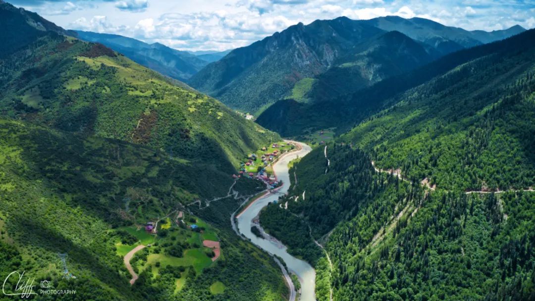
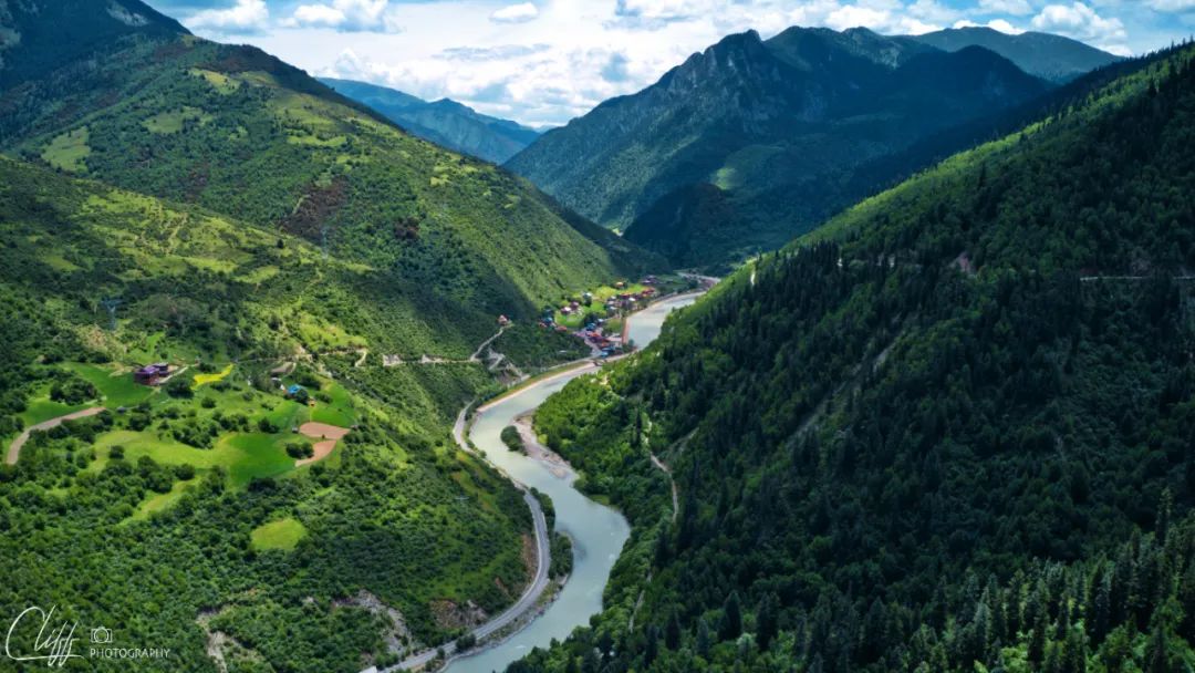
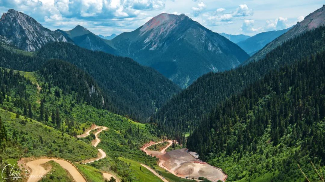
After passing Acha Town and entering the mountains, the road continues to wind along an unknown river.
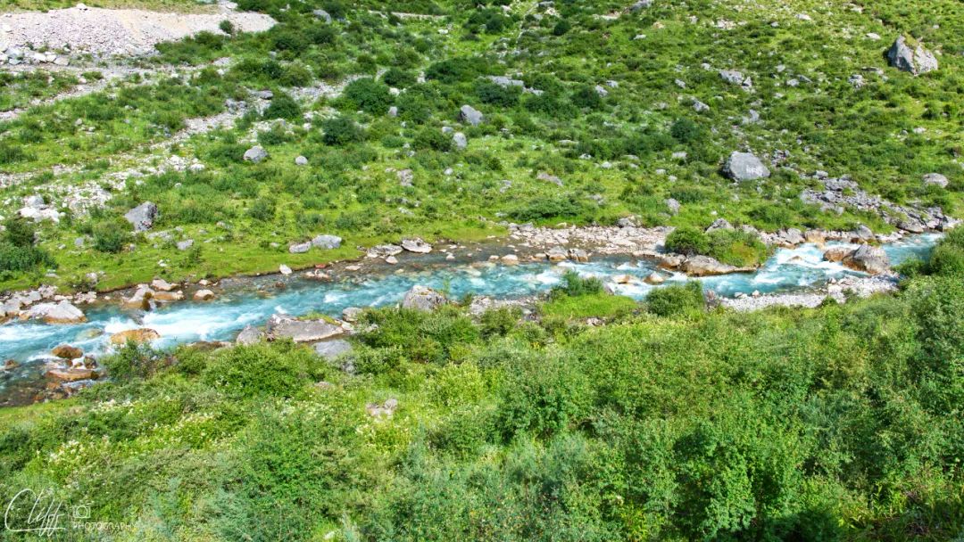
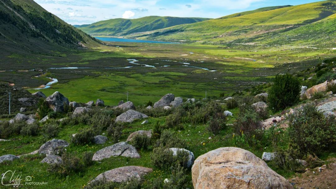
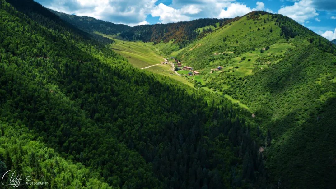
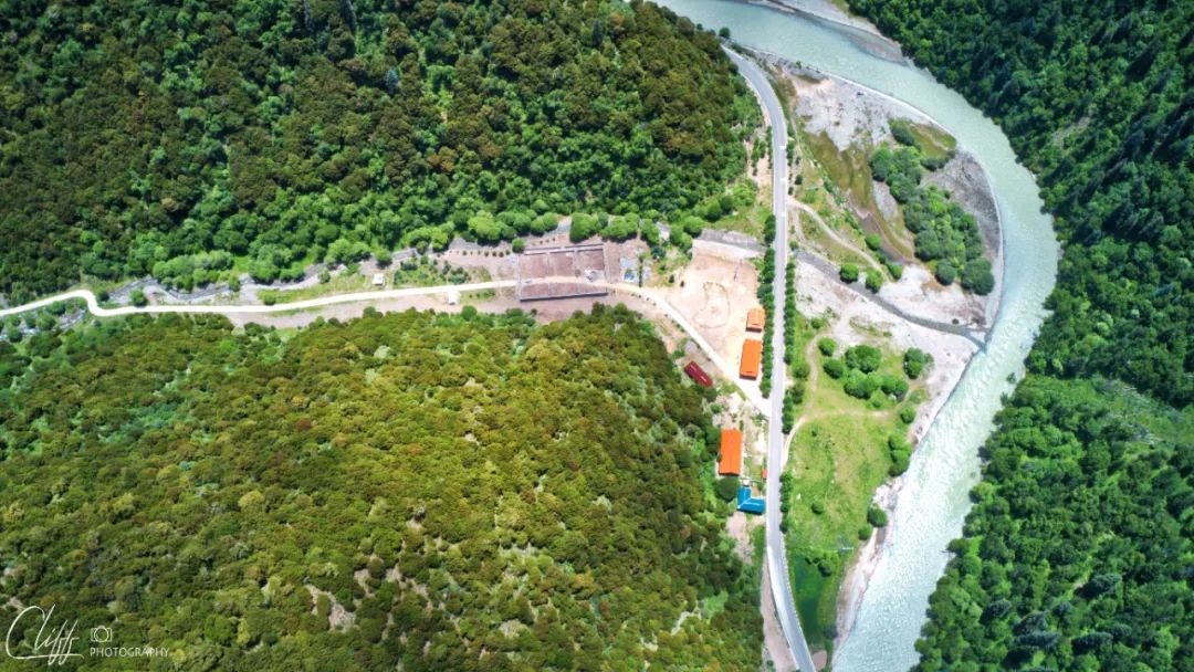
At 12:40 noon, we arrived at a relatively wide river valley.
We were already hungry, but we didn’t see any restaurants along the way, so eating self-heating rice/hot pot became our only option.
This river valley is spacious and shaded by big trees, making it perfect for a picnic. So, I drove over.
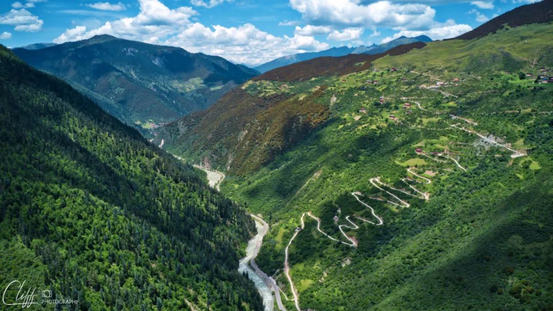
After leaving Acha Town, we climbed the mountain for a while and stood on the mountainside looking back. The scenery was quite good.
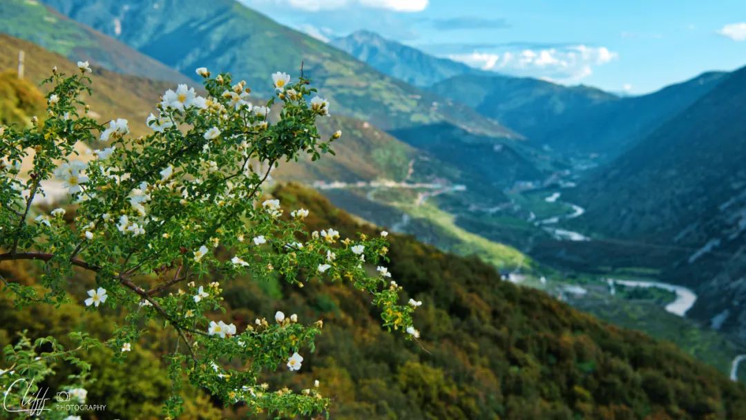
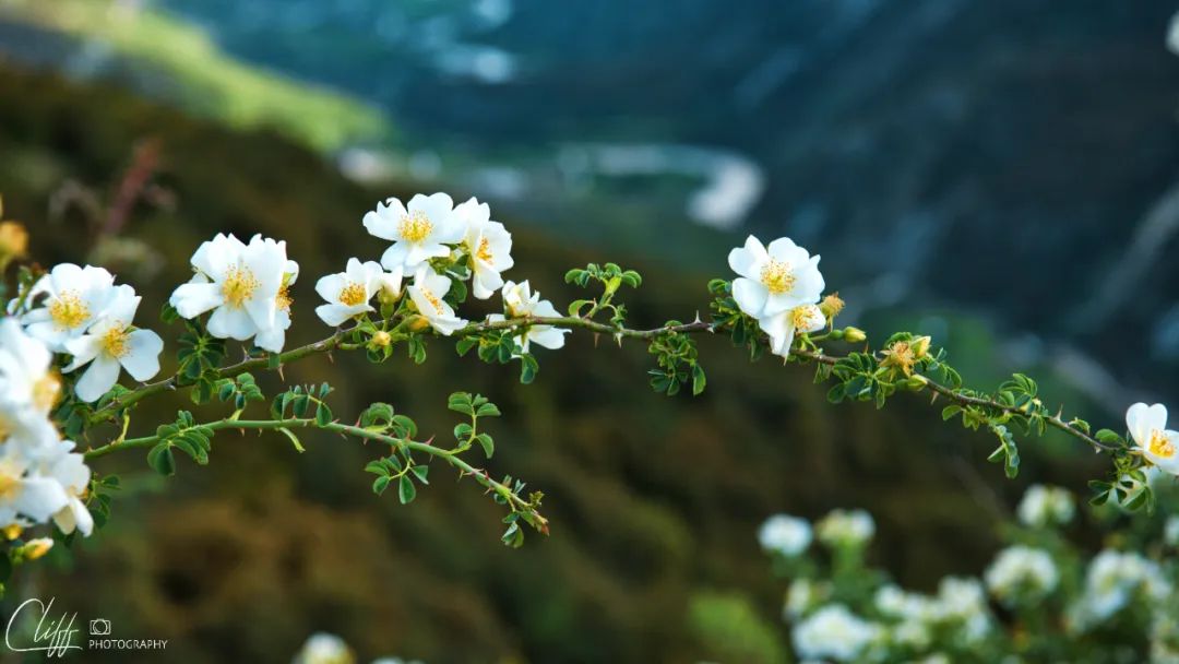
The hillside is full of flowers. Standing here to take pictures, the faint fragrance of flowers penetrates the heart and lungs, which makes people feel extremely comfortable. The only fly in the ointment is that the wire is so arrogant that it’s out of place
Passing through the hillside, we can still see the peaks in the direction we came from.
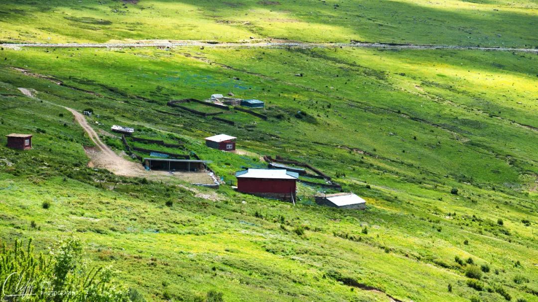
Herdsmen’s house on the hillside
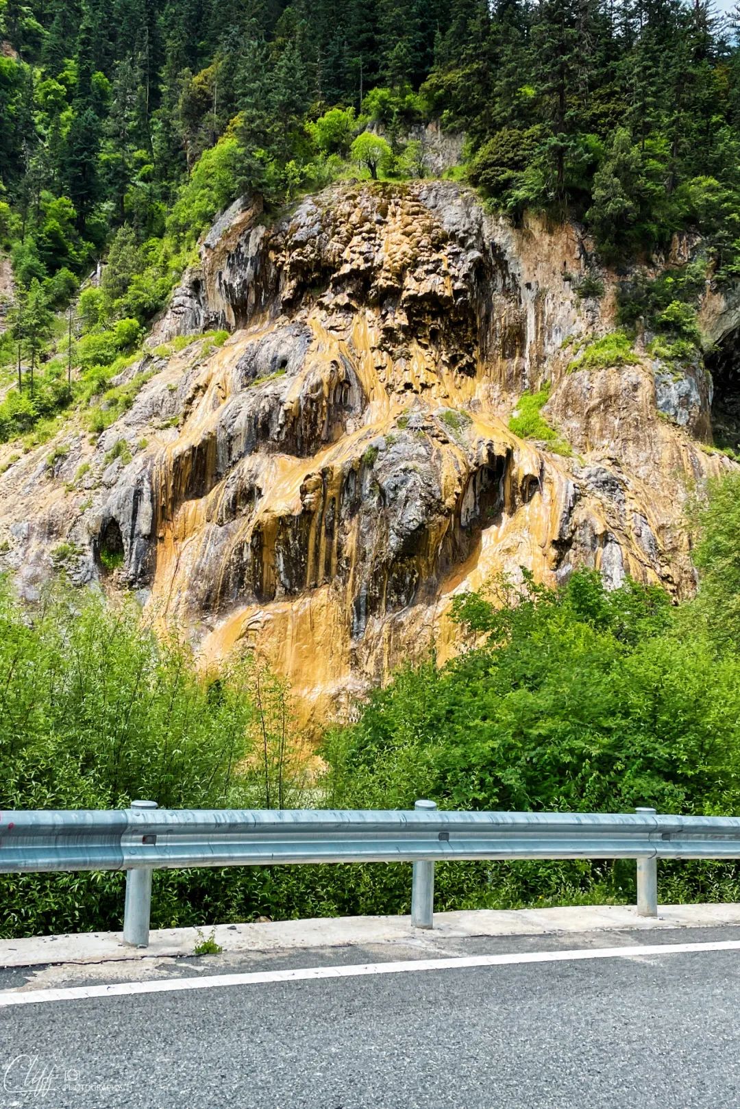
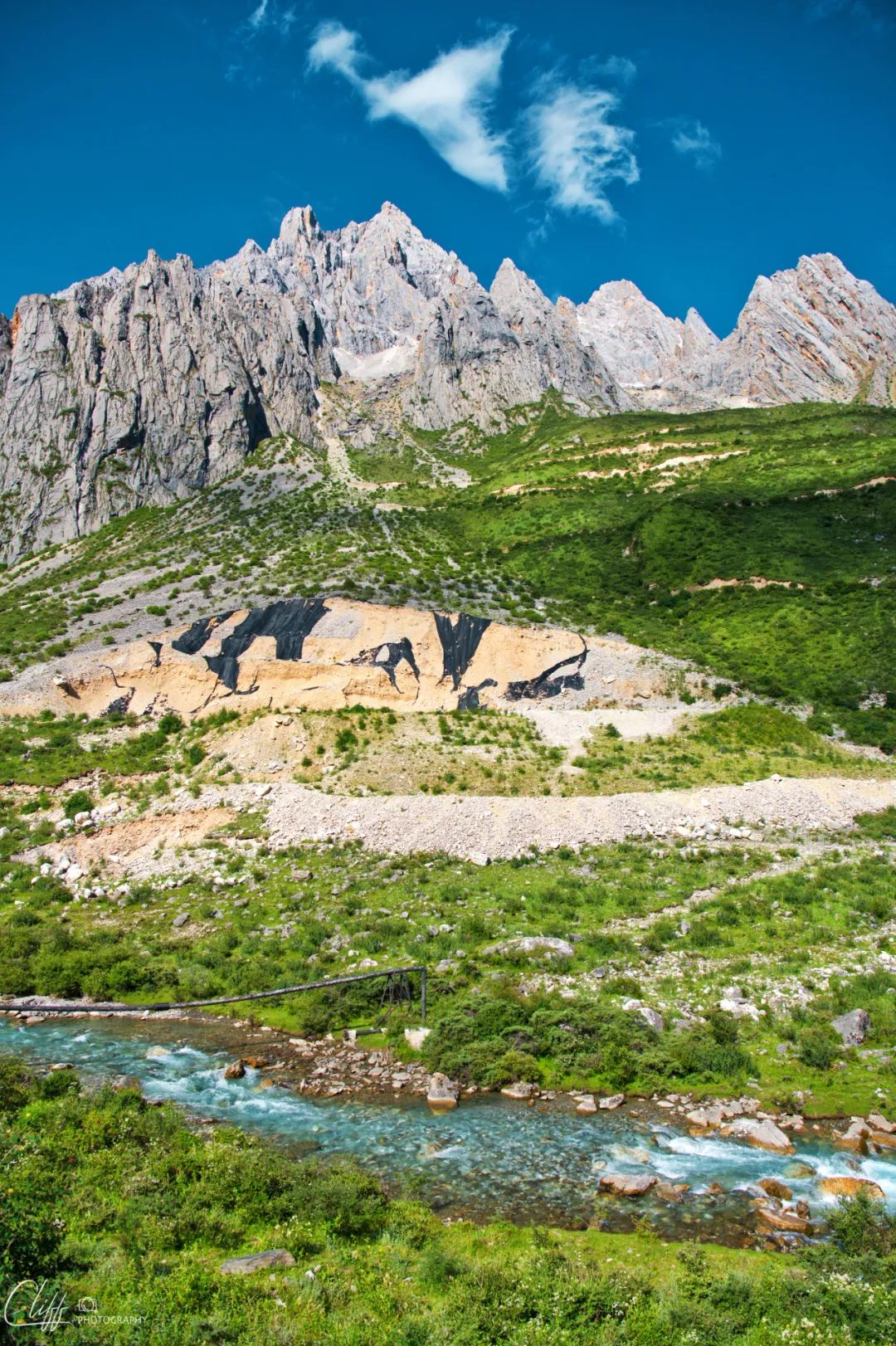
On the way along the river valley, we found a landscape that looked a bit "disgusting". I wonder if anyone knows what it is (sincerely asking for help)?
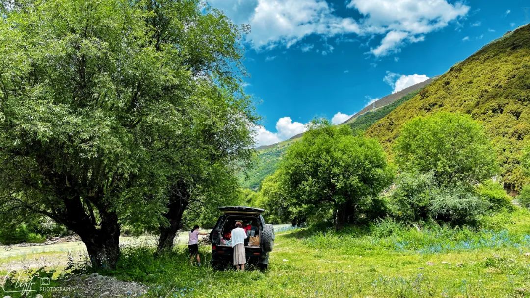
This is truly a unique and best picnic spot
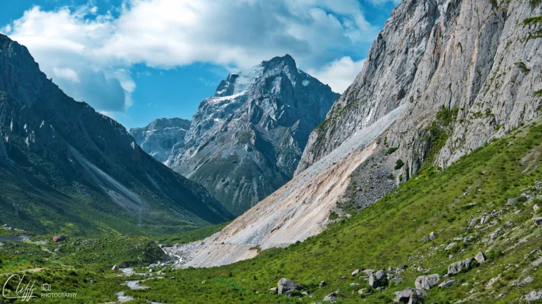
The scenery of the unknown river valley is not bad. This is looking east
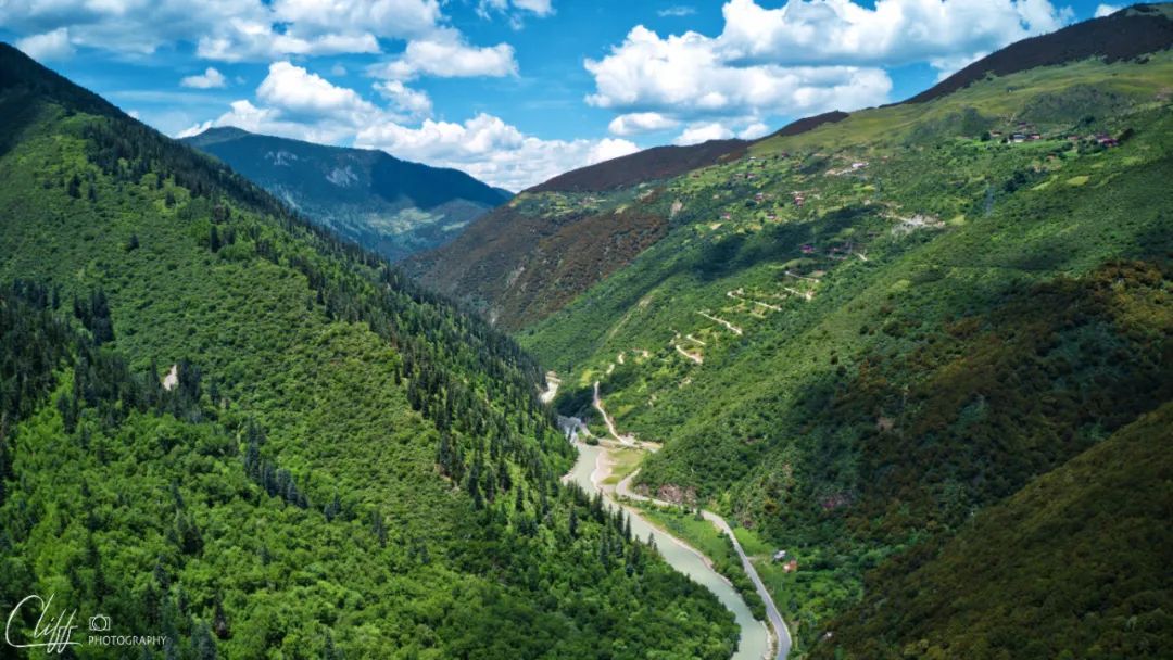
This is looking west. Plants on the mountain show different colors
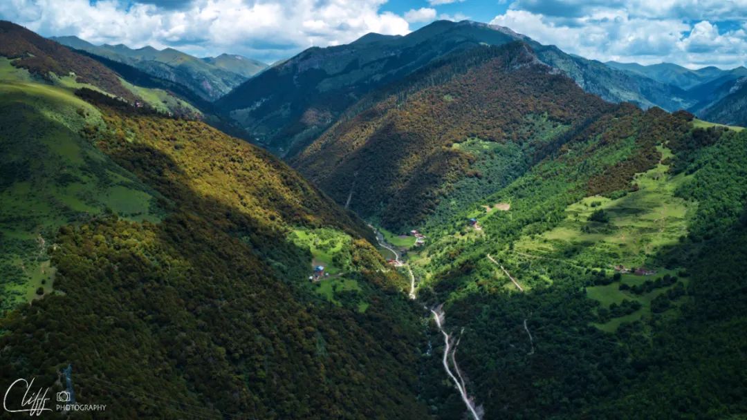
Looking north , the different colors of plants are more obvious
Houses on the hillside , it’s really not easy to live here
the valley itself
Video: July 11, 2022 Aerial photography of the river valley passed by Baiyu Road. The mountains here show several different colors along the river valley, which is very wonderful.
Video: Leaving Lalongcuo and moving forward slowly on July 11, 2022, we came to the intersection to Yaqing Temple. Unfortunately, like Seda Wuming Buddhist College, Yaqing Temple does not allow tourists to enter. There is no way. I had no choice but to continue walking to Batang. At noon, we came to a river valley and had a picnic
*************************************
For lunch today, the King chose a certain brand of tripe self-heating hot pot. It was said to be quite delicious and the King was very satisfied.
When the king was satisfied, everyone was relieved and the atmosphere became relaxed and happy.
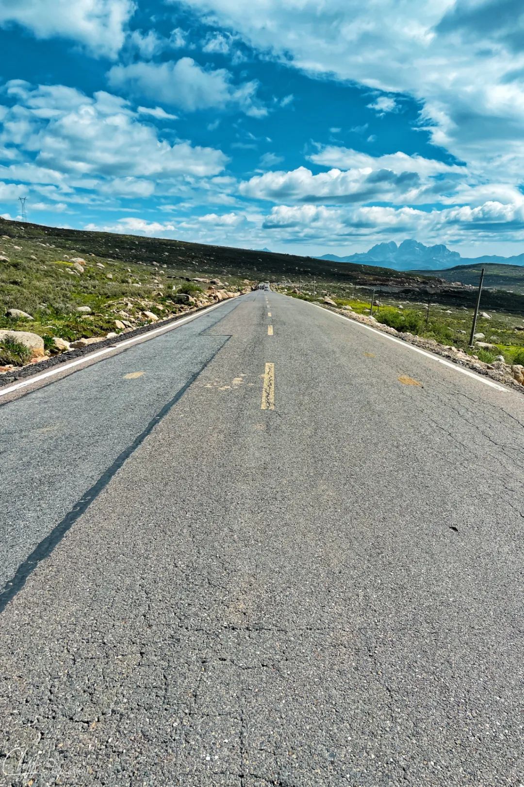
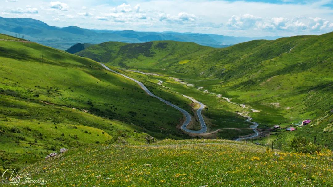
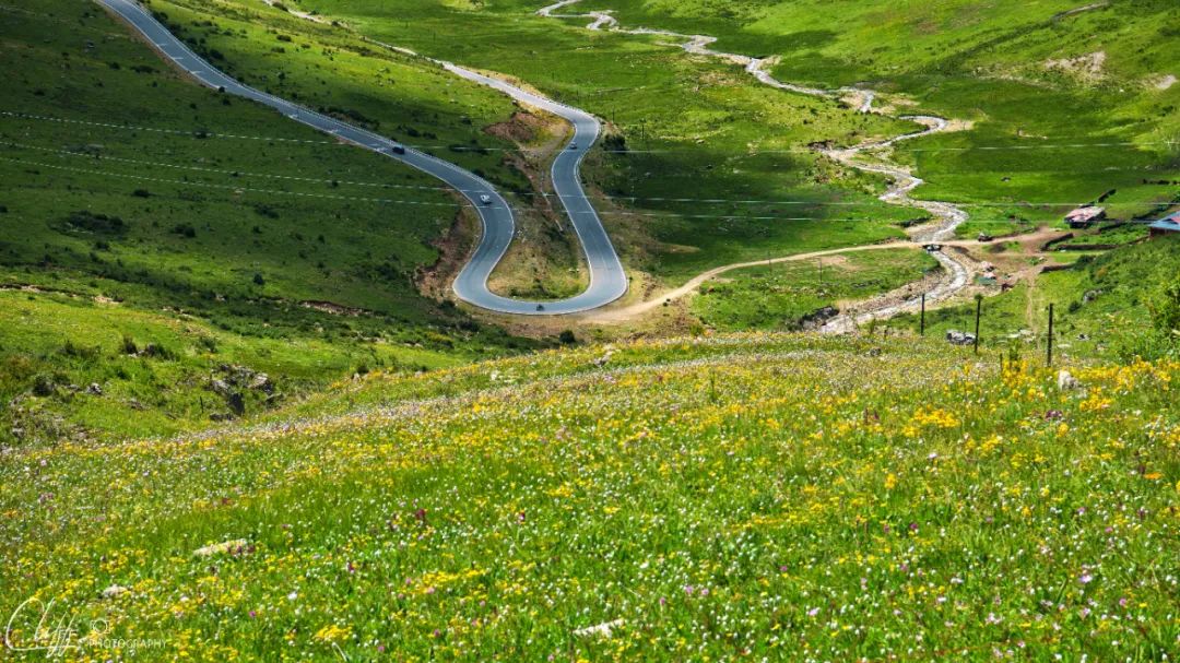
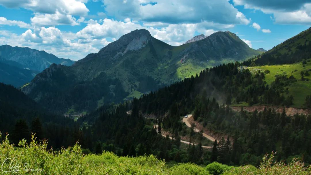
Continuing forward, we are still in the valley. Although the road is not straight, there is no slope, and there are no U-turns. In addition, the newly laid asphalt road is silky smooth, so the journey is smooth.
At 1:53 pm, we arrived near Ronggai Township.
Continuing 15 kilometers northwest from here is the legendary Baiyu County.
The word "legend" is used because this county has never been known to anyone, and it is said that this county has the last patrilineal tribe in our country. The folk customs are simple and tough, so it seems extremely mysterious.
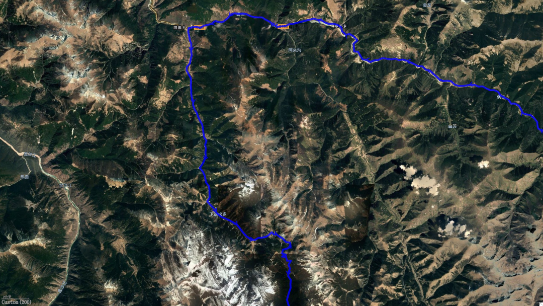
However, Baiyu was not our destination. Our destination was Batang County in the south. Therefore, we left Ganbai Road near Ronggai Township and turned to a road heading south.
This road has neither a name nor a number, whether viewed from Baidu map or satellite map, but it connects Batang and Baiyu, two important towns in western Sichuan. However, if you ask Du Niang, you will find that this road is actually part of National Highway 215.
The map is really lagging behind sometimes.
Since it is a national highway, the road condition is naturally not too bad and is as smooth as Ganbai Road, a provincial highway.
Just as we were whistling and singing songs and moving forward quickly, the road suddenly stopped.
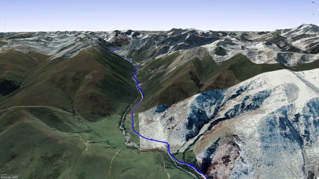
What lies in front of you is a tall mountain called "Myra Mountain", and the tunnel passing through the mountain is still under construction.
What should I do?
No wonder Du Niang kept shouting at the top of her lungs for me to turn around and take a detour (Du Niang said with a confused face, Lord, what did you do? It takes you 13 hours to walk from here to Batang, and you won’t arrive until early tomorrow morning).
I quickly backed the car back, only to find that there was a fork in the road on the left, and a sign on the side of the road reminded me to take a detour (it seemed that Du Niang didn't know this road).
This road is a dirt road, leading to the top of the mountain in a winding way. It looks like the original old road.
Dirt road? ! Very good! The sleepy Leo immediately became energetic when he heard that there was a dirt road.
It seems that holes are being dug for the national highway here to improve traffic efficiency.
The old road is a standard dirt road. It is not only bumpy but also very dusty. Whenever a car passes by, everyone is instantly shrouded in "fog".
However, this is not a difficult thing for us. On the contrary, we enjoy it very much (seeing this, the king must have rolled his eyes at me).
At 2:13pm, we walked on the dirt road; at 2:35pm, we climbed up the pass; at 3:15pm, we arrived at the bottom of the mountain.
It took us a full hour to cross the mountains and ridges. If the tunnel is opened, it is estimated that this journey will not take more than 15 minutes.
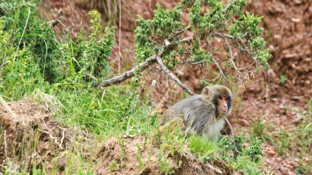
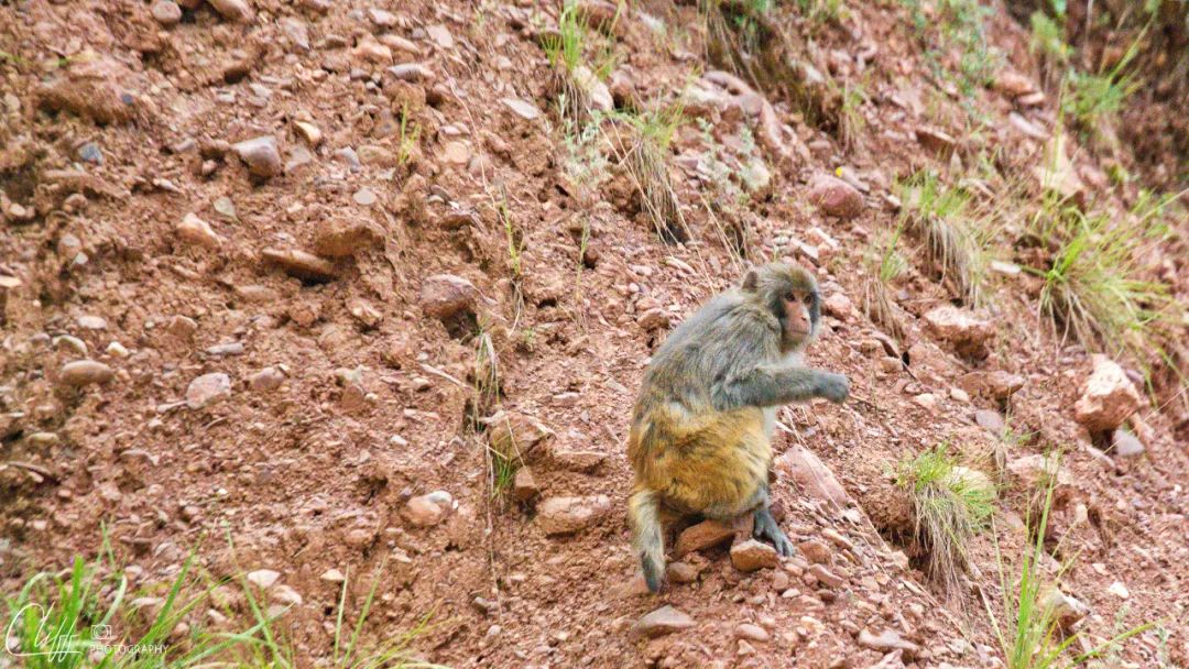
Not long after we walked onto the dirt road, suddenly a group of senior brothers suddenly crossed the road from the right side of the road and ran to the left side of the hillside, which shocked us.
I stopped the car and said hello to him, but he didn't step on me. It wasn't until I said, "No, senior brother, the master and second senior brother were taken away by monsters" that he showed a surprised expression.
Looking back at the way we came, we saw that the scenery was pretty, so we stopped to take pictures.
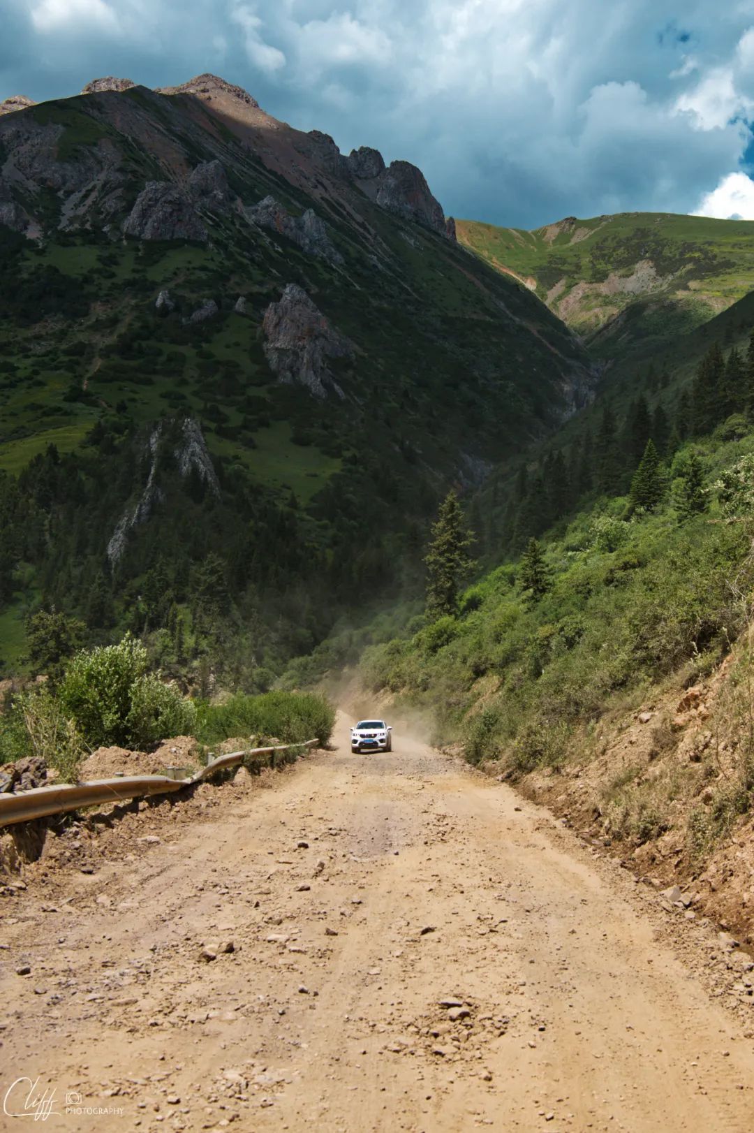
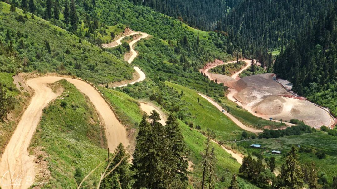
This dirt road is the old road that will soon be replaced by a tunnel.
Video: July 11, 2022 After eating, we continued to move forward. Near Ronggai Village, we left Baiyu Road and headed south towards Batang. Not long after walking, as Du Niang shouted at the top of her lungs to turn around, the road was cut off. It turned out that a tunnel was being built ahead. However, fortunately there was an old road that could be detoured, so we drove up. The old road is a dirt road, bumpy and dusty all the way, which makes me inexplicably happy.
*************************************
On such a beautiful and comfortable afternoon, it is perfect to go on a more than ten kilometers of dirt road.
The next road should be the smooth and comfortable asphalt road in front of us. According to this driving efficiency, we can arrive in Batang at 6 o'clock, which is another perfect time to finish work.
However, unlike what we imagined, although this section of road is already a national highway, it has not been completely repaired.
Because the road is sometimes good and sometimes bad.
I like bad roads, but I don’t like this kind of good and bad roads. Whether a good road becomes a bad road or a bad road becomes a good road, this process often catches people off guard and makes them very uncomfortable.
Sometimes, you have to take a detour.
Of course, this kind of detour is a small detour, not as big as crossing the mountains and ridges just now.
However, it is really uncomfortable to walk.
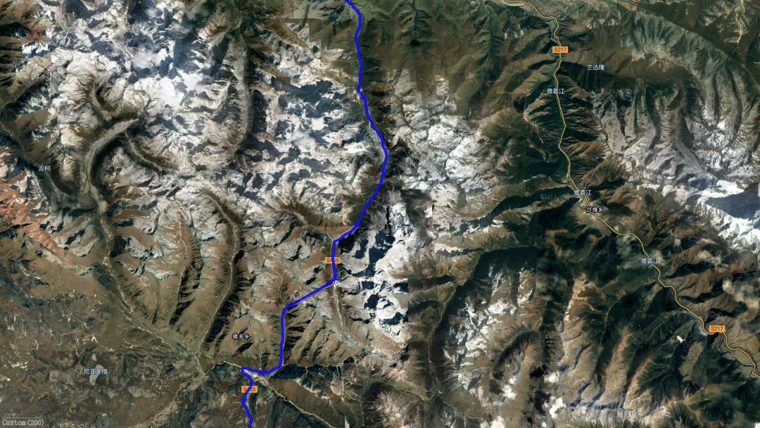
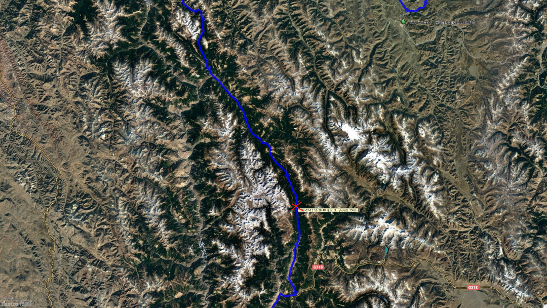
At 4:20 pm, we arrived at the junction of Baiyu County and Batang County. This is the territory of Opala Mountain.
Opala Mountain is the boundary mountain between Batang and Baiyu. The pass is as high as 4,600 meters above sea level. However, there is no need to climb the mountain now. A long tunnel has been built.
Not long after walking through the tunnel, I suddenly saw a queue of traffic.
I looked at the clock, it was just 4:30.
My heart tightened. Is there a traffic jam?
I parked my car behind the convoy and came to the front to get some information.
Fortunately, the convoy is not long. I asked a truck driver in front of me and he said that the road ahead was being built and now was the time for the road to be closed.
When will it open? I continued to ask.
It seems to be 6:30. He answered me without any expression of regret or displeasure (in other words, the driver of a large truck has the best psychological quality).
Have to wait 2 hours! I go!
But what can we do? Just wait patiently.
When you are waiting, time passes the slowest, as if time is like a naughty child who likes to tease you when you least want to be teased.
At 6:30, we heard the roar of the engine, and then the car in front started to move.
Really on time!
So, I quickly started the car and followed the traffic.
Slowly walking through the road construction section, inhaling enough ash to fill our chests, we finally came to the dark and shiny asphalt road that looked like it had just been paved.
The road continued smoothly, and the worried road closures and detours no longer happened.
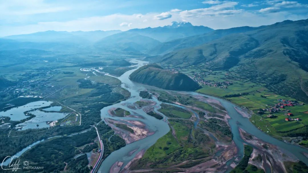
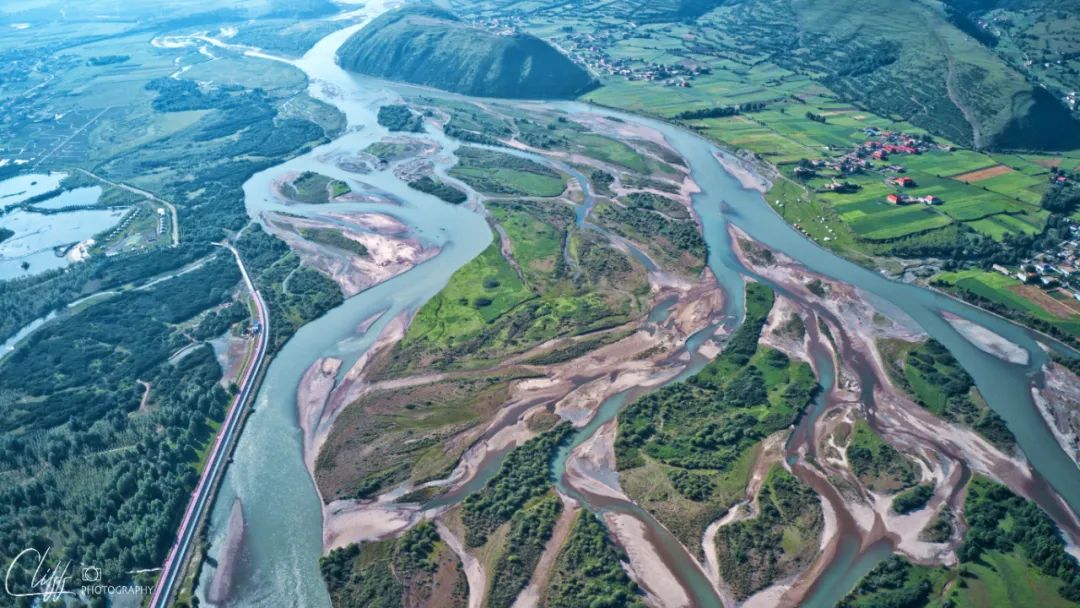
At 7:12 in the evening, we came to the familiar National Highway 318; at 8:01, we finally arrived at the Holiday Inn Batang.
We drove for 10 hours and 43 minutes on the 385-kilometer road.
If Yaqing Temple is open and the two hours waiting for the road to be repaired, we can pay our respects at Yaqing Temple. In that case, it would be perfect.
However, nothing is perfect in the world. For us, it is good enough to reach our destination smoothly.
Is not it?
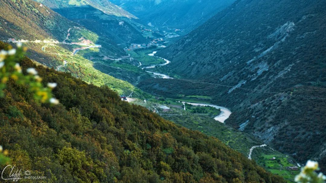
The last shot before arriving at the destination, the fragrance of white wood in the valley
Video: July 11, 2022 After an hour’s detour on the dirt road and over the mountains, we returned to the smooth asphalt road. Just when we thought we would have a smooth journey to Batang, the road started to get better and worse due to road construction, and we had to make detours from time to time. We even encountered road closures for 2 hours. By the time I arrived in Batang, it was already 8 o'clock in the evening. What a tiring day