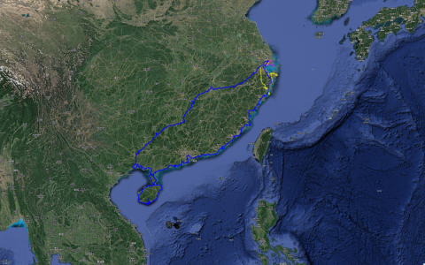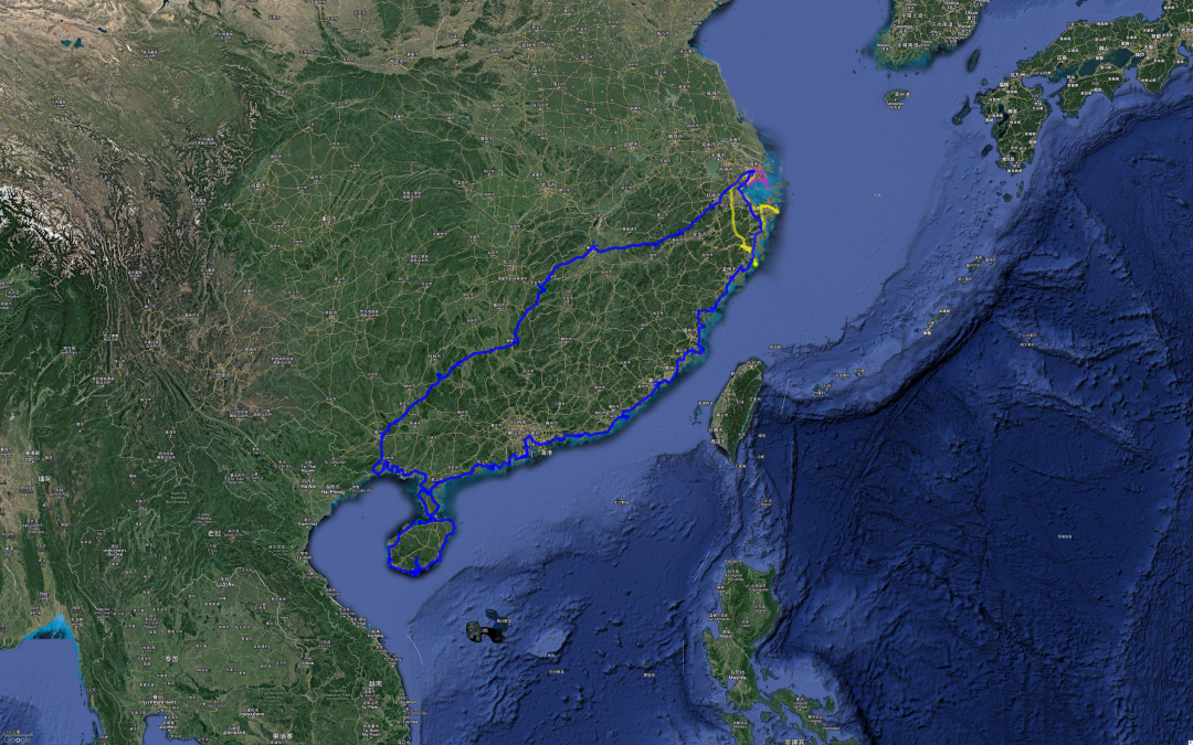
My trip to the South East China Sea along the long coastline started in Shanghai on a cloudy morning on January 16, 2022, and ended on a cloudy evening in Shanghai on February 8, 2022. It lasted 24 days and covered 8,917 kilometers.
This trip is divided into three parts.
The first part went from Shanghai to Dongxing, Guangxi, and took 5 and a half days to reach the westernmost end of our country’s coastline. This is the border between my country and Vietnam.
The second part starts from Dongxing along the coastline, passes through the Leizhou Peninsula, then turns to the South China Sea in Guangdong, and then all the way along the South China Sea coastline to the East China Sea (Shantou Nan'ao Island), and finally ends in Wenling, Zhejiang Province. Of course, this part of the itinerary was cut in half because of the third part, but because they were all on the mainland, the whole trip was treated as the second party.
The third part is around the coastline of Hainan Island, from Haikou to Wanning to Sanya, and then from Sanya to Dongfang and then to Haikou, turning clockwise.
Originally, I wanted to arrange a trip between the mountains and the sea, where I would see the mountains first and then the sea, but I was not able to see the mountains as I wished. From the earliest planned Huangshan and Lushan Mountains, they were canceled due to local epidemic policies. Later, Sanqing Mountain and Wugong Mountain were not seen due to weather reasons. Basically, the part of viewing the mountains was aborted.
Last spring, I went to see Meili Snow Mountain and Namjagbarwa Peak, but I failed. It seems that I have no great connection with mountains.
Therefore, this trip has completely turned into a trip to see the sea, which fits the title perfectly.
Regarding the itinerary itself, here are some summaries:
1. The schedule is a bit rushed. If we only count the coastline part of the journey, it will take a total of 18.5 days, a total of 6398 kilometers, and an average of 346 kilometers per day. In my previous journeys through secret realms, the most comfortable journey was 250-300 kilometers per day, and 346 kilometers was obviously too much. Such intensity will lead to insufficient time to appreciate some beautiful places; often after 3 pm, we need to rush and have to give up many trails and miss a lot of scenery.
If improvements are made, it is best to add another 4.5 days to the coastline, so that the average is 278 kilometers per day. At this intensity, I can walk many secret trails and peninsulas that I had to give up because of time. . Of course, the total mileage of the trip will definitely increase in this way, but even so, the average daily distance of about 300 kilometers will be very comfortable.
2. The preparation for the trip is not sufficient. This mainly refers to the two situations I encountered on the road where my car needed to be repaired. The first time was when I had my tires punctured in Zhanjiang. It was the 29th day of the twelfth lunar month and all repair shops were closed for the holidays. In the end, Tuhu saved me. The second time was on New Year's Day when the brake pads were worn out. All 4S stores were on holiday and did not have stock. In the end, Tuhu saved me. But it is also very dangerous to grind on the road for two days when the braking performance is seriously reduced.
What needs to be improved is to be more prepared when going out later. The first is to ensure that the spare tire is in perfect condition; the second is to prepare the tools to repair the tire yourself; the third is to carefully check the status of wearing parts during maintenance, and replace them in time if a problem occurs to prevent accidents. In the future.
3. The epidemic is not that terrible. This trip coincided with the rebound of the epidemic in various parts of the south. Of course, the sudden emergence of the epidemic in Shanghai, the place of origin, also caught people off guard, and they even wanted to give up the trip. Of course, in the end we bit the bullet and set off. For such a decisive decision, the most important thing is to understand the epidemic prevention and control policies of various places in advance, and to grasp the work schedule of nucleic acid testing points and whether electronic reports can be provided in advance.
Before any war begins, intelligence work is vital. The same is true when traveling. Master key information and intelligence in advance so that you know what to expect. In this way, we can follow the epidemic prevention requirements of station C and conduct nucleic acid testing at station B in advance; of course, when we are at station A, we need to know that station B will still be open and provide electronic reports after we arrive. Of course, it is absolutely necessary to protect yourself throughout the entire process.
During this long coastline trip, there were also some "interesting" discoveries:
1. The long coastline is really too long. If we zoom out on the map, our country’s coastline looks quite natural and smooth. It feels like the journey from Dandong to Dongxing will never exceed 8,000 kilometers. However, in fact, when we zoom in on the map, we will find that the entire coastline is extremely uneven. Every depression is a bay, and every bulge is a peninsula.
Counting these bays and peninsulas that rely on the mainland, the coastline has more than doubled, reaching as many as 18,000 kilometers. If you add in the various islands, the total length of our coastline exceeds 32,000 kilometers!
Therefore, it is not easy for a person who wants to patrol the sea for the country. If you have to be serious, you will be exhausted. Sometimes, you have to be lazy. Some islands with inconvenient transportation can only be abandoned; some deeply sunken bays can only be walked across the bridge.
However, even if you are lazy, sometimes it is not easy. We know that almost all rivers return to the sea. Therefore, on the coastline, there are estuaries of rivers of various sizes, and each estuary is as wide as a trumpet.
Bridges are often not built close to the coastline because the cost is too high. Therefore, when you reach a river mouth and find that there is no bridge, you have to go upstream, cross the bridge, and then go down the river. This adds a lot of mileage.
2. The dirtiest countryside I have ever seen is in Hainan Island. When people talk about Hainan Island, the impression that comes to everyone's mind is of sun, beach, waves and bikinis, and will never be associated with garbage. However, on my way from Haikou to Wanning, when I came to the seaside countryside where tourists would not go, I was really shocked by the garbage hidden in the dense forest and scattered on both sides of the simple road. I won’t go into details here about the specific situation. Those who are interested can refer to the travel note “Day 10 Haikou-Wanning”.
This actually surprised me. After all, messiness has always been associated with backwardness and is the antonym of economic development. However, in the Qinghai-Tibet Plateau, Northeast China, Taihang Mountains, and Daba Mountains where I have traveled, the isolated rural areas there are much cleaner than those in Hainan Island. I don’t know what caused this situation, and I sincerely hope this situation can be brought under control.
3. From south to north, the sea water basically changes from blue to yellow, from clear to turbid. This time, I discovered that the bluest and clearest bay in our country is in Sanya. This is basically the southernmost point we can reach on our self-driving tour. In other words, this is the bluest and clearest bay we can see by driving. sea. After that, slowly heading north, the color of the sea water becomes more and more yellow, and the water quality seems to become more and more turbid. When we arrived in Haikou, the sea water basically lost its blue color; when we arrived in Nan'ao, the sea water turned light yellow; when we arrived in Wenzhou, the sea water turned yellowish brown. Correspondingly, the clarity of the water continues to decrease. When we get to the coast of Zhejiang, we almost don’t know what the sea water originally looked like. It doesn't feel like it's caused by pollution, but more like it's caused by much more sediment in local bays or rivers entering the sea than in the south.
4. In terms of climate, winter can be completely short-lived in the central and southern areas of Hainan such as Sanya, Wanning and Dongfang. Once you reach the northern part of Hainan Island, such as Lingao and Haikou, the temperature will be at least 5 degrees lower. If the weather gets worse, it will be freezing. Further north, when you get to Zhuhai and Shenzhen, you need a coat; when you get to Xiamen, you need a thick coat; when you get to Xiapu, Wenzhou, it's basically the typical winter attire in the south. When we arrived in Ningbo and Shanghai, the damp and cold temperament swept over us again, so you have to wear as much thickness as you need.
In winter, the only inland cities that can compete with Sanya are Panzhihua in Sichuan and parts of southern Yunnan. Therefore, it is wise to choose to spend the winter in Sanya or Panzhihua when you get older.
5. Finally, where is the most beautiful sea view? Everyone’s definition of the most beautiful is different, involving natural factors such as geology, geography, climate, etc., as well as human factors such as local culture and customs. I am a more natural person. From what I have seen, my favorite place, which I think is the most beautiful, is the coast in northern Fujian and southern Zhejiang. There are not only seas but also mountains here; not only rich natural scenery, but also harmonious cultural landscapes. The scenery here is rich enough to include almost all sea-related factors. Therefore, I highly recommend everyone to take a vacation to the seaside in this area. Importantly, it is not far from Shanghai.
Okay, I have summarized a few things here and there, saying whatever comes to mind, there is no logic. If you have friends who want to take my route, please feel free to communicate via private message. I can give you my trajectory and give you more suggestions for optimizing the route.
Next, let’s take a look at the summary of this trajectory.

This is the total trajectory of this trip (blue), in which the yellow and purple lines are the previous trajectories of the east coast of Zhejiang and the east coast of Shanghai

This is from Dongxing, Guangxi - the westernmost end of my country's coastline - to Leizhou Peninsula. This large bay is collectively called Beibu Gulf.

The Leizhou Peninsula part, the strait between the lower part and Hainan Island is called Qiongzhou Seafood

Part of Hainan Island

On the southern Guangdong track from Leizhou Peninsula to Shenzhen, the large depression in the upper left corner is the estuary of the Pearl River.

From Shenzhen to Xiamen

From Xiamen to Xiapu

From Xiapu to Wenling

From Wenling to Shanghai, the yellow color is the trace left by the trip to the east coast of Zhejiang during May Day last year

The purple track is the coastline of Shanghai that I walked in November last year.
